
Powderface Creek
Our planned destination this fine blue sky day (ha! that’d change) was the summit of a ridge that sits to the north of the Powderface Creek Trail in the Elbow River area of Kananaskis, where it tops out at a low pass. From there it appears a short bushwhack will take us to open slopes that would be our goal. Sounds easy enough, however, the weather would fail us, the snow would fly and a biting cold wind would blow just as we got close, so we never quite made it. Too bad, as we were looking forward to the views.
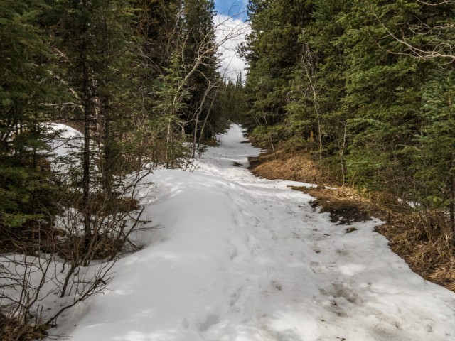
This route for the most part follows an old exploration road. It’s rolling in nature at the beginning, flattens out for a time, then heads up, often times steeply near the end. Even so the going is easy and always obvious. The trail is wide for much of the way and has some sections that are loose, rocky or sometimes muddy depending. This early in the spring, ice and snow can still be found in places. The valley is deep and east facing and so gets little sun.
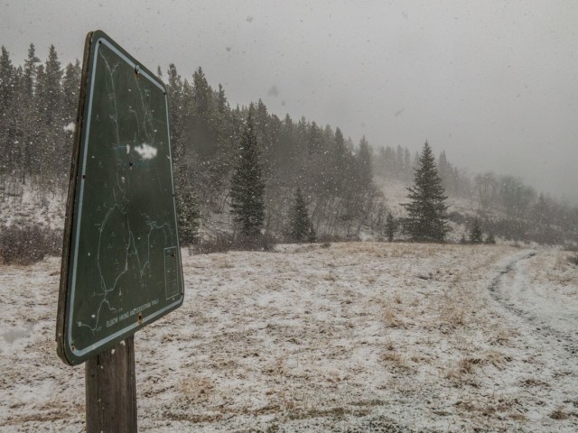
The trail is official, meaning it’s maintained, and is accessible all year round. If the winter gate is closed (mid-December to mid-May) you have to walk down the highway a bit, for a kilometre or so to get to the starting point. From there head for the biffies in the parking lot and take the gravel track heading up behind it.
For the next couple kilometres the grade is rolling in nature and fairly gentle. Side trails are passed a number of times, the most popular one being Prairie Link (official) a connector between the Powderface Creek and Prairie Creek Trails.
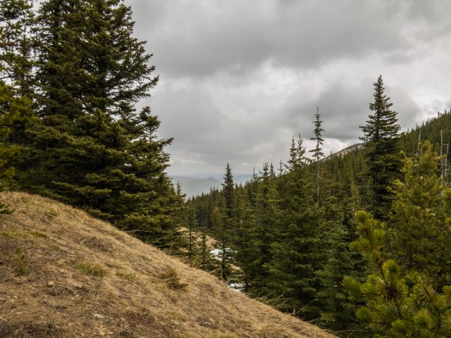
Heading in a steady northwesterly direction, Powderface Creek is paralleled most of the way. At times, the flanks of Powderface Ridge proper can be seen in the distance. It’s treed on this side, but open to the west. It’s a good destination in itself. We’ve been there.
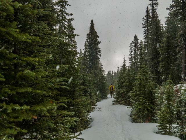
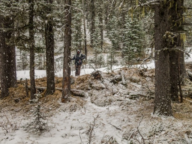
Where the creek crosses over to the east bank, the trail heads up much more steeply now and continues this way for the most part until the pass. This section is rocky and loose when there is no snow. Along here we pass the remains of a mangled old truck off to the side. This is a steep, rough and narrow exploration road, meant more for cat-tracked vehicles, so I wonder how it got this far. It looks like a 60s or 70s model.
A couple young creeks are crossed. At the last one, the road turns right. Take the single track going left however, and follow it into the trees. Soon the forest thins, announcing your arrival at the pass. To the left is a trail to Powderface Ridge, straight ahead a continuation of the Powderface Creek Trail which drops down to the Powderface Trail Road (lots of Powderfaces here, all named after a local First Nation’s fellow).
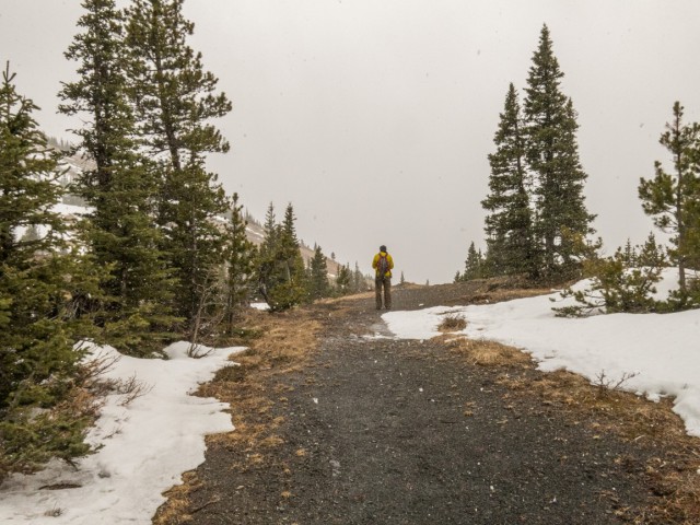
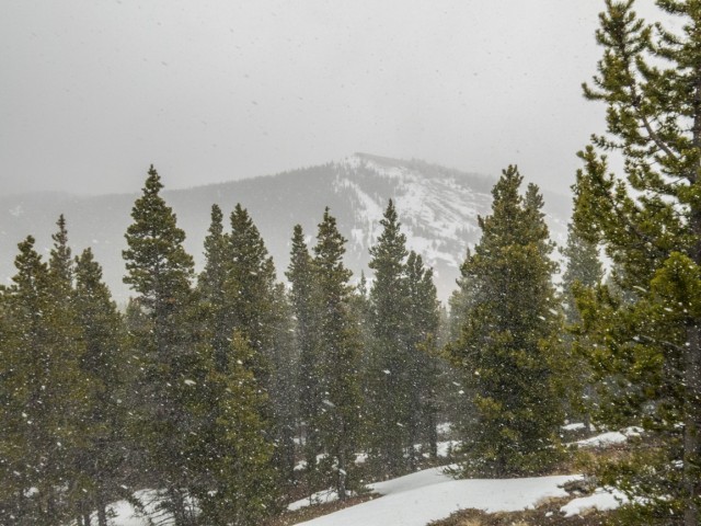
The views to Nihahi Ridge directly west, a long high wall of rock, are good here, except that clouds and blowing snow moved in just as we arrived, meaning we saw nothing of it.
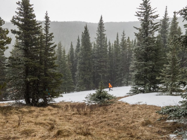
There is no trail to North Powderface Ridge, but the going is normally obvious – head north following a treed ridge which later opens up. We make a half-hearted attempt to continue, but soon turn back. The snow shows now sign of abating, and in fact only increases and the wind blows ever harder. The thought of being on a cold. blustery open ridge loses its appeal. And what would be see anyway? More snow I guess. That’s not really a motivator.
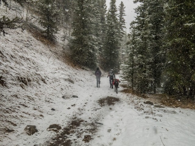
A group of hikers, the first of two we saw this day, arrived at the pass the same time as us. They quickly retreated to lower elevations, while we took time for lunch, the snow swirling around us.
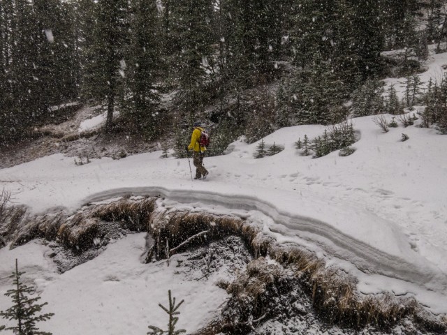
Heading back down, we retrace our steps. The snow continues to fall, heavier and heavier as the minutes pass. We can hardly see. None the less, we have no problems and the trail is obvious even in these white out conditions. Part way down, I find two doors (same exact colour) belonging to that truck seen earlier. Odd, they are well down the valley from it.
Making good time it’s not long before we’re back at the car. Soon after the snow ends and the clouds disperse. Naturally.
Powderface Creek Trail, sometimes referred to simply as Powderface Trail (without the Creek), seems popular no matter the time of year or the weather conditions, although the day of our visit, things were oddly quiet. Expect to see bikers and equestrian riders at times along this route.
Will we try again? Sure, I think the goal is well worth it. North Powderface Ridge, we’re not done with you yet.
More hikes where the weather was less than ideal…
Powderface Ridge not far from here.
Return to Eagle Hill.
Barrier Lake Lookout Loop.
If you wish more information on this trail, by all means contact us!
Date of adventure: April, 2015.
Location: Elbow River area, Kazantzakis, AB.
Distance: 17km there and back.
Height gain maximum: 520m.
Height gain cumulative: 550m.
NOTE: all heights and distances are approximate.
Reference: Kananaskis Trail Guides by the Dafferns.
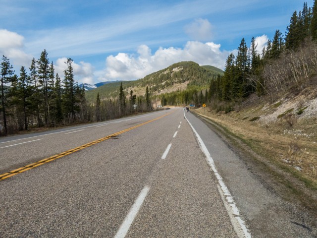
We start under blue skies.
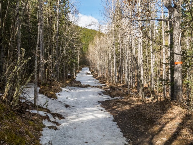
Many sections of the trail still hold snow.
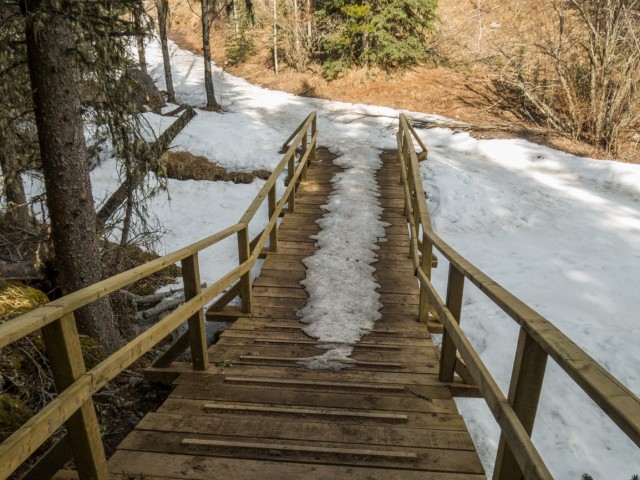
A handy stairway bypasses an icy section.
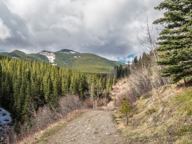
The east facing flanks of Powderface Ridge can be seen in back.
Heading up more steeply now.
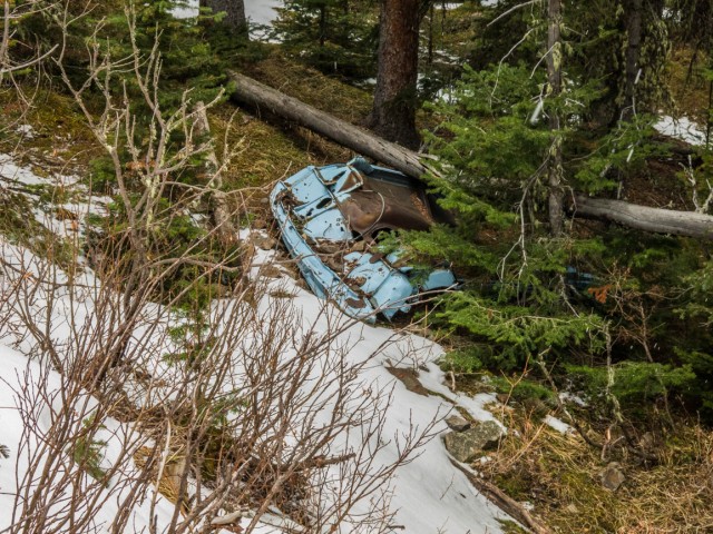
Remains of an old truck.
The clouds move in.
The pass between the two Powderface Ridges.
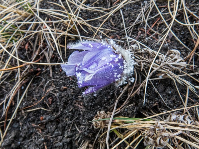
A Prairie Crocus, the earliest flower of spring.
Powderface Ridge proper in back.
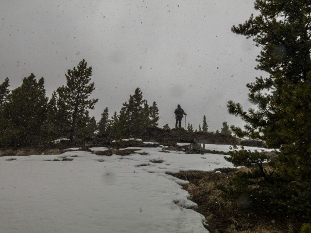
We give up here, not quite at our goal.
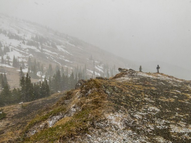
Visibility lessens further.
Time for lunch.
Other hikers head down to escape the snow.
Much of the trail is an old exploration, now overgrown.
The snow in places is still quite thick.
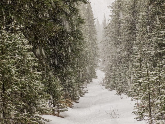
And now it really comes down.
I go off to check something shiny.
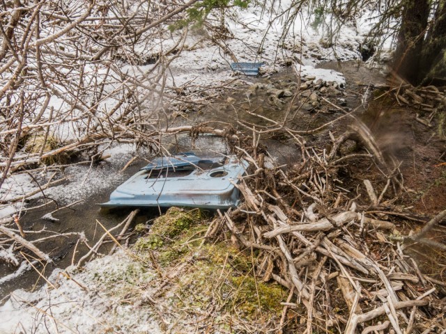
It’s the door to that truck we saw earlier.
Junction with the Prairie Link Trail.
We’re passed by some faster hikers (we’re slow pokes).
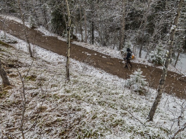
Nearing the end of our journey.
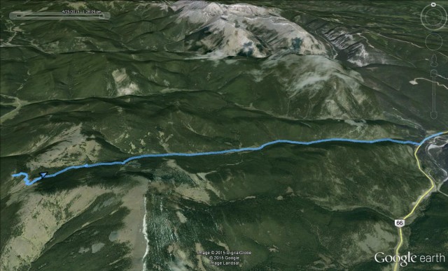
Our goal was the bare spot (left) above the GPS line.
")


Wow! That’s some kind of storm that blew in.
Indeed, it was a white out at times. Not like these sorts of storms are unexpected though. Spring can be quite unpredictable in Kananaskis.