
Razor’s Edge
This hike we wanted to see if it was possible to summit modest sized McConnell Point (front ranges, Bow Valley, Kananaskis) starting at Barrier Lake, using a series of connecting trails. To mix it up it bit. And indeed it can be done, except we failed to account for a two things, time and energy. This route is a loooong one and we ran out of both just shy of our goal. In the end it’s not terribly practical. The last section we hiked however, Razor’s Edge, is a fine objective in itself, with lots of nice views and fun and varied terrain, a real joy to hike, so it wasn’t a complete wash.
We most certainly will return to McConnell Point and instead will approach it the normal (much shorter) way, via the Trans Canada Highway. I guess we should have done that in the first place. Oh well, it was worth a shot and we had fun.
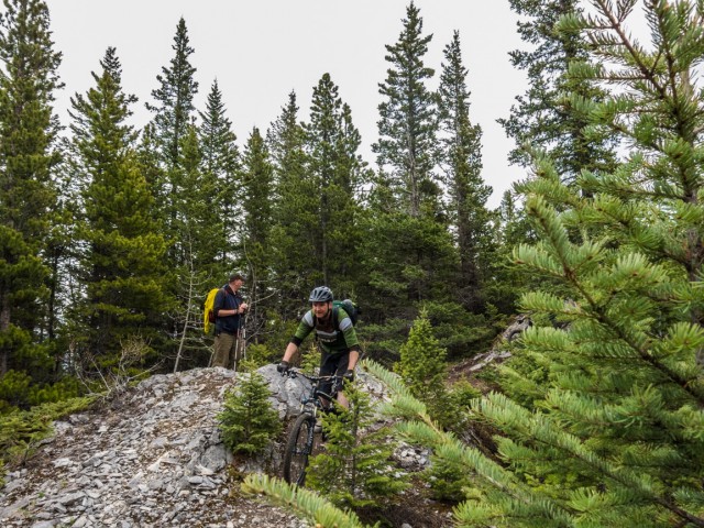
While all the trails used this adventure are open to mountain bikes, the Razor’s Edge section is most popular with riders and as such one should keep eyes and ears open for them. They can be moving fast. Given the way the trail plays out, bikes almost always come in from the south.
If you want to do this crazy route here’s the hows it’s done…
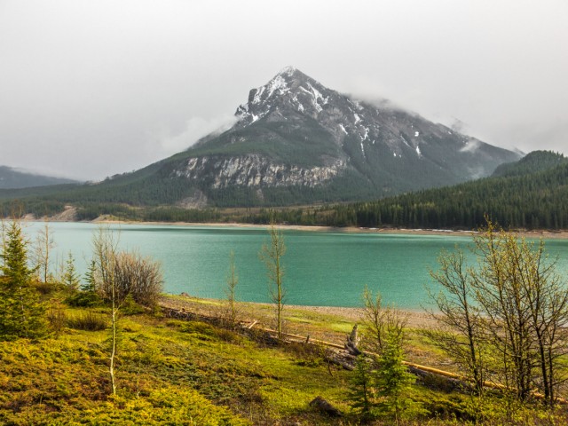
Start at the Barrier Lake parking lot. Cross the dam (always windy) and at the power lines turn left. Sentry Mountain is seen in the east. Stay under the wires paralleling and staying close to the lake until you come to signed junction. Turn right on the Jewell Pass trail. It initially climbs high above Jewell Creek, then drops down to meet it.
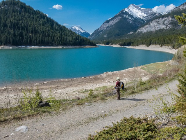
You’ll soon come to tiny Jewell Falls, which is a fine hiking goal all by itself. Always photogenic, it was still frozen on our visit, the ice a pleasant light blue colour.
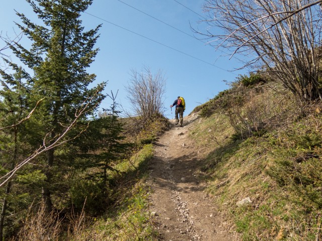
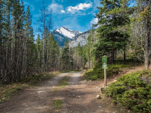
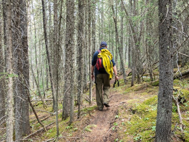
The last click or so, damage and debris from the spring 2013 floods can be clearly seen. A new trail bypasses a washed out section, heading up right behind the falls. It climbs up steeply for a bit then settles into a more gentle grade. At a four way junction (signed) turn sharp right taking the Prairie View Trail. The forest is still thick here.
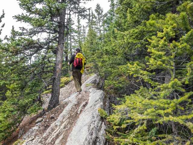
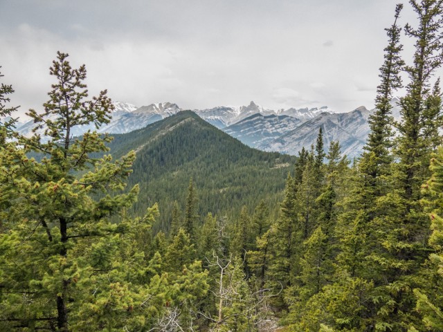
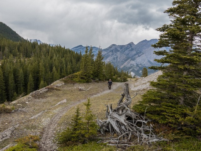
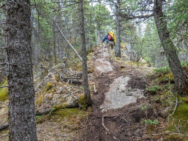
Always heading up, watch for a trail heading off on the left in the next kilometre or two. This is Razor’s Edge, initially in the trees, it meanders and rolls gently. At a bump, the high point for us this day, the woods thin and the going gets more interesting. There are some views here and there, mostly to the east, and the ridge gets more exciting, often becoming quite narrow in places (it’s still in the trees though). There are few short ups and downs, some of them steep with some loose and rocky sections. Watch for bikes – this is where they’ll be moving fastest.
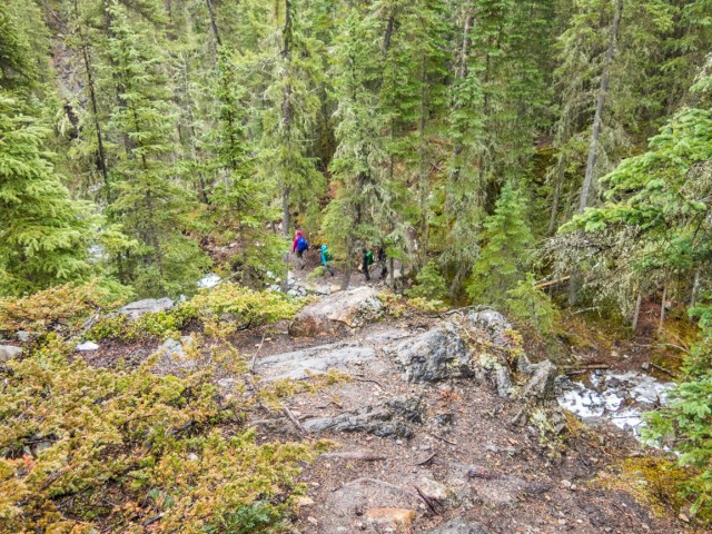
I can see why the trail is so regarded by serious mountain bikers. It’s exciting for sure and even a bit hardcore in places. It ranks highly on many websites. We saw perhaps a fifteen or twenty riders our visit, all of them on the Razor’s Edge section of our route. Most bikes, based on our trip reports, come in from the connecting Quaite Valley Trail, which connects to that four way junction we passed earlier.
Soon our hoped for objective, McConnell Point, sometimes called Biffy Mountain due to a small outhouse looking shed near its summit, comes into view. It’s still a way off. Yikes!
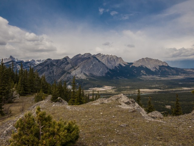
We decide it’s not going happen, no, we know it’s not going to happen. We’re just too tired. Remember, it’s early in the season and we’re not yet in peak shape (get it). Plus the the clock was ticking and we certainly did not want to run out of day. Instead, we decide to follow Razor’s Edge to the ridge’s end and leave it at that. Not really a bad decision, as the views on this trail are fine.
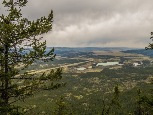
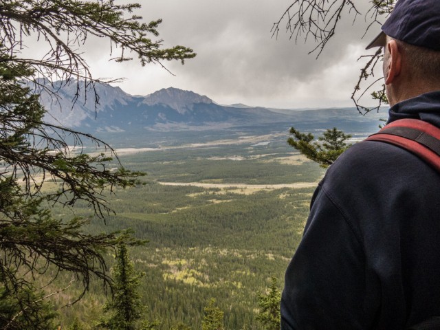
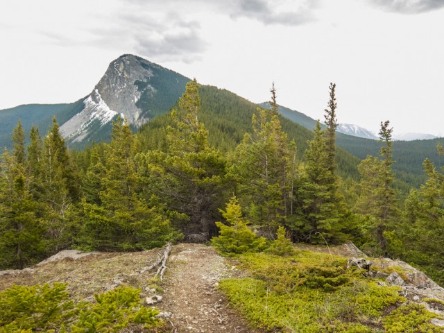
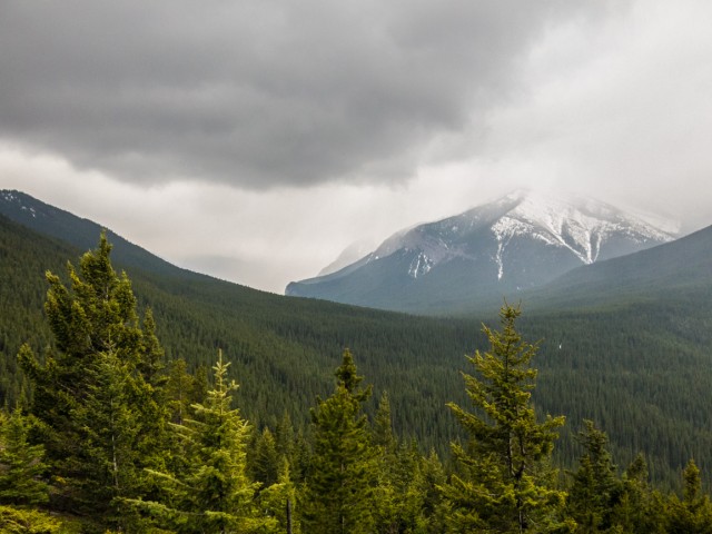
If you’re up here, take time to look at the mountains around you. In the north is the distinctive flat-face of Yamnuska. It’s the first big mountain on that side of the Bow Valley and is a very popular scramble route. To the east rolling hills transition into the the prairies. To the southeast is Yates Mountain, home to the Barrier Lake Lookout. In the west, you’ll see Heart Mountain’s north/south ridge.
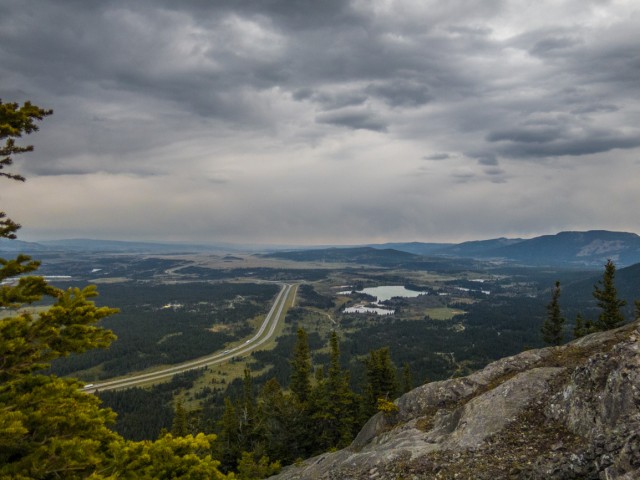
Down below the busy noisy Trans Canada Highway can be seen. The CPR’s east/west mainline runs down the same valley and we even catch view of a passing freight. High altitude trainspotting!
Quickly running out day, we have to head back. Soon a storm rolls in and we get drenched for a time. No big deal, it’s part of the experience.
As said, we’re not through with McConnell Point. Our way defeated us, but we’ll return via the shorter normal route. I’m certain of that. I hate it when we fail to reach our objective, so we must return, even if the goal is not a lofty one.
More hikes in the area…
Lost under Yamnuska.
Jura Creek.
Barrier Lake Lookout loop.
If you wish more information on this trail, by all means contact us!
Date of adventure: May, 2015.
Location: Bow River Valley area, Kananaskis, AB.
Distance: 22km there and back.
Height gain maximum: 420m.
Height gain cumulative: 480m.
NOTE: all heights and distances are approximate.
Technical bits: slabs with loose materials, watch for bikes.
Reference: Kananaskis Trail Guides by the Dafferns.
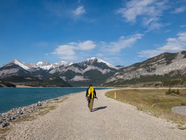
Crossing over the Barrier Lake dam.
Under the power lines.
Lovely colours.
Take a right at the signed Jewell Pass Trail.
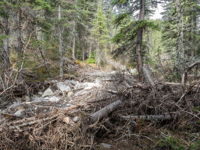
Flood damage (from 2013) along Jewell Creek.
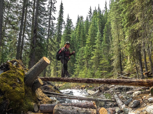
A newly built bridge.
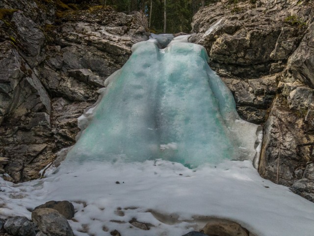
Frozen Jewell Falls.
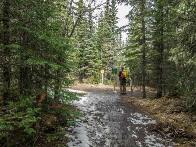
The junction at Jewell Pass.
On the Razor’s Edge Trail.
The trees start to thin out.
Flat faced Yamnuska just left of centre.
The ridge here…well…has a razor’s edge.
Our first look at McConnell Point.
The views get better.
Looking east to the prairies.
Looking west.
Heading back just shy of our goal.
Yates Mountain.
A steep drop off used by (crazy) mountain bikers.
Head’s up!
A short and steep rocky section.
Jewell Pass is roughly centre.
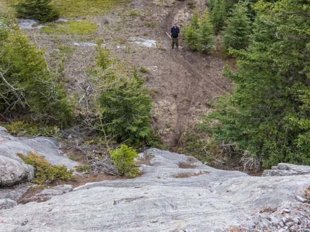
Looking down at other hikers.
Sentry Mountain across the lake.
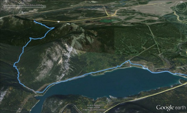
The rather long route. Start right.


Tough and demanding ride, so I’ll hike it next time!
It’s too hardcore a bike ride for me.
We biked it on the weekend. Great ride. Lots of pebbles on the slabs. Wiped out twice.
Myself, I’d be scarred to ride it!