
Upper Kananaskis Lake loop
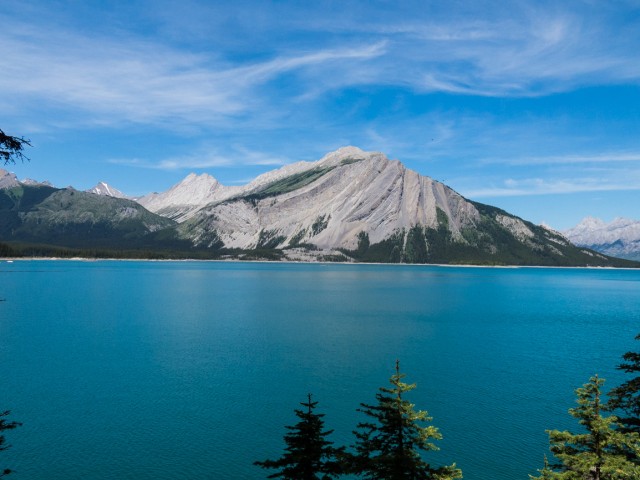
This adventures finds us in Peter Lougheed Provincial Park, deep in the heart of Kananaskis. Our objective is the Upper Kananaskis Lake loop trail, a wonderfully scenic hike that we’ve done before but never tire of. It’s a stunning place, of azure waters, deep green forests and majestic peaks. When the light is right, and it was this day, the amazing colours seen only get better. It’s near impossible to take a bad picture here.
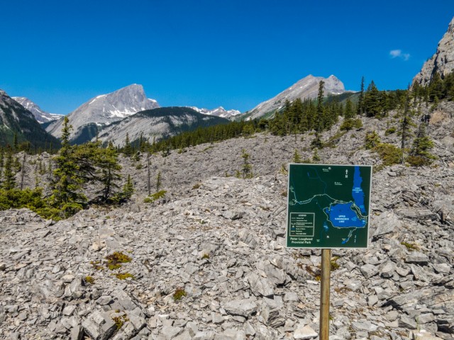
There are two starts to the trail, the south or north Upper Kananaskis Lake parking lots (we picked the former). We traveled the loop in a counterclockwise fashion, not that it really matters. Elevation gain in minimal on this trail which turned out nice for us, given the day turned into a scorcher, sapping much of our energy. Hills, simply, would have been murder.
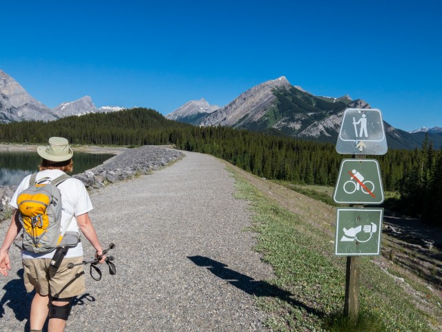
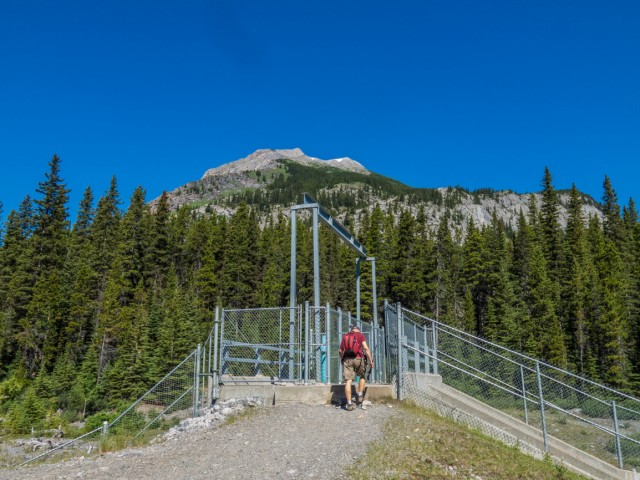
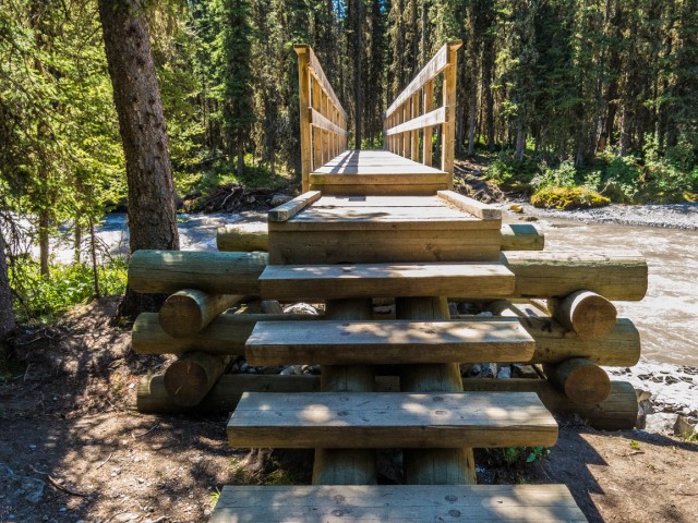
Head out in a northerly direction, on pavement, passing a picnic area, another parking lot and finally a boat launch. Then, cross the dam (recall, the lake is actually a reservoir). Plunging into the forest, the trail stays close to the meandering shoreline for the next few clicks. Here and there are side trails that lead down to the water – good places for photo ops. Lower than usual lake levels mean that some islands located near the shore are now connected via land bridges.
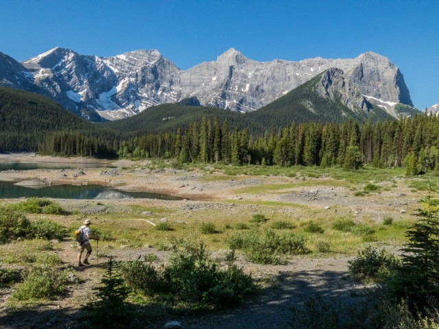
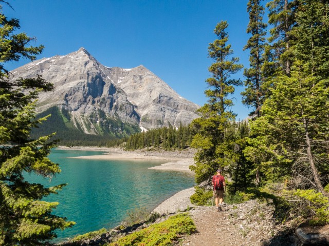
At break in the trees, one gets a good view of mountains to the south, west and north, These include Mt’s Fox, Foch and Sarrail, all sort of interconnected together, Mt Lyautey and Mt Indefatigable.
The lake is alive with water craft, mostly canoes and kayaks.
A particularly scenic bay is passed. The trail has suffered some damage here and a temporary route drops down to lake level just before the north parking lot. We pass a number of anglers working the shore (you can look in the clear waters and see the fish) – we’ll pass lots more people fishing today, some on land, some on water craft.
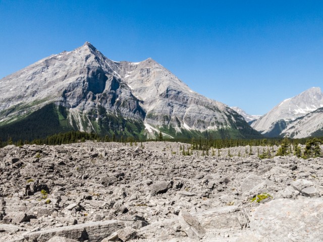
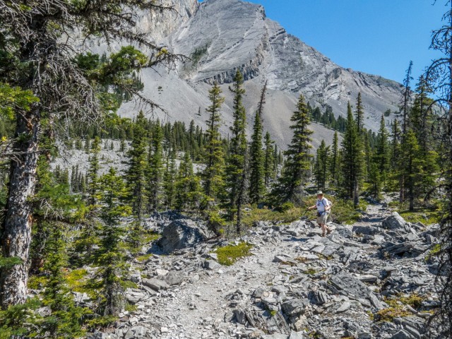
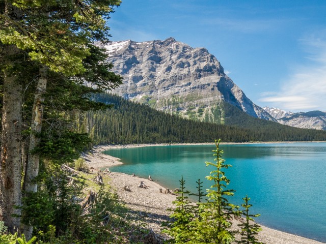
Crossing a spillway (Lower Kananaskis Lake seen below), the trail turns west on the north shore and follows an old exploration road for a time. The decommissioned Mt Indefatigable scramble route branches off here (people still use it). At a signed junction drop down. The trail rises and falls and soon comes to a slide area. This massive jumble of rock came down off Mt Indefatigable eons ago and even now, little in the way of vegetation grows here. We spot some climbers on the slabs above.
At a signed junction, turn left. Before heading back into the trees, check out the views all around. Bedsides the mountains mentioned already, some new ones can be seen in the east, including Gap Mountain and Mt Pocaterra. A small treed bump in front is home to the Kananaskis Fire Lookout. Looking west, a valley stretches off in the distance, home to the Kananaskis River, which we’ll later cross.
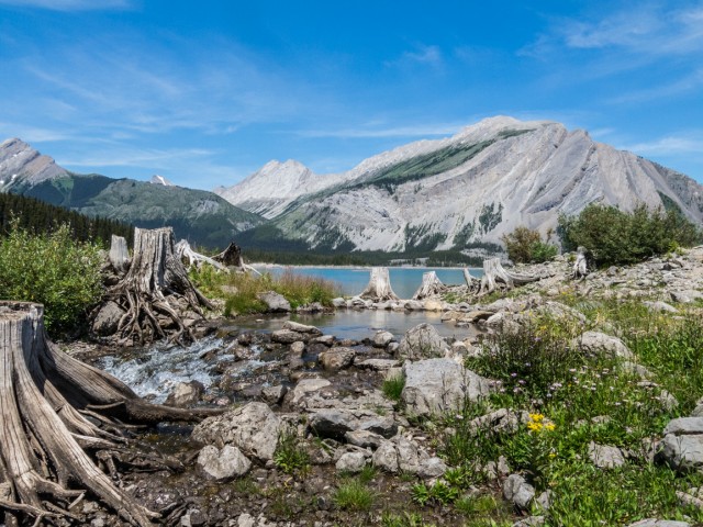
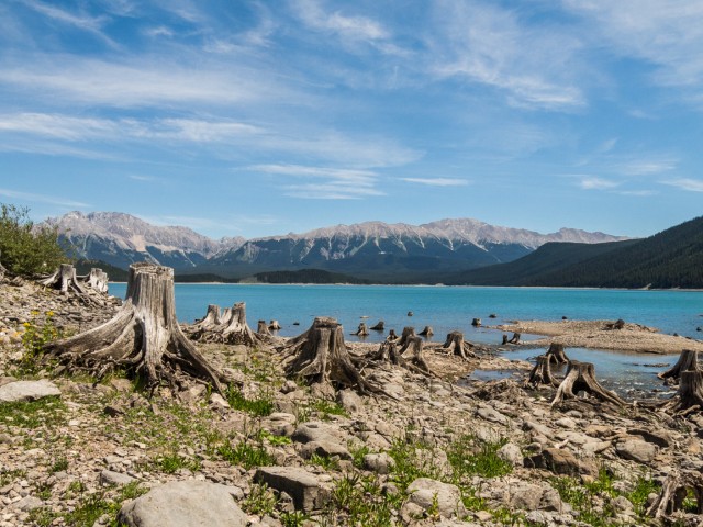
At a side bay, the Point Backcountry Campground is passed. Looks like a nice place to spend a weekend. After a stump graveyard (you’ll notice lots of stumps around the lake – it was a forest here before the waters were dammed) we soon come to the Kananaskis River. Along here, parts of the trail were washed away or damaged in the spring 2013 floods, requiring a reroute. Cross the river just above series of step falls. They’re photogenic, although the forest makes it hard to get a good shot of them.
The trail travels through a boggy area (moose can sometimes be seen here) and leaves the lake shore for a while, rising up then dropping down a bit. A new by-pass has been built along here – due to flood damage I presume.
An unmarked and fairly faint side trail takes one to Hidden Lake, a kilometre or so away (and later more into the back country). The lake is full, but at other times has been totally dry. It has no outflow and instead drains underground. The shore is choked with dead wood. A small waterfall can be seen coming off of a cliff to the right. On the far shore the north face of Mt Sarrail looms above.
Back in the main trail, it heads back down to the lake, or at least very close to it. The vegetation along this section is more rain forest like and very dense in places. At one point a large series of springs bubbles out of the ground near lake level. It’s worth checking out.
Passing a few avalanche chutes, the trail crosses a number of small creeks, one the outflow from Rawson Lake, located in a mountain bowl not far away (and up). The trail was fairly quiet until now but soon got quite busy. I doubt many of the people passed were doing the loop we did however. By now the heat of the day really started getting to us. At least we had lots of shade.
The Rawson Lake trail drops down from right and then soon after Sarrail Creek comes into view. There used to be a bridge here a couple years ago before it was washed away, and I’m guessing there will be one again sometime soon. Until then one can cross on logs above Sarrail Creek Falls, or below them on slippery rocks. Or you can do as we did and ford the stream where it enters the lake. Ah, cool water!
Lots of people we seen here soaking up the scenery, fishing, snapping photos and canoeing or kayaking around. The falls are a magnet.
Back on the trail, it’s a quick uneventful run to the parking lot. The lovely blue skies that held strong all day, soon turned hazy. Lucky us, we had good light most of this trip.
Some of our favourite hikes from the area…
South End of Lawson.
Amazing Burstall Pass.
Headwall Lakes.
If you wish more information on this trail, by all means contact us!
Date of adventure: June, 2015.
Location: Peter Lougheed Provincial Park, Kananaskis, AB.
Distance: 18km combined loop with a small side jaunt.
Height gain maximum: >100m.
Height gain cumulative: >100m.
NOTE: all heights and distances are approximate.
Reference: Kananaskis Trail Guides by the Dafferns.
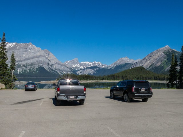
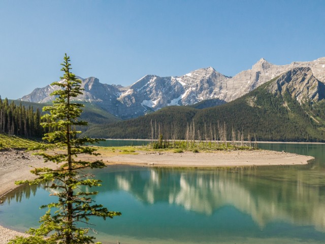
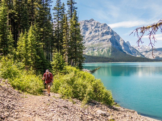
We start at the south Upper Kananaskis Lake parking lot.
Crossing the dam, we head in a counter-clockwise direction.
Can’t complain about the views.
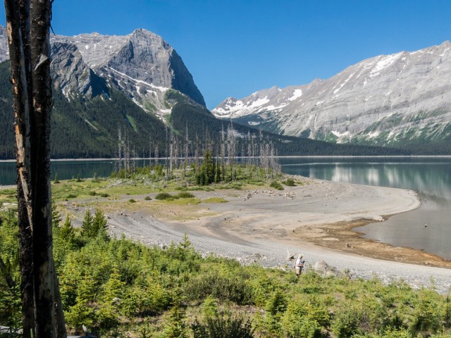
The lake is actually a reservoir and the water a bit low on our visit.
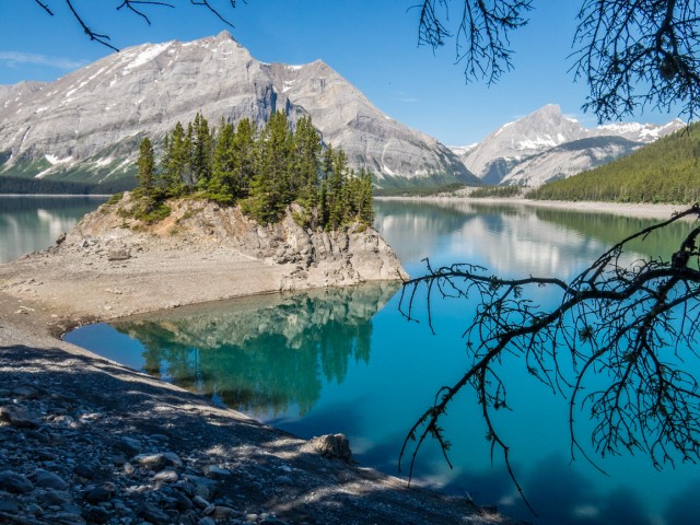
We’re facing south.
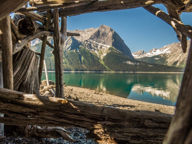
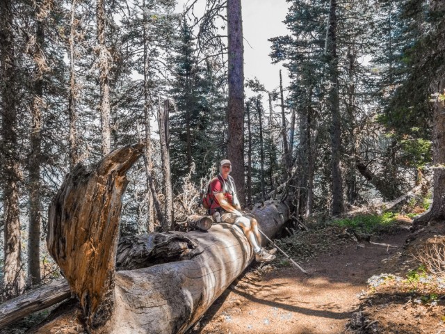
From a driftwood shelter.
When the light is right, and it was this day, the colours are amazing.
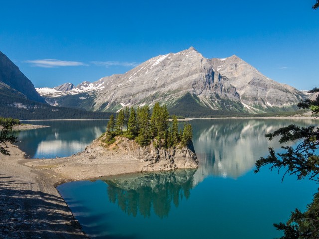
Wow! Mt Lyautey on the far shore.
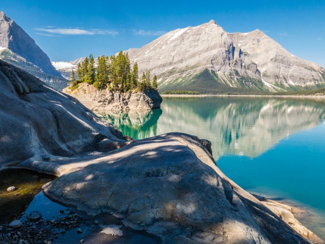
It’s hard to take a bad picture here.
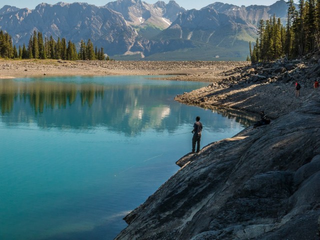
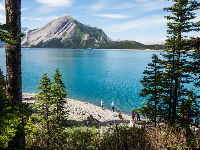
The lake is popular with anglers.
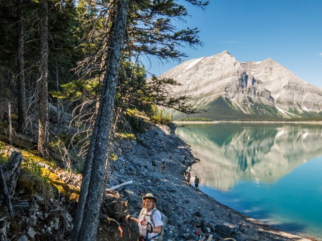
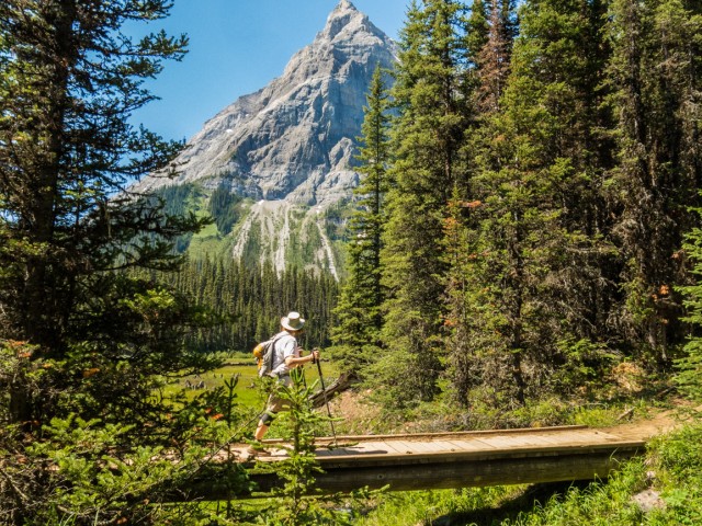
Connie’s never far behind.
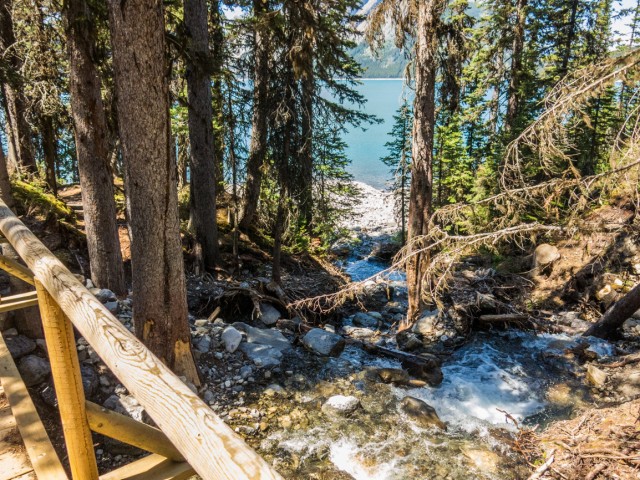
Crossing a spillway.
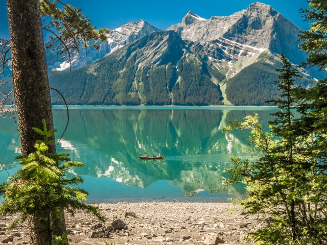
Canoeing and kayaking are also popular activities here.
On the north shore.
We enter the slide area.
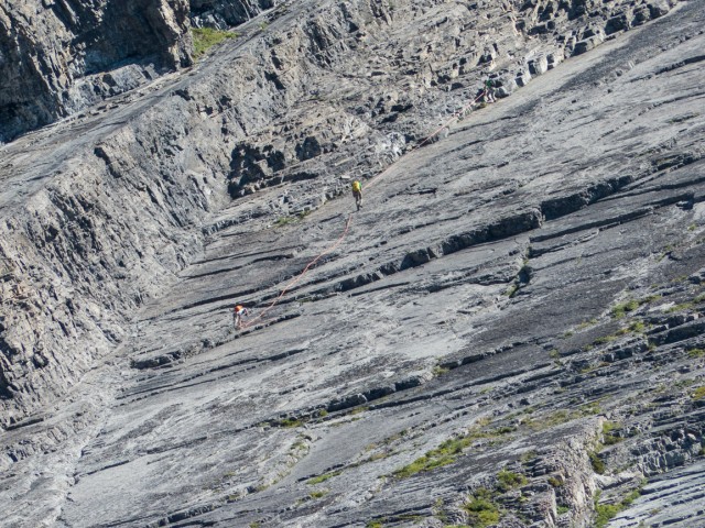
Climbers on Mt Indefatigable.
Nothing but barren rocks all around.
The trail and lake are within Peter Lougheed Provincial Park.
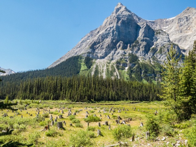
A stump graveyard.
The views don’t stop!
Crossing Kananaskis River.
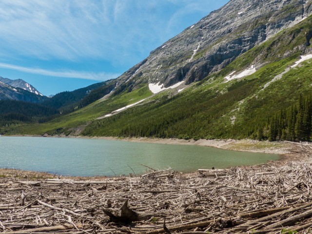
Hidden Lake with its wood-debris choked shore.
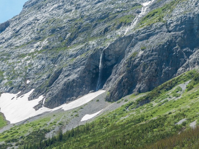
A small waterfall.
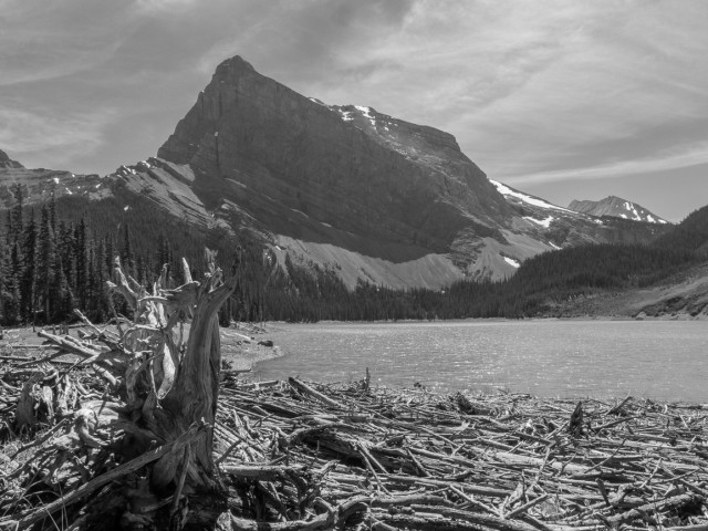
Mt Sarrail on the far shore.
A spring almost at lake level.
Looking east.
Mt Indefatigable.
The south shore.
Taking a break from the heat.
Another great view.
We cross a creek.
Getting closer to the parking lot, we see a lot more people.
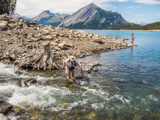
Fording Sarrail Creek.
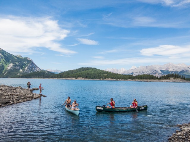
It’s a popular spot.
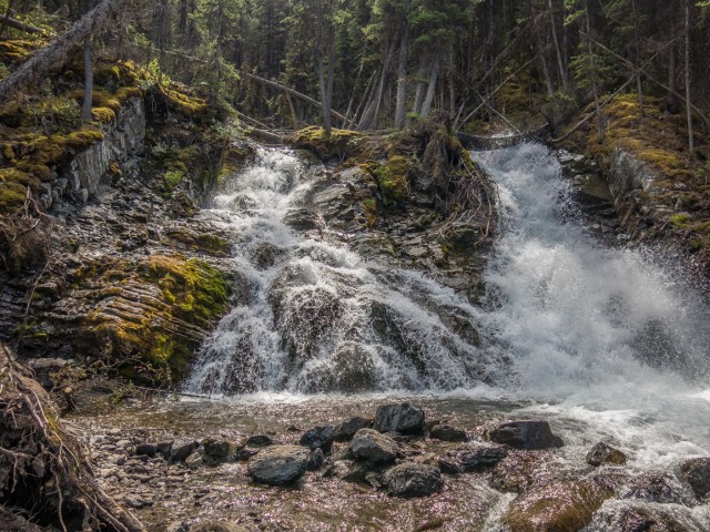
Sarrail Creek falls.
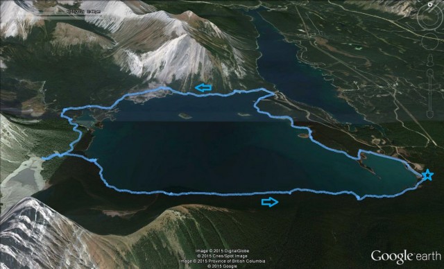
Our route around Upper Kananaskis Lake (star = start).


As we are planning a trip to the Canadian Rockies in summer, can you tell us how much of this spectacular scenery at Upper Kananaskis Lake can actually be seen from the road and from various pull-over stops? We’re avid hikers too but may have some time restraints that would prevent us from taking as many trails as we’d like, so we’d like to at least get in as much as we can from the road – I like to find a map with points of interest on it as one drives the highway that goes by the lake. (We’ve hiked in the Canadian Rockies before but actually never knew this part of Canada was just as awesome!!!)
So nice to hear from you. There are two points that can be driven to where one can view the lake. They’re marked the North Interlakes day use area and the Upper Kananaskis Lake day use area on Google Maps. To see most of it though, you have to hike. Have a great trip!
I noticed a lot of trash on the trail near the falls when we visited last year.
The place was nice and clean on our visit. But damn those people who do such things, a small but troublesome group.
OMG! Amazing photos!
Amazing scenery there. We’re so lucky!
I did this hike last Wednesday with my kid and dog. I would suggest going mid week like we did to avoid crowds found at each end. The scenery never disappointments on this hike. Happy Canada Day!!!!
Even with the crowds near the falls, it was a pleasant place for us.