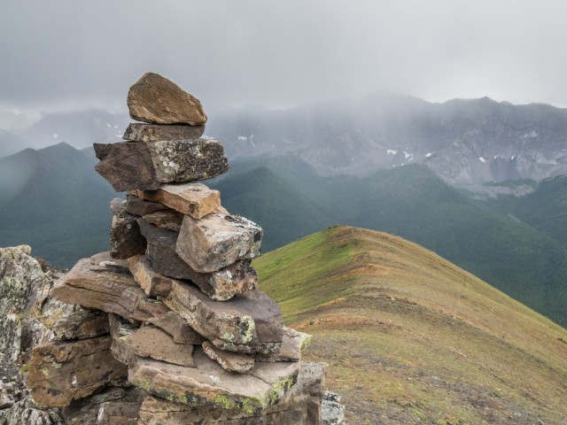
Reaching the top of Mount Lipsett is incredibly simple and easy. One need only follow an old road that meanders up to within sight of the summit. From there is a quick push and you’re done. Even though it’s not a terribly high elevation “peak” (okay, calling it that is stretch, it’s more a big hill), especially when compared to Mist Mountain directly east, the views from it are pretty darn good over all. It’s a hike we highly recommend.
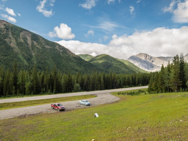
Located in the Highwood Pass region of Kananaskis, the trailhead is along Highway #40 at an obvious pull out, north side, about midway between the Mount Lipsett and Mist Creek day use areas. There is ample parking.
↓ ↓ ↓ ↓ Scroll down for photos and to comment ↓ ↓ ↓ ↓
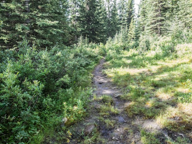
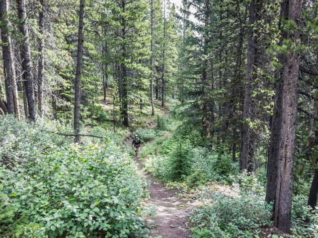
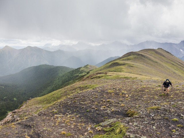
Climb the bank and at a grouping of large rocks plunge into the trees. Get used to them, for the next while that’s all you’ll see. At a junction, soon in, go left and almost immediately after head directly up, sometimes at a sharp angle. This and the last part near the summit, is about as steep as it get. The rest of the way, elevation is gained ever so gently. Hard core types might hate it. We found this “stroll” in the woods pleasant.
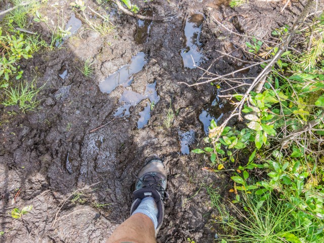
To your right you can hear a gurgling creek but not see it. The trail abruptly turns left and enters a boggy area. Prepare to play in the mud. From here on, almost to the summit, the road is your path. There are the occasional junctions, side roads heading here and there, but there is no way to get lost. The route is always obvious and clear.
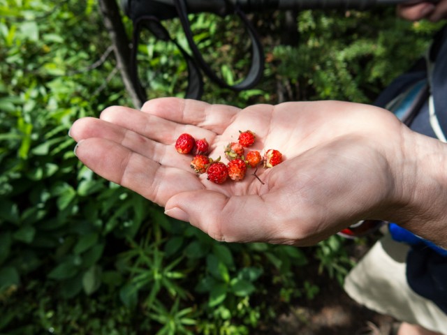
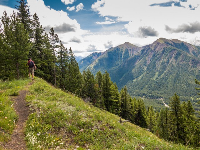
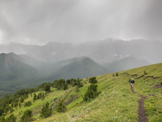
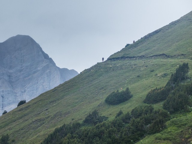
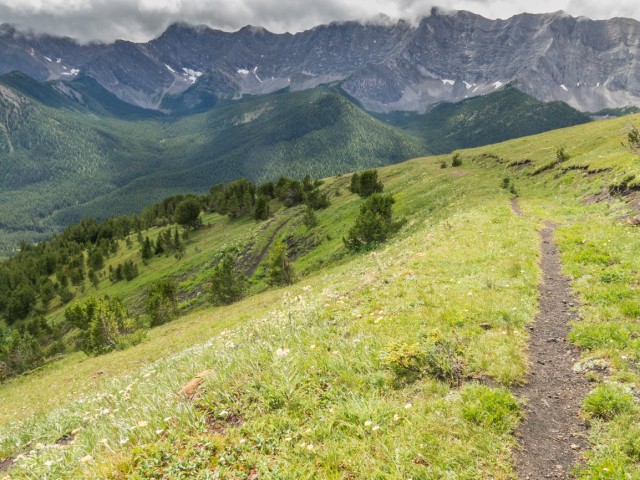
The trail switchbacks, now and then, as it gains height. There are occasional breaks in the trees higher up, allowing hikers a good view of Odlum Ridge in the south (an objective we’ve been eyeing for a time) and later, the barren Elk Ranges in the west. A LOT of wild strawberries grow along this section. They are small in size but yummy beyond belief.
Your path is a coal exploration road dating from the late 1940s or early 1950s, only slightly overgrown considering all the years that have passed since then. There is a lot of the black stuff in the area and many hillsides have scars from this sort of exploration work (they are not logging roads as some say). They’d send a Caterpillar up a hill, crosscutting as they’d go, to see what seams would be exposed. Simple and unscientific.
No coal mines were ever developed in the area. The stuff is good quality, it’s just that transportation costs and declining markets made the projects uneconomical,.The old tracks left behind sure make for good hiking trails. Other hills and mountains in the area that have similar coal exploration roads beside Mt Lipsett include Mist Ridge, Picklejar Ridge (one of the South Mist Hills), Cat Creek Hills, Junction Hill (east flanks), Pasque Mountain and many others. All take you close to the respective summits. Nice!
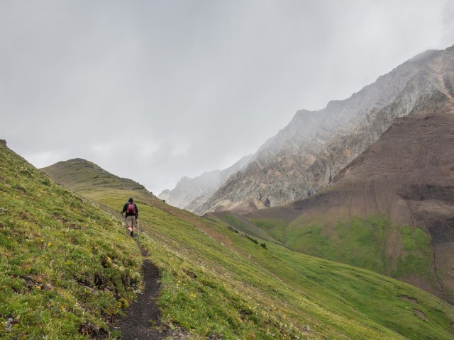
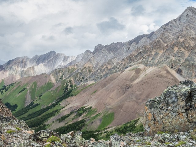
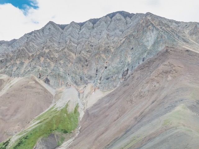
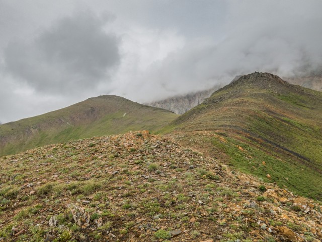
Soon Mist Mountain comes into view, a giant compared to the bump we’re climbing. Mount Lipsett is actually an outlier, a secondary lower summit connected to it. Mist has some nice rock colours but fog kept them from standing out much in the photos.
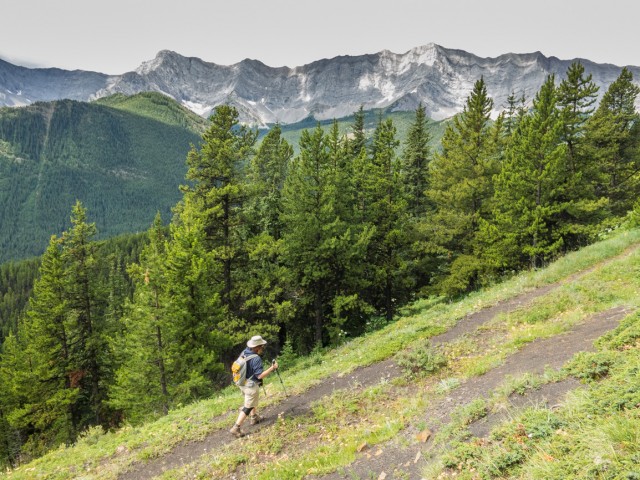
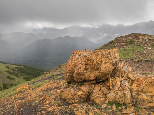
At a switchback the trail breaks out of the trees. Coal seams become visible now, either exposed naturally or in the road cuts. They are numerous seams, all tilted at a near vertical angle. The mines planned here were to be of the pit type.
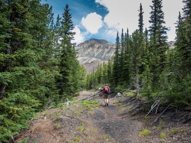
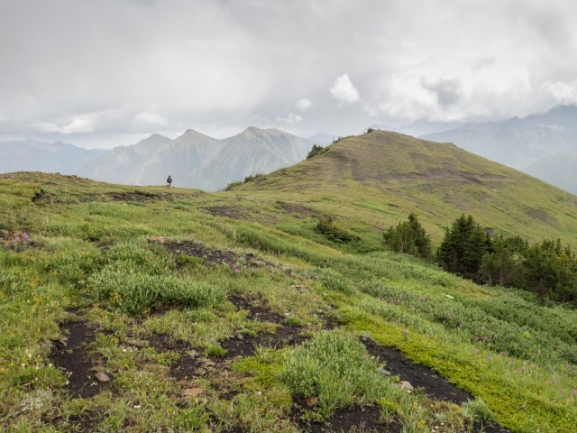
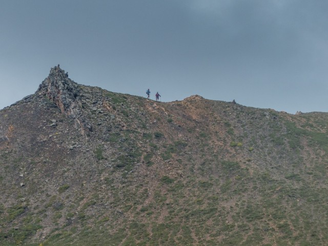
Leave the road where it turns hard left and take the obvious path. The summit is directly north and with a wee bit more work, finally comes into view. From here it’s not far off in distance nor height. We’ll visit the lower summit to the left (west) on our return trip. Traverse a slope then take a line to the west side of an exposed rib, on mixed grass and (sometimes) loose rocks.
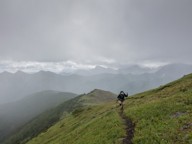
A storm threatened us. It boils and makes lots of noise and we worry we’ll either get soaked or worse, have to dodge lightning, but nothing really came of either. Thank goodness.
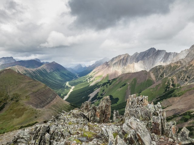
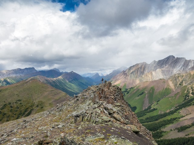
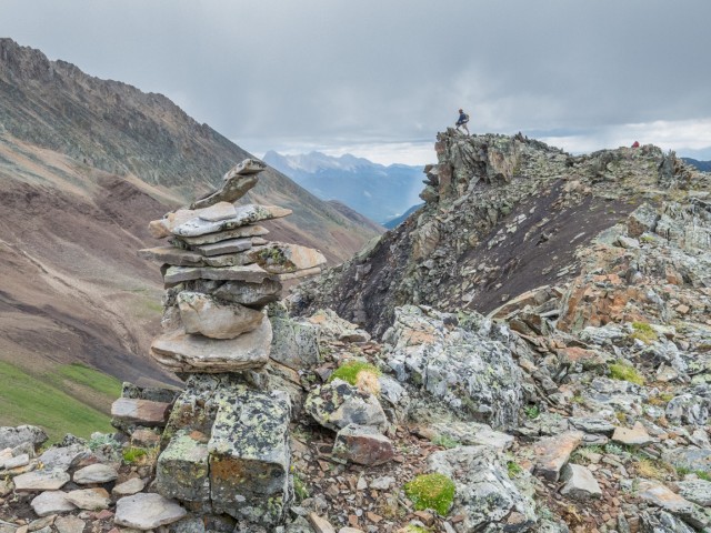
Top out and take in the views. You’re already familiar with Mist Mountain right beside you, aptly named as most of the time it was shrouded in swirling clouds. To the north is Storm Mountain. Below, Highway #40, open only during the nicer months, snakes up the valley heading towards Highwood Pass (the highest paved pass in the country). To the west and heading as far north and south as one can see is an impenetrable wall of limestone call the Elk Ranges. Some the mountains in that group include Mounts Pocaterra, Odlum and Tyrwhitt. British Columbia is right on the far side of them.
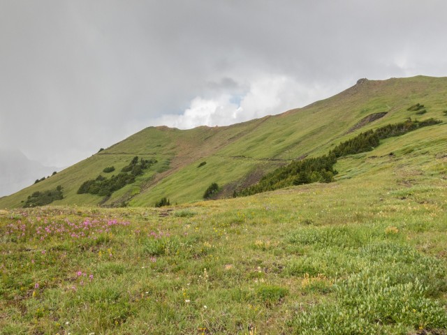
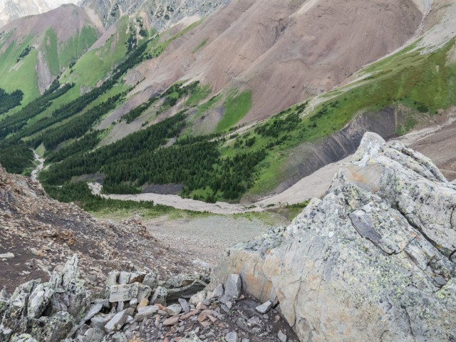
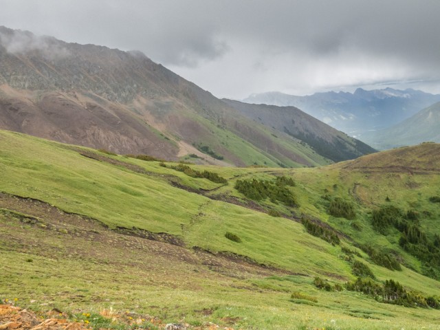
Directly south are a series of low-ish (relatively speaking) ridges and hills. And a sea of green. Directly below us is the Mount Lipsett/Mist Mountain col, it’s alpine environs a prime bear habitat. There was a warning at the trailhead mentioning a bear in the area.
We noticed a slump on the side of Mist, a huge one, easily hundreds of metres on each side, which exposed some coal.
We planned for lunch in the trees, so that we could find a sheltered spot just in case the rain fell (as it turns out nothing but a mist fell, and only for a short time).
As Connie headed down I quickly take in the lower summit of Mount Lipsett and the small ridge (or rib) that extends from it in a westerly direction. At its end I lose a bit of elevation and intercept that coal road that we left earlier and not long after meet up with Connie at the junction of it and the path to the summit. No trees up here meant we saw each other the whole time and could even easily converse, even if we were a click or so apart.
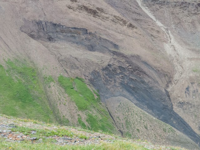
I notice more coal outcroppings here. The seams, separated by rock bands (stone not The Stones) and partially covered by grass, are quite obvious. Had they mined here, Mount Lipsett would have had it’s top shaved off considerably.
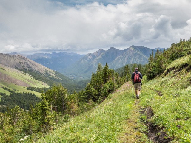
Trace your steps back to your car. Our trip down was uneventful and soon we’re back where we started, amazed just how easy this trip was. The rewards were great for what seemed like little work
We passed perhaps a half dozen other hikers this adventure. Not too busy, we like that.
Mount Lipsett is named after a World War One era British General that worked with Canadian Forces. He died just before the conflict ended and the mountain was so named shortly after.
If you wish more information on this trail, by all means contact us!
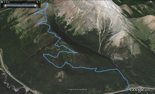
Date of adventure: July, 2015. Location: Highwood Pass area, Kananaskis, AB. Distance: 16km-ish by our route. Height gain maximum: 710m. Height gain cumulative: 780m. NOTE: all heights and distances are approximate. Technical bits: it’s prime bear country. Reference: Kananaskis Trail Guides by the Dafferns.
Glad we could be of help. It’s fantastic trail. Sorry, it’s been quiet here, that book deal, but once it’s behind us in a couple months we’ll be posting more epic hikes. Stay tuned.
Thanks for the trip my maiden name is lipsett my dad was a vet of the First World War Albert Clifford lipsett he also farmed in Alberta has family in lougheed I didn’t know there was a lipsett mountain Thankyou Jacquleen lipsett Hendry
It's a strange curiosity in south Kananaskis, there on a hillside and we have no idea who created it. We asked around and no one's completely sure about its history. In the past it showed the Canada 100 logo from 1967 but in 2017 someone changed it to reflect the country's 150th.
That's our friend Emily from DanOCan.com having a look.
Exploring history with Off the Beaten Path with Chris & Connie. Photo: 2017. Posted by Connie.
April 13th 2024, the Beer Parlour Project visited the Viking Hotel, Viking Alberta and it too was an awesome time. There's Rob Pohl with his curious view camera and in the other photo Chris is seen interviewing local character Doug.
The Viking dates back to the 1930s and replaced a hotel on this same lot, which had earlier burned down.
Incidentally April 13th is also Chris and my 28th anniversary. Chris said he forgot this when scheduling this but that's fine and it doesn't matter where we celebrate but that we celebrate.
Exploring history with Off the Beaten Path with Chris & Connie. Photo: 2024. Posted by Connie.
April 12th 2024, the Beer Parlour Project visited the Warspite Hotel, Warspite Alberta and it was a great success. They put up our sticker and look for it if you ever drop by. This will be another chapter in what will be a multi-year adventure documenting small town hotels all over the west. We chat with owners, patrons, old timers, local characters and we learn about the building too.
It's believed this one is 100 years old in 2024 and we'll confirm details during the research phase done later.
When we're done we'll have a huge collection of digital and film photos, plus voice recorded interviews for an art exhibit and a book is likely.
Exploring history with Off the Beaten Path with Chris & Connie. Photo: 2024. Posted by Connie.
This little stone house was built in the 1910s and while it's not exactly clear when last occupied, research suggests it was empty only a couple decades later. This is a dry area of the Alberta and most settlers moved out by the '30s. Trees in back were planted by the folks that lived here and there's no others around as far as the eye can see. In fact, there's nothing but natural prairie in every direction. When the word "remote" comes up, this is the place they're speaking of.
Look to the comments for more info and to see a stone smokehouse also on the property 👇
Exploring history with Off the Beaten Path with Chris & Connie. Photo: 2017. Posted by Connie.
The hardware business is long gone but their old sign from about a century ago remains. We were doing a little walk-about in Three Hills and had a tip to look here. It's little things like this that we love the most, hidden reminders of things that came before and clues to the past that aren't so obvious.
More info in the comments👇
Exploring history with Off the Beaten Path with Chris & Connie. Photo: 2023. Posted by Connie.
The Canadian Pacific Railway at Summit Lake Crowsnest Pass in 1983 and 2023. The trains still run, but the railyard and associated infrastructure is a distant memory. Haze in the now photo is from distant forest fires. The old Summit Hotel can be seen in back in both and it's one of the few things still standing here from earlier times.
The Then photo come thanks to the John Bjorklund collection at the Center for Railroad Photography & Art and is used with permission. They sent us others and we'll hopefully be putting them to use later this year.
Go to the comments for more info 👇
Exploring history with Off the Beaten Path with Chris & Connie. Posted by Connie.
Thanks to the The Val Family for making this post possible. If you like what we do and want to support this ongoing project (12 years now), go here: https://www.BIGDoer.com/help-the-society/


")


Thank you for the pic of the parking area, I always thought that was the trailhead, but now it’s confirmed. Gorgeous photos. Can’t wait.
Glad we could be of help. It’s fantastic trail. Sorry, it’s been quiet here, that book deal, but once it’s behind us in a couple months we’ll be posting more epic hikes. Stay tuned.
I will be looking for your book for sure!
Awesome! It’s about the history end of things, but still it’ll be epic! Stay tuned.
Beautiful!
Short and sweet – thanks for commenting!
Wow!
Person of few words 2.0. Thanks, even the brief comments are welcome.
Beautiful !!!
A person of few word! Thanks!
Lovely photos and narrative. I was also here with our hiking club just one month earlier still remember this hike fondly.
Thank you so much! We love this hike, fun and interesting and nice scenic views. It’s about perfect.
Love reading of al your travels!
Thanks, and we so love presenting them to all our readers. Pleas, drop by often and comment when you can.
Thanks for the trip my maiden name is lipsett my dad was a vet of the First World War Albert Clifford lipsett he also farmed in Alberta has family in lougheed I didn’t know there was a lipsett mountain
Thankyou
Jacquleen lipsett Hendry
It’s so nice to hear from you Jacquleen. What an interesting connection!
Great time hiking this trail. A bit muddy at the start but all fun for the rest of the way. Great website, we read it often.
Glad you keep coming back. We love that hike!
This is terrific, thank you for sharing and building this website! We have no mountains where I live.
Your IP suggests SK. No mountains there, for sure!
(via Facebook)
Wow! That’s a hike of twenty somethings!!! I admire you two for your endurance and stamina plus determination!!
We’re 20 in spirit!
A great day with my best friend! XOXOX
Indeed, I could do this forever.
Excellent photos. Hiked this trail only once thanks for the memory.
We’ve done it twice and loved it lot both times!