
Protection Mountain Mine
Protection Mountain Mine
Story and photos by Chris & Connie.
This is a “history hike” where we combine two of our favourite obsessions. We’ll climb to a point high up on the flanks of a peak in Banff National Park to visit the Protection Mountain Mine (official: Eldon Showing) an operation that dates back about a hundred years. It’s one of the highest in elevation we’ve ever visited and the views from it are simply amazing. At the site are some small scale workings, tumbled down sheds or buildings of some sort, and the remains of living quarters. An old pack trail is used to gain access.
The trailhead is located off the Bow Valley Parkway (Highway 1A) about a dozen kilometres west of Castle Junction turnoff and not long after the (closed) Protection Mountain Campground. There is a pull off on the south side of the highway. A park pass is needed for this hike so be sure to display it in your window.
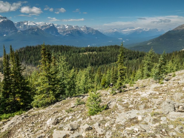
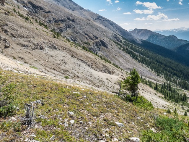
Cross the highway and follow a path next to stream as it head towards a power line right of way. Continue on, paralleling the same stream as it plunges into dense woods. For the next few clicks, the going is easy and for the most part fairly level, with the occasional boggy section and creek crossing to content with, some with rudimentary foot bridges.
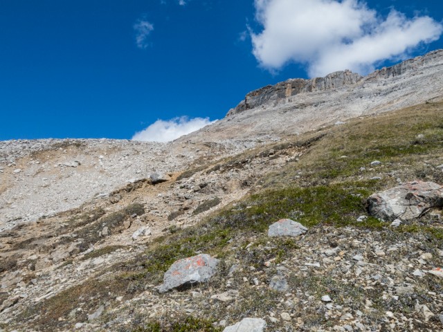
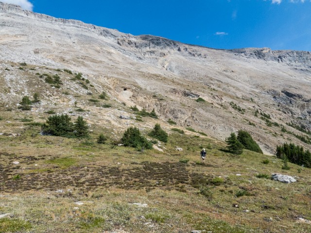
Just when you think something’s wrong – this is a mountain hike after all and shouldn’t it climbing – the trail starts to head up. Between now and the mine, there is nary a break in grade. Not one, but at least the angle is always fairly moderate. This is the old pack trail built in support of the Protection Mountain Mine. In spite of its age and that it sees light use today, it’s not a terribly popular nor well documented route, it’s in remarkable condition. Numerous old blazes can be seen on trees as you hike. The day of our visit, the whole forest floor was carpeted with mushrooms. Gazillions of them, so many types and shapes and colours, some of them freakishly large.
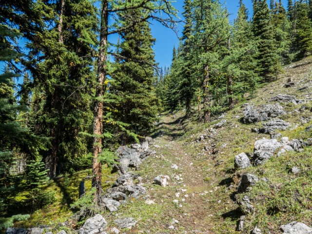
The Protection Mountain Trail makes the occasional switchbacks. Notice the deep gorge on your right through the trees, home to a small and noisy stream. Outside the odd opening in the woods, there are no views. But there will be later, at the end. And they’re spectacular!
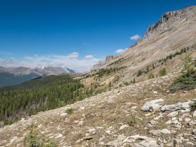
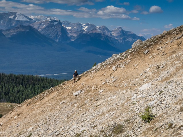
Up and up and up you go. It seems endless. Very briefly, as the tree line is neared, the grade eases, but not for long. The ground becomes rockier. Soon, if you look down and to your left, you’ll see an old cabin on a small parcel of level land (flat areas are rare up here). We’ll visit those remains on the way down. Larch trees announce your entry into the sub-alpine zone. Even they thin quickly and soon it’s all just barren rocks everywhere.
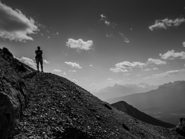
The views are breathtaking. Above is a step scree slope topped by daunting cliffs. The summit is still a fair way up and off though. Protection Mountain is a high one, and a long one, a near impenetrable wall of rock extending for many, many kilometres in either direction of your position. If you want to go higher now, the going is a scramble.
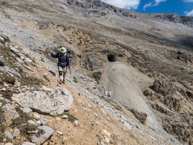
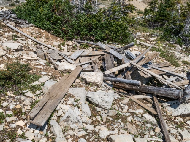
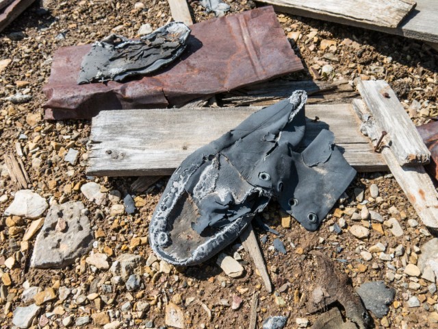
At a bend the mine adit (entry) finally comes into view, a gaping hole punched into the solid rock at the top of as steep gully. At this point are the remains of a couple small structures. Some old boots can be found inside one – we find old boots a lot. Strange.
To reach the opening take the faint trail heading right, taking care when traversing a steep and loose bank just before the adit. Trending left is a second trail. It looks like a continuation of the pack trail we’re on and we presume it’s simply going to head above the opening and double back at some point. As we find out afterwards during research, it heads up, quite a bit higher, to a second opening, which we did not know about on our visit (I understand it’s collapsed anyway). This trail is also used by scramblers going higher.
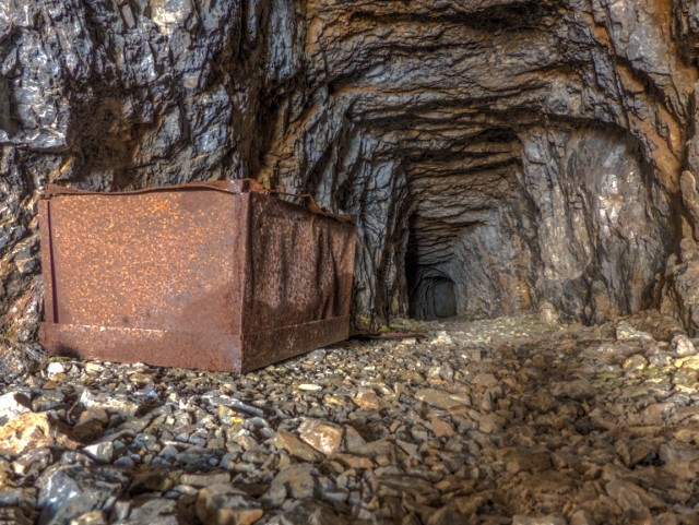
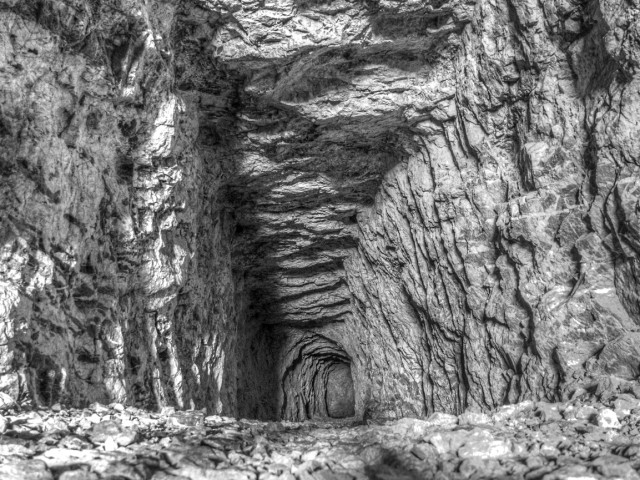
The mine itself only goes back a few dozen metres. It meanders a bit, before abruptly ending. As you go in deeper you’ll notice the tunnel (technically a “drift”) pinches and gets both narrower and the roof lower. Unfinished drill holes at the working face tell us they had intentions to continue on a bit further when work, I guess, was abruptly halted.
Going inside there are no real dangers to speak of. The rock is solid and stable, and given it’s short length things like air quality issues are not a concern. With the low roof, a helmet should be worn. Outside light is able to penetrate to the end, it’s that short. As seasoned mine explorers, we NEVER recommend entering any workings, but this one is pretty benign.
Inside are the remains of a well rusted stove (weird, it’s heavy and was brought here why?), what looks to be a length of bent drill steel, and a short piece of rail – not a small mine rail but of full size. No obvious evidence could be seen of a mineral bearing vein or ore body. We looked inside and out including at the small waste material dump at the entrance. I know others have found copper stained rock here, in bright greens and blues.
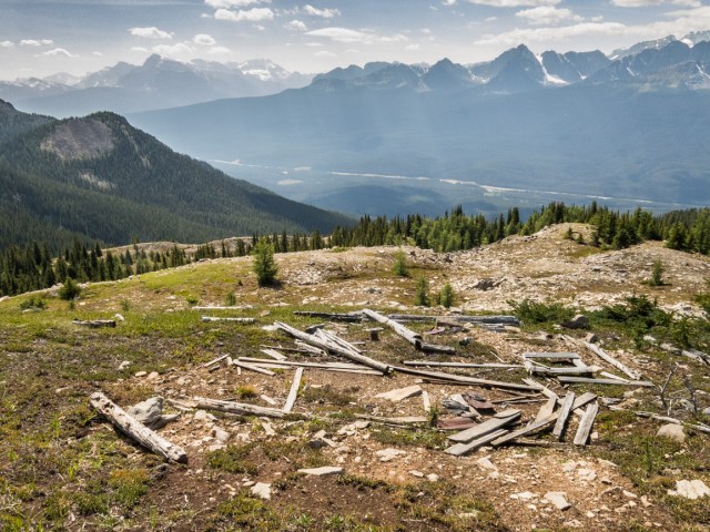
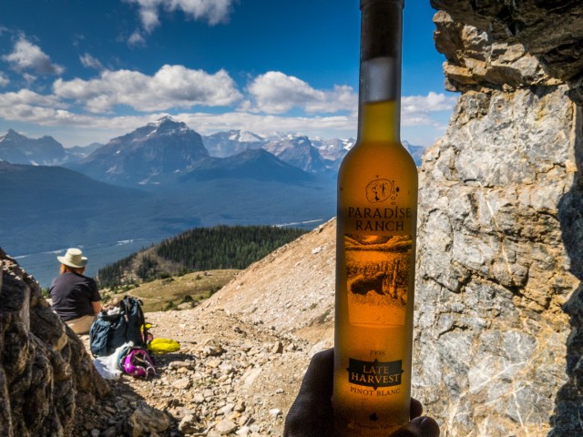
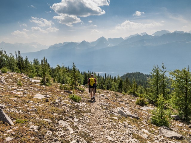
Turn around and take in the sights outside the entry. It’s the mine with the best view…period! All around are huge towering peaks. Below is the Bow Valley, the Trans-Canada highway, the CPR’s east/west mainline and an endless see of wonderful green. In the west the giant Chateau Lake Louise (we cannot afford) can be seen. Smoke from forest fires in the northwest US soon rolled in, obscuring everything in the distance. This spot makes a fine place to stop for lunch.
This is by definition a prospect mine that exploits a mineral showing (recall in government records it’s known as the Eldon Showing). Simply, they were testing the waters if you will, sampling as they went to see if mining on a larger scale was feasible. And clearly it wasn’t. The ore deposit was quite small and highly localized, proven by the small scale workings.
The ore, what little there was of it, was a mix of galena (lead), sphalerite (zinc) and chalcopyrite (copper), contained in veins, stringers and small pockets. These are not metals in the pure sense, since they’re bonded with other elements (sulphur mostly in this case) and require smelter processing to liberate. This is pretty typical. Pure, or native metals in their as-we-known-them form, are fairly uncommon.
Metallic minerals, by the way, just don’t exist in the Alberta Rockies making this occurrence a real anomaly. Head to BC and there are lots of metal mines. No so here. We know of three or so.
Old government reports (1950s) speak of two other adits (entries) on the Protection Mountain/Eldon Showing property somewhere nearby. Their location is not made clear however – we scoured the immediate area and came up empty handed. At least one person tackling the summit of Protection Mountain makes mention of a collapsed entry further up. By the way Eldon is in reference to a railway siding directly below the workings.
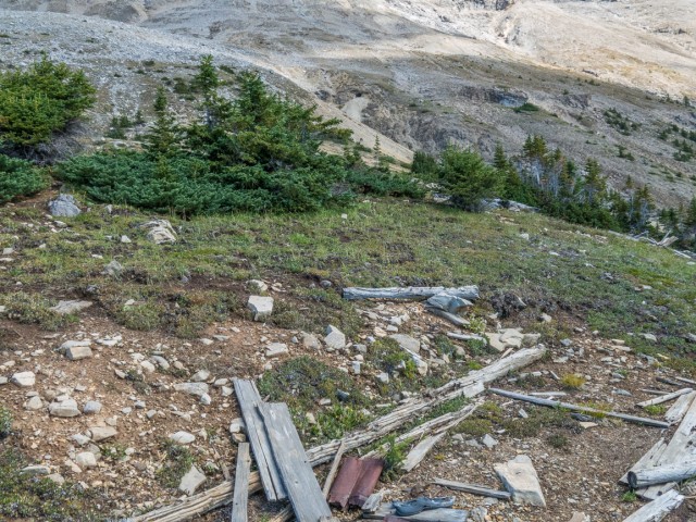
One the way back down, we examine the living quarters. There is a rustic cabin, sans roof, with an old stove sitting outside. Nearby is a garbage dump and some odd wood cage type things. No idea what they are.
When the Protection Mountain Mine operated is not entirety clear. We’re pretty certain it’s not the 1880s or 1890s as it seems most people think. We’d say it’s from a couple decades later. Some little clues help. Round machine made nails found at the various structures suggest we’re dealing with something post 1900 (square nails were the standard before). Cans in the dump seem be from the 1910-ish period,. The stove at the living quarters matches models from the 1910s. The earliest government report we found mentioning the operation is from the mid-1910s.
People today might find it odd that mining or mine exploration was allowed in Banff National Park, but it was tolerated in the early years. A coal mine, not far from the Banff townsite, was in production into the 1920s. Bizarre!
Return the way you came. The hike up to the mine means some 900+ metres of elevation gain. For some reason it seemed like more, much, much more and even longer heading down (strange). To summit the mountain add a couple/few hundred metres more of true scrambling to the equation. We thought of doing it…for a brief moment….but soon came to our senses. We lacked the time. Yeah, that’s it. No, we saw a rare cliff bear. We wanted to…buuut.
Protection Mountain is so named as it “protects” a remote valley to the north. The long mass of the peak sort of acts as a huge wall keeping everything out. The mountain has had this name since the 1910s. If it had one before, we’ve not found any references to it.
More “history hikes”…
Sunken (Lost) Creek to Dibble Mine – Cranbrook BC.
One Mine Ridge.
DC3 plane crash.
Check out this post…
Beachwood Estates.
If you wish more information on this place, by all means contact us!
Date of adventure: August, 2015.
Location: Bow Valley, Banff National Park, AB.
Distance: 13km round trip.
Height gain maximum: 950m.
Height gain cumulative: 950m.
NOTE: all heights and distances are approximate.
Technical bits: A few loose sections of trail near the end.
Article references: Alberta Geological Survey, Alberta Department of Mines (Alberta Energy).
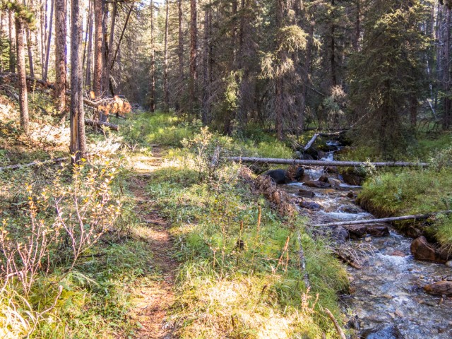
The Protection Mountain Trail follows this stream for a time.
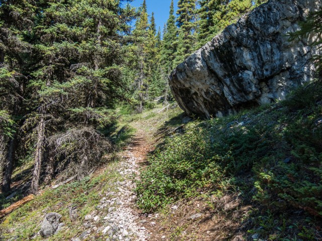
The grade is always moderate.
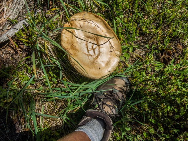
A HUGE mushroom (size 12 boot).
The old mine pack trail is in fine shape.
We break out of the trees.
Looking northwest-ish.
Remains in front, mine entry in back (black dot).
There was a small shed or building here.
The view east.

Target in sight!
Looking back, Connie is not far behind.
Well, are you coming?
Fine wine in a mine. Paradise Ranch Ice Wine (1998).
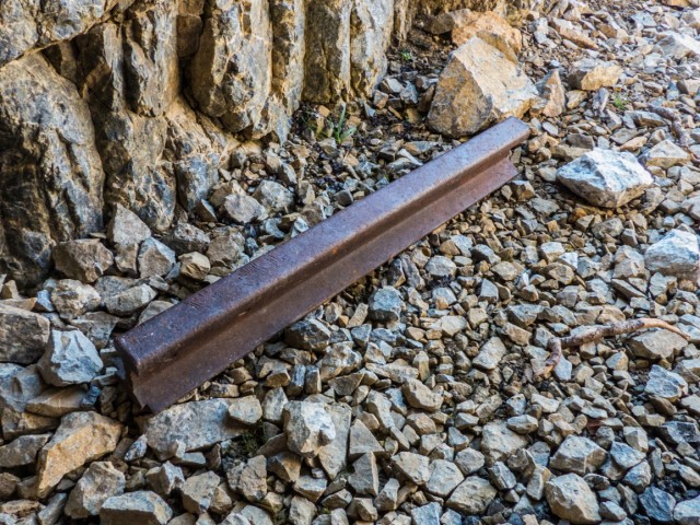
A length of rail.
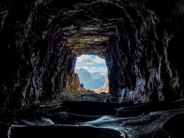
An amazing view out.
Not sure why there is an old stove in here.
The workings only goes back a few dozen metres or so.
Unfinished drill holes can be seen on the working face.
The Protection Mountain Mine (aka Eldon Showing) dates from about a century ago.
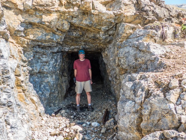
Helmets are always a good idea.
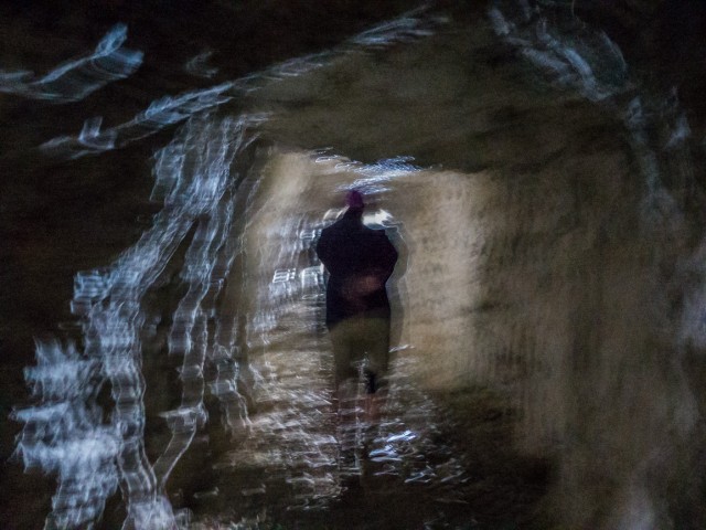
Inside…
Looking above the mine.
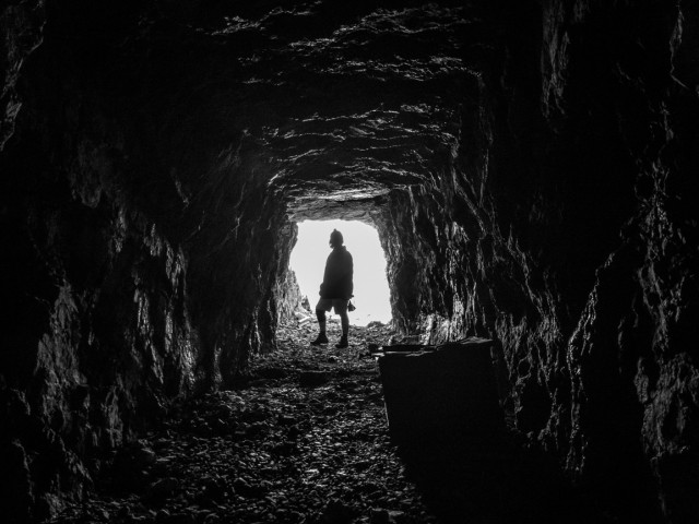
Heading out.
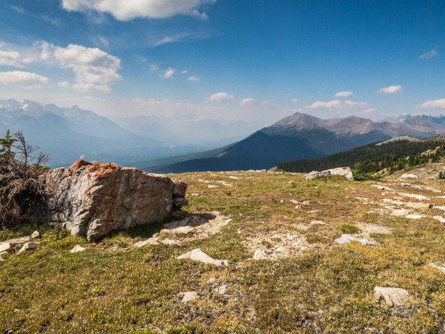
Smoke from forest fires in the US rolls in from the west.
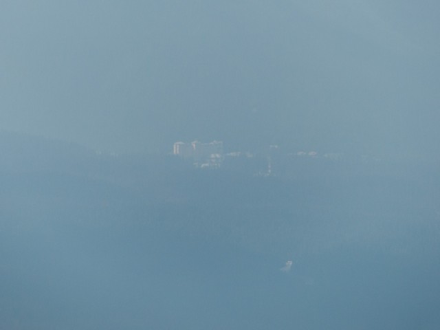
Soon Chateau Lake Louise is near obscured.
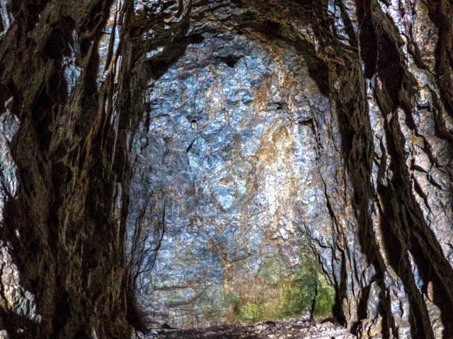
The adit (opening) can be seen mid-picture.
Old boards were scattered about.
We often fine old boots. Odd.
Heading towards the cabin.
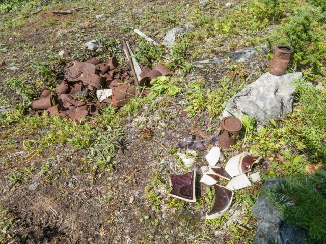
The garbage dump.
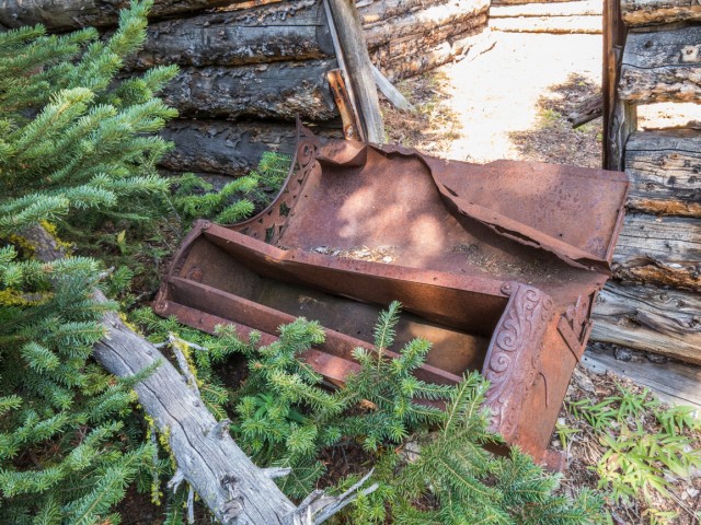
An old stove at the cabin.
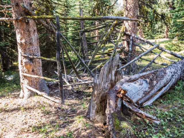
A cage of sorts, but for what?
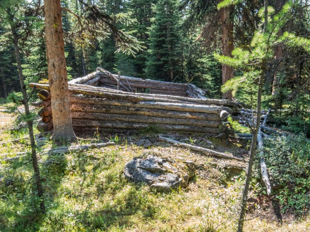
The living quarters for those working the mine.
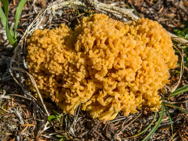
A Coral Mushroom?
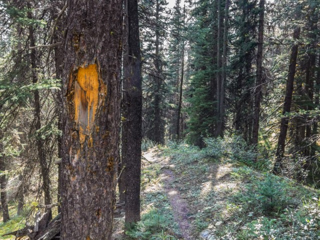
An old blaze.
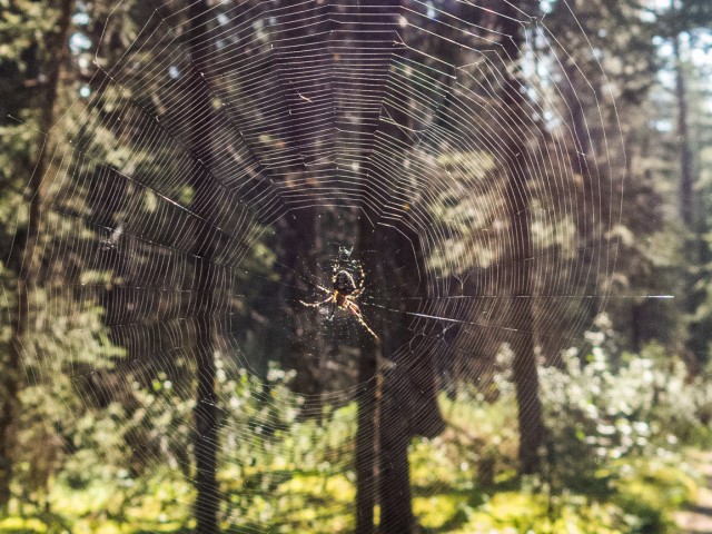
Yikes, almost ran face first into this guy!
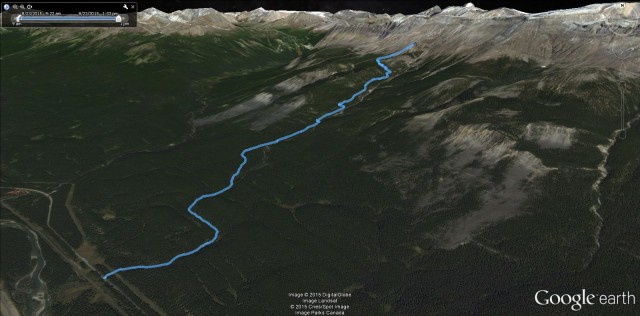
The route up Protection Mountain.


Excellent
Short and simple, but we’ll take it. Thanks!
Thanks for share, I enjoyed the read too. Love pictures. I wish there were more.
So pleased you liked it. Next time, we’ll get more photos. Promise. Drop by often.
This is so cool!!!
Hey, I just said that, previous comment. But you are so right!
Very interesting. I used to work/live just down the road at Baker Creek. I had no idea about this!!
Little known stuff up there in the hills. It is cool! Thanks for commenting.
I enjoyed this report very much! I’m always curious when I see pics of old mines, how or why they seem to be so clean inside. No rusted tools laying around, no weeds, no spider webs, no sign of bats…can you explain this?
We often find old tools, just here all there is was that stove and a piece of rail. Floors are clean and level so carts or wheelbarrows have a smooth path. Not sure how bats pick a home but maybe this place doesn’t work for them – too small maybe? We have seen them in bigger/deeper mines. There’s often Daddy-Long-Legs inside. Sometimes they cover the walls. Not here though. Other spiders? Sometimes we see them at the entrance but that’s it.
Nice write up and photos! We explore many old mines here in BC and love the history.
The item you call a stove in the mine appears to be an ore cart sitting upside down that is missing its trucks (wheels and axles).
We’ve actually explored a lot of mines in BC, mostly really remote back country ones and those that are smaller in particular. We don’t always publish the adventures but think we will starting this year. Would love to chat sometime about your outings. Mine history is our favourite subject. In fact it is a stove – I know it does look like an ore car. It’s smaller than it looks, has an oven door and those round openings on top. Do a Google Image Search for “Protection Mountain Mine” to see it from different angles. There was a cabin nearby, which is perhaps where it came from. Why someone went to the trouble to drag into the mine is beyond me.
After seeing the other photo of the top it definitely is a cook stove! Strange item to lug up the mountain.
I usually go by the user name Kootenaycat in various forums as well as panoramio.
My email is XXXXXX@XXXXXXX.com (link removed for privacy reasons) if you’re looking for any info on the mines around the southern West Kootenay area
Cheers!
Kevin
Kevin, thanks. I think the stove came from the nearby cabin. Still, it was some work to get it inside the mine. And for what? Well, it got us talking. You’ll hear from us again! I hope to be out that way this summer.
Hi! Nice article – thanks for posting.
I’ve been up to the Protection prospects four times now, trying to find the remaining mine sites. In addition to the one obvious one, I’ve found one more (collapsed), but have heard that there are four in total. Google Earth used to show this area in great detail, and you could see the old trail above the first entrance quite clearly, and that’s how I found the second site. I’d still love to go back to continue the search.
I also found the workings of the old Eldon mine, which is up the opposite side of the valley. It was very difficult to find, but has more “stuff” to see – cabins, rail cars, assorted machinery, etc. Could this be the Eldon Showing you reference in your article?
You are most welcome. Records and first hand accounts from people who visited the mountain make mention of three or four entries into total up there. The others are not all that far from the main adit, which is the longest. I didn’t know that when we visited however and found out later. Message us if you wish more info. If you’re speaking of the mine across the highway, I know of it. In government records, which I have access to, Protection Mountain is listed officially as the Eldon Showing, while the mine across the valley is called Hawk Creek. There’s other workings in the area too, a surprising number in fact. Know a fellow who visited them all in the ’70s. Have a great week!
Incredible views of the Bow Valley! Thank you for sharing:)
I know, pretty nice! Thanks for commenting and drop by often.
This is amazing. Great shots, Chris and Connie.
Thanks so much, we saw your hotel from our vantage point.
Shared to Ghost Town Hunters.
Always appreciate it!
The inside to out shot is great. Hard work to get the light right I imagine.
It was a challenge indeed.
Chris/Connie, thanks for posting this, it’s something I didn’t know existed.
Interesting, isn’t it?
(via Facebook)
Awesome photography guys!
Thanks, it was a fun outing.
Great pics, love the wine bottle shot.
It was amazing, very tasty wine!
Thanks for this interesting tour. I recall hearing about this once but never knew exactly where it was. And I am familiar with the Bankview operation near Cascade Mountain.
Our pleasure! From the emails and messages we’ve received a good number of people heard about, but knew not where it was.
Fantastic story and photos. I’m so happy that you both take the photos and tell me the story so I do not have to do it!!! But, you make it seem as if I am there with you guys.
You’re always with us in spirit!