
South Mist Hills
Story and photos by Chris & Connie.
This adventure we’ll be visiting the South Mist Hills and will summit the most westerly of the trio and the one that’s middle in height. Located in the Highwood River area of Kananaskis these modest-sized mostly grassy topped bumps are not visited as often as Mist Ridge just to the north. They’re very easy to get to however and offer up some very wonderful and inspiring views of their own. I think they’ll get more popular with time.
The trail starts at the Mist Creek day use area on Highway #40 west of Longview and south of Peter Lougheed Provincial Park. Take the path heading north near the biffies and paralleling the river – look for scars from floods a couple years ago. Soon after, cross the highway. Watch for traffic! Look up and a little to the right and you’ll see today’s objective looming above.
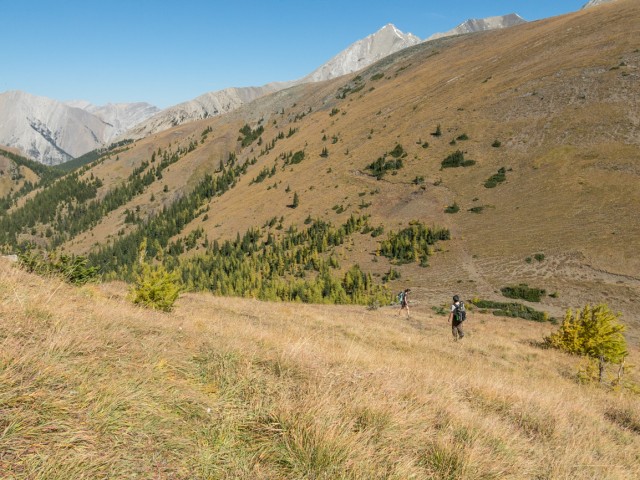
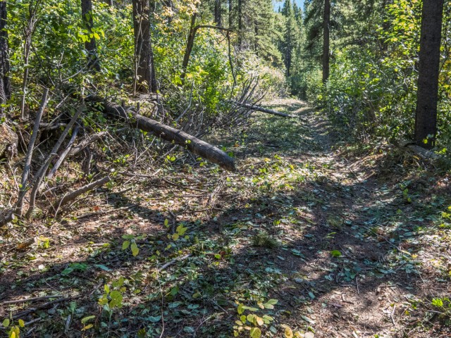
Enter the woods and soon after come to the old highway alignment. Turn right, follow it for a bit, then at a sign turn left and leave it behind. For the next little while, the trail (a former coal exploration road), heads north gaining minimal elevation. One boggy section is crossed. We pass a group of hunters on horseback – expect equestrian and bike traffic. Cuts and berms are seen every now and then, no doubt put in place a long time ago to keep jeeps and 4x4s from using the trail.
At a signed junction stay on the old road as it turns right and heads up at a moderate angle. Until now, the route used has been the Mist Creek Trail. Heading left is a continuation of that trail. For the next phase of the trip you’ll travel along the unofficial Mist Ridge Trail. Later transfer to yet another route.
Almost immediately we come across a fellow cutting back the Alders on the trail. They grow like crazy here, reducing the road to a narrow overgrown path in places. We’re impressed that he’s taken the initiative and thank him for his work. His task is Herculean!
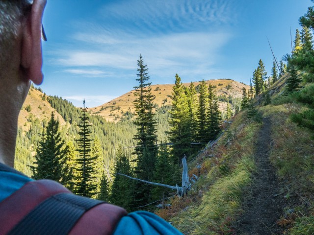
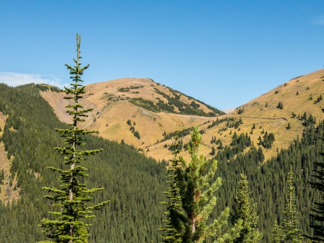
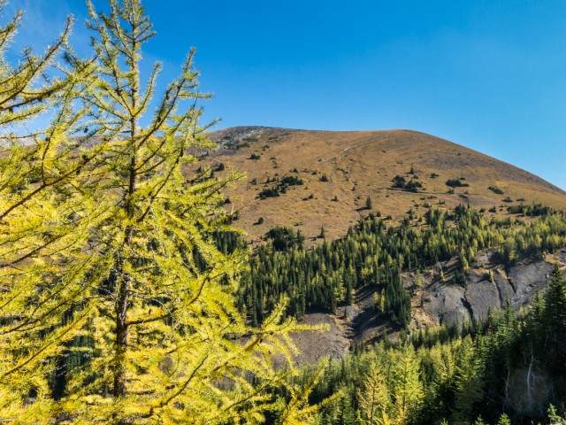
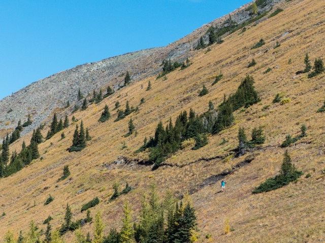
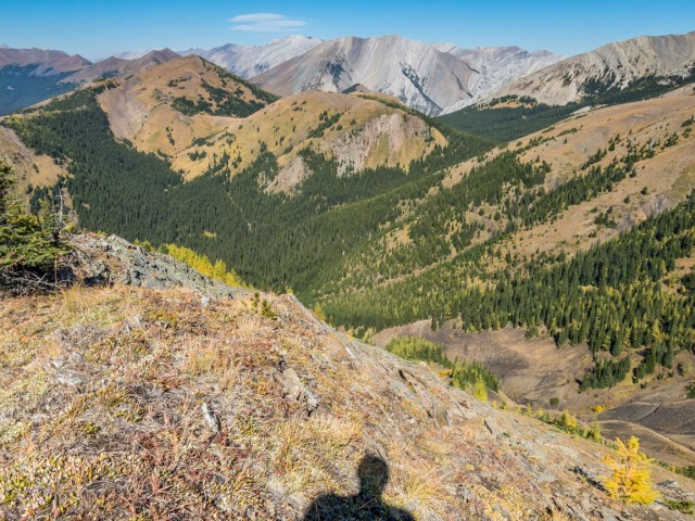
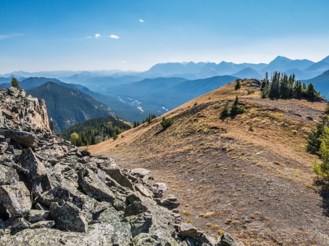
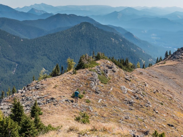
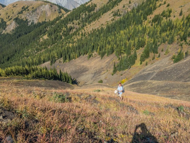
Gaining elevation consistently the trees start to thin part way up. To the west one can catch the occasional glimpse of “Nameless Ridge” (formerly Eagle Ridge) and in behind and towering over it, the barren face of Mist Mountain. To the north is the south end of Mist Ridge.
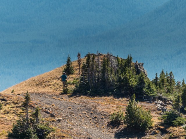
Come to a nice view point at an opening in the trees. Across the valley, one can see the coal exploration road, the same one we’re on but which we’ll leave soon, heading up towards Mist Ridge. The most northerly of the South Mist Hills comes into view. The road splits and we head hard right. Its zig-zags a couple times then heads east, all the while gaining elevation steadily. We’re soon in the larches, which are just starting to turn, a little early compared to most years.
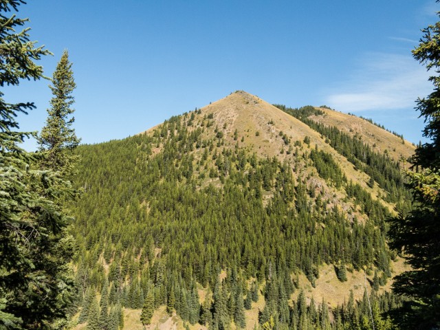
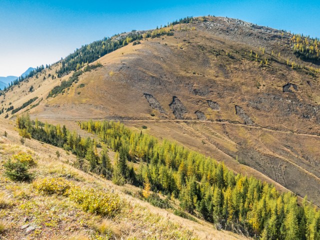
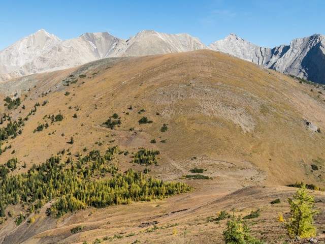
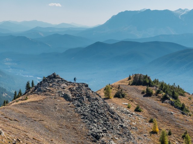
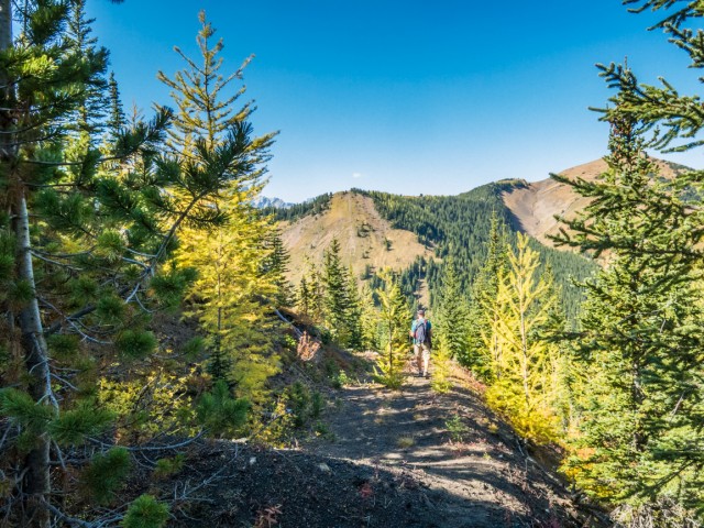
Breaking out of the trees completely, the road cuts across a very steep hillside heading for a col between two of the hills. Who ever made this road was crazy – we’ll elaborate on why it’s here shortly. At the gap we gain some views to the south. Directly ahead is the middle of the South Mist Hills, the highest of the three but just by a little bit compared to the summit we’ll visit. To climb it, simply go up the grassy slopes. We were up it a few years back – we came in from the back side that time, exiting down the same road we just ascended. We called it Picklejar Ridge then (after the nearby creek). The name South Mist Hills was coined more recently in a hiking guidebook and will probably win out over the moniker we gave it.
The coal road turns right (a short offshoot heads left which I visit), traverses a steep hillside, switchbacks and abruptly ends. Part of the hill here has slumped. Within sight of the top, head up the mostly grassy slope, hitting the ridge spine just before the summit. Turn right and with a hop, skip and jump the top is reached.
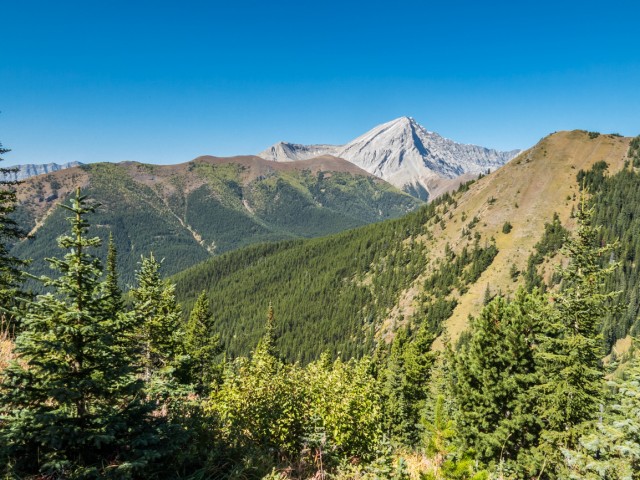
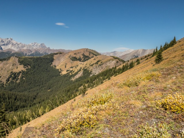
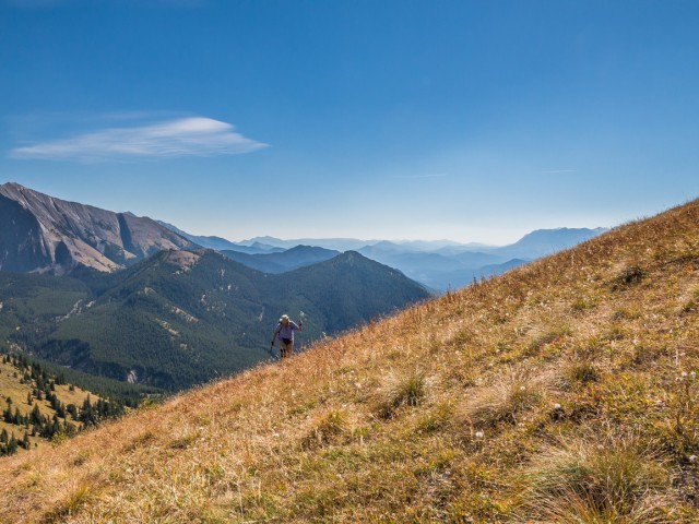
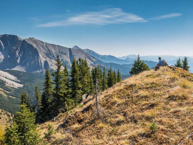
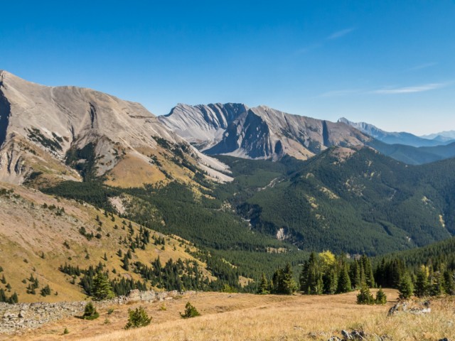
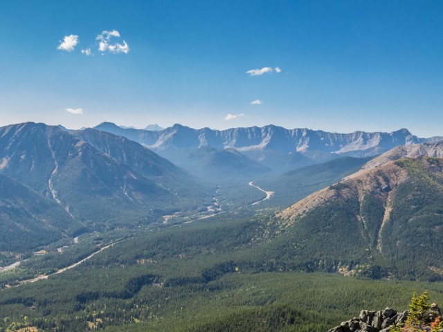
In spite of the modest height, the views from here are stupendous. Mist Ridge can be seen across the valley. It’s a looong and undulates…a lot! In the east is a near implementable wall of limestone, Highwood Peak at the centre, some showing signs of having been visited by scramblers. To the southeast is a mountain rimmed valley home to the Picklejar Lakes. You can’t see them from this angle however (we’ve been, they’re nice). A series of low-ish rolling hills extend south. Highway #40 and the Highwood River can be seen directly below.
Odlum Ridge sits to the southwest. In behind is another wall of rock, the Elk Ranges, separating Alberta from BC. Southern views were somewhat obscured by a blue-ish haze. To the north it was clear and gorgeous.
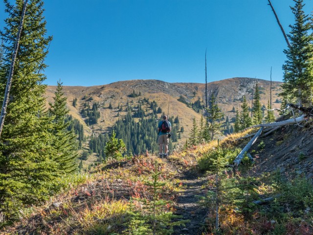
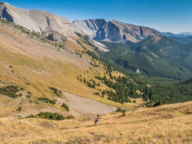
An open and fairly level ridge extends south from the west South Mist Hills summit and I take some time to explore it further. It later drops down toward Picklejar Creek, never to steeply, and looks like an easy off trail alternate descent route. We choose to stick with way in as the way out.
The road that is your path most of the way dates from the late 1940s or early 1950s. At that time, a firm was looking for coal in the area – there is a lot of it here. The South Mist Hills and Mist Ridge were explored together.
Their method was a rather simple. They’d cut across a hillside using a cat-tracked dozer, expose some coal and then sample it to see if the the material was suitable and the volumes economical. The strata here is quite tilted, the seams aligned almost vertically which no doubt could have complicated things. A pit mine was planned which would have greatly changed the face of the area – the hills would have lost their tops! I pretty sure they’d never allow mining today.
Fast forward to now, these old roads make great wilderness trails – funny, if they were new, we’d be protesting the damage! These are not the only coal exploration roads in the area. Nearby Mount Lipsett, Cat Creek Hills, Pasque Mountain and many, many others hills and ridges in the area show similar scars from around this time. I guess markets never materialized, but they sure tried hard.
Once you’ve had you fill head back the way you came. Leaving is hard for us and I bet it will be for you too. The South Mist Hills are a blast! You’ll like them.
Other modest-elevation summits we’ve visited…
Ridge 710871 (Gunnery Ridge?).
Missinglink Mountain (interesting by name alone).
Return to Eagle Hill.
If you wish more information on this train, by all means contact us!
Date of adventure: September, 2015.
Location: Highwood River area, Kananaskis AB.
Distance: 13km there and back.
Height gain maximum: 620m.
Height gain cumulative: 620m.
NOTE: all heights and distances are approximate.
Reference: Kananaskis Trail Guides by the Dafferns.
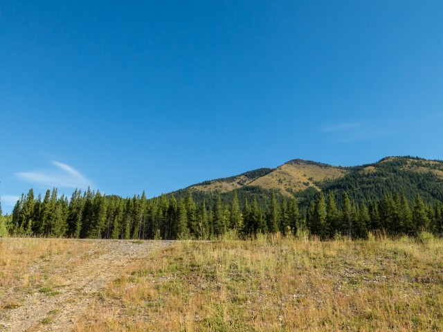
Our objective comes into view.
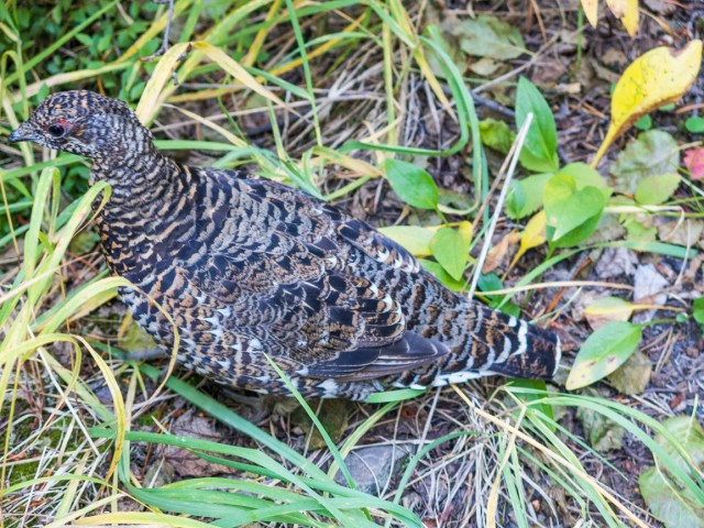
Sharing the trail with a grouse.
The south end of Mist Ridge.
The lowest and most northerly South Mist Hill in back.
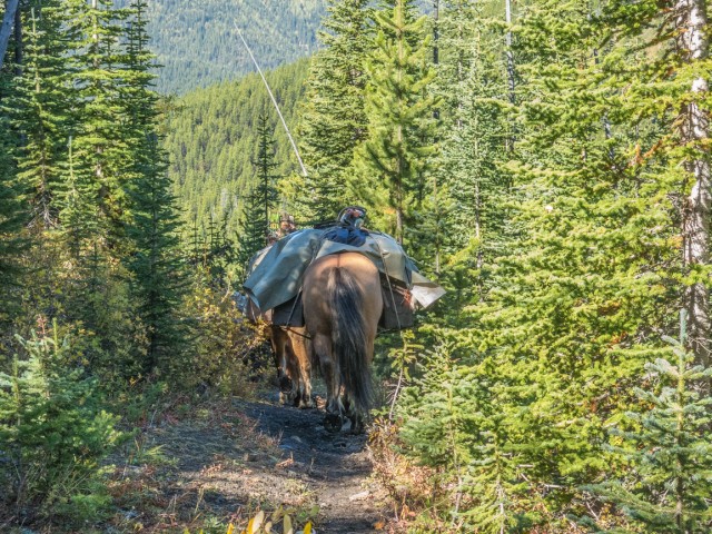
We passed two groups of hunters on horseback.
Mist Ridge on left. Note the old road.
Nameless (formerly Eagle) Ridge, left, with Mist Mountain in behind.
The trees thin.
The larches have just started to turn.
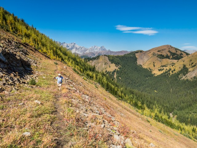
The road cuts across a steep hillside.
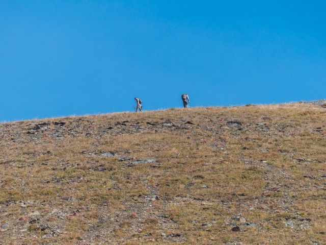
Other hikers spotted on the middle (and highest) South Mist Hill.
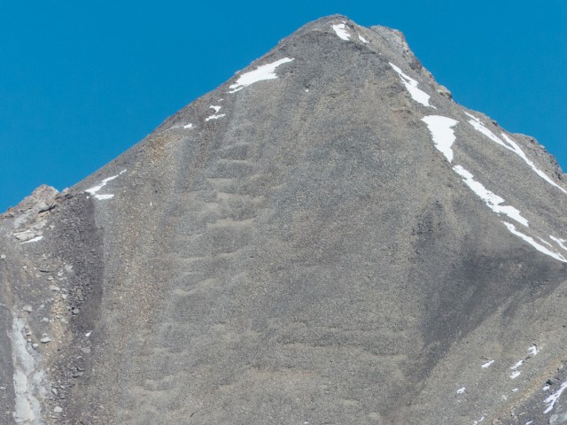
Evidence of scramblers having visited this mountain.
Coal prospect scar in back.
Looking north.
The road takes one very close to the summit.
Heading up on grass.
We pass hikers heading down.
From the summit.
The col between the middle and west hills.
Looking south.
I check out the ridge.
The Pickljar Lakes are located in that bowl but can’t be seen from this angle.
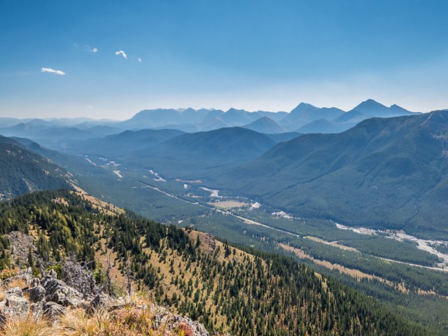
Highway #40 and the Highwood River can be seen below.
That wall of rock in back marks the Alberta/BC border.
Connie watches from the summit.
A blue haze blanketed the valley to the south.
I’ll turn around here.
We’re back on the road.
We’ll soon be back in the trees.
Always pleasant going.
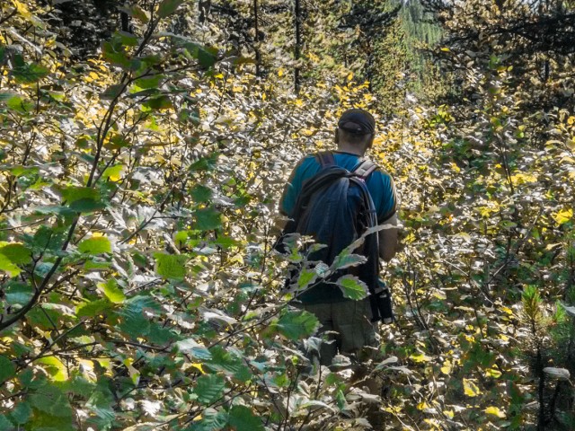
Alders have taken over the trail in places.
A nice fellow has done some clearing however.
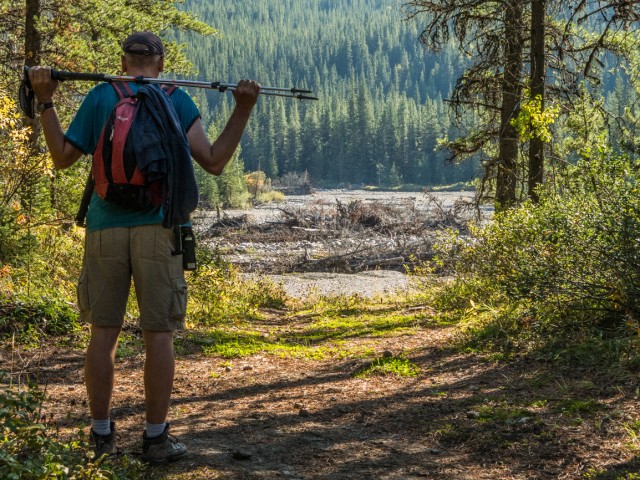
The Highwood River shows damage from 2013 floods.
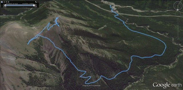
The South Mist Hills route.


")


Great trail review! Love the photos, especially the misty blue hills from the summit. But where’s the wine! The Highwood is a gem.
– Kaptain Kananaskis
Love that area too. Oh, we always have wine even if you don’t see it. No hike, no summit, no exploration of any type is complete without a bottle (and when we do it with friends, two). Reminds me, I have a bottle chilling even as I write this. Nice to know you Kaptain!
WOW!! Beautiful!
I loved this hike!
( remember to breathe )
We have to remind ourselves sometimes.
I’ve been to the top of Mist Ridge, but never these hills. Eagle Ridge or what ever it’s called I’ve climbed hundreds of times.
Give them a try. They’re nice! We want to hike Eagle Ridge sometime.
Can you provide a map drop point on google for where eagle ridge is? I’ve been trying to find out if it’s the same eagle ridge my dad’s ashes are on. Please if you can help I’d be so grateful!
Here you go…50.542469 -114.880818
The Eagle Ridge name has not been used (officially) for some time.
Thank you so much. If you’re curious it’s not the same ridge but it’s helping narrow down the location. Thank you so much! I’m forever in your debt. Thank you!
You are most welcome. Keep in mind there is an Eagle Hill in K-Country, which is much easier to get to account it being home to a popular hiking trail. Could it be that?
That is the one. I just now looked and realized this was for mist hills 🙂 we’re heading there August long.
Thanks again!
Always happy to help!
I checked out the rest of the pics on your site and there are some very interesting shots in there. Great photography!
Thanks, we love to share our adventures with all you.