Rosedale Alberta then and now
A good sixty five years separate the two images used in this then and now article. The scene is Rosedale Alberta, in the Red Deer River Valley badlands, first along the train tracks in 1948 and then again in 2016, the same spot, but with the rails now gone. The original image is a postcard that shows some people’s belonging pilled up next to the rails during a flood – it appears the background area is partially under water and flow ice.
The town of Rosedale was founded around a century ago with the coming of the railway. Coal mines drove the local economy for many decades. Today, the place is home to several hundred people and was amalgamated into the town of Drumheller in the 1990s. Interestingly, in both the then and now photo nothing of the community can be seen – but it’s close by, behind that hill in the back and also a bit to the west and northwest, a bit off frame. Still, it looks as though there is nothing here.
Not seen, but just to the left, is the Rosebud River. At this point it is very close to where it joins the mighty Red Deer River (also just behind that hill) which cut the wide valley here. The flood mentioned in the old photo was caused by an ice jam several kilometres to the east down that larger waterway causing it and all those feeding it, in the immediate area, to back up and spill their banks. We found numerous documents that spoke of the Red Deer River flood of 1948. It seems a lot of people were affected.
It’s not clear who the people seen are, there are two if you look close, and where they and their belongings came from, but presumably they had a house nearby. Today the nearest one is a couple hundred metre behind the shooting position.
Various boxes and furniture can be seen in the pile. From the looks of it, it was all placed here hastily, understandable I guess since floods don’t make appointments. Presumably the railway roadbed was just high enough to avoid the water. Notice they placed the stuff just far enough off to the side to avoid them being hit by a passing train. I wonder how long it was before the waters receded? And what happened to these people’s lives as a result of this flood? It was tough time, I bet, for sure.
The postcard was produced by Vogue Studio of Drumheller, who seemed to be quite active in the 1930s and 1940s. Most, if not all their work, was from the local area and while a few colour examples were produced much of it was in plain old black and white. Despite spending much time researching the firm, that’s about all we found. Still, their work lives on via those images.
The railway track seen in the old photo was the CNR line running between Saskatoon Saskatchewan and Calgary Alberta. It was put down in the 1910s, by the Canadian Northern Railway (Alberta Midland charter), closed down in the 2000s and only pulled up last year. The rails being gone are pretty much the only significant change from then to now, and the rest of the scene today looks much as it did.
The postcard is a scan that comes from Peel’s Prairie Provinces, a resource of the University of Alberta in Edmonton. The image is no longer under copyright from what we could research, not unusual, these rarely are. The “then” image was sourced by this author but most seen on this website are sent in by readers.
If you have an old postcard or photo taken by yourself or someone in your family showing a scene that would make a good “then”, please drop us a line. We’ll revisit the site, shoot a similar photo and write about it in a article. You get credit and big than you from us. And you’ll likely learn something too.
Finding the exact location of this then photo was pretty simple and lining things up was a piece of cake too. This was in fact one of the easiest then and nows we’ve done. Recall we find most of these places by researching (we’re rarely told, and request to not be) and by simple footwork. As always, the now image was lined up in camera and not in post.
The BIGDoerMobile can be seen in our photo. It tends to sneak into these posts without us even realizing it.
A nearby grain elevator…
Prairie Sentinels – Rosedale Alberta.
Articles from the area…
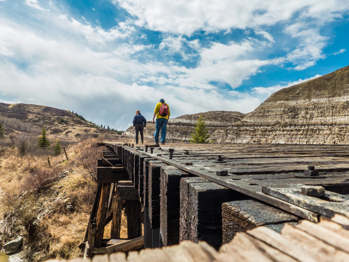
East Coulee’s historic wood bridge.
Badland’s Collection.
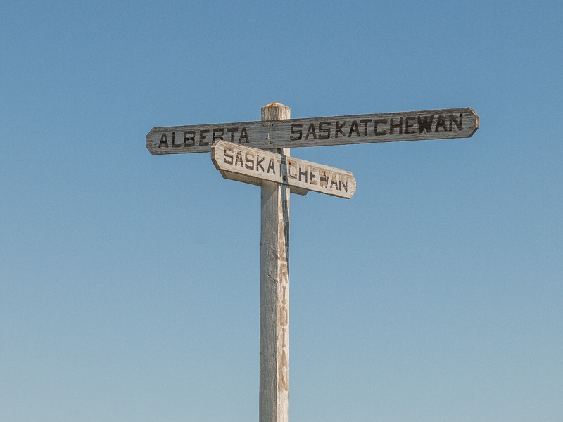
Dorothy Alberta.
If you wish more information on what you’ve seen here, by all means contact us!
Date: January, 2016.
Location: Rosedale, AB.
Article references: Book: Hills of Home – Drumheller Valley, CNR records.
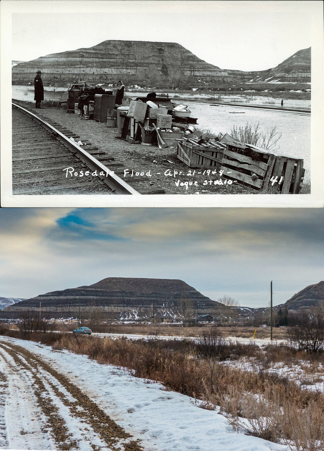
Down by the tracks in Rosedale Alberta, 1948 and 2016.



Well done Chris!
Thanks!
That’s awesome Chris!
Thank you Tim!
Love your photos !!!
It so pleases us to hear that, thanks!
I love “then & now” photos like this. Nicely done.
We so love doing them, but don’t do enough of them. Hard to find just the right “then” photos that we can use.
I am always excited to see a post from you guys. Thank you.
That makes us so happy to hear!
Love it…
Happy to hear that!
My Dad & Mom were living in Newcastle at this time. Thanks for the pictures.
That town flooded too as I’ve seen. No town close to the Red Deer River was spared. And you are most welcome!
I really enjoyed your article, because I lived through that flood! I was born in 1938 and by the time 1948 arrived, I was living in Edmonton, so are you sure the flood wasn’t in 1947? Maybe I have my facts mixed up. Anyway, I am now 78 years old and my husband and I are planning a trip to that area on September 2nd and 3rd..probably a final one, given my age.
As to the flood..I remember it vividly. My father was a miner at the Star Mine (across the Suspension Bridge), and I remember the miners fleeing the flood across the suspension bridge, dodging big chunks of ice hitting the bridge. The river had spilled its banks by then, and the streets were already flooding. By the time the miners had washed up in the “wash house”, they had to be evacuated to higher ground on rafts. Their families had, by that time, fled to higher ground. My Mom and sister and brother and I slept in the catholic church that night. By next day, the waters had receded and we were able to return home. We found our floors covered in mud. We had recently bought a new chesterfield suite, and it had mud several inches up (I was very young…this is how I remember it…it may not be totally accurate). We let the furniture dry and then we scraped and brushed the mud off. Life went on…everybody just dug in (literally) and slowly life got back to normal. The following year, with rumors of mine closures, we moved to Edmonton.
I have never forgotten what I remember as the Big Flood of 1947 (?????).
Thank you for your very interesting article. When we lived there, no one had any idea the Drumheller Valley would be such a well known place. I used to play on the HooDoos. Now they are out of bounds. A few years back, my husband and I visited the East Coulee Coal Mine and found the Miner’s Cabin on display, which had once been in Rosedale…I had played in it as a child, and a picture of me with my friend is there (her parents owned the cabin). You have brought back many memories.
Thank you for listening to the ramblings of an old woman!
You keep on as long as you like! Always super happy to hear from people connected to what we’ve documented. Oh such memories, and through the eyes of a kid makes it all the more interesting. So sad what people lost. Folks seemed so tough back then. Take a hit, roll with it, brush yourself off, move on. Too many wusses today – haha. Totally confident the flood was in 1948 based on the all corroborating records we found (lots). Have fun on your trip! It’ll be a special one.
irene when did they rebuild the camp bridge
Anyone’s welcome to comment if they know.
What was the name of the store in front of the Star Mine Bridge? I know it is no longer there, but it was in 1940’s
No, afraid not, sorry. Perhaps one of our readers would know.
I remember it was owned by Mr. Gorbous a couple of years before the flood, and I think it was just called the STAR MINE STORE. He and his two boys, Glen and Melvyn lived in the big house beside the store. (Glen, of baseball fame.) Then, he sold it to the Ruskins, who lived in a “new” house across the road from the store. I think that it was owned by the Ruskins at the time of the flood…
I am now 82 and still rambling!
Thanks for adding to the conversation and keep on rambling!
I remember it was simply called The Star Mine Store and run by Mr. Gorbous, whose son later became a baseball personality in the States. After Mr. Gorbous left, it was run by Mr. Ruskin…still called the Star Mine Store.
Sorry, but I don’t know. As I said, I was a little girl then, and Camp seemed a world away from Aerial (Star Mine, as we called it). I wish I could help you.
Sorry. I don’t know.
I hate to see a dead railroad.
Us too!
Sorry to see more tracks pulled up.
Yeah, there are few branchlines left it seems.
Nice job re-photographing this.
Thanks, I love it when we get so close like this.
Exact duplication… well done!
That’s what do, and it’s all lined up in-camera.
So sad to see families’ belongings stacked next to the tracks due to the flood in the 1948 image.
So true. At least they were able to save some things.