
Raspberry Ridge
On this adventure we follow an old horse trail that leads to an active fire lookout perched high on an open grassy hill. While the height gained is nothing huge the 360º views from the top of Raspberry Ridge are simply breathtaking What a great way to enjoy Canada day! Spending time with Connie, a wonderful hike and wine (we always bring wine)!
Deep in South Kananaskis, the trail head is along Forestry Service Highway #940, a gravel road, and is about 11kms south of the Highway #40 junction at Highwood House. At the parking spot there is a pull off and a gated road (actually two, one leading down Cataract Creek) and this is where you really start your adventure.
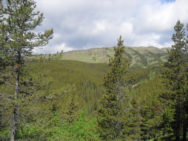
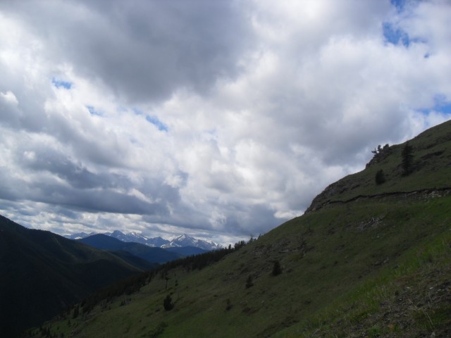
Take the upper road and follow it past a small boggy section. Then enjoy the trail as it meanders through the woods gaining and losing a little elevation here and there. It’s often heavily forested at this point but there are occasional breaks where you can catch views of the fire lookout way above you.
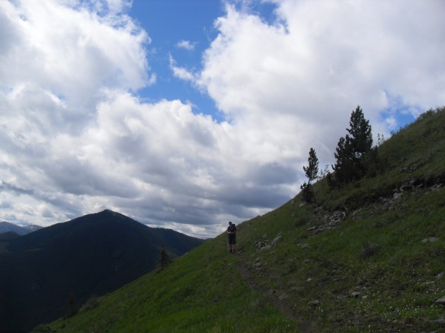
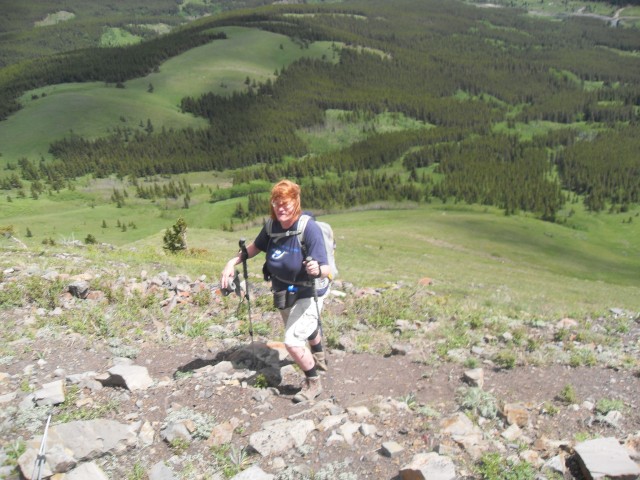
At the base of Raspberry Ridge, in a clearing, there is a split in the trail. The one to your right attacks the hill straight on, but we elected to follow the longer but easier-on-the-knees switch back trail over the direct way up. Our route, which is not as well used, continues to follows the old horse trail as it zig-zags its way up the bare grassy slope.
Along the way there are lots of strawberries to be seen, but few of the namesake raspberries. To bad, raspberries are my favourite.
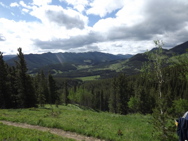
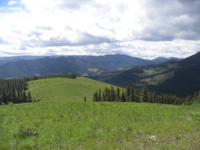
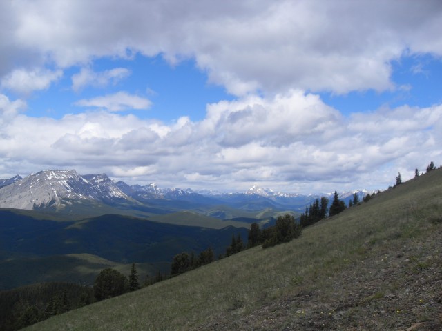
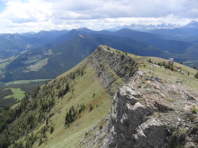
Once the switchback trail gains the south ridge, it’s a simple matter of following the spine up, gaining additional elevation as you go, until you reach the lookout. This way is never steep and is quite pleasant. Below you at this point are a number of attractive rolling meadows, blanketed in grasses and flowers. They remind me of one scene from the Sound of Music (you know the one I am talking about) and I am almost expecting the Von Trapp family and Baroness Schraeder to show up at any moment.
Heading north up the ridge, it’s not long before the fire lookout building comes into view. They have been so kind as to set up a picnic table nearby and it’s made of concrete so it does not blow away.
Which lead us to the winds. At times, it’s like a hurricane up there, often blowing for days and days on end. On out visit we were lucky as it was mostly calm. Thank goodness. It did pick up on the way down though.
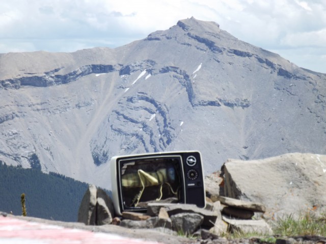
This is an active fire lookout so be sure not to bug the person inside who has work to do. By the helicopter pad is the famous and often photographed grasshopper TV, which has been up there for many years.
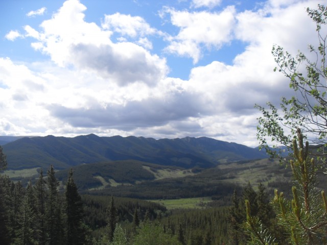
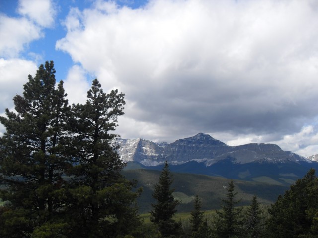
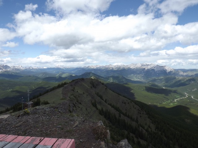
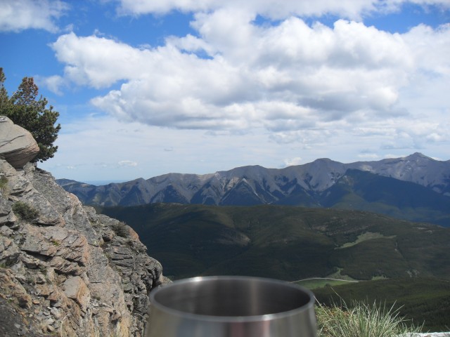
Enjoying the views, to the west near the great divide is a huge unbroken wall of limestone peaks. Hidden from view and just on the other side of them in BC not terribly far away, is the huge Fording Coal operation near Elkford. Occasionally you can hear explosions as they work the mine. To the east is Mt Burke, the home to the abandoned Cameron fire lookout, long forgotten but still standing guard. The one we’re visiting replaced it in the 1950s. There is a clear view of Calgary some 100km away.
One our trip we shared the summit with a few hikers. All used the direct route up over the one we picked, so we had that section of the trail all to ourselves.
Not far away is another nice hiking destination and to see the trip report for it, follow this link…
Pasque Mountain.
To see some other ridges we enjoyed hiking up, go here…
Cat Creek Hills.
Wind Ridge.
If you wish more information on this trail, by all means contact us!
Date of adventure: July 2012
Location: South Kananaskis
Distance: 16km round trip (shorter if you take the direct route).
Height gain maximum: 650m
Height gain cumulative: 650m
Technical bits: None.
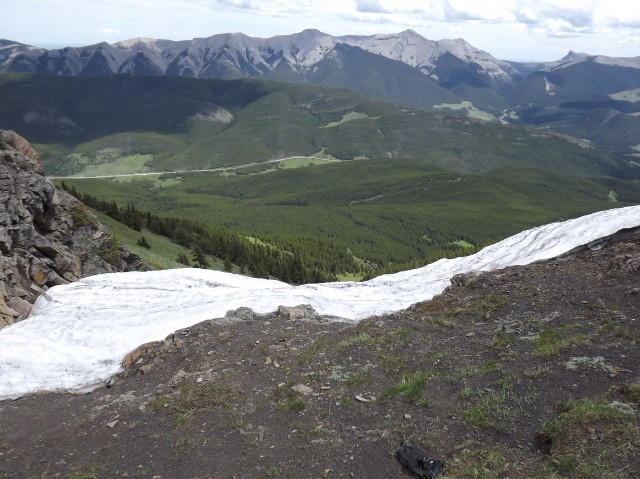
Notes: It can get windy once on top. I mean completely knock you over windy.
Reference: Kananaskis Trail Guides by the Dafferns.
At the start Raspberry Ridge comes into view.
Occasionally we break out the trees.
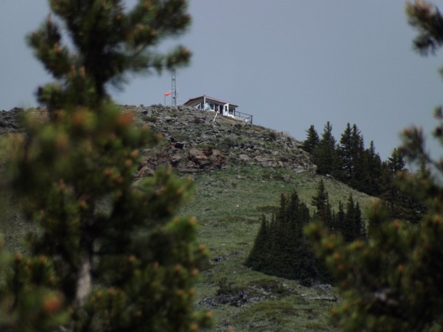
The lookout from below.
Looking up the the Cataract Creek valley.
I was expecting the Von Trapp family to show up at any moment.
The old horse trail.
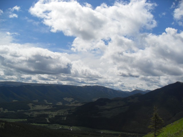
The view here is to the southeast.
Looking east with Mt Burke on the left.
We zig-zag our way up.
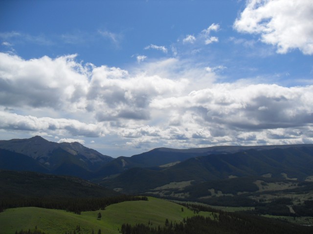
Gaining the ridge, mountains to the west come into view.
Looking roughly northwest.
At the top of Raspberry Ridge.
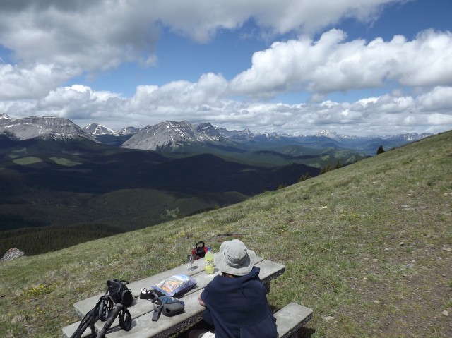
The picnic table is concrete – so it doesn’t blow away.
Looking north from the helicopter pad.
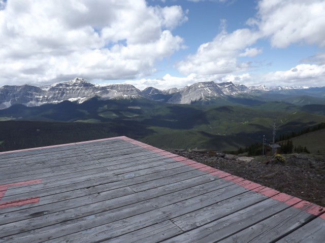
At the top looking west.
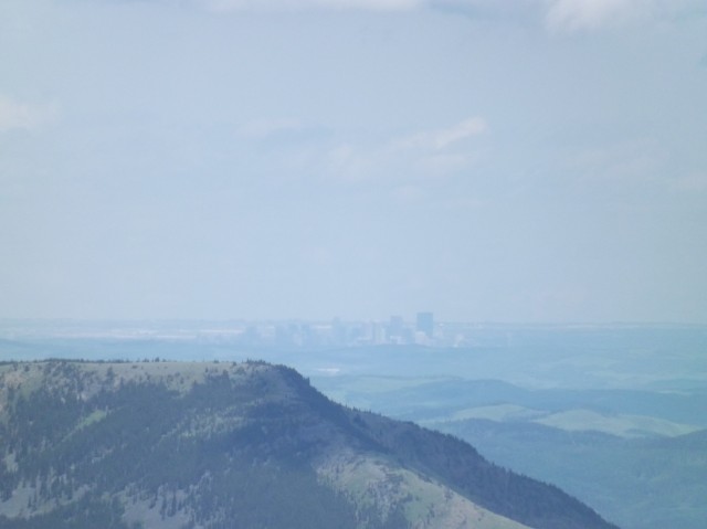
Calgary over 100km away.
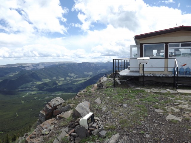
The Raspberry Ridge lookout has an excellent view.
The original fire lookout (that little bump) on Mt Burke in back.
The obligatory wine shot.
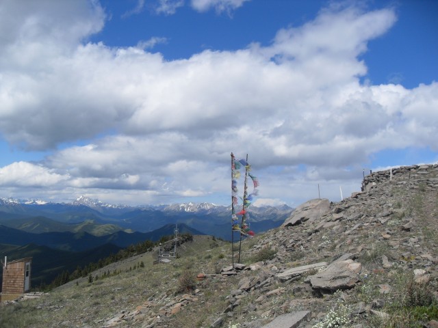
Prayer flags and the biffy with the best view.
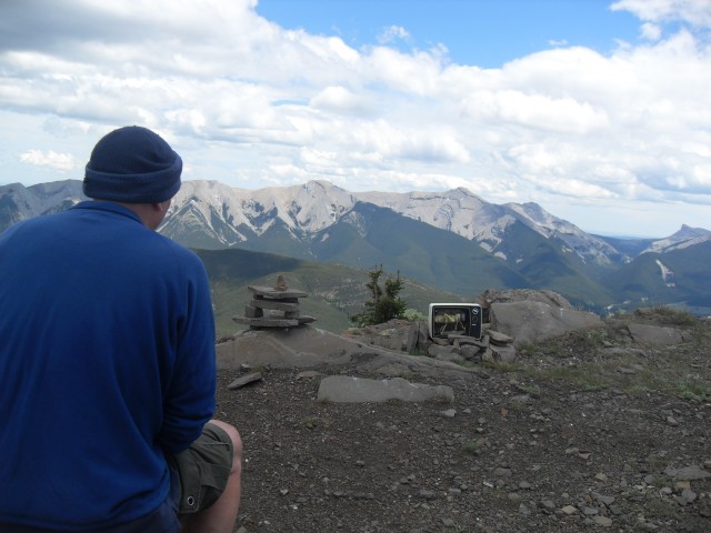
My favourite channel. all grasshoppers, all the time.
At the top of Raspberry Ridge, looking south.
It’s always windy up here.
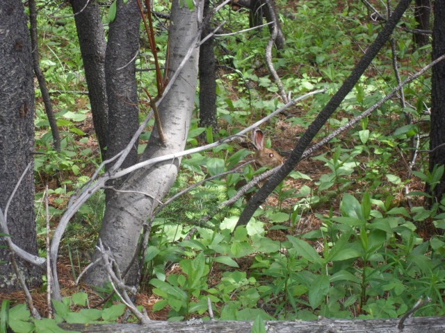
A bunny at the end of the trail.


HI, Chris & Connie. I just read the new one and this one. Love the story in both. The photography is much better in the recent post. Much improved technology these days. Our gear and software keeps getting better. And, of course, our skills.
Well done, as always.
Byron
Thank Byron. Yes, an improvement in tech (still we’re pretty low tech) and of course skills and understanding. One should always look to do better next time.
Who doesn’t love the Grasshopper channel?
It’s my favourite!
Grasshopper TV. BEST. THING. EVER! Thank you for much for sharing your wonderful experiences.
Nearly every hiker that visits Raspberry Ridge takes the obligatory photo with the Grasshopper TV. It’s what you do up there.
We tried to do this hike last year but read the directions wrong and some how ended up doing mt Burke, has anyone else made this mistake, and if so where did we go wrong?
Raspberry Ridge is almost directly opposite Mt Burke (not a bad goal either BTW) but is on the WEST side of the gravel highway. There is an obvious pull off with a gated road on the right side (when heading south) not much north of the Mt Burke trailhead. There are almost always cars parked there, which can be helpful in letting you know you’re at the right spot. If you need more help, send us a private email.
Finally! Someone’s blog that DOESN’T SUCK! Real information and a new place I hadn’t heard of! Yay!
Nice way to put it!
TV with a grasshopper ????
It’s been on Raspberry Ridge for years. Someone had an interesting sense of humour that’s for sure.
I can’t wait to do this hike. There are so many great ones on your blog to choose from but this looks to be a must do!