
Mesa Butte
Some call it Square Butte, but to most it’s Mesa Butte. Regardless of name it’s a modest height and easily climbed bump, in the foothills of Kananaskis west of Millarville. Mostly treed, it’s wide open to the south, rewarding hikers with pleasing views of rolling hills and low ridges below it. It’s doable all year round and is quite popular – oddly, we had the place to ourselves this day. We saw no one.
There are numerous ways to reach the top, most of them short and sweet. We wanted to mix it up, doing something more involved and not as busy as the other routes in. Our way comes in from the highway right at the Kananakis boundary and uses a combination of gas well roads, pipeline right of way and established trails to reach the summit, along with a bit of off-trail thrown in for good measure.
Cows free range here in the summer and fall. Notice all the old calling cards scattered about and the sometimes chewed up trails.
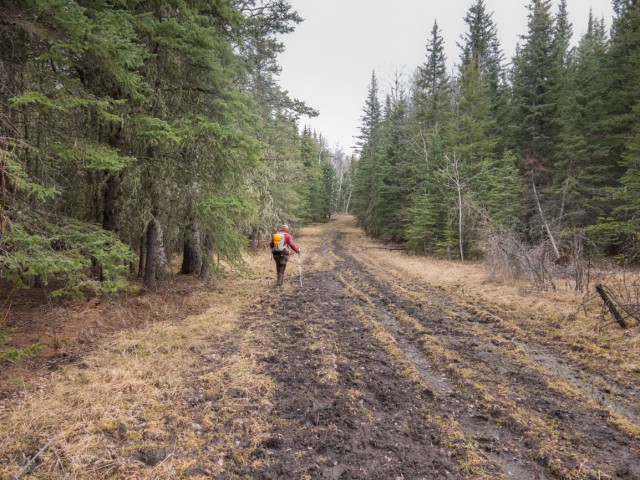
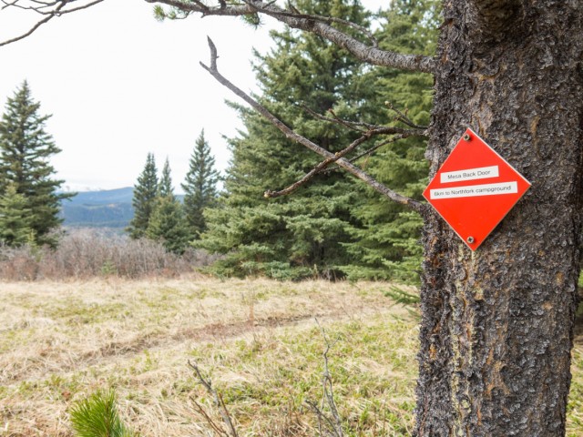
Start on the gated gas-well road opposite the North Fork Campground on Highway #546 – your objective will be visible from here. Heading south, walk along the nicely packed gravel for a time. Just past a large meadow but before a sharp left bend, transfer to a muddy jeep track trending gently to the right.
Prepare to play in the mud for the next click or two (this is the Kananakis Foothills you know). Drop down to a low swampy area (rudimentary bridge) and enter a meadow. We find some pretty fresh bear prints here.
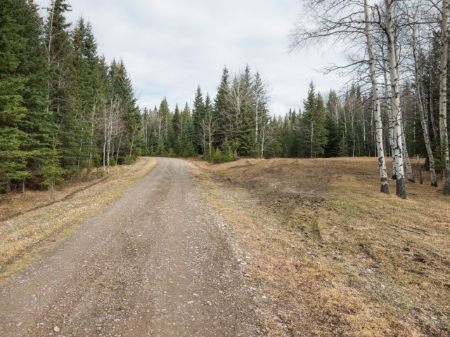
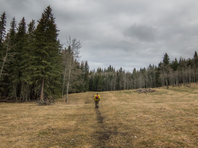
To the right is a hill which can easily be done, Just head up the grassy slopes. A pipeline right of way comes in from the east and then turns north here which will be the trail for the next bit. It’s wide, open and grassy and the going is easy and pleasant enough.
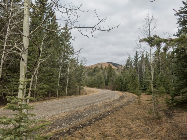
The right of way bends sharp right then heads up and over a small rise. At the top, find a fenced-in monitoring station. Just before it look to the left and spot the obvious trail heading into the dense forest. Follow it for a time, gaining some elevation here and there before breaking out onto the grassy slopes just below the east aspect of Mesa Butte. Leaving the trail behind, we tackle the steepness head on, huffing and puffing as we go, before eventually meeting up on a connecting ridge a bit east of the true summit. The trail we just left can be used to summit too, via a connecting route, or can be used on the down trip. We liked our route.
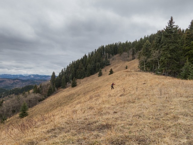
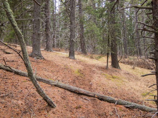
Turn left, head up, sometimes steeply, sometimes in the trees, sometimes not, on a faint trail. The woods get more and more thick as the final elevation is gained. The ground levels off. Prepare to hop over dead fall here. Turn hard left at the first opportunity (bits of trail) keeping close to where the treed ridge drops away. The forest thins and soon on you’re atop the flat summit.
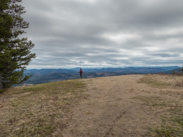
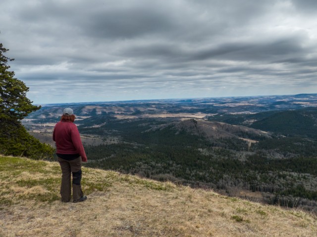
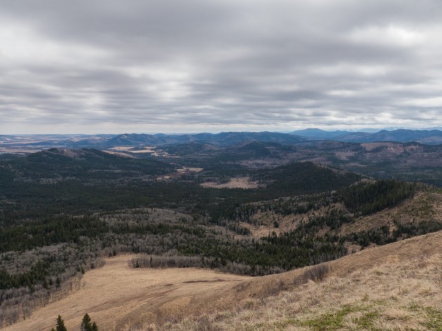
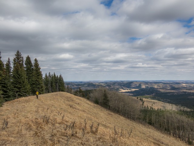
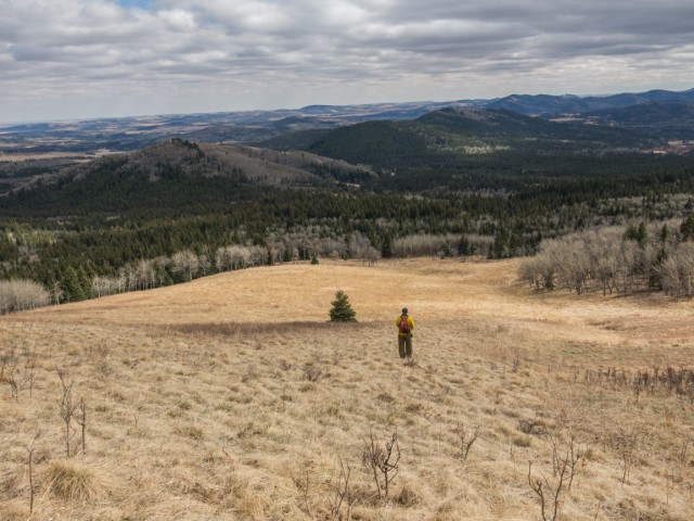
The views are excellent, an endless expanse of rolling hills and ridges heading off to the south. We’ve been up a few of those seen in the distance – Carry Ridge, Muley Ridge, Pine Ridge, Deaths Head among others. Directly east is the Kananaskis boundary (ranches and acreages on the other side) with the hills transitioning off to the plains. Calgary can be spotted to the northeast.
Some tall peaks to the west can be seen. Lots of green hills between you and them. Looking down, the very steep grassy slopes (don’t slip) lead to dense woods in the valley below. Most of the route in would be visible, if not for all those the trees. Two different obvious trails that take in Mesa Butte come in from the west, one heading into the woods at a red diamond, the other taking the obvious grassy ramp leading down at the west edge of the summit (geocache here, under a spruce). Looks like dirt bikes have been sneaking up to the summit from a nearby off-road vehicle area.
There are several nice lunch spots at the edge of the trees. Someone’s set up a fire pit with wood, logs turned benches, a shovel to extinguish the fire and even weenie roasting sticks. While we enjoyed our meal, with wine of course, we were serenaded by the sounds of gunshots coming in from somewhere below. I understand people set up temporary shooting ranges in logged out clearings and gas well pads to the west of Mesa Butte.
We take in the views some more. So should you, they’re particularly pleasant for a lowly foothill summit.
Not happy with turning around this soon, we take to the wooded potion of Mesa Butte. There are some intermittent trails (easy going) and the top while dense with trees, it’s rather flat overall and surprisingly extends off for some distance to the north. We walk the trees aimlessly hoping to stumble onto something interesting, like maybe a view in some other direction. But all we see is trees. Still, we appreciated the exercise and it’s fun enough.
These meanderings were not counted in the heights and distances listed and is that red line on the GPS track. The actual summit of Mesa Butte, perhaps 20m higher than the open viewpoint is actually somewhere in the treed section. Not that it matters.
Back at the summit, retrace your steps back to the car. You could also try dropping down to the west, and intercept a trail that trends hard east hugging the lower flanks of Mesa Butte that eventually takes one back to the pipeline right of way (you used part of this trail to come in). Or you could go up and over some low ridges to the southwest, eventually finding one’s way back to their car via the Curley Sand Trail. A Kananakis Trail Guide will help here.
Naming conventions – Mesa: a table top shaped hill, which it is. Butte: a hill sort of by itself, which it is. Name applied, sometimes as hill sometimes as butte, starting in the 1890s and made official, as butte, half a decade latter. Recently, renamed Square Butte, although most people still refer to the hill by the original name.
A different approach…
Mesa Butte via Curley Sand Ridge.
Modest height hills…
Green Mountain.
Return to Eagle Hill.
If you wish more information on this trail, by all means contact us!
Date of adventure: April, 2016.
Location: Kananakis AB, west of Millarville.
Distance: 9km total by our route.
Height gain maximum: 300m (ish).
Height gain cumulative: 320m.
NOTE: all distances and heights are approximate.
Reference: Kananaskis Trail Guides by the Dafferns.
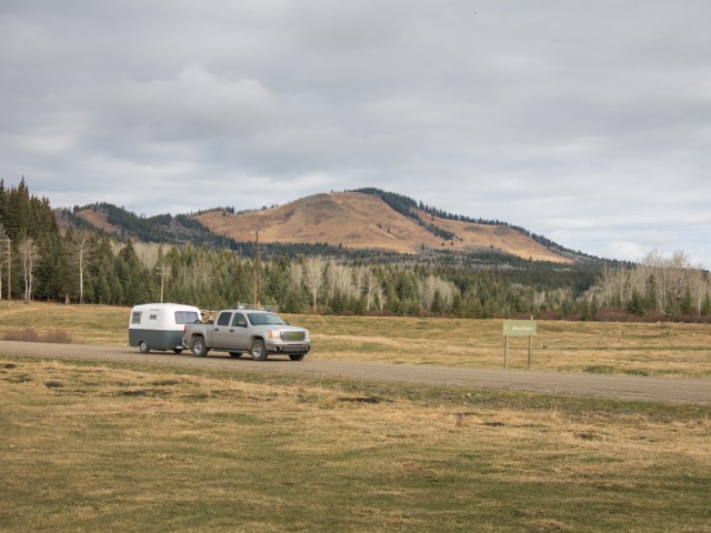
Our goal, Mesa Butte, in back. Boler!
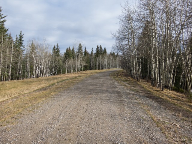
On the gas road.
Turn right on a muddy jeep track here.
Mesa Butte comes into view.
Playing in the mud.
The gate failed to keep us out.
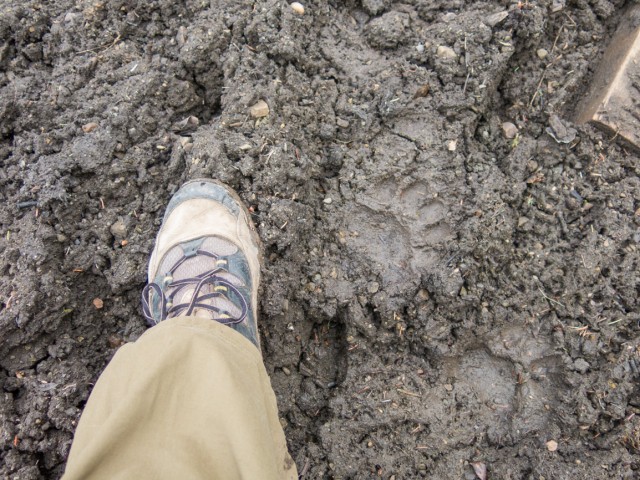
There’s a bear about
On the pipeline right of way.
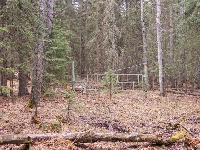
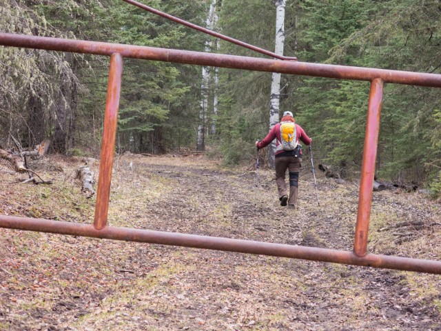
No road, but here’s a gate.
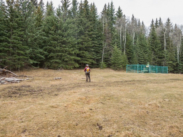
Turn left at the fenced pipeline station into the trees, on an obvious trail.
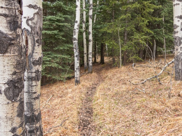
The going is easy.
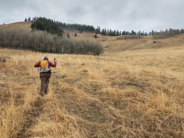
We’ll leave the trail here, tackling the slopes of Mesa Butte head on.
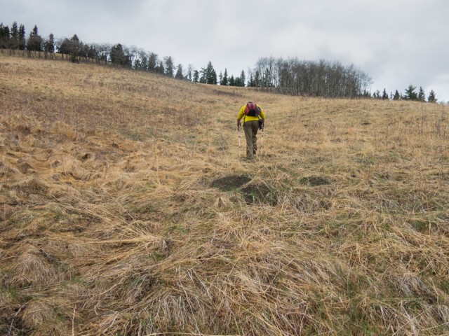
It’s steeper than it looks.
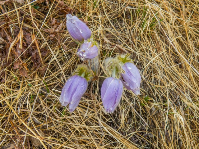
Prairie Crocus, the first flowers of spring in this part of the world.
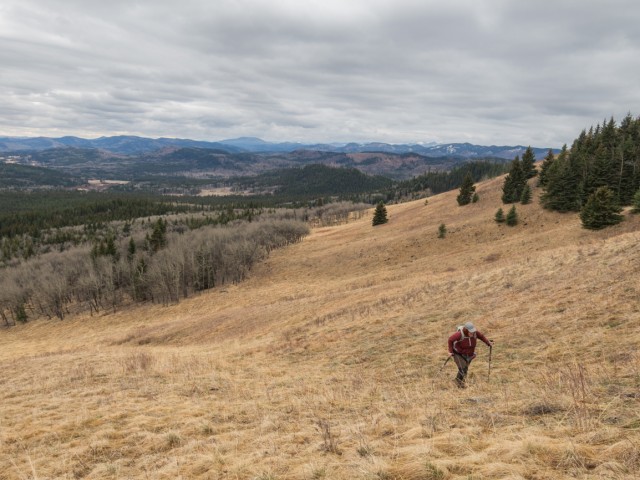
Lots of low rolling hills in the vicinity.
Gaining the ridge.
Back into the trees for a short time.
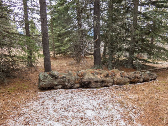
Lots of burls on this tree trunk.
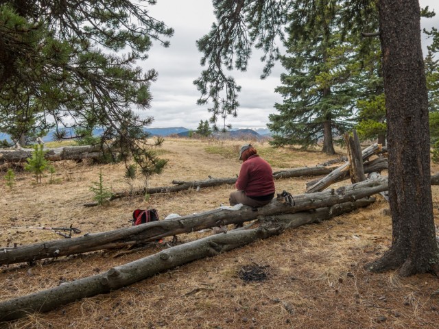
A pleasant lunch spot.
The top is quite flat.
Looking southeast here.
Our starting point is roughly centre, grassy area at the base of the left most hill.
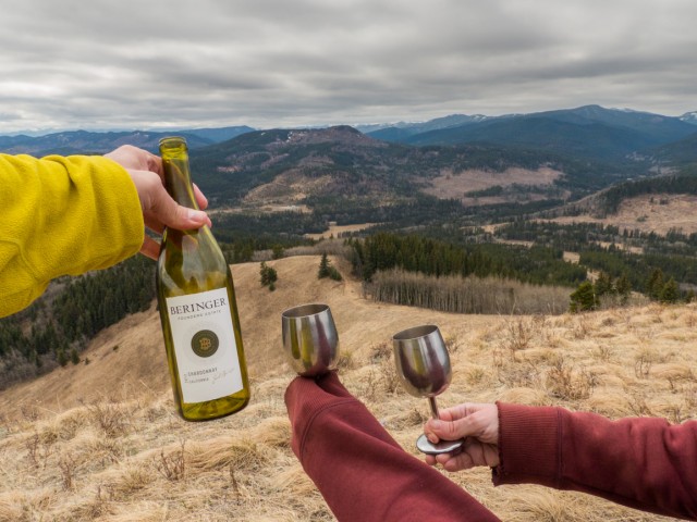
Today’s wine selection…Deaths Head in back.
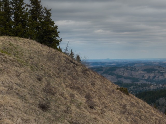
Calgary can be seen, if you look hard, just right of centre.
An alternate trail up Mesa Butte.
Ninja!
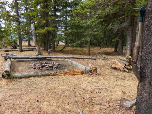
Time for a weenie roast.
About to drop down the grassy slopes.
On last look before we’re back into the trees.
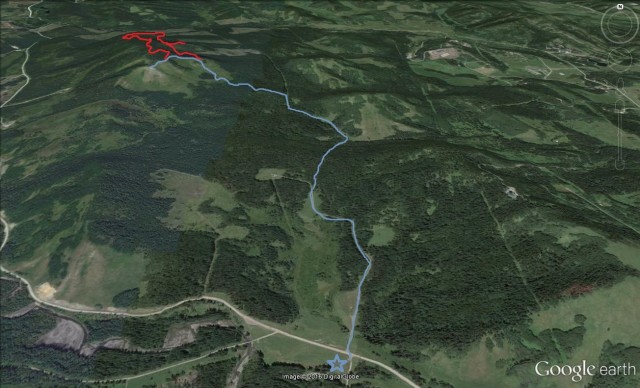
Our route up Mesa Butte. Red line: aimless exploratory wanderings.
")


Do you know if you can take horses along the route that you took? Thanks!
I wouldn’t recommend it for a number of reasons (in places, super steep, a mud bog and sections of narrow single track). There are official equestrian trails in the area however, if that helps. Check with the Kananaskis Trail Guide online.
A new route up Mesa Butte! Often wondered if it could be done following the pipeline as you did. Nice.
It was a fun route too, a bit different than the normal ways up.
(via Facebook)
I was here last November. Lovely views – you can even see the towers of downtown Calgary on the far horizon.
Yes, we saw downtown. Pleasant little outing.