
Hell’s Ridge
Welcome to Hell, Hell’s Ridge that is, South Kananaskis Alberta, a hike you may think twice about given that dark and sinister name. In reality however, it’s something actually quite wonderful. And fun. Heavenly…oh quit! It’s a short steep climb to the modest-height summit, where some pretty decent views await. The ridge crest extends off for some distance and is only a little undulating. so depending on time and ambitions, you have the option to go ridge walking for an hour or so more or the chance to easily bail at nearly any point should the adventure have to be cut short.
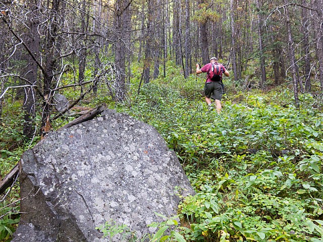
There is no path to speak of much of the time, but route finding challenges are fairly minimal – it’s just up and east through dense woods for the ascent and down and west, again through more trees, for the descent. Quite honestly, it’d be hard to mess it up but still make sure you’re comfy with the idea of going “off-trail”. Since few people hike the ridge, you’ll likely have it to yourself. We did.
Park at a pull-off opposite the Etherington Campground on Highway 940 (gravel), some clicks south of Highwood House. The ridge is immediately to the east, its base like right at your feet. It’s a long one, extending off in both a north and south direction for some distance. The south end is treed and not really of interest.
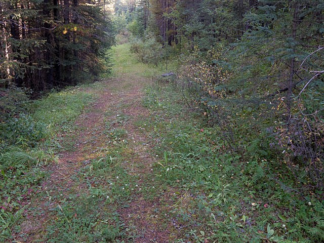
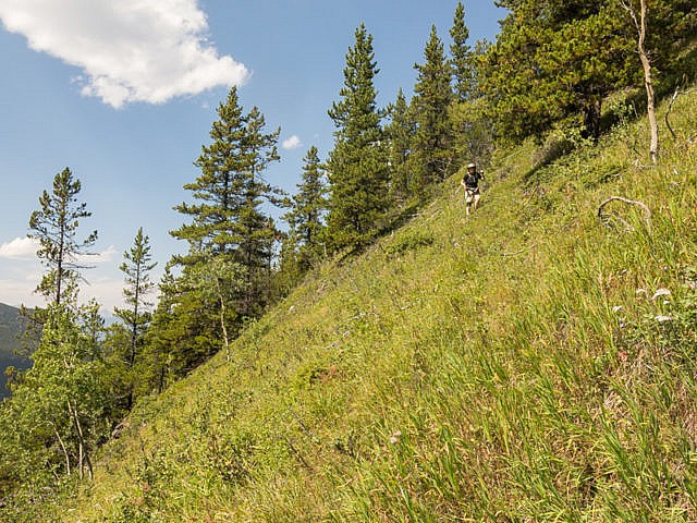
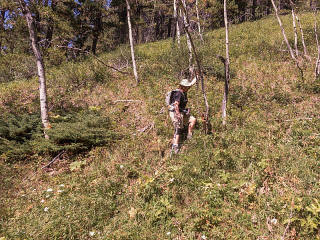
Find an old road next to the creek and follow it north for a couple hundred metres. At any point that looks good tackle the wooded slopes to your right. Just keep heading up east, always be in the trees, taking what ever line suits you. Okay some people may find the bushwhacking a little Hellish – come on it had to be said.
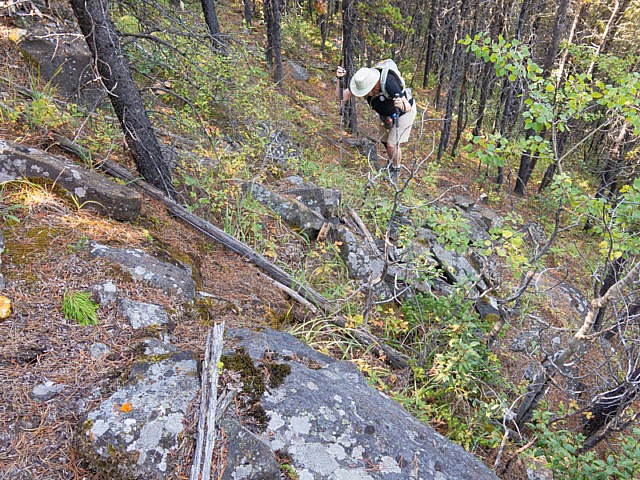
The grade is steep or super steep, without a break. You may encounter small cliff bands that may have to be circumnavigated. Occasional game trails help here. Once in a while you may find some flagging and even the odd “people” trail. These are usually faint and peter out quickly. Still, as long as you’re going up, you’re doing it right.
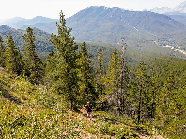
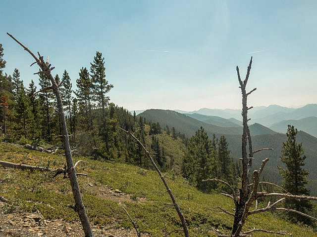
Gain the ridge crest, still in the trees. If you’ve kept on a dead-easterly heading, the summit should be to your left. Heading north now, and up, the forest thins just before the top. Trees, those damn trees, block the view to the east and do so along most of the ridge crest. To the west however, it’s generally open ground, or mostly so, here and at each high point heading north, even if it sometimes it doesn’t look so in our photos.
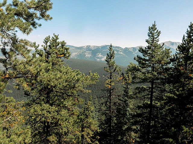
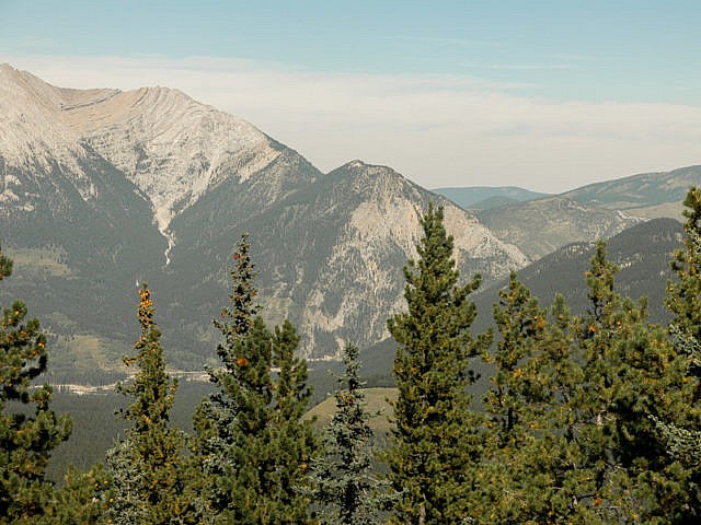
Let’s take it in. In front are a series of similar low ridges. South to north there’s Raspberry Ridge (with a fire lookout), Etherington/Baril Ridge and the Coyote Hills. All are similar in height to Hell’s Ridge and mostly treed with grassy open summits. In behind, a fair distance away, is a connected series of peaks running north and south acting as an implementable wall. Mt Armstrong and Baril Peak are the ones directly west.
To the left one can see the south heavily forested end of Hell’s Ridge. It’s not worth considering as an objective.
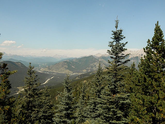
Far north, Junction Hill can be seen. More tall limestone peaks that way too, and a wide treed valley. Below is the highway you came in on. It’s not far away at all. Look for the dust trails of passing autos. Directly below but unseen is deep canyon home to a gurgling creek and just east, an old road (you were on it briefly earlier), paralleling the ridge which will be your path on the return trip. No matter where you drop down from Hell’s Ridge, you are guaranteed to intercept it.
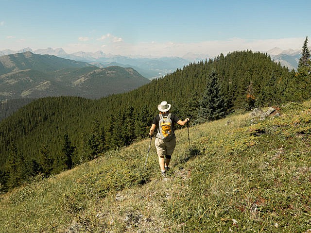
Continue north following the undulating crest. Sometimes you’re fully in the trees, other times in open areas, almost always west facing ones. At one point you’ll have a view east, well northeast and can see Gunnery Mountain and behind Holy Cross Mountain. Grassy ramps, at nearly every high point, head down and west and make easy egress points. No matter which you choose, you’ll spend some time in the trees down low.
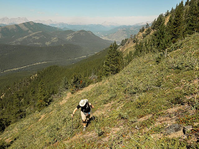
We take in a few high points and make our escape. We were limited in time and thinking about it now we missed out on a lot of fun. Things look to open up more as one heads north. Next time. You should continue on if you can. On the descent, no matter where you choose to do it, you may have to skirt some rock bands. Take care so as not to dead-end somewhere hard to get out of. The terrain may force you into a drainage, which could mean scrambling over dead fall, or travelling rocky creek beds. The joys of being off-trail. The down part can be super-steep at times, much like it was coming up.
Things level a bit. Just when you think the trees will never end, come to the old road and turn left (south). It runs fairly level and the going is real easy. You can often hear the creek gurgling unseen down and to the right and even cars passing on the nearby highway. You’ll make good time and before long will be at your ride. Wasn’t that good? Now you can say you’ve been to hell and back (couldn’t resist).
The name Hell’s Ridge? Something to do with cattle wrangling and how “hellish” it was to retrieve them off the densely wooded ridge.
Did someone say ridge walk?
Powderface Ridge.
Volcano Ridge.
Wind Ridge.
If you wish more information about this trail, by all means contact us!
Date of adventure: August, 2016.
Location: South Kananaskis AB.
Distance: 8km loop, up to 12-14km if you extend the ridge walk more (which you should).
Height gain maximum: 500m.
Height gain cumulative: 580m-ish (more if you go further).
NOTE: all distances and heights are approximate.
Technical bits: some route finding challenges.
Reference: Kananaskis Trail Guide by Gillean Daffern.
Once on the road, head right and up into the trees.
Steep bushwacking.
There is no break to the grade.
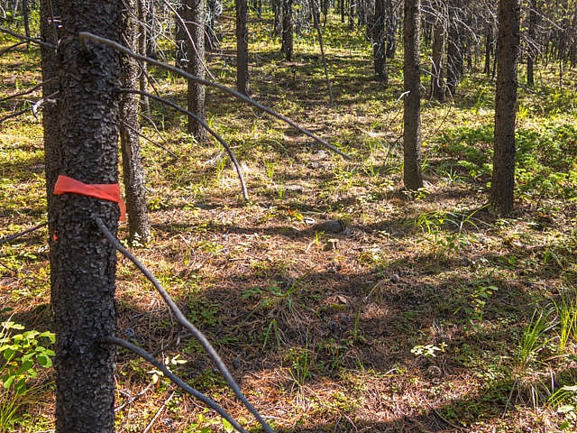
We found this faint flagged trail then lost it.
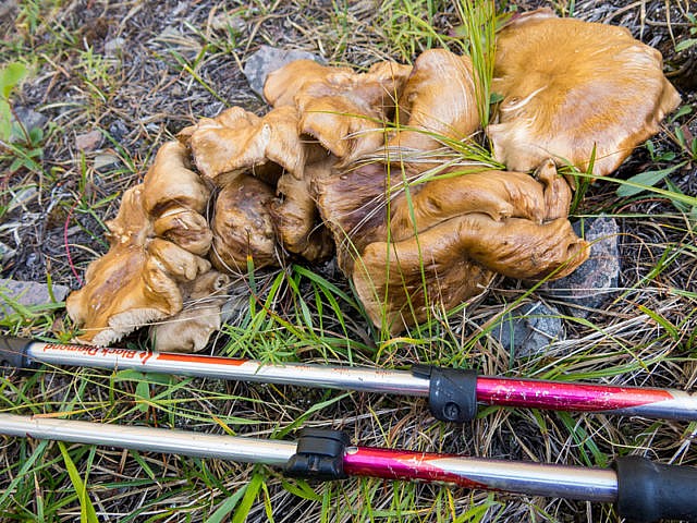
Tons of Mushrooms on Hell’s Ridge.
Raspberry Ridge in back – lots of haze this day.
Coyote Hills, back left.
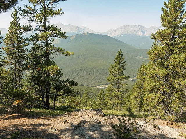
Etherington/Baril Ridge front, big peaks behind.
That bump centre – the treed south end of Hell’s Ridge.
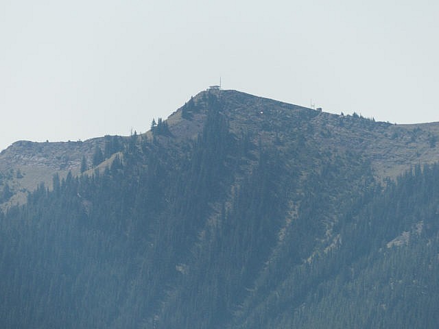
The Fire Lookout on Raspberry Ridge.
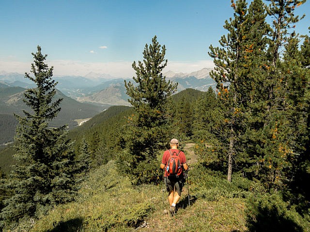
heading north.
Limited views to the east.
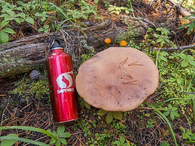
They grow big here!
From one high point to another.
Junction Hill in centre.
Gunnery Mountain and bigger and behind Holy Cross Mountain.
Dropping down on steep slopes – don’t slip here.
And down we go.
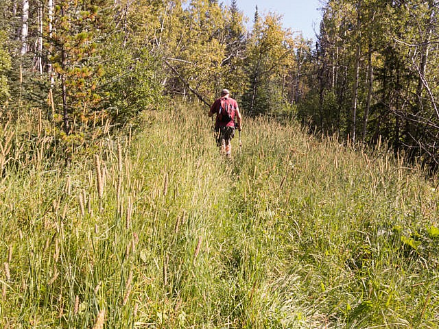
Back on the road, well grassed-over here but mostly wide open and clear otherwise.
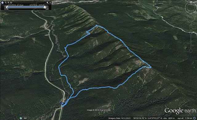
Our route – counter clockwise – you should take in more of the ridge.


Absolutely gorgeous ridge. You have a great website.
It’s a nice little ridge. Thanks we try hard. Come back often.
(via Facebook)
Good one. I have only been up on the other side on Raspberry Ridge.
Yes, I’ve been up there too. Hell’s Ridge has a similar personality but is not busy like Raspberry.