
Muley Ridge
Muley Ridge is one of the “Entrance Ridges”, so called given they’re right at the Kananaskis border. Located in the Sheep River area west of Turner Valley, there’s a nice little trail that takes in this long low lightly-forested north trending hill. The views from the summit and along the crest are certainly nice, but then it’s a outing in the woods and how can that be bad? To please the eye, there’s rolling hills to see all around, and in the west the tall peaks of the Alberta Rockies.
This trail can be done all year long (your winter kit should include spikes or yaks). To mix it up a bit, we added a loop to the out and back, taking in a small hill first (Entrance Hill) – just ’cause it was there – before heading up Muley Ridge proper. You can do it this way, or just follow our return route there and back if you can’t be bothered. There’s also an option to hook up with other ridges in the area, or it can be done all by itself. The choice is yours. By our route, there’s a bit of off-trail trekking. It’s no brainer stuff though.
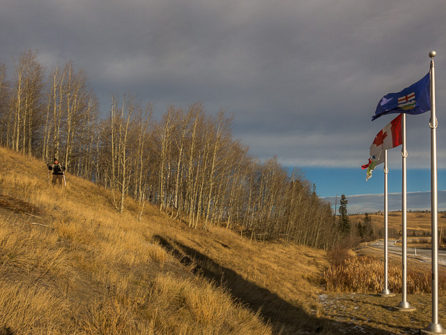
Park right at the Kananaskis boundary on Highway #546. Look for the sign and flags, you can’t miss them. There’s a pull off here with parking for many cars. If you follow our route head up the hill directly north on grassy slopes and turn left on reaching the top. You’ll have to hop a fence along the way. Watch that barbed-wire!
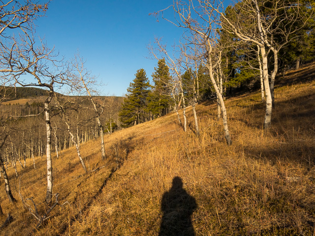
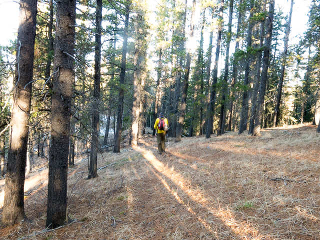
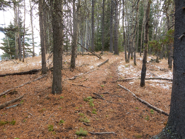
Interestingly there’s a bit of trail up here. Others had a the same idea we did I guess. Somewhat open to the west, enjoy the scenery as you hike along the hill top. Soon on drop down in a northerly direction, keeping left-ish where the woods are less dense.
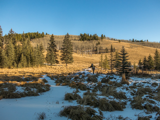
Come to a wet meadow, frozen on our visit, but most certainly a yucky bog during warmer times of the year. That suggests it’s best to do our route in the off season. Cattle free range in the area, in summer, so expect to see their calling cards even after they’ve left. Directly east is Muley Ridge. Take a grassy ramp up just to the left. It’s not too steep nor difficult.
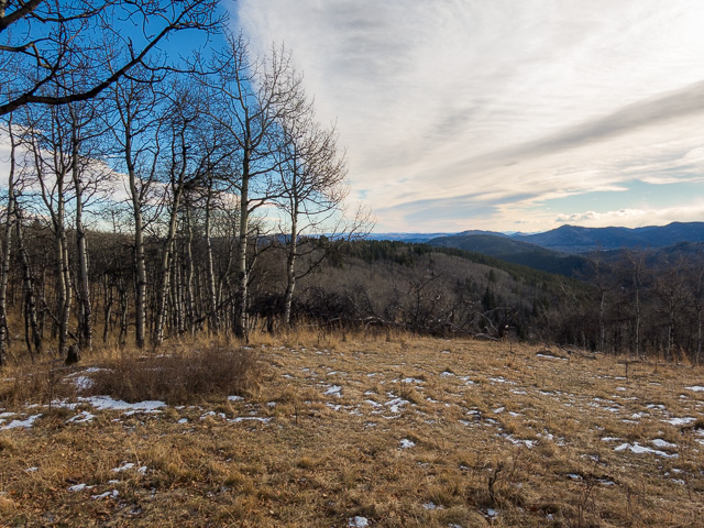
On reaching the crest trail, turn left. The ridges rises gently most of the elevation already gained, and the going is easy. Occasional breaks in the trees offer up views to the west. Directly in front is Forked Ridge, which one day we suspect we’ll visit. A lot of people, we understand make a loop using it and Muley. The peaks in the west, shrouded in snow our visit, seem far way.
There’s no views to the east, for the most part, expect where the trees thin from time to time. You might catch a glimpse of Carry Ridge in that direction, it runs parallel to Muley, and off in behind, grassy rolling hills transitioning off to the plains. This is the very east edge of Kananaskis.
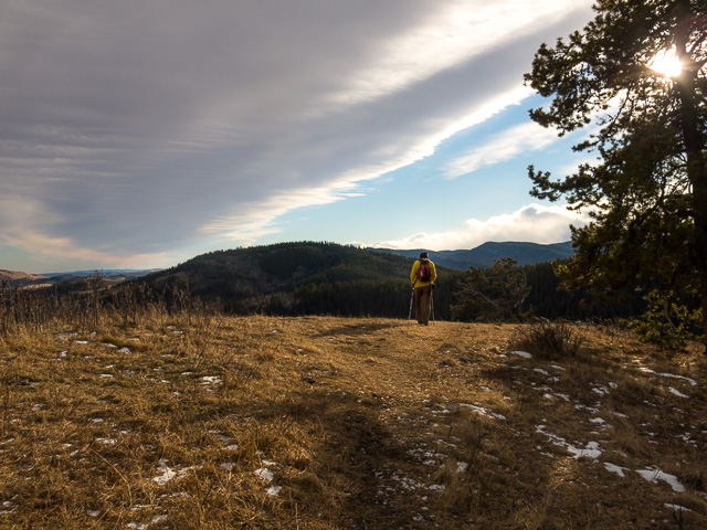
At a point there’s a junction. The right trail drops down and can be used to connected with Carry Ridge, which we just spoke of, or a trail that runs between it and Muley. Soon on come to the “summit” at a grassy meadow open to the west. If you’ve brought lunch, find a nice fallen tree turned bench and take in nature. There’s Forked Ridge within shouting distance, more bumps behind it, lots of rolling bumps, all those trees, meadows and peaks in the background. Not bad at all.
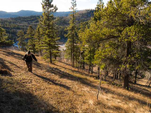
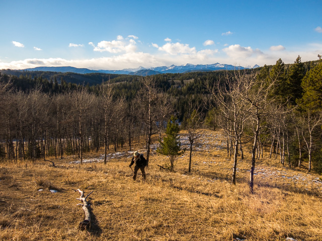
Time for home? Retrace yours steps. At the point where you came up continue south on the obvious trail. At the edge of the ridge drop down steeply on open slopes into a valley and turn east. Coming in from the left is the trail leading to Carry Ridge. It’s a worthwhile objective. We’ve done it a few times.
At a muddy meadow, just before the boundary fence (Anchor D Ranch property on other side) turn right, cross a small creek and head up into the woods. Cows have made a mess here. But if the mud’s frozen it’s not so bad. Come to a cat road, turn right and follow it up as it switchbacks once, going up and over the shoulder of small hill (the same hill started on). Wait, what, there’s more work? At the boundary fence turn right and soon on drop down to your car.
This trail is never going to be high on anyone’s to-do list. It’s a good choice if time is limited, when you’re feeling lazy, or when trails deeper in Kananaskis are snowed in or otherwise inaccessible. Still, it’s not so bad. We had a blast…but then we we always do. We had the place to ourselves this trip.
Easy hikes like this…
Mesa Butte.
Diamond T.
Back to Brown Lowery.
If you wish more information about this trail, by all means contact us!
Date of adventure: December, 2016.
Location: Sheep River area Kananaskis, AB.
Distance: 8km part loop, part out and back.
Height gain maximum: 280m-ish.
Height gain cumulative: 400m-ish.
NOTE: all distances and heights are approximate.
Technical bits and notes: none.
Reference: Kananaskis Trail Guide by Gillean Daffern.
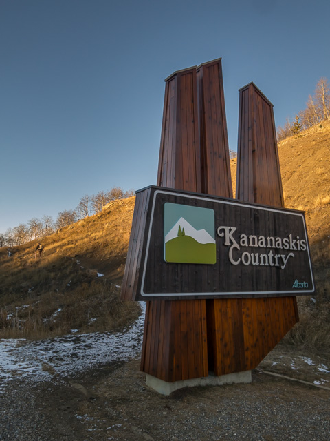
Park at this sign.
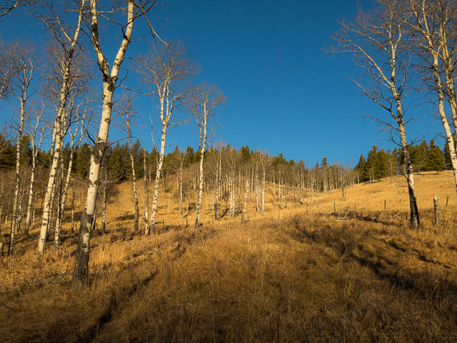
We’ll first go up and over “Entrance Hill”, just for the heck of it.
All the hills here are collectively called the Entrance Ridges.
Easy hiking here.
We’ll soon drop down.
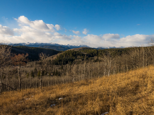
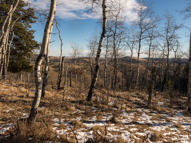
This area of Kananaskis is all treed hills and ridges.
Muley Ridge, behind, comes into view.
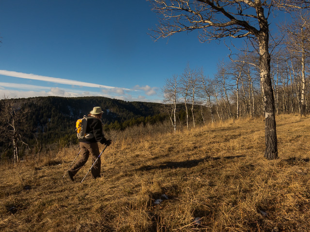
Making our way up on grassy slopes.
To the east, behind the trees, Carry Ridge.
Forked Ridge the next bump west.
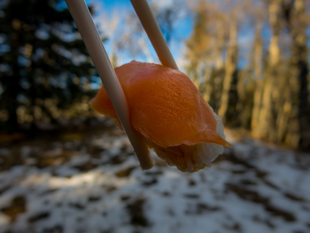
Lunch on the trail should be special – we make sure it is.
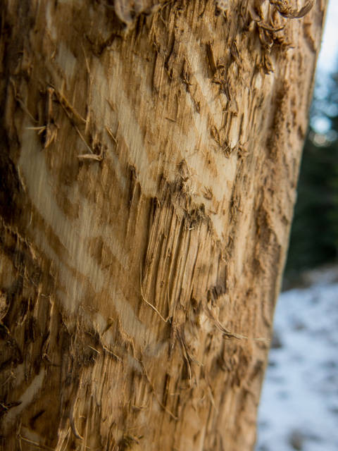
Elk eat the bark off certain trees.
The view south from the lofty”summit”.
On the return, a pretty typical view.
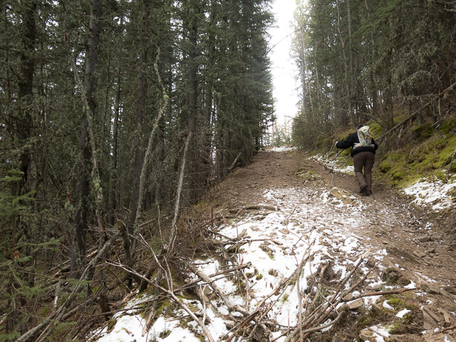
Even though it’s December there’s little snow on the trail.
We’ll drop down here…
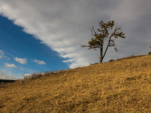
A wind ravaged pine.
Almost in the valley.
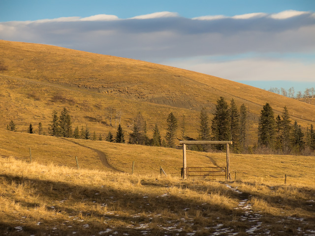
Anchor D Ranch property on the far side of the gate.
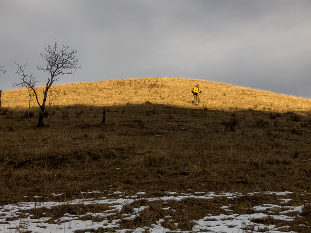
Up and over a small hill.
Back at the start – at the very entrance to Kananaskis.
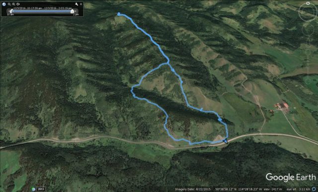
Our route up Muley Ridge – loop part was clockwise.


(via Facebook)
It feels so good to wander in these wide open spaces.
Good for the soul, good for the mind, good for the body. No down side!
So lovely and familiar. I have hiked in this area several times with our hiking club, and enjoy it very much.
I like that Sheep River area for hiking. Those rolling hills and ridges are pretty special. Thanks for commenting!