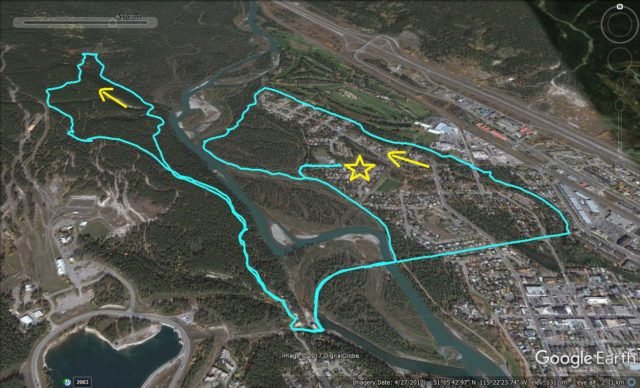
Here’s a fun little hike, far easier than most we chronicle. It makes a loop around the west end of the Canmore Alberta, also hitting up some trails in the woods just across the river. Mountains, lots or them to see. Stunning stuff here! There’s a bit of history too, the site of a vanished coal mining community, plus an abandoned rail line with a spectacular bridge. Lots of variety, lots to take in.
There’s many possible starts to the adventure. We found some public parking along dead-end 17th Street, well west of the super busy parts of town (which can get absolutely nuts), keeping us from having to fight for a space. Sanity intact, head west and at the last house hit the trail and turn left.
Canmore Loop: an easy hike with a bit of history in the mix. A Chris and Connie Adventure!
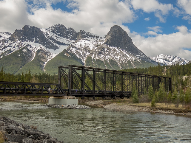
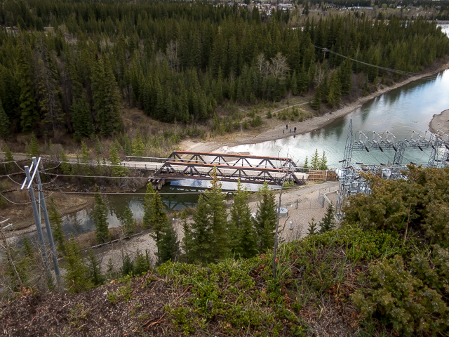
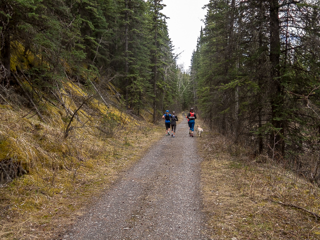
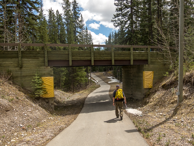
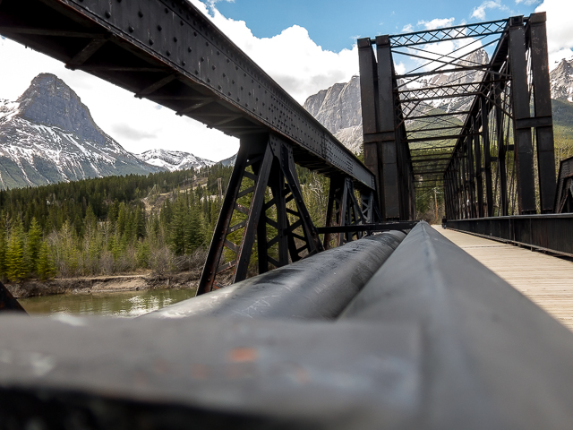
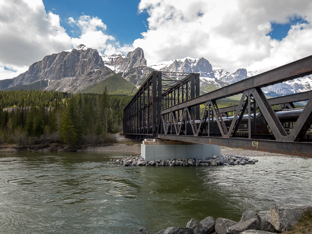
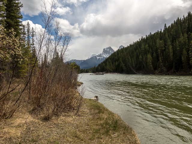
Stroll along at a leisurely pace, passing others out for a walk. Be sure give a nice hello to all. Meeting up with the Bow River, the town’s historic train bridge (aka, the Canmore Engine Bridge) comes into view. This structure will be the subject of its own “Bridge Hunting” article soon. It uses an uncommon truss form (bridge-nerd lingo) and of course is quite old. It was used by the Canadian Pacific Railway to access some coal mines.
Scroll down for photos and to comment
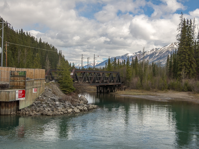
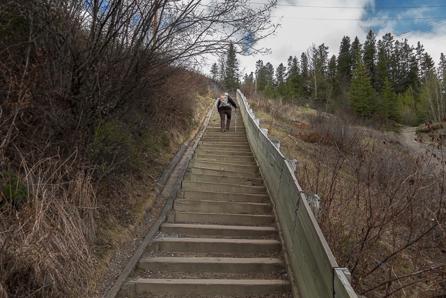
Cross over the river and follow the old rail line for a time. One more bridge, a smaller one at a side channel, pass a hydro plant, then hit the stairs. All couple hundred of them. Top out and look down with satisfaction. Those steps just got owned. Honestly, who needs a fitness membership?
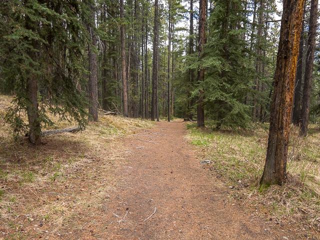
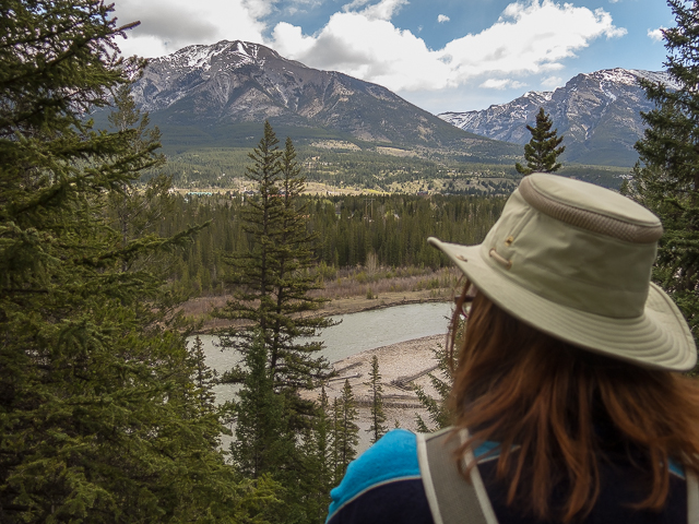
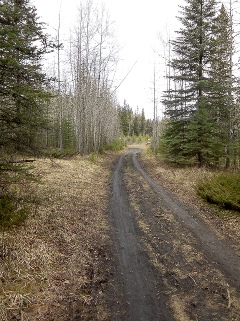
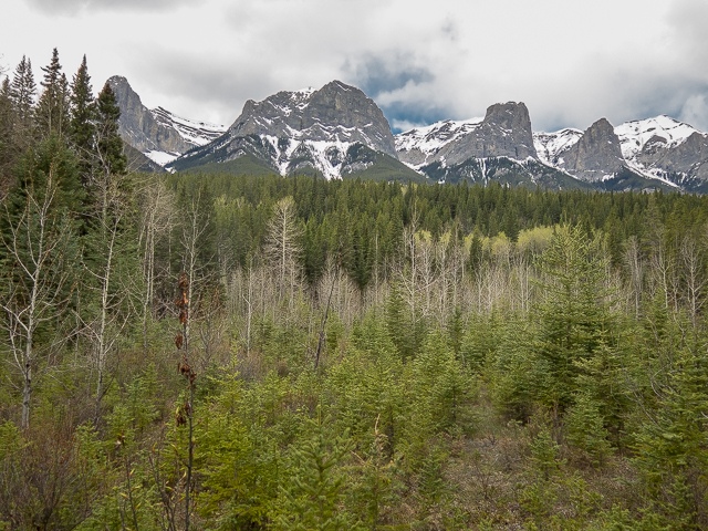
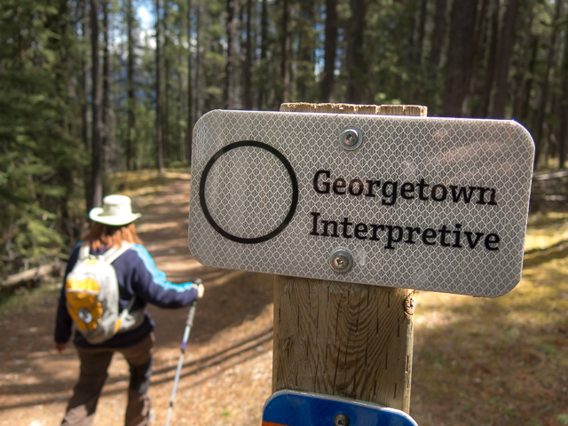
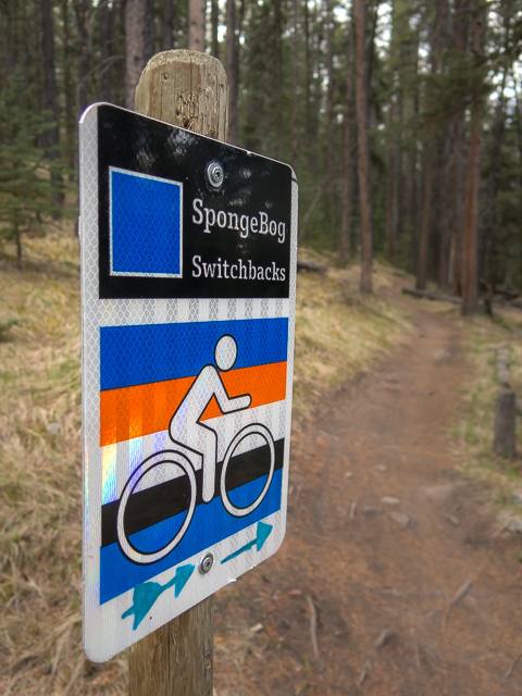
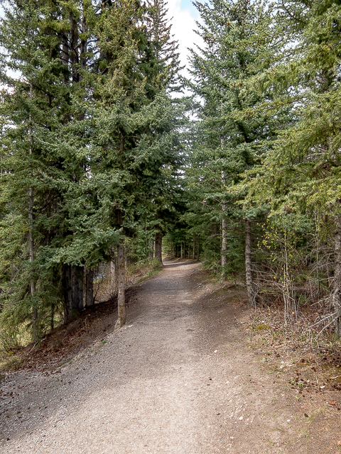
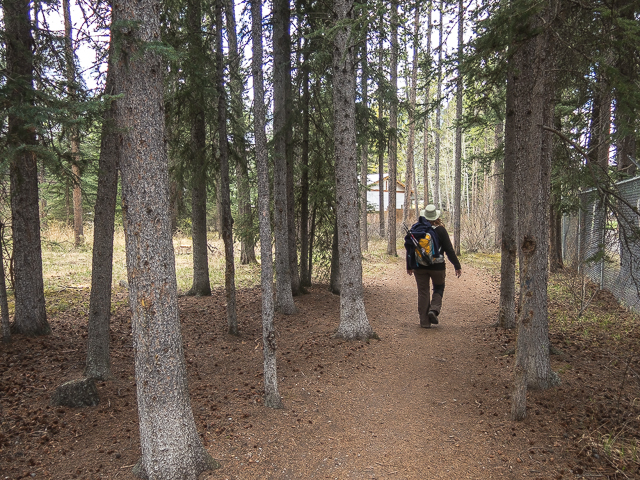
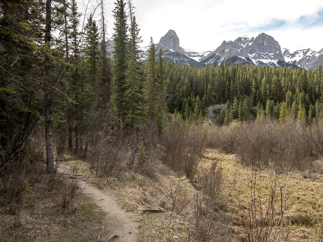
You’re now on the Georgetown (Interpretive) Trail, just one route within the Canmore Nordic Centre Network. Meander west, passing many side trails (many of which are for bikes only). There’s lots of signs here so it’d be hard to get lost. On a high bench above the Bow, an occasional break in the trees affords one a good look west across the valley and the big peaks found there. Awe inspiring! But wait there’s lots more mountains yet to see.
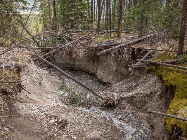
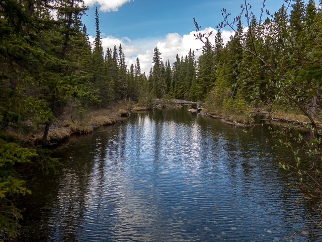
A tiny little stream shows signs of having two personalities. It’s a trickle today, but deep gouges and cuts in its channel tell us it’s got a nasty side.
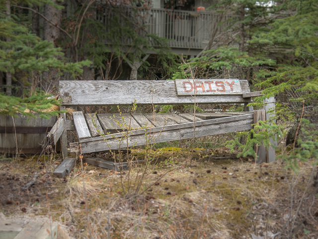
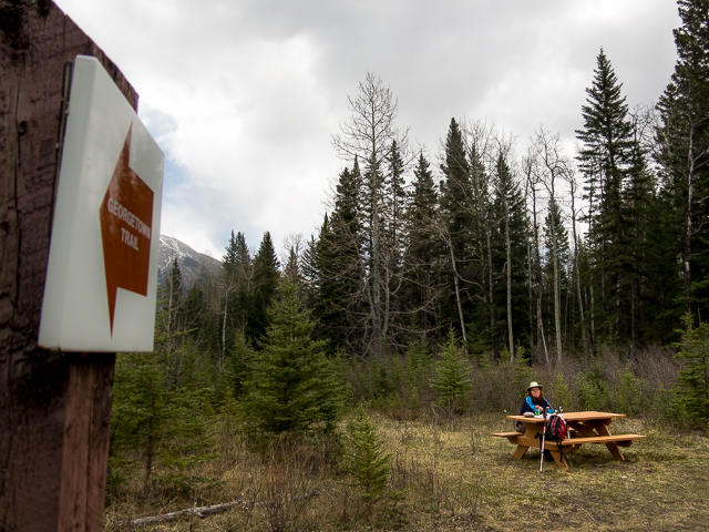
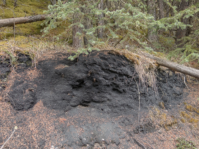
Drop down. Soon on coal slack underfoot marks your arrival at Georgetown. Yes, there used to be a community here on these flats, circa 1910-1916. They used to mine the black stuff here – there was and still is lots of coal in the area. Outside some occasional remains here and there, most of them easily missed, there’s very little to indicate there was ever anything here. It’s like Georgetown never existed. There’s a couple interpretive signs that explain a little of the town’s history.
A picnic table makes a fine lunch spot, the many peaks of Mount Rundle towering overhead. This is the east end of a limestone mass which extends off to the west for a half dozen kilometres or more. All the way to Banff in fact.
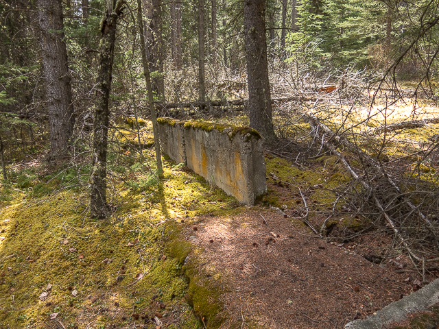
Done chowing down? Next, take the trail heading south and up and at the next junction, soon in, turn left. There’s some concrete stuff to your right sort of hidden in the woods, ruins from the Georgetown Mine.
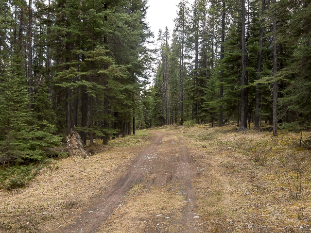
The road gains elevation, but never too steeply. Pass many more bike trails, keeping an eye open for riders (it’s a popular place). Spend a moment or two on a paved path, then join up with the Georgetown Trail you came in on. Retrace your steps back to the train bridge.
Follow the old rail bed, which until the 1970s served the Canmore Coal Mine nearby. Pass an old “tell tale”. What’s this? Thought you’d never ask. It’s a series of dangling ropes or light chains hanging over the track which on striking employees riding the tops of cars (which they did in the old days) reminds them there’s a close clearance structure ahead, the bridge in this case. It’s a warning. Duck! Or get taken out.
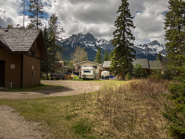
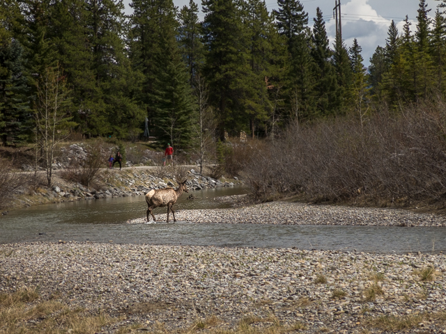
Back in town now. The first of several groups of elk seen this day are passed. They pay us no mind. We hear bears can be found on or near the trail at times too. None showed for us. Your mileage may vary.
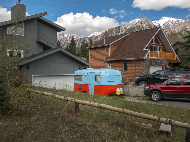
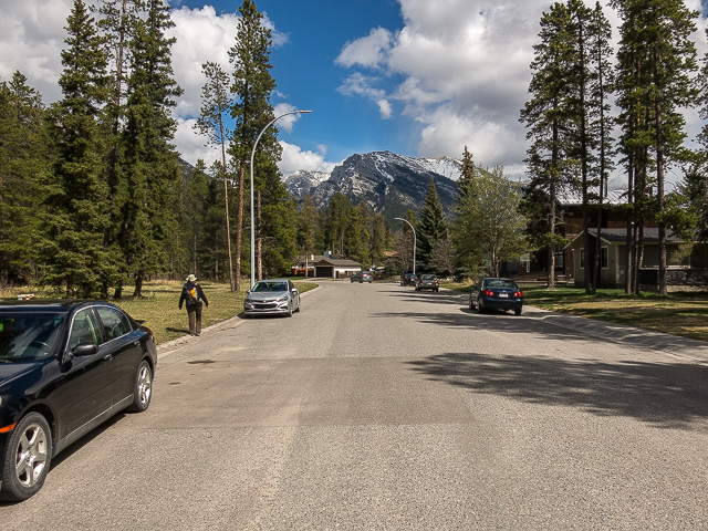
Houses back onto ponds and backwaters. Lots of trees. And those mountains all about. Nice place to live, here in the Rockies. We’re blessed. We have the best playground in the world.
At a T junction, leave the railbed behind and follow the dirt path leading west. For a time it’s jammed in between houses and a placid river channel and later a golf course (warning – we just missed being hit by an errant ball) and yet more back yards. Keep an eye open for the elusive Boler here. We spotted two in quick succession.
We’d love it if you SHARED this post.
Trending north, soon on go right, a side trail leading to “Larch Island” which in fact seems Larch free (those trees preferring the alpine) and rather un-island like. The only water was the Bow on the one side. Wander about in the peacefull Larch-less woods here.
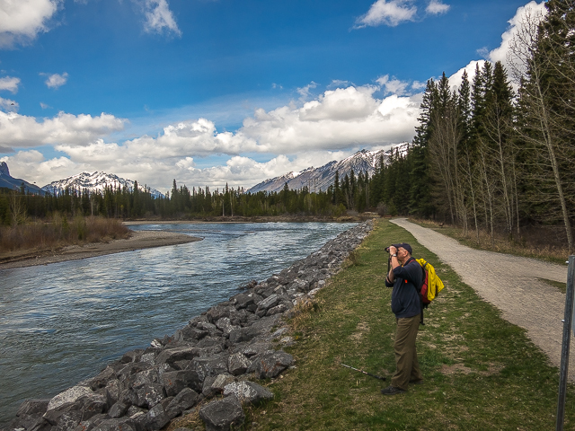
Come to the Bow. To the east more stunning peaks, Ha Ling and one of the “Three Sisters” poke out above the forest. Hit the main trail, left here, then soon on a right back on the road where you parked. Drive away, Fast and Furious style, another fun hike behind you. Hope you enjoyed it as much as we did.
If you wish more information about this trail, by all means contact us!
Date of adventure: May, 2017. Location: Canmore, AB. Distance: 13km. Height gain maximum: 150m-ish. Height gain cumulative: 250m-ish. NOTE: all distances and heights are approximate. Technical bits and notes: Expect to share the trail with human and beast. Reference: Kananaskis Trail Guide by Gillean Daffern.
I’d suggest parking in the shopping area on Railway Ave. Lots of room at the back away from the shops.
If you start by the railway near the TD you can see the former spur line curving off the mainline. Starting there adds 2 more bridges (ties and possibly rails still in place) over Policeman’s Creek and I think Surprise Creek.
Look for the remains of a tell tale just before the bridge walking from town. Rail used is dated I think 1880s.
Great walk! I’ve enjoyed it several times since moving here in 2014.
Since the post is from a few weeks ago, then a definite yes! Looks straight and true (disclaimer: we’re not engineers). The pier does look like it had some work done to it post flood however. Perhaps it got damaged and then fixed up.
It’s a nice walk, for sure. The town is in such a nice setting, what with those mountains all around. Pleased to inform! I bet a lot of people wonder what it is.
We used to do something called the "pointless challenge" 🤪 and miss those days. It was so much silly fun and often frustrating as heck. In these we'd invite people to send in random photos of obscure locations, but not give any information, and then we'd track where it was and shoot something similar.
Most of these came from old family collections, as was the case here. Anyone up to resurrecting the series?
In hindsight, why didn't we pose someone in our shot?
Pointless: “Devoid of meaning (or) senseless” Merriam-Webster.
If you like what we do and want to support this ongoing project (12 years now), go here: https://www.BIGDoer.com/help-the-society/ Thanks to Connie for making this post possible.
Exploring history with Off the Beaten Path with Chris & Connie. Photo: ca1970 and 2014. Posted by Connie.
Captured on a cold, cold day many years ago. We've been passing this old house for decades and it's little changed in that time. At some point we expect to drive by and it'll be gone.
Exploring history with Off the Beaten Path with Chris & Connie. Photo: 2017. Posted by Connie.
When retired old railway cars usually get cut up for scrap. Sometimes, however, they find their way into the hands of the general public or whomever. Flat cars make good bridges, and boxcars can be transformed into storage buildings and the like. Case in point here. We see them used like this often enough and in this case, it's part of a corral.
Incidentally, this boxcar dates from 1950 and this was found by tracing the old road number, which is still visible.
Exploring history with Off the Beaten Path with Chris & Connie. Photo: 2017. Posted by Connie.
This central Alberta racetrack was never a commercial operation but instead just a fun place for car enthusiasts in the area to get together. Early '70s or thereabouts and it only lasted a few years. Even thought it's been abandoned for that long, there is no doubt what was here.
You know we like the the obscure stuff and this one fits the bill perfectly. Found by accident while backroad cruising and the history comes thanks to local car guy Mike.
Exploring history with Off the Beaten Path with Chris & Connie. Photo: 2022. Posted by Connie.
On top of little Myrtle Mountain in the Kimberley (BC) Nature Park.
There's some good wilderness fun to be had here and nice views as you can see, but the real reason we came is mining history. The whole area near the ski hill was extensively worked over a century ago and we were looking for evidence of this. We didn't find much in the area searched, but it's a big chunk of property and we hope to return to cover more ground again soon. Of all the subjects we cover, mining related is a favourite.
Still, it was a good hike and that can't be bad. Look to the comments for more info 👇.
Exploring nature and history with Off the Beaten Path with Chris & Connie. Photo: 2022. Posted by Connie.
It's a strange curiosity in south Kananaskis, there on a hillside and we have no idea who created it. We asked around and no one's completely sure about its history. In the past it showed the Canada 100 logo from 1967 but in 2017 someone changed it to reflect the country's 150th.
That's our friend Emily from DanOCan.com having a look.
Exploring history with Off the Beaten Path with Chris & Connie. Photo: 2017. Posted by Connie.


I’d suggest parking in the shopping area on Railway Ave. Lots of room at the back away from the shops.
If you start by the railway near the TD you can see the former spur line curving off the mainline. Starting there adds 2 more bridges (ties and possibly rails still in place) over Policeman’s Creek and I think Surprise Creek.
Look for the remains of a tell tale just before the bridge walking from town. Rail used is dated I think 1880s.
Great walk! I’ve enjoyed it several times since moving here in 2014.
Paul Tatham
Awesome Paul, something to look forward to for the next visit! Thanks for the tips.
Just did some riverbank work a 1/4 mile from there.
You must know the river well! (note: Randy, a friend, runs heavy equipment doing among other things, riverbank remediation and flood mitigation).
I remember walking across that bridge many times as a child.
Cool memories!
Did this bridge survive the flood of 2013? Anyone?
Since the post is from a few weeks ago, then a definite yes! Looks straight and true (disclaimer: we’re not engineers). The pier does look like it had some work done to it post flood however. Perhaps it got damaged and then fixed up.
I take it, that’s some type of pipeline on the bridge.
Yes, but not sure what it carries. Will be researching that soon however. Plan to do a piece just on the bridge – so love these types of structures!
Awesome photos! We walked that area last year and I have some similar photos. I always wondered what that thing hanging above the pathway was…
It’s a nice walk, for sure. The town is in such a nice setting, what with those mountains all around. Pleased to inform! I bet a lot of people wonder what it is.