This post should have been published last week. We meant to publish it last week. Really, honest to God we did. We started work on it, got about half way done, then something darn distracting stole us away for a couple working days. It’s only Chris & Connie holding down the fort, it’s crazy busy here and sometimes we get spread a bit thin. You know how it goes…
So here, after the fact, a few days after this country’s birthday, a post that was supposed to be published before in anticipation of that event and the build up leading to it, a look at a special “Canada” display.
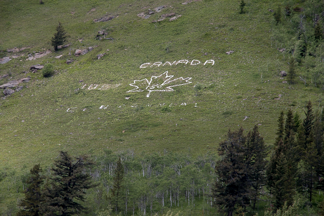
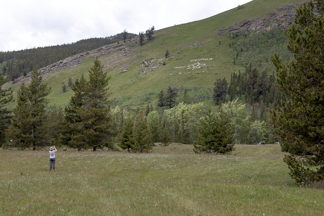
Some random hillside: on display in the remote Alberta Rockies…“Happy Birthday Canada”. By Chris Doering and Connie Biggart.(BIGDoer/Synd)
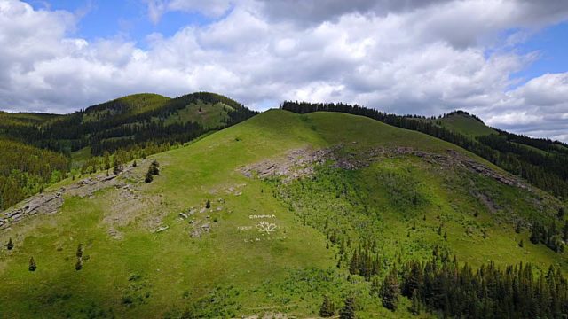
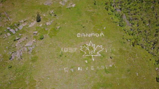
On the sides of some hill, along some meandering forestry road, real remote and far from any civilization, a rock display, originally put in place to celebrate the nation’s Centennial, but recently modified to do the same for its 150th.
Better late than never, as the old saying goes. We missed it by thaaaaat much.
The location…it’s along highway #940, a gravel affair that runs north/south in the front ranges. Here, where it meets Maycroft Road, which comes in from the east, just beyond “The Gap”, not far from where the Oldman River and Racehorse Creeks join, below Thunder Mountain, is the display. On the flanks of “Fly Hill”, it’s visible from the road, if you know where to look and is situated right below a back country campsite.
Who made is not known. We called around and called around more, and while many locals were aware of it, no one seemed to really remember any details.
“It’s always been there…sorry no clue.” “Put in the summer of 1967” – but that part we sorta knew anyway. “Some hippies, I think.” So nothing solid, although everyone racked their brains as best they could.
So it remains a mystery.
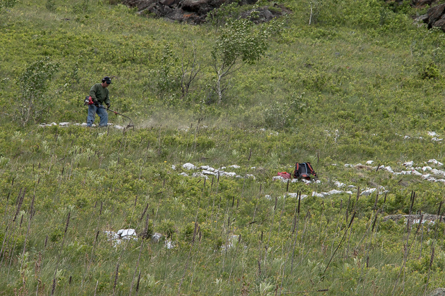
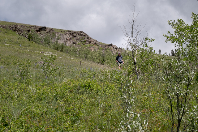
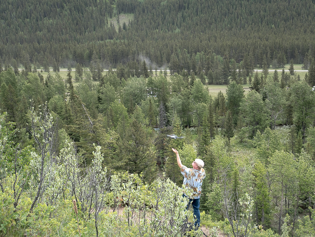
Why didn’t we ask that fellow trimming the weeds around the display? You see him in the pics. At the time we had a lead on the history, which turned out to be a dead-end, unbeknownst to us I’m afraid, and we simply didn’t want to bother him. Was he the fellow who also rearranged the display? How is he connected to it otherwise? Or did he just want to do his part to spruce the place up for the big day? All good questions. No idea if they’ll ever be answered.
If you have some info on this display, we’d love to hear from you. We’ve rarely come up this short. And it’s bugging the heck out of us!
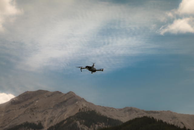
Joining us this trip were good friends Dan and Emily who are into this kind of weird stuff too – they got their own website which you can check out below. They brought their drone – a capitol idea. Short of climbing nearby peaks, how better to check out the display? Their footage is amazing. Scroll down below the photos to see the vid. You won’t regret it.
Shameless plug…be sure to check pay a visit to DanOCan.com. It’s Team BIGDoer recommended! Tell ’em Chris & Connie sent you.
Looks like hiking/scrambling legend Bob Spirko had the same idea as us and unknown to us at the time, was exploring the ridge above the display the same day of our visit. Small world. We only came for the display – he of course had to make the summit. That’s his style.
If you wish more information on what you’ve seen here, by all means contact us!
Date: June, 2017. Location: Crowsnest Pass Area, AB. Article references (and thanks): Dan and Emily Overes from DanOCan.com.
Yes, I saw that article about those two fellows. But yes, who originally did it? Check the comments for a hint from another person. Looking into it as we speak. Thanks for commenting!
Nice that this Centennial monument has been preserved and updated. I stumbled across this one in a reforestation area while browsing Google maps northwest of Barrie Ontario near where I live. I don’t think it will get a makeover. It’s located at 44.597917, -79.627259.
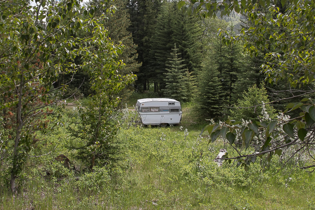
Captured on a cold, cold day many years ago. We've been passing this old house for decades and it's little changed in that time. At some point we expect to drive by and it'll be gone.
Exploring history with Off the Beaten Path with Chris & Connie. Photo: 2017. Posted by Connie.
When retired old railway cars usually get cut up for scrap. Sometimes, however, they find their way into the hands of the general public or whomever. Flat cars make good bridges, and boxcars can be transformed into storage buildings and the like. Case in point here. We see them used like this often enough and in this case, it's part of a corral.
Incidentally, this boxcar dates from 1950 and this was found by tracing the old road number, which is still visible.
Exploring history with Off the Beaten Path with Chris & Connie. Photo: 2017. Posted by Connie.
This central Alberta racetrack was never a commercial operation but instead just a fun place for car enthusiasts in the area to get together. Early '70s or thereabouts and it only lasted a few years. Even thought it's been abandoned for that long, there is no doubt what was here.
You know we like the the obscure stuff and this one fits the bill perfectly. Found by accident while backroad cruising and the history comes thanks to local car guy Mike.
Exploring history with Off the Beaten Path with Chris & Connie. Photo: 2022. Posted by Connie.
On top of little Myrtle Mountain in the Kimberley (BC) Nature Park.
There's some good wilderness fun to be had here and nice views as you can see, but the real reason we came is mining history. The whole area near the ski hill was extensively worked over a century ago and we were looking for evidence of this. We didn't find much in the area searched, but it's a big chunk of property and we hope to return to cover more ground again soon. Of all the subjects we cover, mining related is a favourite.
Still, it was a good hike and that can't be bad. Look to the comments for more info 👇.
Exploring nature and history with Off the Beaten Path with Chris & Connie. Photo: 2022. Posted by Connie.
It's a strange curiosity in south Kananaskis, there on a hillside and we have no idea who created it. We asked around and no one's completely sure about its history. In the past it showed the Canada 100 logo from 1967 but in 2017 someone changed it to reflect the country's 150th.
That's our friend Emily from DanOCan.com having a look.
Exploring history with Off the Beaten Path with Chris & Connie. Photo: 2017. Posted by Connie.
April 13th 2024, the Beer Parlour Project visited the Viking Hotel, Viking Alberta and it too was an awesome time. There's Rob Pohl with his curious view camera and in the other photo Chris is seen interviewing local character Doug.
The Viking dates back to the 1930s and replaced a hotel on this same lot, which had earlier burned down.
Incidentally April 13th is also Chris and my 28th anniversary. Chris said he forgot this when scheduling this but that's fine and it doesn't matter where we celebrate but that we celebrate.
Exploring history with Off the Beaten Path with Chris & Connie. Photo: 2024. Posted by Connie.
Javascript is required for this site to function. Please enable it in your browser settings and refresh this page.
Please log-in to continue... This allows unrestricted access to every post @BIGDoer.com, popups are eliminated, commenting is on and the "contact us" page is enabled.
Your social site may send you a routine notice of login.
Or signup, here: Subscriber Register ___ BIGDoer.com: Serving up POP HISTORY & other McFun!…(Mmmm, yummy bite-sized pieces.) One million plus words & tens of thousands of photos!


Now that we know who spruced it up for the 150th, it would be interesting to know who originally put it there in 1967.
Yes, I saw that article about those two fellows. But yes, who originally did it? Check the comments for a hint from another person. Looking into it as we speak. Thanks for commenting!
Nice that this Centennial monument has been preserved and updated. I stumbled across this one in a reforestation area while browsing Google maps northwest of Barrie Ontario near where I live. I don’t think it will get a makeover.
It’s located at 44.597917, -79.627259.
Nice find…that is awesome! Google Earth is so cool when it comes to finding stuff like this. The 1867 is still quite clear. Thanks for commenting!
Kananaskis ,just south of the gap. My backyard as a kid.
Have not explored it near enough. Due back soon I hope.
Great working with you.
Ditto, it’s always fun to hang with like minded people!
Neat! Love that area!!
It’s gorgeous out there. Agree, it’s great.
When they had prisoner working in the Racehorse area they did the sign, I remember watching them.
Oh, now that’s some new info coming to light. A starting point…we’ll ask around and I’ll PM you too. Thanks!