
Lesueur Ridge
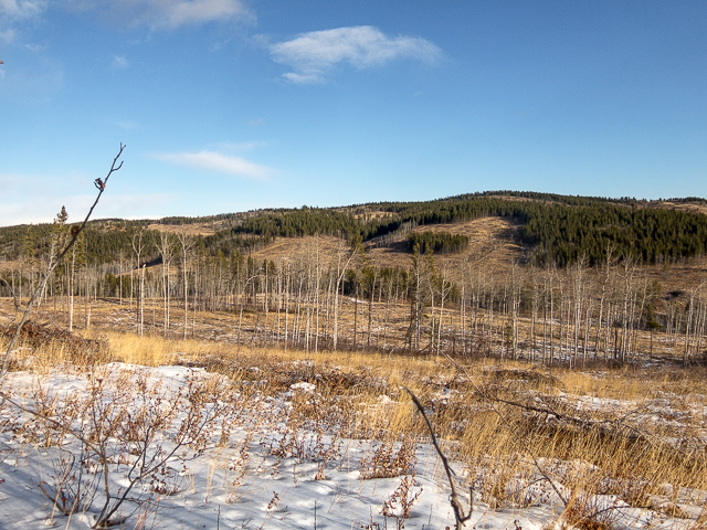
That chunk of Kananaskis in the north is generally the domain of the all terrain vehicle. Still, there’s a number of places that can be hiked in the area without the two modes clashing. Lesueur Ridge, right at the K-Country Border, just west of the Forestry Trunk Road (Hwy #40), a bit north of Waiparous Village is an example of that. It’s a fine little loop hike and from its open south facing slopes up at the top there’s wonderful views of huge peaks to the west, rolling ridges to the south and plains off in the east.
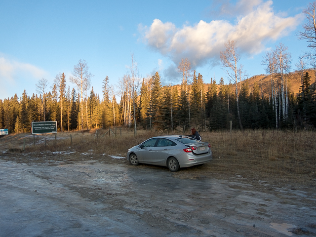
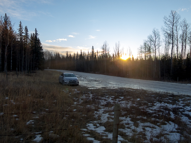
The trail head is about a click down the “TransAlta” Ghost River Road, a gravel affair all rutted and bumpy. Expect lots of ice come winter too. Park at the first cattle gate and head north on the obvious trail, west side of the fence line. East/west trending Lesueur Ridge comes into view almost immediately. Gain a little elevation, gravel underfoot and come to a junction.
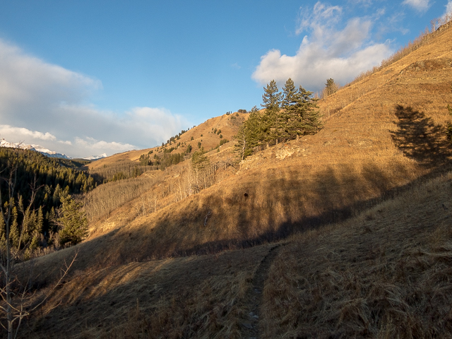
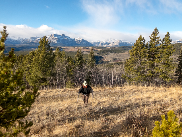
A decision is to be made – do the loop clockwise, with the most fun (so, high points) near the end or the other way around. We choose the former – of course. So if following our track, turn left here. The trail traverses below Lesueur Ridge. Look at those open grassy slopes, broken by the occasional cliff band, knowing you’ll be up there soon enough. Expect to encounter free-range cattle here, depending on the season. We did – some up near the ridge crest – mountain climbing bovines!
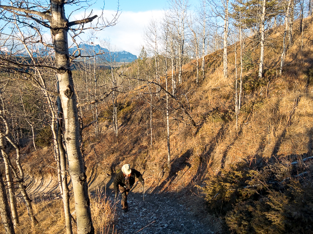
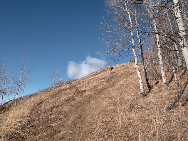
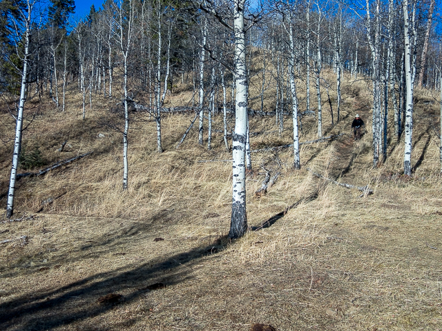
A gorge, home to little Lesueur Creek, can be seen below to the left. In some places it’d be a long tumble down if one were to trip. Pass through clumps of trees from time to time, some gnarled and bent from the almost always present winds found here (odd, it was dead still this day). Come to Lesueur Creek. Down low here the trail got real icy, and since we forgot our Yaks, we elected to go off trail. If you continue the normal way, it continues west for a wee bit, comes to a cut line, turns hard right and makes a b-line upwards to gain the ridge. We liked our little bushwhacking adventure.
The going for us was easy enough through the trees. Some route finding skills help here, but mostly if you simply head up taking what even line is easiest, you should get to where you’re going. The higher one goes the more the trees thin.
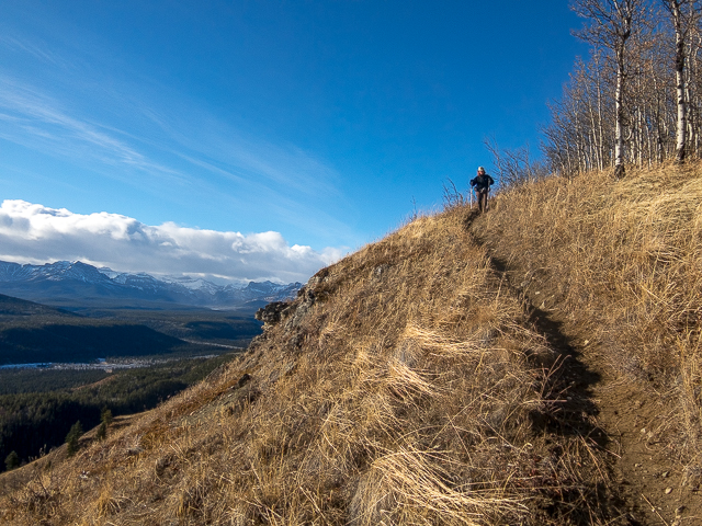
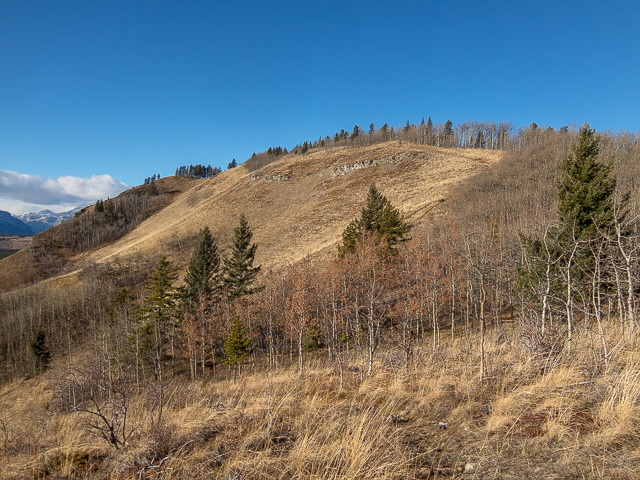
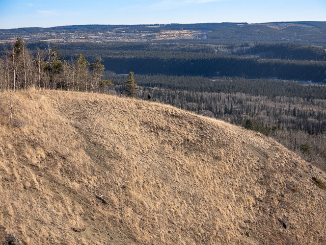
Soon on the gain the ridge and intercept the trail up there. Now the views start, but they get better further on. The north facing side of the ridge offers up little in the way of visual interest and is heavily treed, save for an area that was logged.
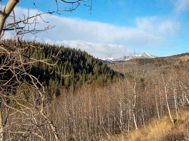
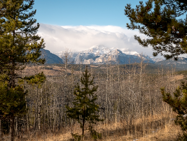
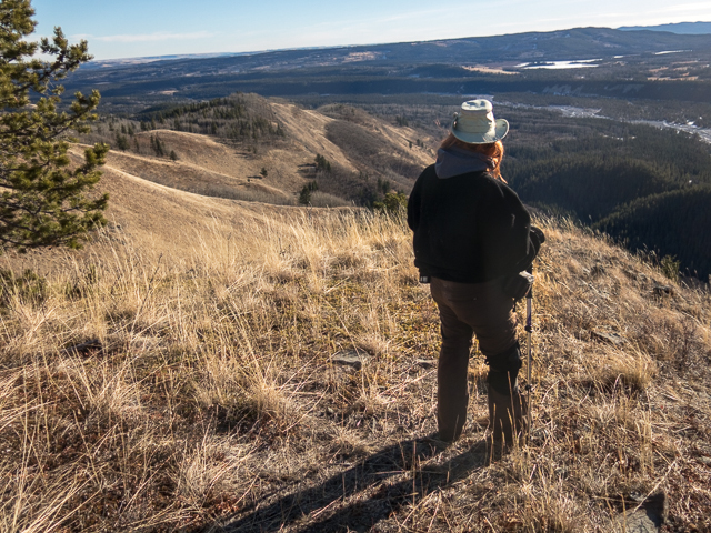
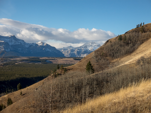
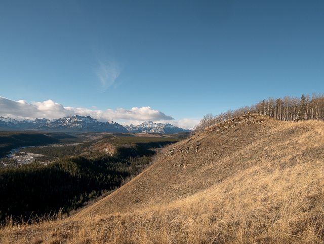
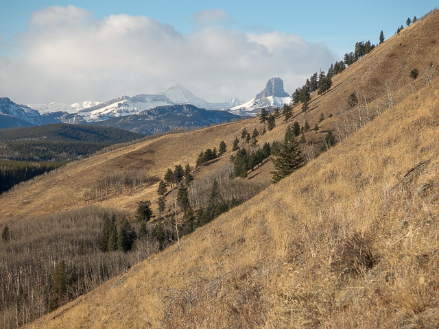
The ridge undulates a little, as they are apt to do. Pass through successive bands of trees, an occasional outcropping or promontory making fine view points. An obvious side trail makes a line to the best one. To the west and looking much Wyoming’s Devil’s Tower and even named similarly, is Devil’s Head, the most distinctive peak off in the that direction.
To the right is Blackrock Mountain – we did it long ago but think we should return. Many other mountains are seen, but they’re pretty far away.
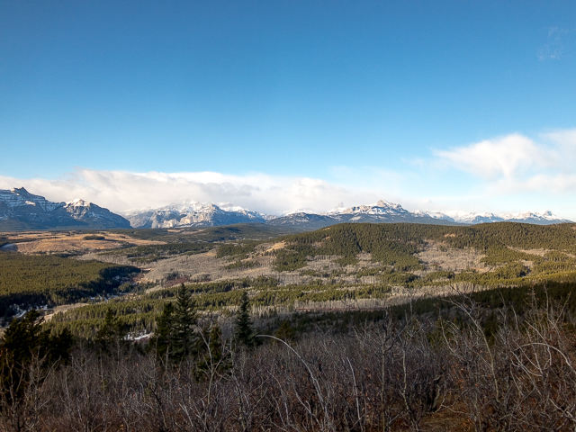
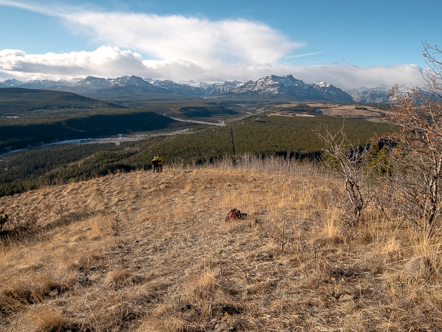
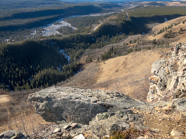
Below, the snaking Ghost River is seen. At times so are some sections of the TransAlta Road– and the part we can see is a sheet of ice. More than one truck, and outside the first click or two, a truck is what you need to take it in, almost lost it and went into the ditch. Directly below, Lesueur Creek Gorge, and off in the distance, a sea of trees on the Stoney Nakoda First Nation’s Reserve. If you have a long lens you can also see the Trans-Canada Highway way off there in the distance. To the east, hills transition to the plains.
Up here’s a great lunch spot.
Continuing on, the ridge drops down, sometimes very steeply. In no time, come to the junction passed earlier and soon after it’s back to your car.
Lesueur Ridge can be done all year round. Our visit was done on an oddly snow-free December day. Even the mountains in the west had little of white stuff on them. We saw no one else this day, so I don’t think the trail is overly popular. We liked it, though. From time to time, we heard the winning buzz of ATVs, but they were off in the distance and otherwise it was pretty quiet. Your mileage may vary. In summer it’s a busier and noisier.
There’s options to extend the Lesueur Ridge hike, including taking in a small hill to the west. It looked treed, so we didn’t see much to be gained from it.
What’s in a name? Lesueur was a family that once ranched in the area.
More hikes like this…
Hell’s Ridge.
Windy Point Ridge.
Carry Ridge.
If you wish more information about this trail, by all means contact us!
Date of adventure: December, 2017.
Location: Kananaskis AB, Waiparous area.
Distance: 9km loop.
Height gain maximum: 300m-ish.
Height gain cumulative: 330m-ish.
NOTE: all distances and heights are approximate.
Technical bits, warnings and notes: ATVs can frequent the area.
Reference: Kananaskis Trail Guide by Gillean Daffern.
Our objective in back, basking in the first light of day, Lesueur Ridge.
The trailhead is along the “TransAlta” Road north of Waiparous.
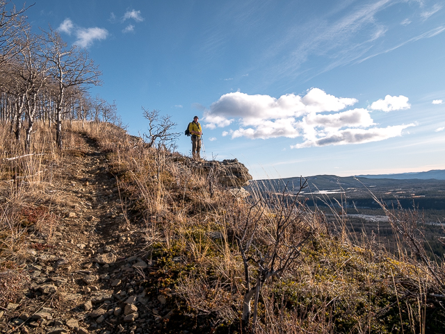
Early in the hike, up a little rise.
Traversing below the ridge.
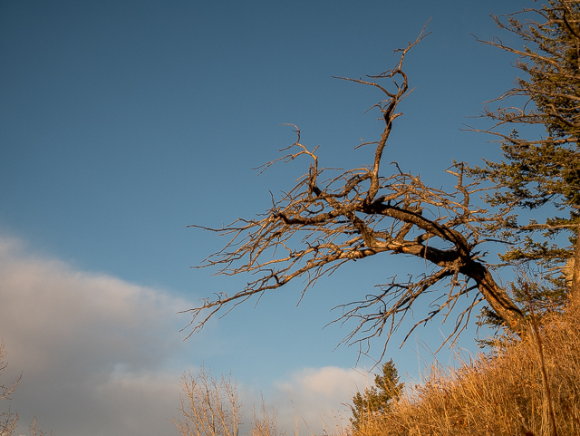
A twisted old tree, a reminder of the tough conditions here.
The big peaks are some distance away.
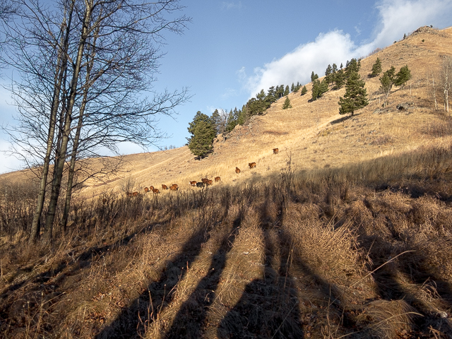
Expect to see free range cattle.
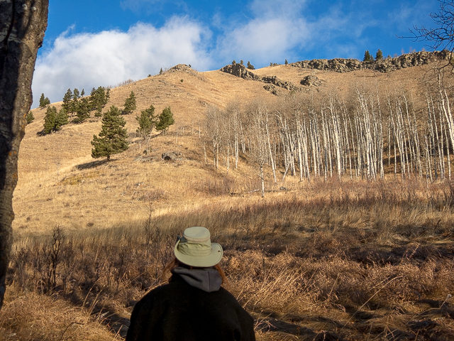
Looking up at Lesueur Ridge.
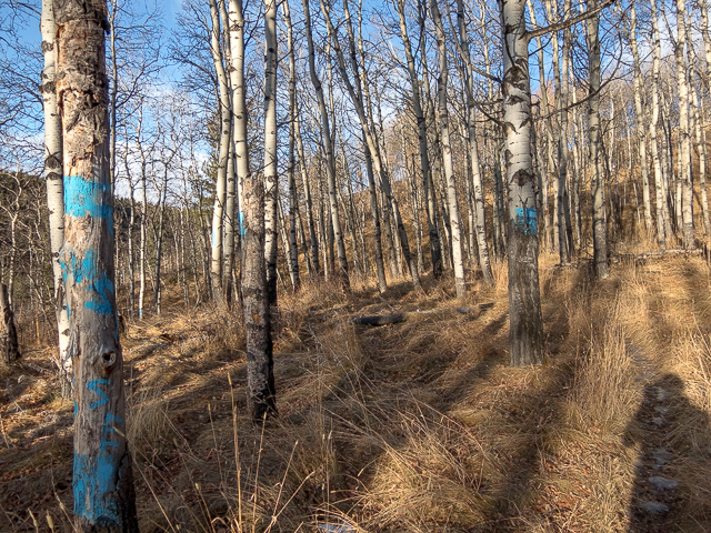
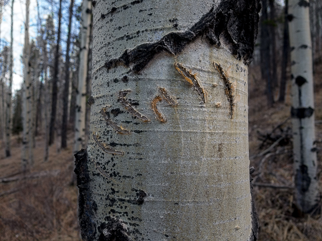
Blue splotches of paint everywhere.
Devil’s Head back left and right, Blackrock Mountain.
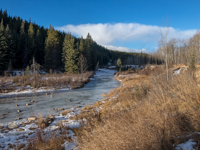
Little Lesueur Creek, all frozen solid.
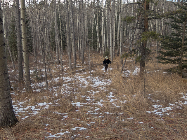
It got icy down low, so we started up the ridge – here we’re bushwhacking it.
Mr Bear’s calling card.
The trees thin offering up this nice view.
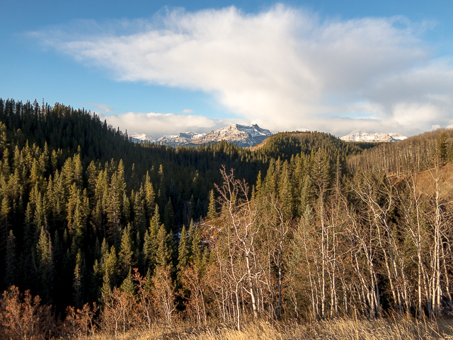
Looking west, the Foothills transition to the Rockies.
Given it’s December, there’s very little snow, even up high.
To the north, a cut block – not much to see here.
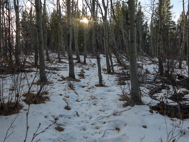
In the trees, snow and ice underfoot.

It was a crisp winter’s morning.
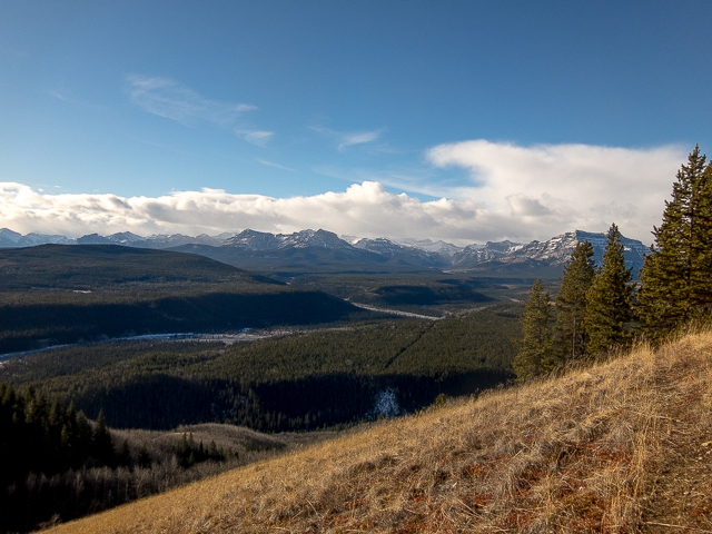
Finally, on the ridge proper, this view of Wild Alberta.
On the far side of those peaks, Banff National Park.
To the east, the hills peter out.
Found on the trail…
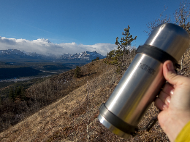
Vietnamese Instant Coffee awaits – hooked on the stuff.
A most enjoyable hike.
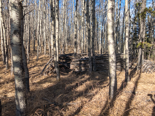
Ready to move in…
Where we just visited.
Looking west offers up the best views.
Down there Lesueur Creek and further back the Ghost River.
Your humble author.
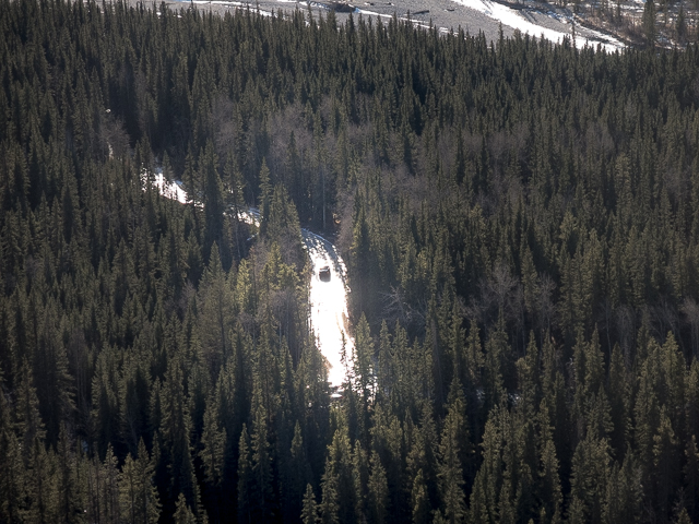
The TransAlta Road is a sheet of ice.
At the east end of the ridge, we’ll soon drop down.
We keep looking back…
Devil’s Head can be seen all the way from Calgary.
A steep descent.
Joining up with the trail in.
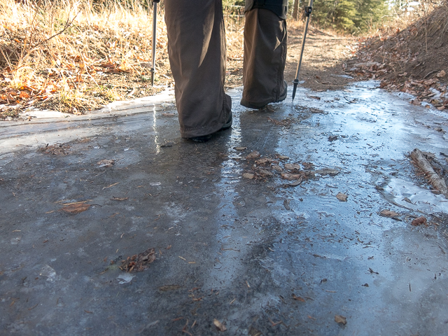
Ice was a hazard this day – and we forgot the Yaks.
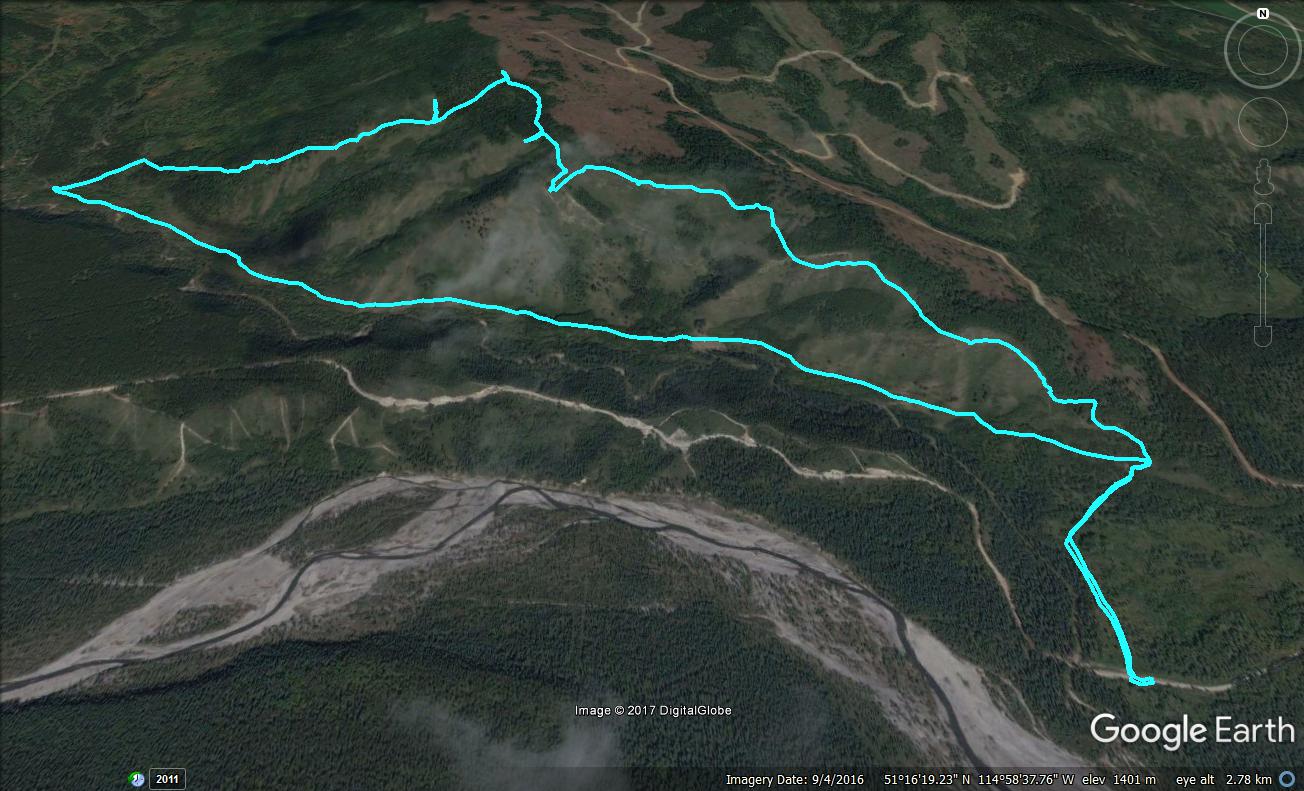
We did Lesueur Ridge clockwise – stubs are view points.


So nice to get out so late in the season with my best friend!
I know, what a special treat! Love hiking with you.
Best view of the Ghost Valley!
Not a bad view at that! Thanks for commenting.
Great images and great share! Thank You Chris & Connie!
You are most welcome!