
Crowsnest Ridge
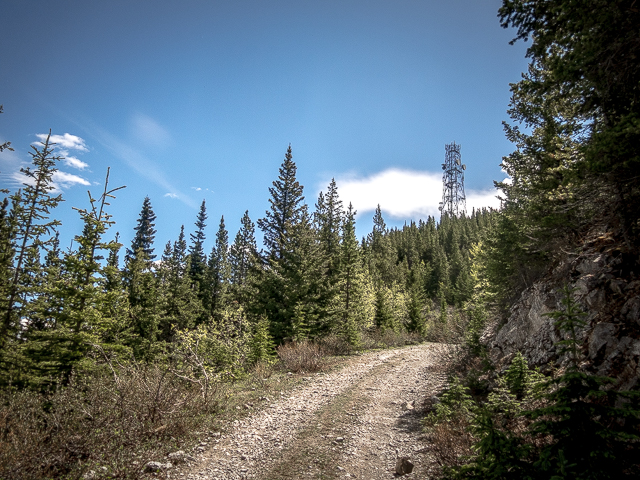
If you’ve cruised around the Crowsnest Pass of Alberta perhaps you’ve seen that huge radio tower sitting atop a rocky promontory right above Island Lake. Yes that one, just prior to reaching the BC border…that’s the place! Well, it’s the goal for this hike. The trail, an access road used by maintenance crews, is super easy, a pleasant climb up to the top to a most scenic viewpoint. And what a treat for the eyes awaits – towering peaks all around and stunning emerald-tinged lakes. Fantastic! And it took so little effort.
Start at Crowsnest Provincial Park, off Highway #3 just inside British Columbia. At the far west end of the parking lot there’s a gated road – that’s your trail. It immediately bends east, joining a pipeline right of way for a time, and soon after, at a small creek, starts gaining elevation. There’s a number of side roads heading off this way and that, all of which can be ignored. It’s straightforward and simple, just head up on the most well used road, which sometimes deviates from the pipeline right of way, but is always close, paralleling the power lines to your left. There’s the occasional glimpse of the ridge ahead, but much of the time on this section you’re in the trees.
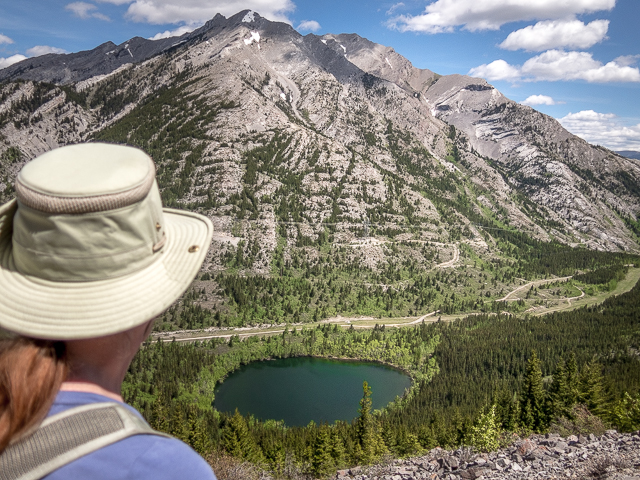
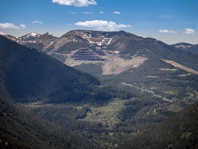
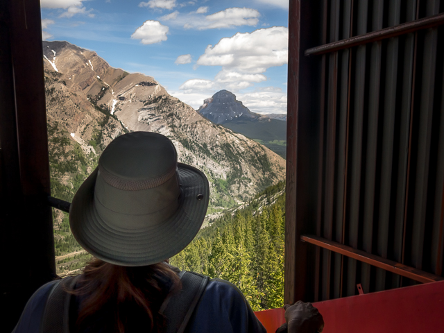
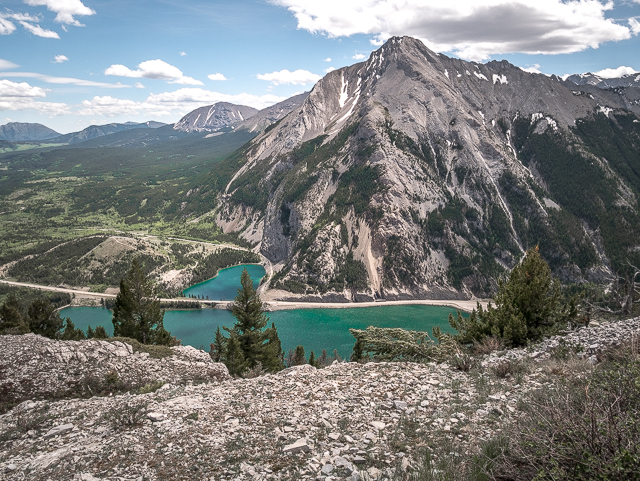
Come to a valley between Crowsnest Ridge, right, and conjoined Phillipps Peak/Mt Tecumseh, left. You’ll get a real fine view of them later. Levelling out on hitting the pipeline right of way again, at Phillipps Pass, take note of the spur road heading up Crowsnest Ridge at a three way junction. Take it and starting climbing again. Keep an eye open for bears – we saw lots of signs in the area suggesting they frequent this valley.
Gaining elevation at a nice steady pace, little Phillipps Lake, more a glorified pond, comes into view. What an amazing colour! It’s believed to feed the stream that emerges from Crowsnest Lake Cave on the opposite side of the ridge via underground channels in the porous limestone found here.
History moment! Phillipps Pass was a route used by Rum Rummers back during prohibition days. Now it’s pretty quiet, the only visitors being the odd hiker, and crews who maintain the pipelines and power lines that traverse the valley and who care for the radio tower and it’s equipment up high. And dog walkers as it turns out…
As we gain elevation a group of friendly hounds show up to say hi. Way down there, the truck they came in on. There must have been a dozen of these pooches, all outfitted with radio collars. A shrill whistle from their handler down there, and they’re gone in a flash, barking excitedly as they go.
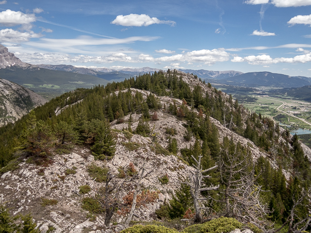
At a broad sweeping switchback, gain the ridge for a moment. From here you can stick to the road or if you’re feeling ambitious you can take to the ridge crest. It’s pretty rugged in places, however, with lots of crags and rock bands between you and summit. Lots of flowers blooming on our visit – the whole trip.
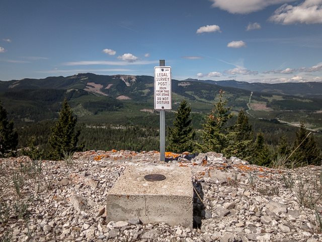
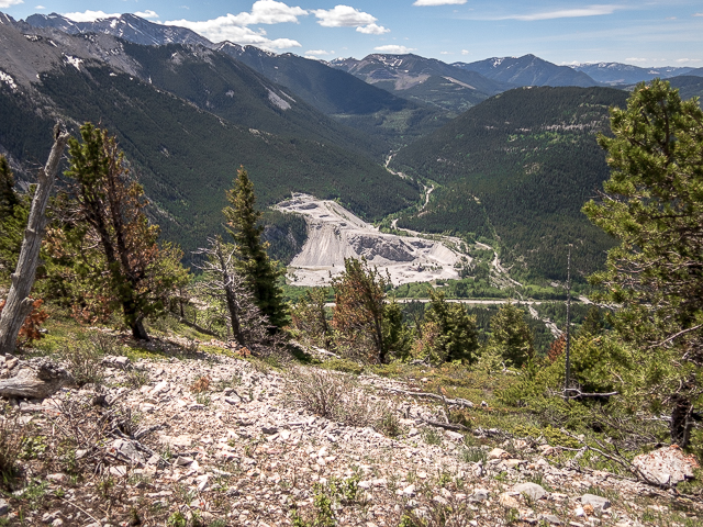
To the west into BC, views of Mt Erickson and Loop Peak (the latter, more a hill). Along this section of the road you’re right at the Alberta/BC border, and cross back and forth between them many times as you gain height. Below, scars from a quarrying operation (Summit Lime Works).
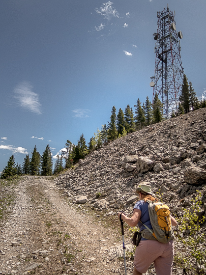
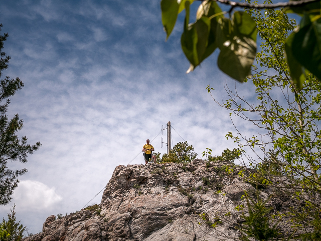
The tower beckons.
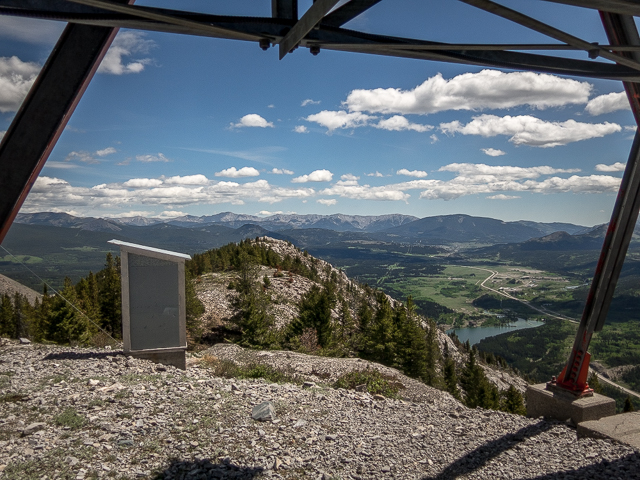
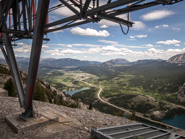
Now running below the ridge, pass through a gate. One more switchback and soon after arrive at the tower. It’s huge! Wander about below it, taking all that fine scenery. Directly south is Sentinel Mountain (sometimes called Sentry) and to the right, another quarry below and further in back scars from a former coal mine (see: Tent Mountain was torn a new one). The latter, like Crowsnest Ridge, straddles the Alberta/BC border.
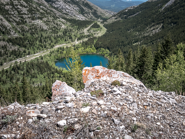
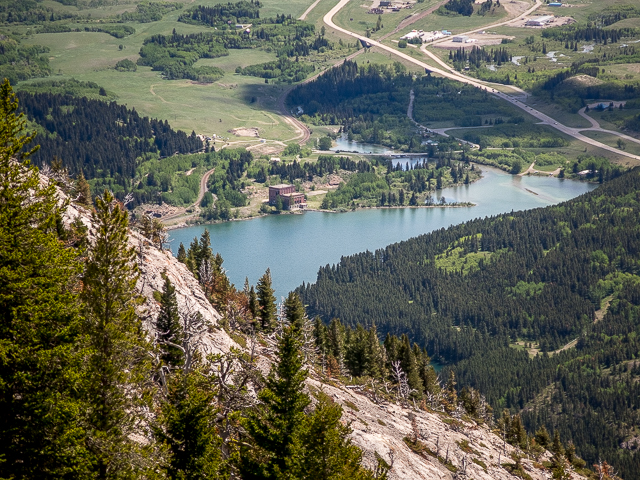
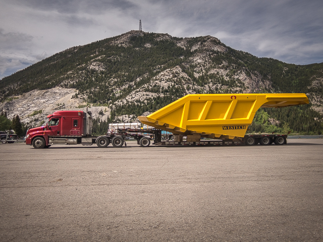
Below, the lovely emerald green colours of Island Lake. And behind it the Crowsnest Highway. Down there at a highway pullout, a huge dump truck dump body (likely headed to the coal mines just west of here in BC). We’ll take a look this big yellow thing later up close. Seen along Crowsnest Lake further east, the Crowsnest Power Plant) built in the 1920s and unused since the 1960s.
Looking east there’s Turtle Mountain. You’ve heard about the Frank Slide of 1903? Of course you did…it happened at the base of Turtle. We can just see the town of Coleman out that way. And a bit to the north and a closer in is Crowsnest Mountain, all sort off by itself. Behind the radio tower, what’s left of a tramway that once brought up parts and tools. Check out that outhouse…it’s got the world’s best view! Look up from under the tower…it reaches the heavens. Vertigo!
I take in the east ridge a bit, but get turned back at a deep crag soon after starting. I guess I could have made the down climb, but I’m feeling a bit unsure. Back under the tower, it’s chow time. We always pack a picnic lunch full of yummy stuff.
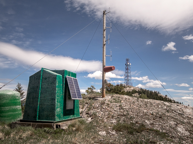
There’s a number of weather monitoring devices at various places on the ridge, some old and disused (and fallen over). The wind here can sure blow – in fact, the “Pass” is famous for it – but the day of our visit things were oddly calm. Our first time on Crowsnest Ridge, years ago, we were hit with a spring snow squall: Crowsnest radio tower. White out conditions!
When you’ve had your fill, retrace your route back to your car. Now wasn’t that fun and easy?
Amazing then and now posts from the immediate area…
Then and Now – Wild Horse Hank.
Crowsnest Pass then and now – Chinook Motel.
Crowsnest Pass then and now (a view from Island Lake).
If you wish more information about this trail, by all means contact us!
Date of adventure: June, 2018.
Location: Crowsnest Pass, AB & BC.
Distance: 13 km there and back.
Height gain maximum: 550m-ish.
Height gain cumulative: 600m-ish.
NOTE: all distances and heights are approximate.
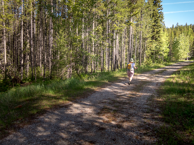
Starting out in BC – it’s easy going the whole way on an old road.
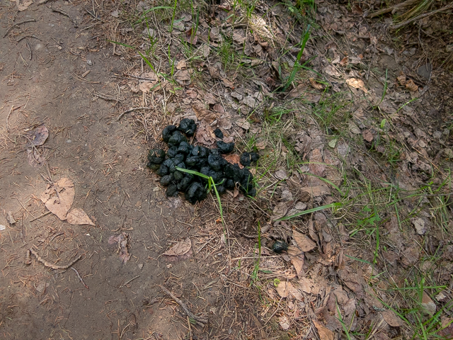
In Alberta now, a Bear’s calling card.
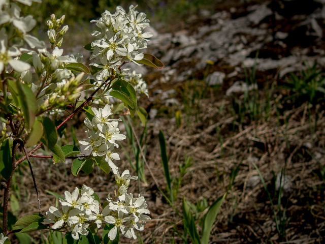
Lots of wildflowers on our visit.
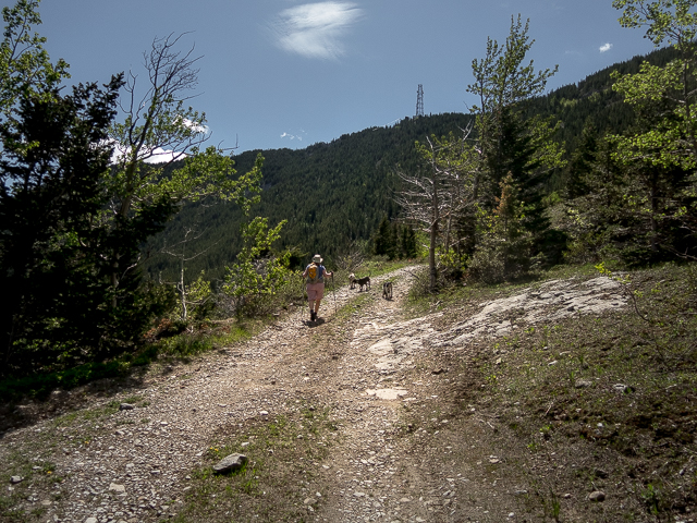
Objective sighted…and some dogs drop by to say hi.
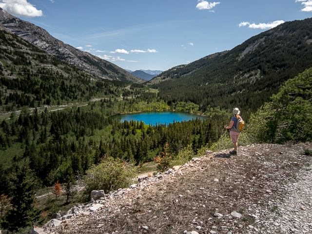
Little Phillipps Lake.
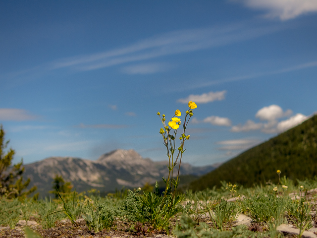
A lone Buttercup.
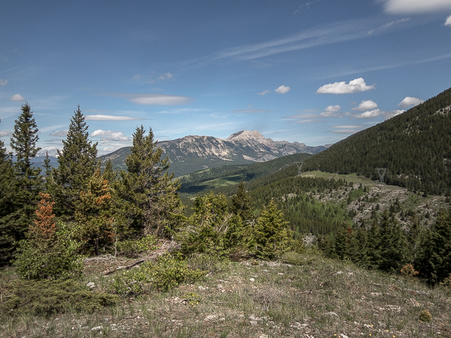
Mount Erickson in BC.
The ridge in behind the survey post, Loop Peak (also in BC).
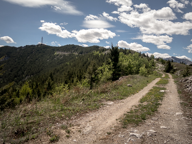
The grade is always gentle.
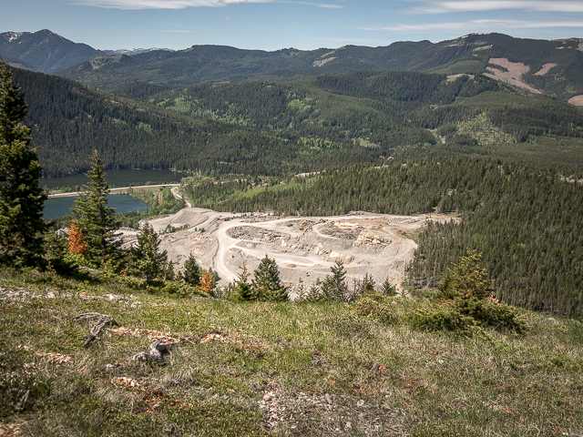
Scars from a quarrying operation.
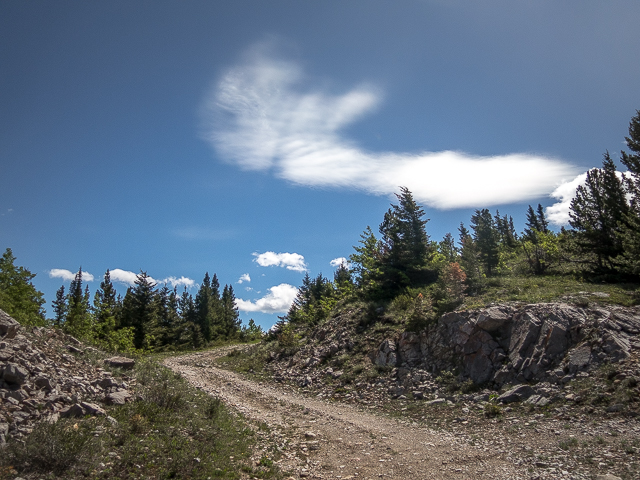
Soft wispy clouds…

And here’s another…
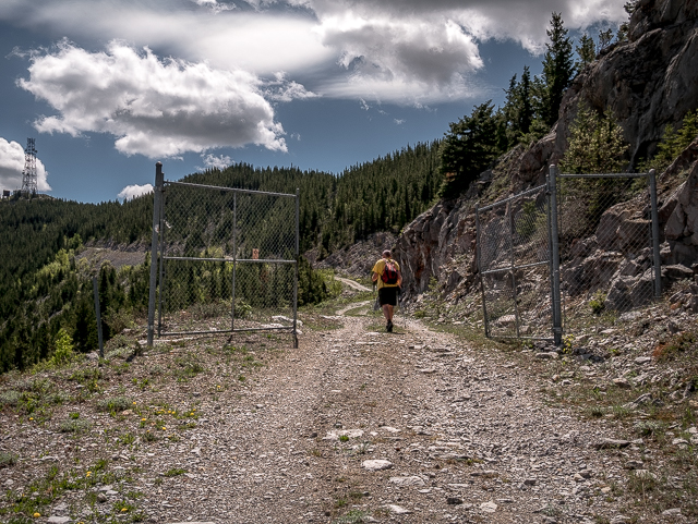
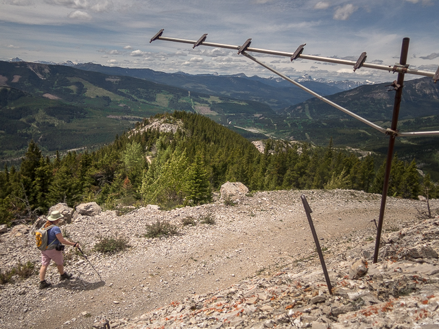
Pass through a gate.
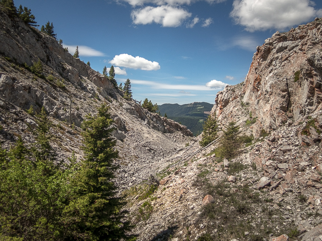
The ridge is rugged in places.
The lake is said to feed the flow coming from Crowsnest Cave.
Phillipps Peak/Mt Tecumseh.
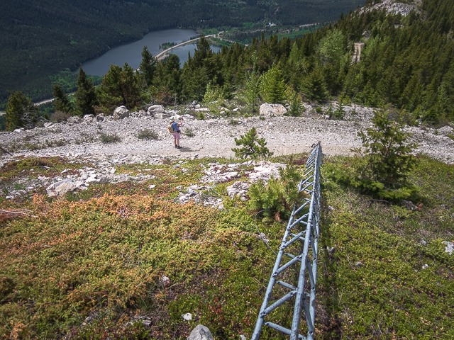
It gets closer.
Almost there!
Looking south – here we’re on the Alberta/BC Border.
Scars from a coal mine on Tent Mountain.
Under the tower looking east.
The old power plant below.
Crowsnest Mountain seen from the tramway building.
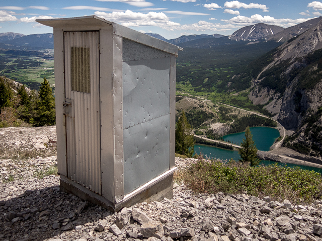
Nice views from the outhouse.
I investigate the east ridge, but get turned around here.
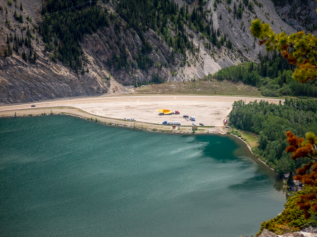
A big load down by Crowsnest Lake – we’ll take a closer look later.
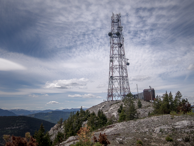
The tower is huge!
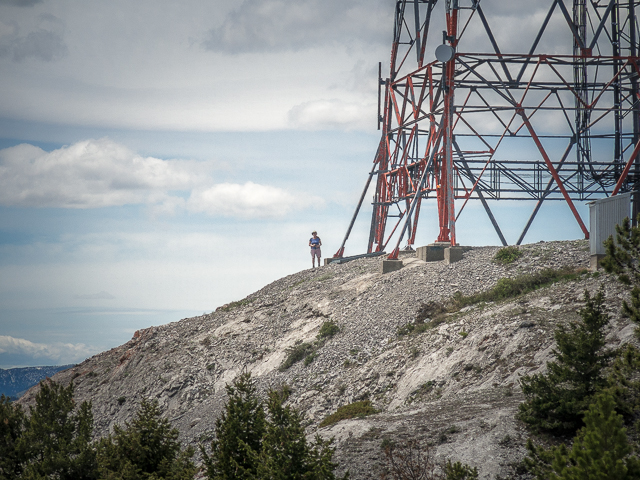
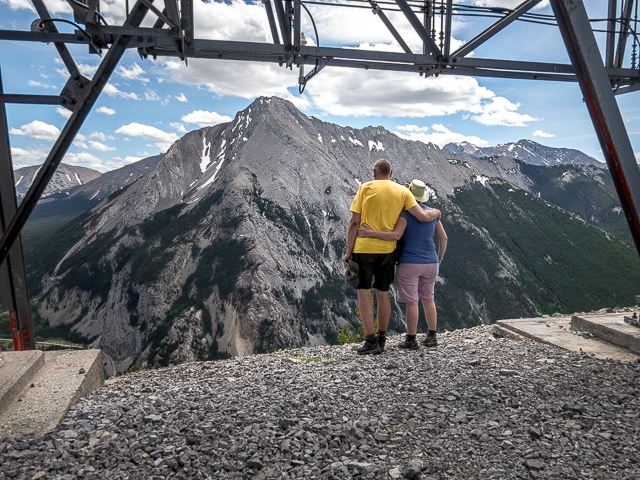
Connie for scale…
Sentinel Peak (sometimes Sentry Peak) and Island Lake.
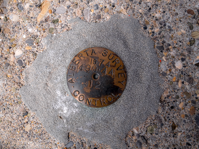
From 1974…
In the distance, just right of centre, Turtle Mountain.
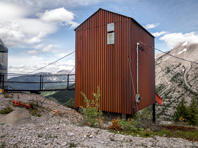
The tramway shed – the system is no longer used.
Ahhh, our happy place.
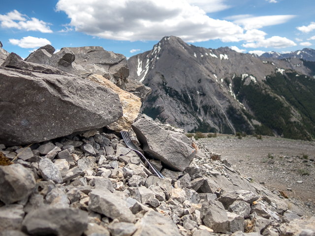
This fork…
Heading down.
This mast fell over.
Further down the ridge, a weather monitoring station.
Hi!
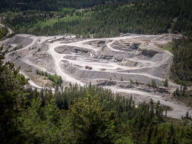
More quarrying below.
Here’s the reverse angle.
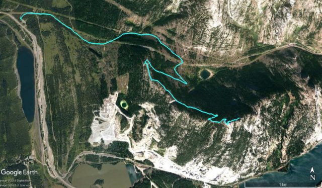
The Crowsnest Ridge Route.


Amazing views!
And it wasn’t all that much work. Thanks for commenting.
So pretty!
The Pass is stunning from all angles. It’s why we love the place.
Fantastic shots of home.
Ahh, glad we could help!
Miss the awesome fresh air, thx for sharing.
It is our pleasure! Yes, the air is pure out that way.
Beautiful!
We see so many amazing places.
Beautiful, I love these photos!
Thank you!
How was the wind up there?? 😂😂
Very un-Pass like. It was dead calm.
Great photos, love that first one of Phillips Lake. That tower is huge, must have been quite the operation to build way up there.
Thanks! That little lake is so picturesque. There’s another like it, in colour, just above the quarry workings too, which I noticed on Google Earth. Yes, that tower. And it has to be well braced against the winds that almost always blow up there. That’s one cool piece of engineering.
How beautiful – you are inspiring trips around this great province every time you publish photos like this. Love this. Thank you for caring so much!
Ahhh, that’s so touching! Thanks, it’s you we do it for. And we’ll keep the fresh content coming.