
Threepoint Creek
In 2018 we barely hiked. For any number of reasons we were just not able to get out into the woods, some gig getting in the way, poor weather perhaps, winter not wanting to let go, or maybe it was health issues – far too many of those that year. Together is was a giant conspiracy to keeps us from doing what we so love. Still we got out and hiked few times although rarely was it anything spectacular. Seems we got a tad out of shape in the process too. Bummer!
This year we hope things will be different. If it kills us…
Here’s a lazy day hike, one taking in the Threepoint (sometimes Three Point) Creek Trail paralleling its namesake watercourse, in that lesser hiked section of Kananaskis east of Millarville. It’s all gently rolling hills here and thick stands of trees. This is a painfully easy trek with little in the way of challenges, route finding issues or even with much elevation gain. Our intent was to take in the Hog’s Back (also Hogsback) trail part way in but problems at a creek crossing meant that was a no-go. Next time.
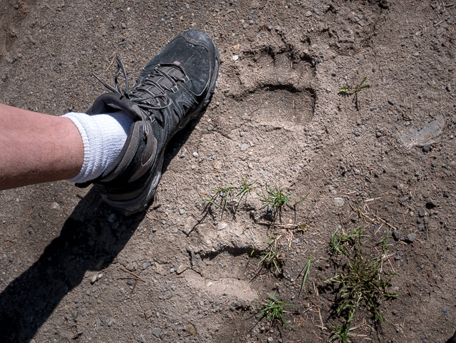
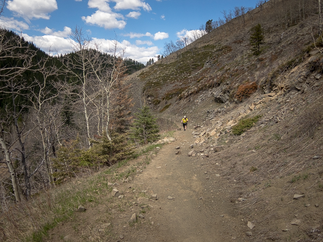
The hike starts at the far end of Highway #549 just past where it turns into McLean Creek Trail, right beside the Mesa Butte Recreation Area, at the gated well road. If the gate’s open you can cut a couple clicks off this trail and park further in. Locked up tight on our visit. Cross Threepoint Creek and either continue up the road, or take the trail that roughly parallels it. Shot up signs and signs saying no shooting and pipelines here. And bear tracks!
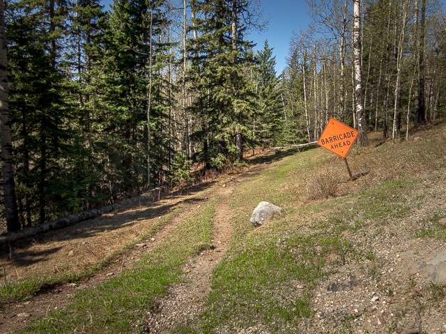
Avoiding side roads, cross the creek again and soon after turn left on a reclaimed fire road marked (on our visit) with an orange “Barricade Ahead” sign. Here we’re very close to the McLean Creek Off Highway Vehicle zone so expect to hear the buzzing of quads and dirt bikes from time to time to the south. And once in a while something motorized might even find its way on to this trail. They’re not supposed to be on it, but some still do. We saw the tracks.
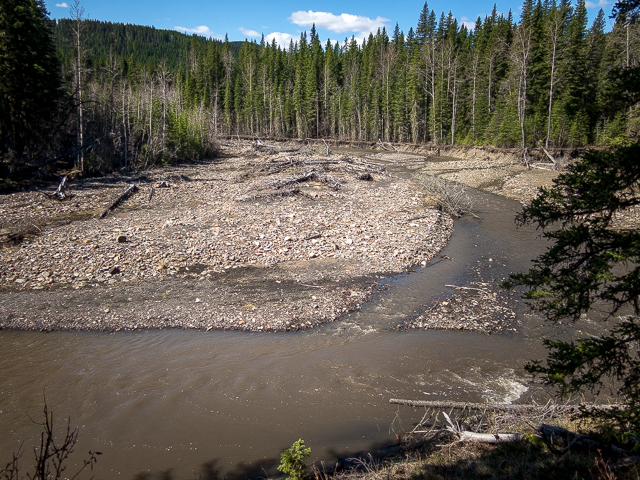
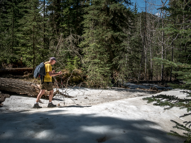
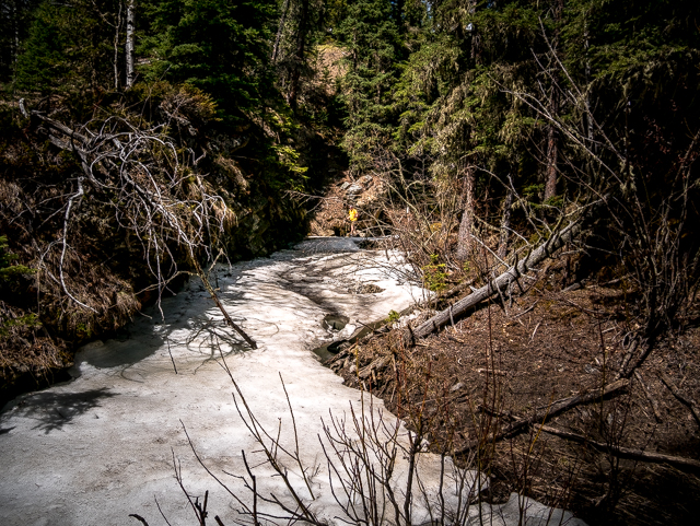
Continue on paralleling Threepoint Creek. Sometimes you see it, sometimes you hear it, sometimes neither, but it’s always close. In places see carnage from the spring 2013 floods. Witness the collapsed banks, jumbled piles of wood debris and other signs speaking of the power which even a small stream like this has come heavy rains and rapid snow melt. Hop over an occasional side stream. Thick flows of ice remained on some of them on our visit – winter only just ended weeks before.
At certain times of the year cows roam free in the area so be sure to close any cattle gates passed.
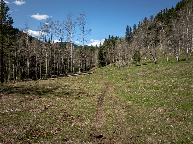
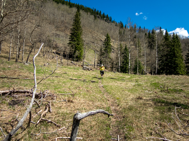
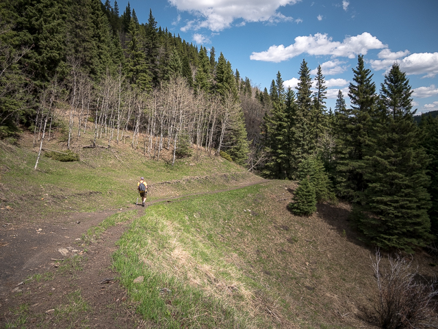
Rise and fall a bit, meander this way and that. Such an easy hike. Bear tracks! Sometimes you’re in the trees, sometimes it’s meadows and even if the views are rarely far reaching it’s still scenic in its own right. Hell, a stroll though the woods is rarely bad. Still, every now and then one can glimpse big peaks off in the west. The road was used to service the Forgetmenot (or Forget Me Not) Mountain Fire Lookout which is long gone now. Horses would bring in supplies for the lookout personal via this road.
Continuing on, the trail takes a line higher above Threepoint Creek now. It’s now way down there.
More pleasant hiking. Not everyone needs be a bucket list outing. Soon on the Hog’s Back trail splits off to the left. It was our hope to continue on using this trail which later takes in a viewpoint above a spectacular canyon, but high water where the trail drops down and crosses Threepoint Creek had us doubling back. What to do now? Continue on the Threepoint Creek trail of course! Hog’s Back – maybe we’ll see you in 2019.
Back on the Threepoint Creek trail – bear tracks! – and soon in, Connie’s knee problem which has been dogging her for the better part of a year, makes its presence known. It’s clear the pain is becoming hard to handle.
What to do? Regroup? Struggle on? No, break out the beer! And the fine and meat and cracker plate. Might as well enjoy it all – beats a power bar lunch any day. So there we are chowing and chatting and enjoy the solitude (we saw no one else this day) while sitting on a fallen log not far from our turn around point. It’s things like this where time stands still. Something utterly trivial made so special for reasons difficult to explain. Odd how that is. And with some Tylenol, Connie’s feeling better. Later it’d be therapy which seems to be helping.
You can continue on the Threepoint Creek Trail , if you don’t turn back where we did. You can even make a loop with the Hog’s Back Trail. Maybe we’ll check it out sometime. Retrace your steps back to where it all began. About the easiest hike ever. Bear tracks!
Stay tuned, we’re already planning our 2019 hikes. Should be some good stuff coming your way once winter’s history. Hiking is one of our passions and the mountains our second home. And we miss is so. In the meantime we’re out walking in the city to get back into shape.
Close by…
Death’s Head.
Mesa Butte.
Mesa Butte via Curley Sand Ridge.
If you wish more information about this route, by all means contact us!
Date of adventure: May, 2018.
Location: Kananaskis Alberta, west of Millarville.
Distance: 15km if you follow our route (ish – gps acting up).
Height gain maximum: 250m (guess)
Height gain cumulative: 300m (guess)
NOTE: all distances and heights are approximate.
Technical bits: Bears will be watching you!
Reference: Kananaskis Trail Guide by Gillean Daffern.
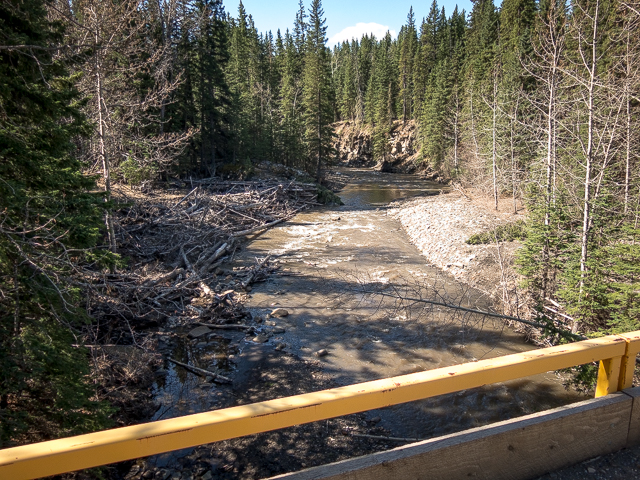
At the start, crossing over Threepoint Creek.
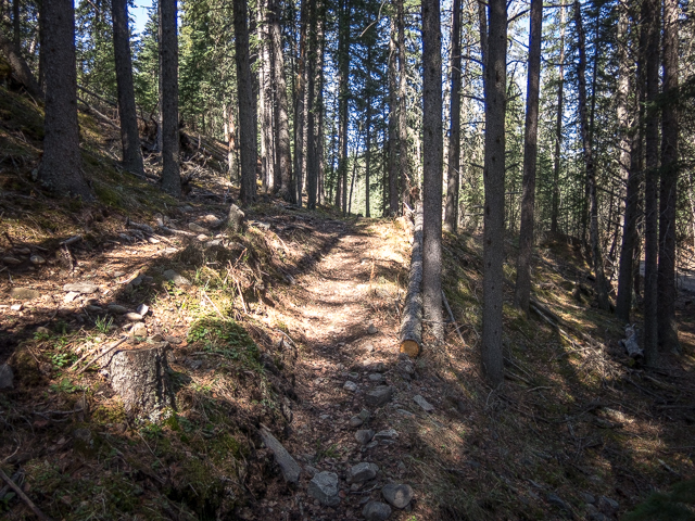
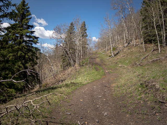
Easy going in the trees.
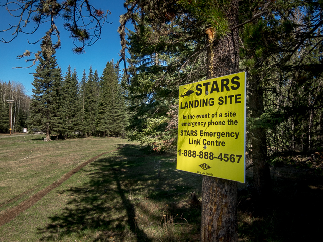
If a gas/pipeline worker gets injured.
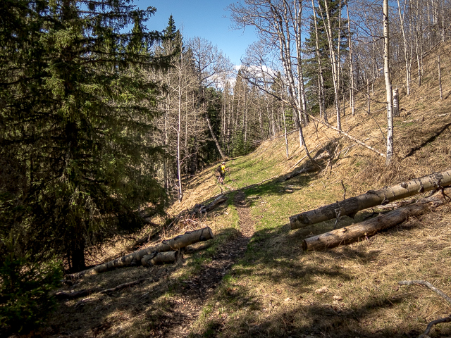
Some company today?
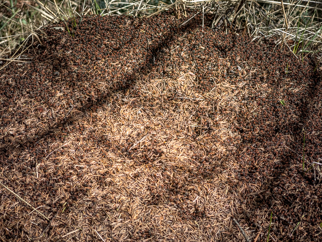
Ants!
This way…
Along an old reclaimed road.
A most glorious day.
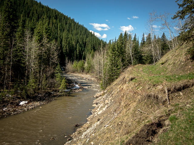
The trail keeps close to the creek.
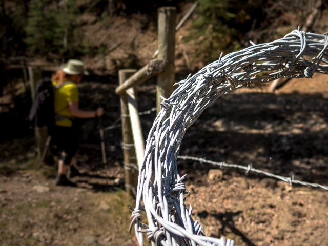
Passing through a cattle gate.
Straightforward hiking here.
Safety vest yellow!
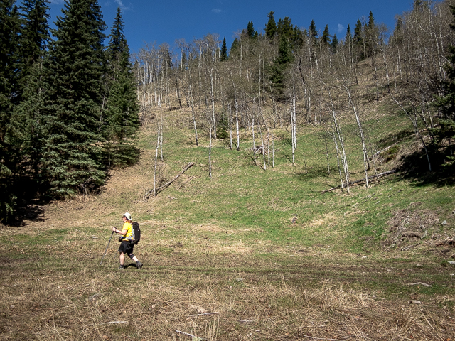
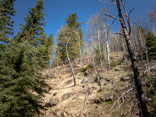
In the rolling foothills.
Here the trail’s been eroded away.
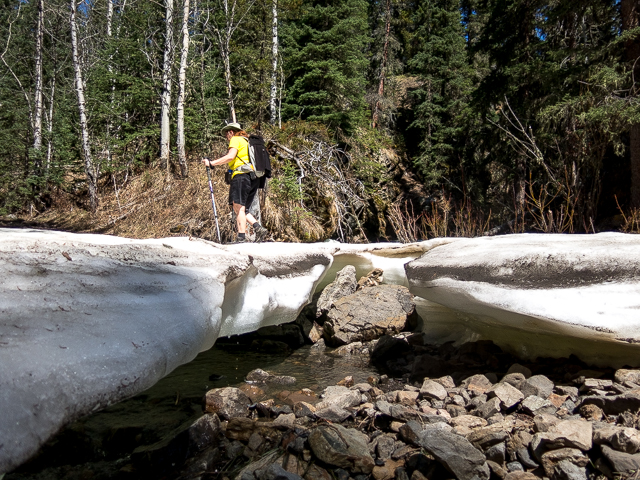
Reminders of winter’s hold on the land that spring.
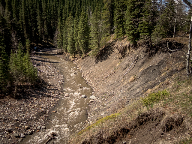
Higher up above the creek now.
A typical view.
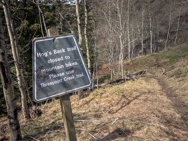
To the “Hog’s Back” – high water said no.
A lazy day hike.
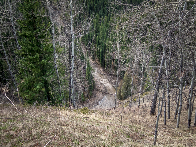
It’s way down there now.
Hill behind is the Hog’s Back.

A cold one…
Heading back now.
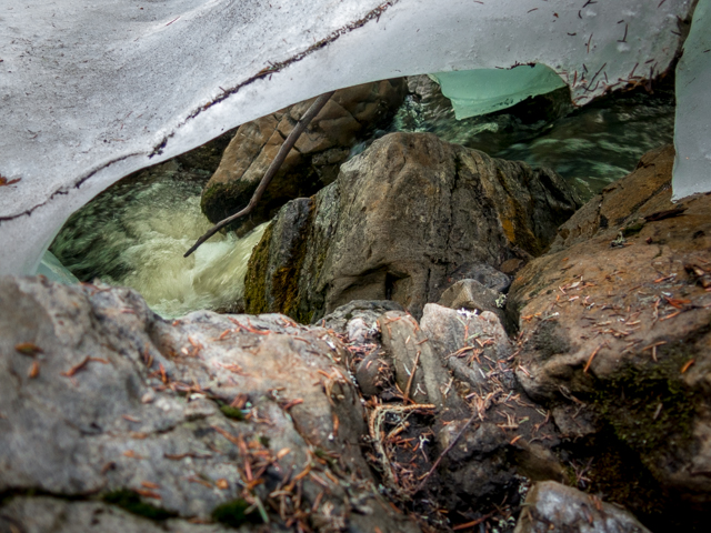
Ice and water.
Exploring a side creek.
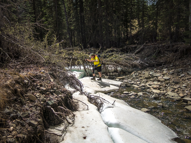
The snow only left weeks before.
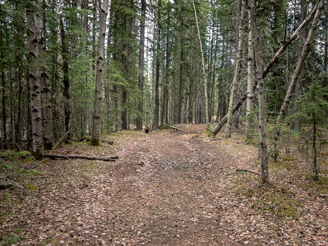
A pleasant stroll.
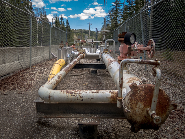
Lots of gas wells in the area.
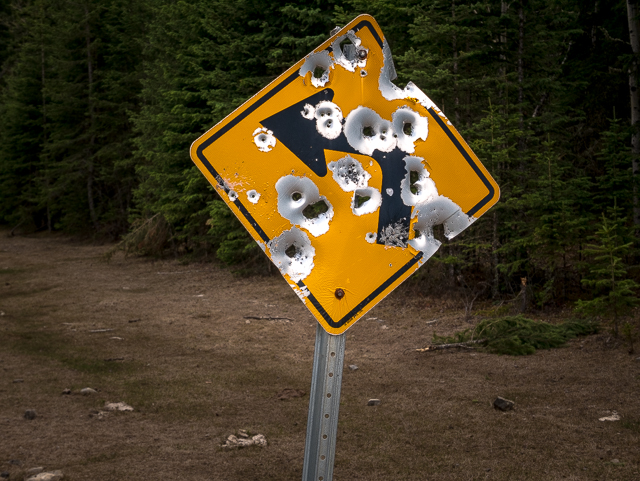
No sign is safe.
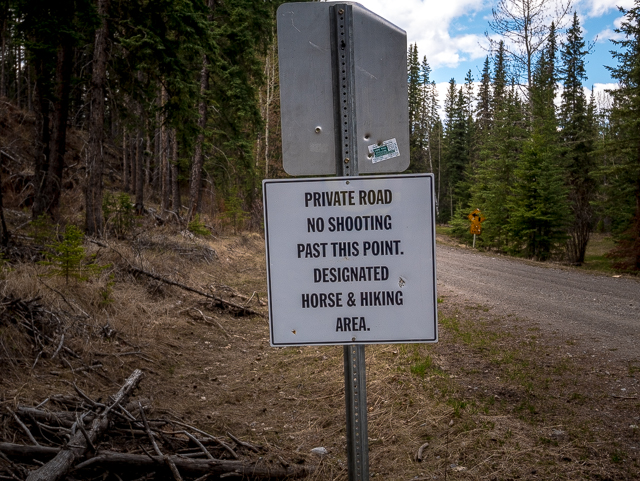
No shooting eh?
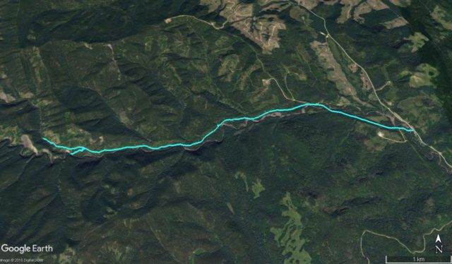
Our route – stub=turned around due to high water.


I just found your blog. It’s wonderful. I lived at the Ranch on Three Point Creek and outfitted for many years in the Kananaskis. I have been over the Hog’s Back so many times and it never failed to impress. We didn’t hike we had horses and let them do most of the work. Our base camp was on the Sheep but we covered most of Kananaskis as well as trips over the divide into BC and back. I will enjoy exploring more of your posts. You have probably seen this cabin on your way into the forestry west of Millarville. The Ballachey Ranch was home for many years. I do so miss it.
Thank you for stopping by. Wow, what a great time that must have been. K-County is such a treasure. Yes, we’ve seen that cabin and in fact have it on our pin map as a place to check out, on tracking down the owners first of course, at some point in the future. Our to-do list is over a thousand places strong!
Boys and their guns…
Yup, no sign is safe.
Looks like a nice day’s hike. We camp in the area and always hear guns going off.
We’ve heard them from surrounding hills too. As long as we’re not in their sights!
We’ll get back to those mountains soon!
Yes, 2019 will see our triumphant return, big time.
Hog’s Back has some amazing views. There’s actually two creek crossings.
We really hope to return someday.