
Hike to Payne Bluff
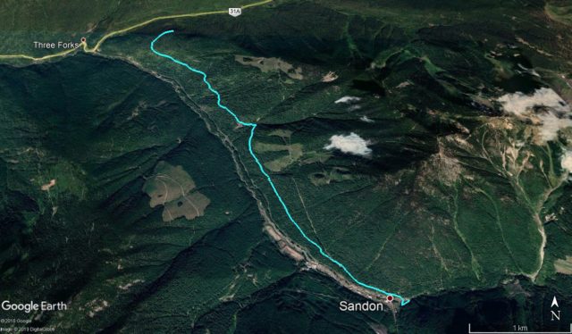
If you find yourself in the historic ghost town of Sandon BC, in the “Silvery Slocan”, and are looking to stretch the legs a bit, we’ve got an excellent adventure to recommend. Starting right in town, the Payne Bluff Hike takes in the old “Kaslo & Slocan Railway” roadbed, an easy, mostly flat trek of just over a dozen clicks round trip. At times it’s a pastoral stroll through the woods, but occasionally it takes an airy high line on steep precipitous slopes, where one should step carefully. Along the way, there’s many things of historic interest to explore, bits of K&S track left behind and old mining remains, and plenty of scenery.
The trail is shared with bikes so keep a look out for each other.
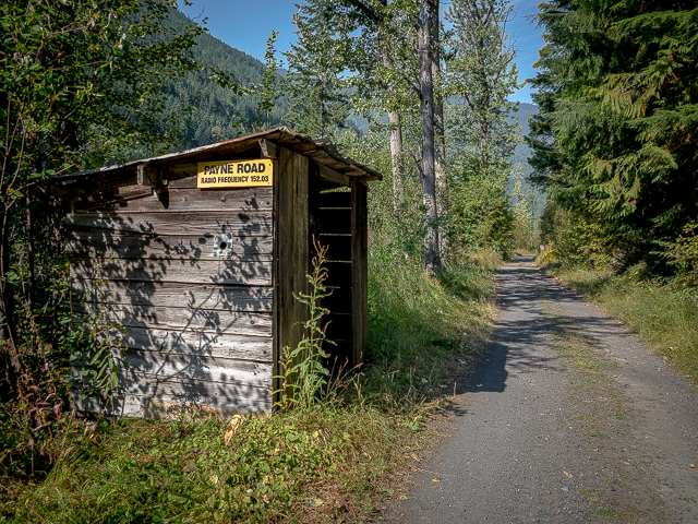
It all starts on the east side of Carpenter Creek in Sandon, on the road to Cody (a second cool ghost town we’ll post about later). There’s a sign and pull out to mark the spot just before some cabins. You could actually drive some of the trail and shorten the outing, but that begs the question why. There’s nothing unpleasant about doing the entire route on foot as we did.
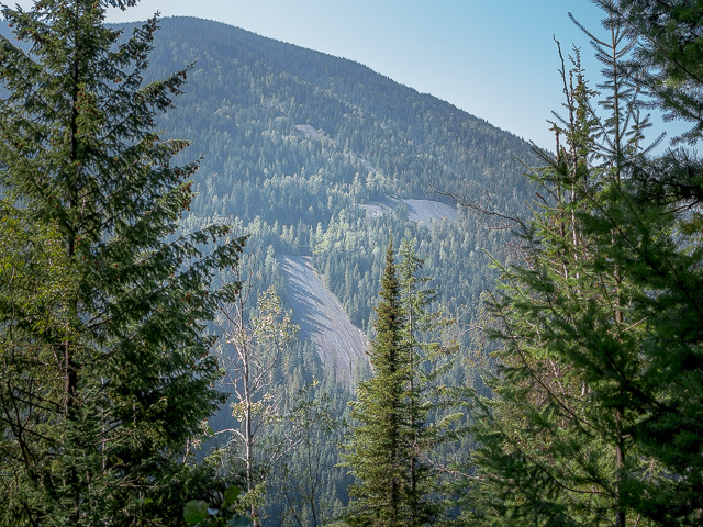
Head south on “Payne Road” built atop the railway roadbed. At a couple breaks in the trees, look down upon Sandon – we spent the weekend there and could see out tent. When the town was booming (circa 1890s-early 1900s), there were houses and such on the steep slopes above the old rail line here, once protected by that lone fire hydrant found along the trail, that seems oddly out of place. We followed a path heading up that must have been a steep street to investigate to see what we could see but found only some odd boards and the occasional building depression. Undergrowth is thick here masking much.
The Kaslo & Slocan was a narrow gauge line (three feet in this case)*, built to minimal standards, whose main purpose was to ship out the great quantities of high grade ore coming from the area mines. It operated from the 1895 to 1912, although the section walked here was out of service by 1909.
*Most railways are standard gauge, so four feet, eight and half inches. Narrow gauge allowed a line to be built cheaper and quicker.
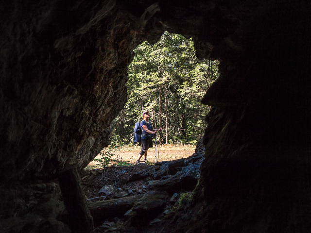
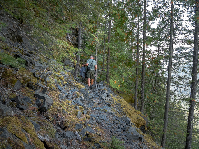
Keep straight at a split in the road and take the lesser used double track. Say goodbye to Payne Road which continues up and to the right. Soon in look for a “prospect”, a hole punched into a rock bluff to test its potential for mining. All the mountains around are full of valuable metallic minerals but here specifically, they didn’t find anything, the tunnel ending mere metres in (and us looking silly in our caving helmets). Come to a signed parking spot, where you can start if you’re not feeling ambitious and want to drive the first section of the K&S/Payne Bluff route. The slopes steepen and the trail narrows. While hiking watch for beaked hazelnuts, which can be eaten. And try to avoid brushing against nettles, which will inflict a painful sting (not long lasting thank goodness), which grow in shaded areas along the old K&S line.
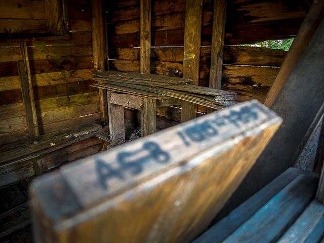
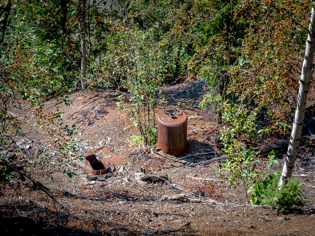
Soon in come to the Altoona Mine (later Hallmac Mine). There’s a small shed here with core samples and a section of mine track. They Altoona operated (it had other names too), often sporadically, from the 1890s to the 1980s. There are several levels to the mine and this only one, with many more way up slope…somewhere. In pictures from a few years ago the entry here was still open but it’s since been covered in loose rock and scree, deliberately we suspect. Mines are dangerous places and they don’t want the general public going in.
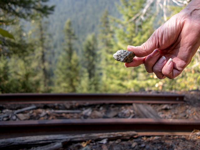
Scattered about underfoot, silvery chunks of “galena”. Mostly an ore of lead, silver is often present as well, sometimes in great quantity. In addition, the mine produced plenty of zinc and a smattering of other metals.
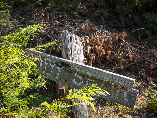
Back to the hike, soon in pass the junction with the Cody Spur, a line heading up and away towards mines higher up above Sandon. There’s an interesting rock wall here.
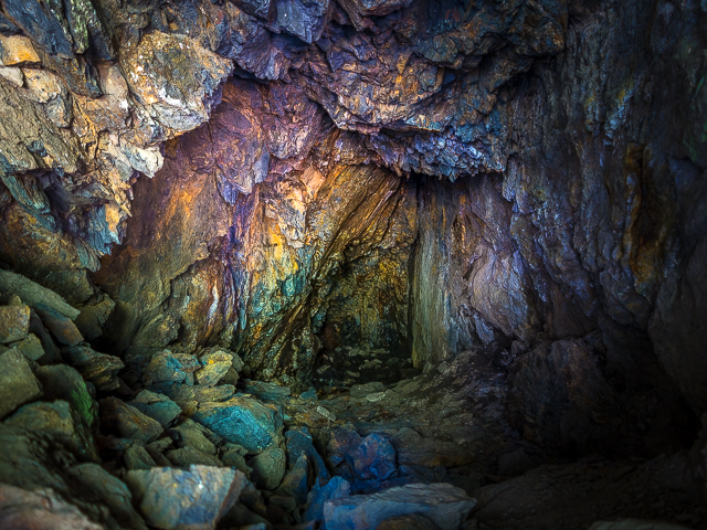
Another prospect mine is passed, which like the earlier one only goes back a short distance. Colourful rock inside! Prospect mines were often not registered and we found nothing on either of those seen today, although they are on Altoona mine property, interestingly. After closing the K&S roadbed became a mine road to the Altoona.
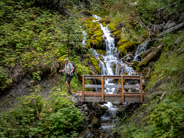
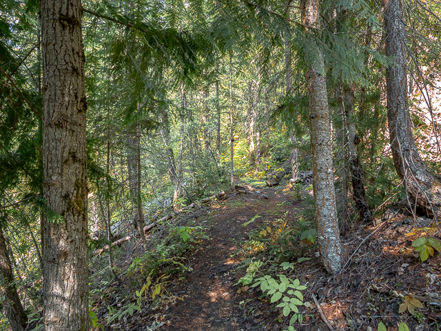
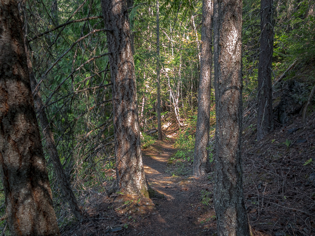
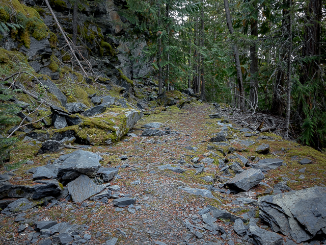
In places where there used to be trestles, the Payne Bluff trail reverts to single track meandering this way and that while following contours of the land, before returning back to the old K&S roadbed. There’s a nice little gurgling stream along here.
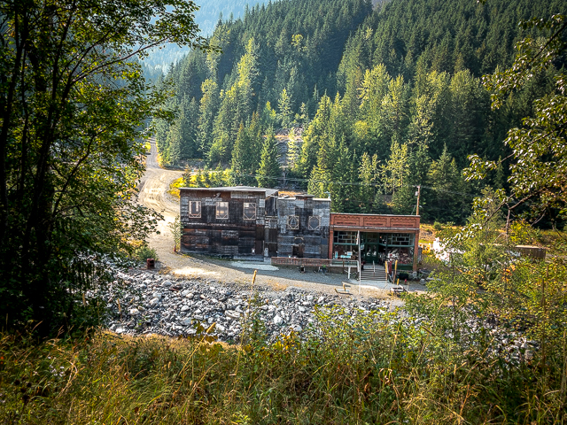
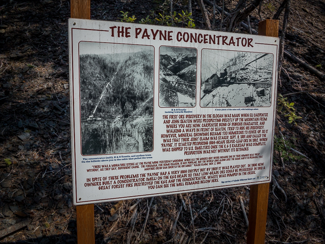
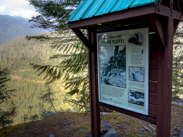
Next, it’s the location of the Payne Mine Concentrator. The workings (entries) were far up Payne Mountain above, the ore being brought down by tramway for processing and loading into railcars. There’s a sign here that shows how it all looked back then and explains operations. Wow! The K&S took the ore to Kaslo a bit to the east, where it was loaded onto sternwheelers on Kootenay Lake, then reloaded onto CPR cars a bit east of Nelson, for final rail delivery to the smelter in Trail BC or forwarding to US based processors. What a laborious and expensive undertaking – but the ore here was rich, so it worked. For a time.
The standard gauge Canadian Pacific Railway, incidentally, also served Sandon, but via the opposite side of the valley. Ore carried by them also took a torturous route to market. In the 1910s the CPR took over select sections of the Kaslo & Slocan and after regauging, operated them into the 1950s, but not the Payne Bluff section.
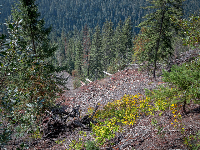
Below it’s ore dumps, and the odd signs of machinery, and bits of wood. Not much really, just a big scar left behind. Hard to believe buildings stood here given how steep the terrain is.
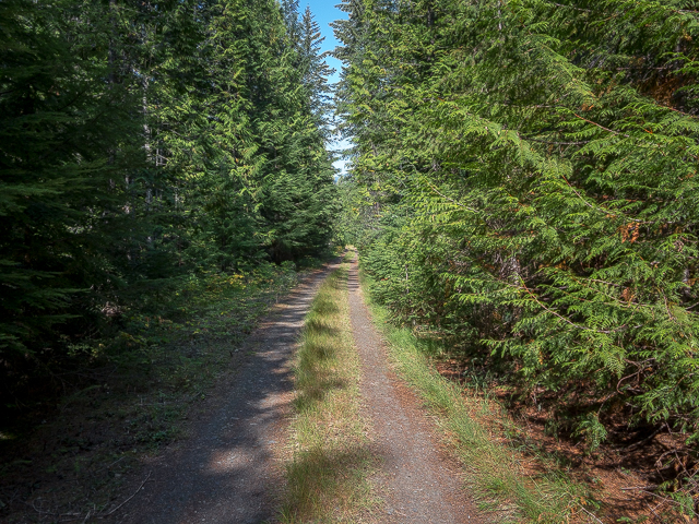
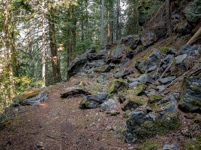
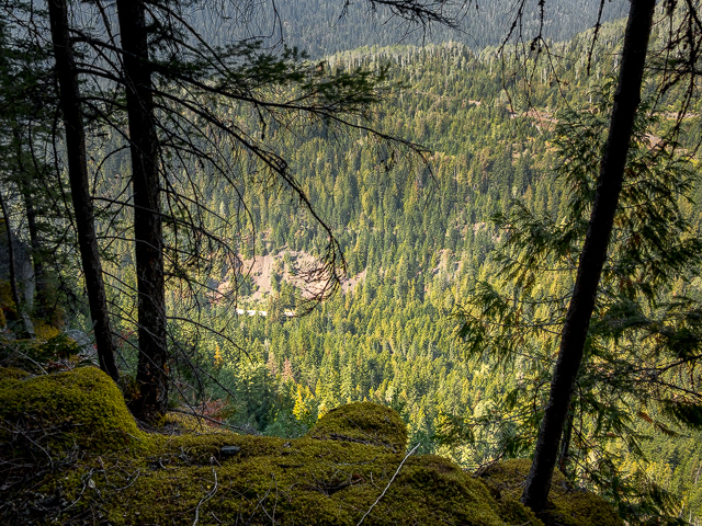
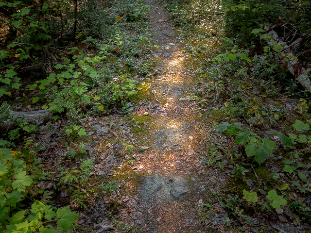
Next it’s a nice stroll in the woods on mostly single track (seems much of the roadbed here is gone). Once in a while the trees thin enough affording one a look across the valley to more mining scars, or up the valley to the mountains which surround Sandon. Stunning!
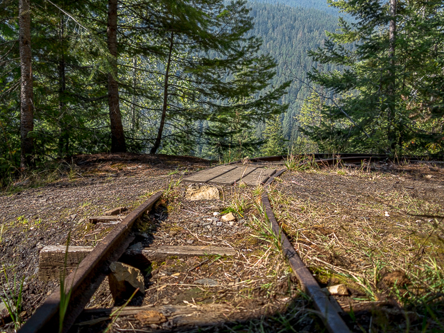
At a signed junction – this way to Payne Bluff, down that way (steeply) to the former town of Three Forks. Next time maybe. Continuing on, come to a “frog” one component in a turnout (or switch) left behind. This suggests there was a passing siding here. In places depressions mark where ties once were…over a hundred years ago!
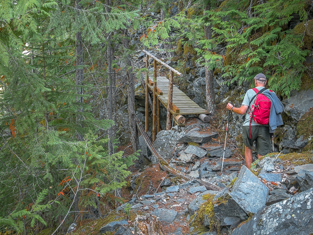
The trail is rockier now and uneven and the terrain far steeper. Soon in come to an interpretive sign on a nice flat area, a place we’d return to for lunch. It seems many people call it a day here given the next section becomes a tad technical.
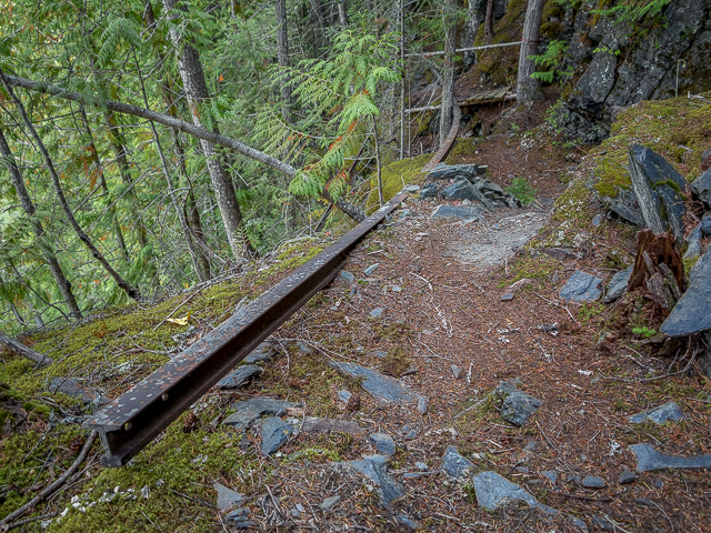
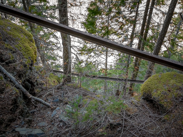
Now it gets interesting. In the past much of the railway along this section was supported by trestles, but these burned down around 1910. Left behind are rails dangling this way and that, never recovered by salvagers, with hikers having to pick their way around them to pass. Some become makeshift hand or guard rails. To the left, beyond those scant few trees, it’s a straight drop down. Way, way down! Imagine it, a train on a spindly wood trestle clinging precariously to the mountainside high above the valley floor. Yikes! There’s a photo showing how it was back then at that sign. Google “Payne Bluff” to see other photos from the old days.
Not only did it take big brass ones to build this line here, just operating it must have been an incredible adventure. A derailment would be tragic. Passenger trains did operate on the line and on looking out on the down side, it must have felt as though they were flying.
Climb up and over big boulders, taking advantage of strategically placed ropes on which to grasp, hop over rails and cross shaky foot bridges spanning deep chasms, and go as far as you dare*. Damn, that’s a long way down. For a few hundred metres (which seems far longer), it’s trembling knees and cold sweats for us wusses. Then, when you’ve had enough of Payne Bluff return to the comparative safety of the intact roadbed back at the sign.
*The K&S Trail continues on in that direction, all the way to the (ghost) town of Zincton and perhaps beyond should the urge to keep going hit you. Flagging marks the way. We have no idea the conditions, terrain or difficulty of it all, but suspect it’s not for the casual hiker.
Take in the views, enjoy lunch as we did, then retrace your steps back to your car. It’s over quickly, as good things seem to play out. What a great “history” hike, easy on the legs, but still a nice workout, and one that offers up so much awesome that not partaking of it should be a punishable crime. It’s a must do when in the area. Please tells us how you liked your Payne Bluff Hike along the old Kaslo & Slocan.
This…
A Tour of Sandon BC.
BC adventures…
Ymir, Friday Nights – an evening in a forming mining town.
Troup Junction – railway archaeology.
Mining under Moyie Falls – right under them.
If you wish more information about this route, by all means contact us!
Date of adventure: September, 2018.
Location: Sandon, British Columbia.
Distance: 13km, out and back
Height gain maximum: >30m-ish.
Height gain cumulative: >60m-ish.
NOTE: all distances and heights are approximate.
Technical bits: In some spots, take extra care so as not to trip.
On the trail to Payne Bluff.
At a break in the trees, a view of Sandon.
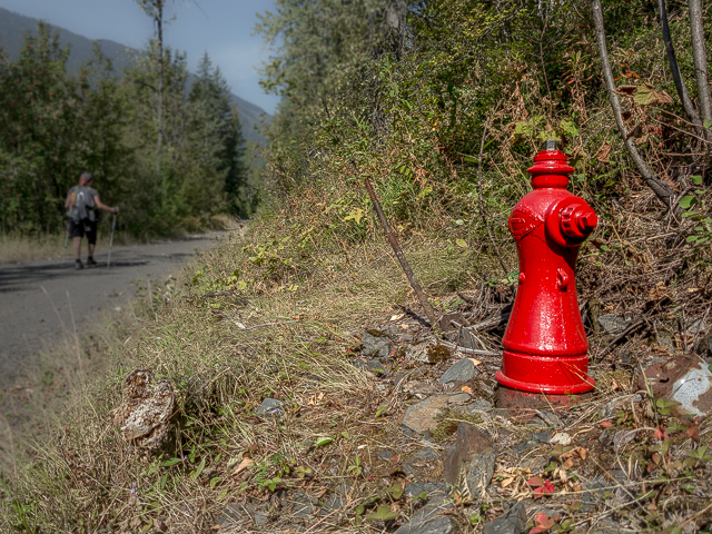
This lone hydrant.
Along the old Kaslo & Slocan.
Passing a prospect.
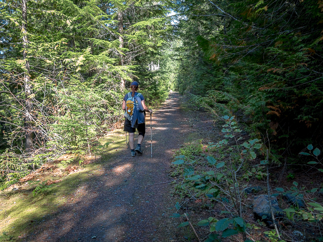
There going is mostly flat and easy.
At the Altoona Mine.
Old mine rails left behind.
The stuff they were looking for…
At the junction to Cody.
An adit going back a short distance.
A bypass trail.
Remains of the Payne Concentrator.
There were huge buildings on this steep slope.
A bit of history and some old photos.
A pleasant jaunt through the woods.
Across the valley, more signs of mining.
It’s a delight to hike.
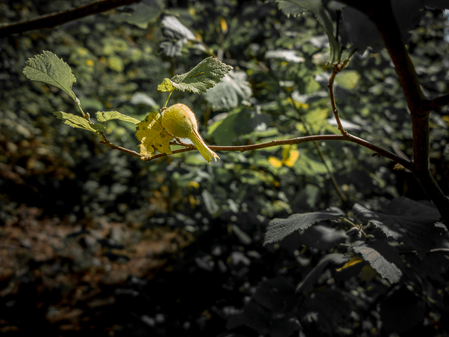
Beaked Hazelnuts.
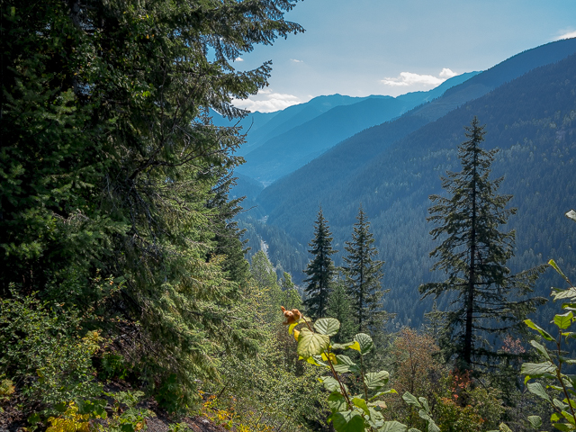
Blue haze is from forest fires.
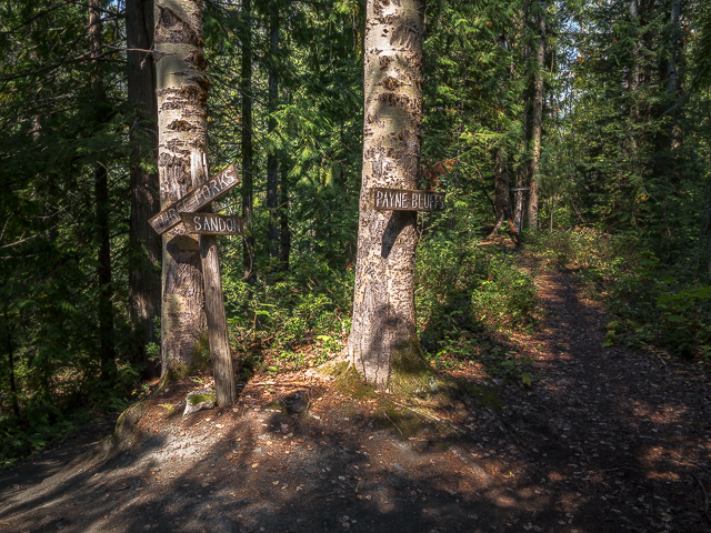
Left, down to Three Forks and ahead Payne Bluff.
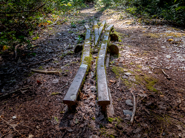
Remains of a siding.
Almost there.
Just a bit over that footbridge.
Old rails announce your arrival.
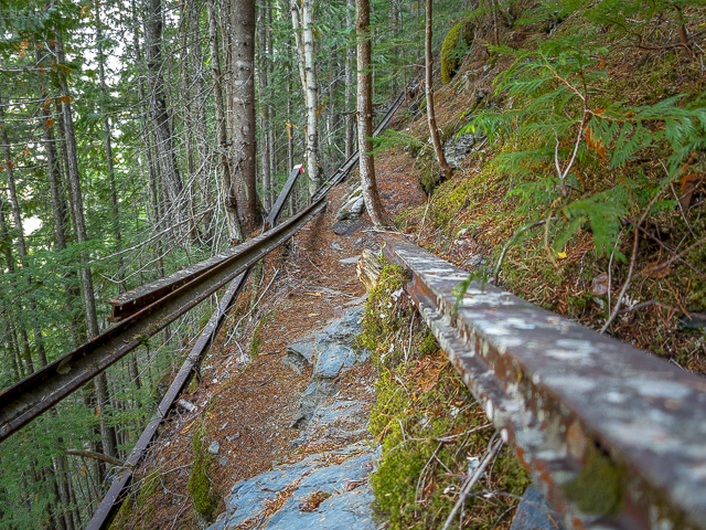
These were left behind when a trestle burned long ago.
Beyond the rails, a long drop down.
On the edge.
Heading back to find a lunch spot.
Learn some history at this here sign.
Heading back.
Depressions mark where ties were located.
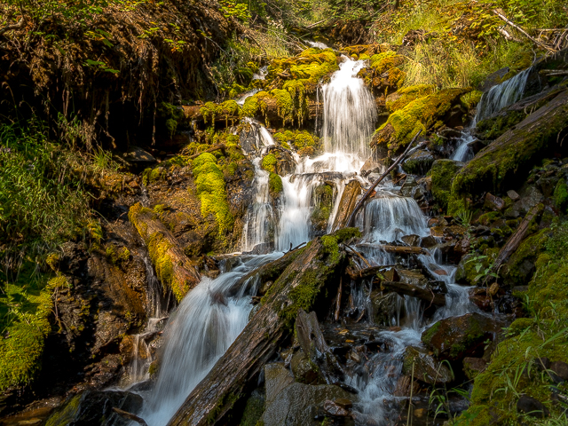
Gurgling away.
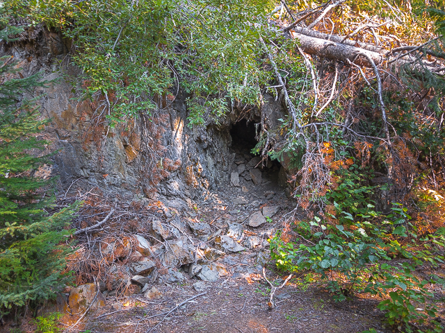
Just a little hole.
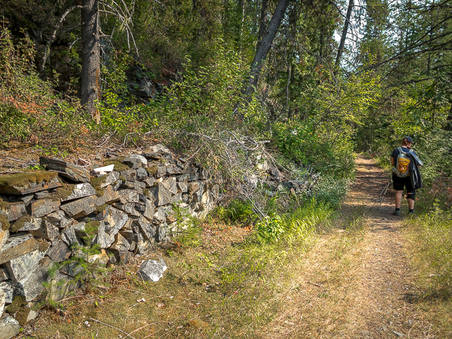
This rock wall.
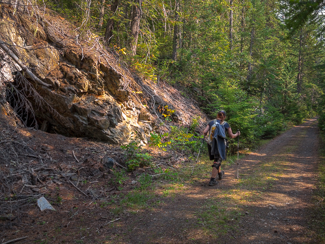
Left, one we investigated earlier.
13km of pure fun.


")


Thanks for this. Within the past year or so I learned that one of my my great grandfather’s brothers, George Lovatt, built a sawmill in Sandon in 1898. We met our kids in Nelson for a week in July and so managed to drop in to Sandon as part of the trip and see the pile of scraps where the mill once stood. It is fascinating to be in my 8th decade and learn that that side of may family history was more than prairie farming. I completely understand the comment I just read that mining history can be a fascination.
The terrain resembles the island of Shikoku in Japan, where I had the opportunity to walk on a pilgrimage a decade and a half ago.
Wow, what an amazing connection and how wonderful you were able to pay Sandon a visit. It’s such a special little town. We looked up that pilgrimage route in Japan – WOW! We did the Camino a few years back and it was mind blowing. Thanks for commenting.
You know, it’s crazy. I grew up in castlegar, and every year we camped in the slocan, we would quad all the roads/trails around sandon and cody, reco peak and Payne mountain , exploring all the old mines and whatnot…but have never hiked to the Payne bluffs.
We’re back! It’s a wonderful little hike and highly recommended. We’re hopefully coming back to Sandon in 2021 (assuming the world is still around). Mine history is a passion.
Wow. Great pix. We enjoyed a month long adventure in the Kootenays in 2014, going from Revelstoke to Creston. The Sandon area was a definite highlight, finally getting to the same historic sites as that of those famous pictures. Thanks for the reminder of a great trip!
Fond memories of a great times past are the best. Glad we could help stir them up. Sandon is amazing and we’re itching to go back.
Neat! I recall reading that some of the Galt narrow gauge equipment ended up on the K&S – I wonder what happened it to all when it folded? That would have been an interesting trip on a train along the side of the mountain back in the day!
Galt stuff made it to the K&S? It would be interesting to find the disposition of these. That they built the line at all in that precipitous country amazes us. What a thrill it would have been to take in Payne Bluff in a passenger car back then. But then again…
Loved that hike!
Next time we’ll get you a nose guard! Only Connie will get this…
You’re in my back yard.
What a special place you live. That area is amazing.
You should do small group tours.
One day. Small intimate ones of three or four people. Stay tuned we may just do this if enough people ask.
Awesome hike…!
One of the best hikes ever. If you love mining and railway history, it’s incredible.
Great pics!
Thank you Richard!
Dangerous walk.
In some places care should be taken, but most of the time hiking the roadbed is easy and carefree.
love the area !
Goodness yes, we feel the same way. The Silvery Slocan is magical.
Lived in Nelson for 8 years and never made the journey to this incredibly historic spot… maybe one day I’ll return just to experience it…
Do it! We say, and Hal and Vida say. Welcome to Sandon, you won’t regret the visit.
I think you should not step to the left.
At least some rails in places acted as sort of handrails or fall guards. Still, it’s a long drop down at Payne Bluff.
Amazing feat of engineering at the time!
Can’t decide if the engineers were certified geniuses or completely bonkers. It’s hard to wrap one’s head around just how challenging building that railway was.
Been on the same spot .
Seems a lot of people have been. The day of our visit we had the place pretty much to ourselves.
That should be on my list since I’m working in Sandon all tourist season and that’s so close by😱😯
Make it happen…we insist.
Cool!
Thank you for taking the time…
Lots of fabulous history in the West Kootenays! I’d like to go back on a road trip.
We love the history there. Mining, and the riches that came of it, and the broken dreams too, is so fascinating.
Been there, done that, looking for the location of the famous Payne Bluff photo.
The spot looks to be right where that one interpretive sign is.
You said ‘tell me what you think’….I think be careful…great pictures.
Yes! In some places a stumble or trip could be disastrous. Most of the time, however, the trail is not so bad.
Wow great shots.
Thank you, we sure enjoyed sharing them.
Cool stuff. It sucks we ran out of time and only made it as far as the Altoona mine. Next time 🙂
It’s definitely worth taking in the trail further. It’s AWESOME!
Love it there!!!
You have be some kind of strange to not. What a great place Sandon is, and to the people behind it all, those who’be made it their life’s work to preserve the place, so
Hal and Vida, what a great job you’re doing.
been there– it’s totally amazing. Plan to hike up again this summer!
Good for you. We could hike that trail again and enjoy it no less.
Wish I was there…
Said everyone who has read this post. We sooooooo want to go back!
Sweet!
Short and…and we’ll take it.
Wow, sure looks different from the famous picture taken about 100 years ago with the engine on the little trestle. Very much overgrown now. Is it hard to get in there?…
We all know that photo. What a crazy line that railway took. Not too hard to get there, a fairly level hike. Not too overgrown either, with a clear path the whole way.
I need to get out this way this summer and have a look around.
You’ll enjoy it, I promise.
Very cool !
It sure is an amazing place!
Wow, love to plan a hike with a tent 🏕 for one nighter.
Camp in town – they got some nice spots – and day hike the old K&S.
Sandon is one of my favorite places to visit.
Itching to go back…now if we can swing it…
Gayle and I hiked the trail in 1994. Love the trail, and was very informative with the interpretive signs.
Not just a hike but a history hike. Now that’s the stuff.
The area is amazing!!
Amen to that!
Love it. I’ve been through there when I was a kid but didn’t know the history. Then I got the book “The Skyline Limited: the Kaslo & Slocan Railway” by Misters Wilkie and Turner several years ago. I’ve been through the book so many times it is starting to fall apart.
Been looking for that book. Read it before and it’s a great history of the line.
Great pictures and story of Sandon and the Payne Bluff trail.
One of the best places to step back in time and get a feeling of what it was like to be there in it’s glory days.
Well done.
Thank you! That compliment made our day. Agreed, it’s easy to get lost in time out in the Sandon area. We so want to go back!
I have spent weeks in the area exploring mines. It is an amazing historical area. I did a great show with Hal Wright he took me into a 120 year old mine and showed me the city hall, his steam locomotive and powerplant. he is an awesome guy!
Hal was so accommodating to us too. He’s doing an amazing job. And Vida helped us a lot too.
WOW!
Short and sweet, but we’ll take it.
From train rails to hand-rails.
Funny how rails ended up that way.
In the 1980s, I walked here from the Sandon end with a friend, and it was still pretty dramatic!
It’ll never cease to be amazing – that’s one cool hike.
Good find. Heading back out there in sept. Hopefully the forest fires won’t be an issue again.
Thanks, it’s so cool. Yes, those always present fires that seem to happen with regularity these days.
I have been to Payne Bluff once. I would like to do the whole K&S right of way.
The thought of doing that crossed my mind too. I wonder how much is passable and not overgrown and if some sections even still exist? Would be worth looking into.