
Eagle Hill via Seventy Buck Valley
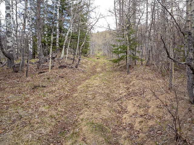
We’ve hiked up to the modest summit of Eagle Hill on countless occasions and enjoyed it every single time. This visit we take a new to us route via Seventy Buck Valley from the south, instead of the traditional one which comes in from the east. It’s a different approach that’s a tad shorter, lesser used but no less enjoyable. On hitting the “official” trail well over three quarters of the way in the route you’ll travel is a mix of reclaimed logging road and sometimes forest path. And all the elevation gain is near the end.
Expect many views of your objective along the way, the summit beckoning with each new break in the trees. There’s a few boggy sections here and there, but otherwise it’s super easy going. A sometimes indistinct track along with a few side roads/trails/cutlines means there’s a chance one could go astray if not paying attention. Getting lost in thought might mean getting lost in life. We saw evidence of others who took the wrong turn.
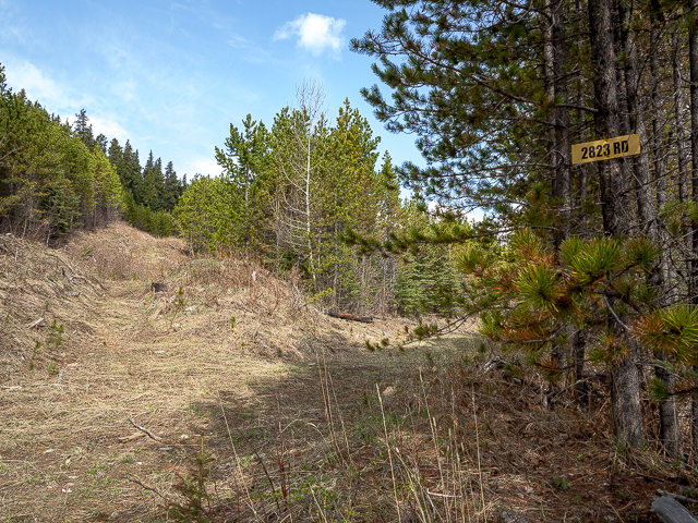
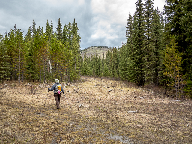
Park at “Crane Meadows” off Highway Sixty Eight (Sibbald Creek Trail) at a bend about five clicks west of the Sibbald Lake Provincial Park turnoff. Look for the grassed-over road heading north into the woods and park below it on the shoulder. Gear on, take to the trail. Soon in pass cut block after cut block. The area was logged some years ago, less than ten we recall, and already the seedlings planted soon after the harvest have grown to be a good size.
It appears a bear that frequents Seventy Buck Valley and we saw many prints along lower sections of the trail. Some droppings looked recent too. Interestingly we saw more animal tracks than that of people. Bear, deer, elk, moose perhaps and others.
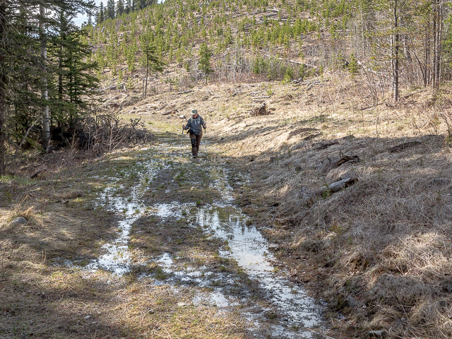
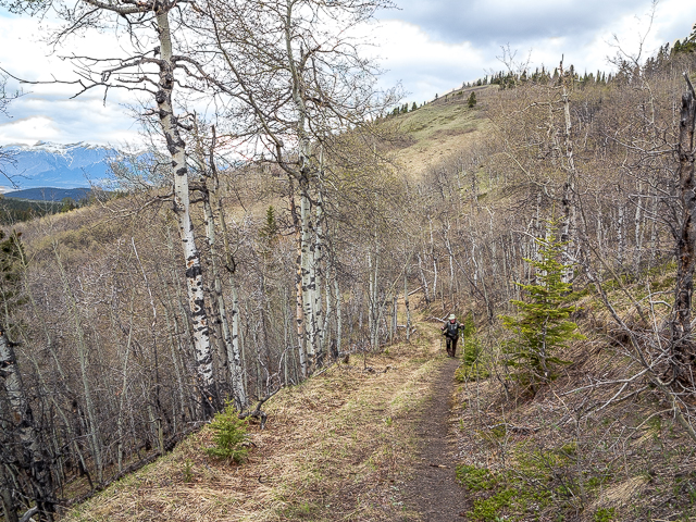
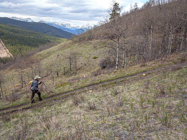
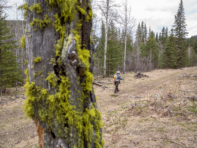
Meander right at the base of a hill. The road’s mostly level and the way here obvious. Pass some wet areas, one pool so deep it required a detour for us. Trend left below more cut blocks. Where an old sign is tacked to a tree come to a junction. Right is the way to Eagle Hill, and left takes you to Seventy Buck Viewpoint (never been…for next time). At a break in the trees, the day’s objective, the grassy north face of Eagle Hill comes into view.
On an easterly heading now, drop down a bit into a low lying area that we suspect stays wet all year round. Come to a four way junction, a cutline/sorta road looking thing crossing the path you’re on. Resist going left (which looks the proper way) and instead continue east. We saw footprints heading the wrong way…don’t follow them.
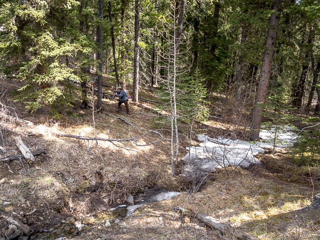
Soon bending left, at a creek crossing (culvert), the road peters out becoming a narrow grass path in the trees. Start climbing in a northerly direction, slowly at first, then later more steeply. At a T-junction turn hard right and head up. At this point you’re directly below Eagle Hill’s summit, out of sight for now, but soon to come into view as you climb.
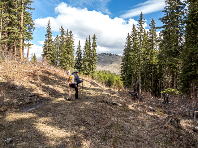
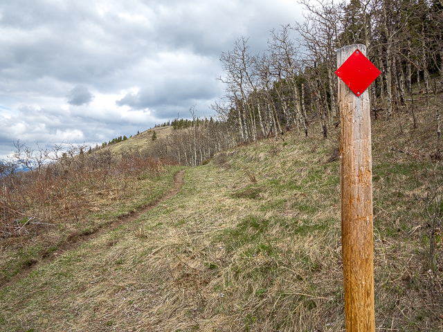
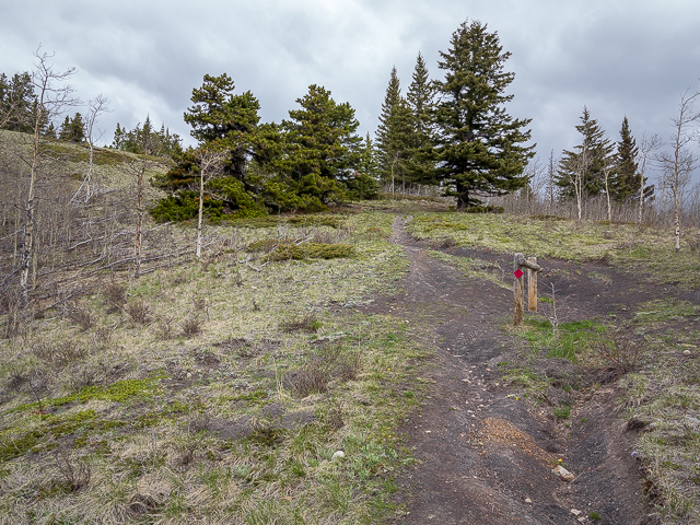
After more up come to the official Eagle Hill Trail (maintained by K Country staff), and at a marker pole turn hard left. There’s the objective ahead! Up until now, we saw no one else, but once on this section things got busier. And it’s not only hikers seen but sometimes equestrian riders and cyclists too.
Continue climbing, taking in a switchback, and soon in it’s the final push. There’s a hitching rail just below the summit, then a few steps more and you’ve topped out. It’s not a big hill, or hard hike, but it’s a summit none the less. And for that give yourself a reward (for us wine).
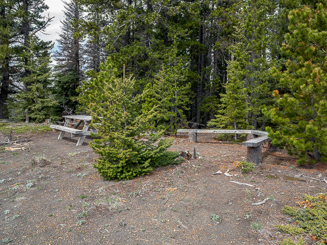
Since our last visit a few years back, someone’s set up a picnic table, protected by some trees, on the far side of a fence. They’re actually on the Stoney First Nation’s Reserve, the border splitting the summit of Eagle Hill.
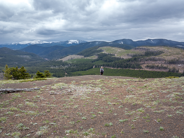
Take in the views. To the east, it’s green rolling hills and ridges. South-ish there’s loftier summits including Cox Hill, Moose Mountain in back and to the left (with a zoom lens you can see the fire lookout on its summit) and closer in and to the right there’s Hunchback Hills. We’ve been to the top of all these and loved every one.
To the west is a near impenetrable wall of towering peaks well off in the distance. Flat faced Yamnuska is the most prominent and across the valley it’s Yates Mountain home to the Barrier Lake Lookout. Snaking it’s way to the mountains is the Trans Canada Highway down there and below it’s the Morley Flats a vast expanse of level land just before the ramparts that are the Alberta Front Ranges. Trees preclude you from seeing anything to the north.
Hunker down (it’s typically very windy here) and enjoy you lunch. You did bring one, right? Crows soar overhead, and once in a while an Eagle has been known to show. We saw one, very briefly this day, but some distance away. Hence the name I guess. Say hi to other who’ve joined you up here. We saw a couple groups come and go.
When you’ve had your fill of Eagle Hill, return the way you came. And there you have it, some nine clicks behind you when you’re done, some two hundred and seventy five metres of elevation made easy work of (something a bit more in height than Calgary’s tallest tower) and hopefully many smiles along the way.
Now wasn’t that a fun little outing? Please tell us what you think in the comments below. It’s quick and easy and you don’t even need to register.
By the traditional route…
Return to Eagle Hill.
More from the area…
Hunchback Hills.
Deer Ridge.
Ole Buck Mountain – it’s HUGE!
Cox Hill.
If you wish more information about this route, by all means contact us!
Date of adventure: May, 2019.
Location: Sibbald Area, Kananaskis.
Distance: 9km there and back
Height gain maximum: 275m-ish.
Height gain cumulative: 300m-ish.
NOTE: all distances and heights are approximate.
Technical bits: Extreme exposure…not.
Reference: Kananaskis Trail Guides by Gillean Daffern.
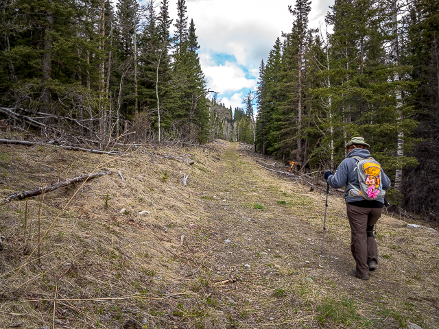
Starting out on a reclaimed logging road.
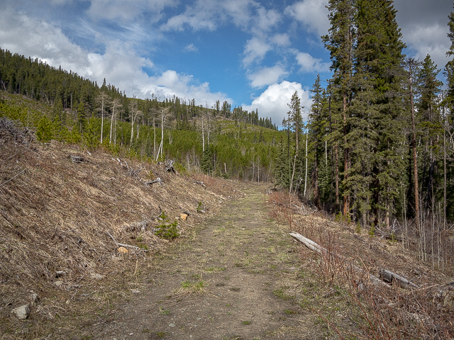
Cutblocks are passed.
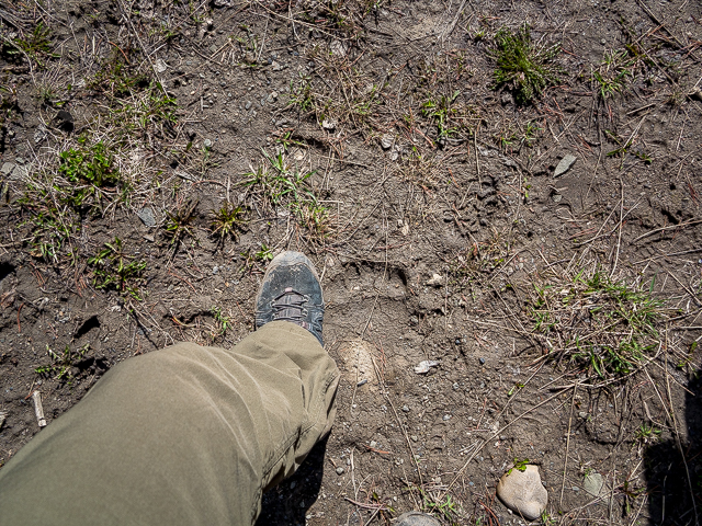
We followed bear prints for a good couple clicks.
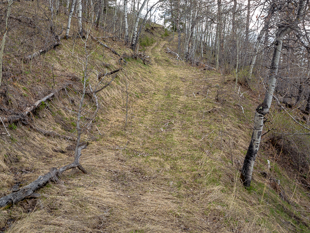
Expect some boggy sections.
At a split in the road, right for Eagle Hill.
Bypassing a very wet section.
Eagle Hill has been spotted!
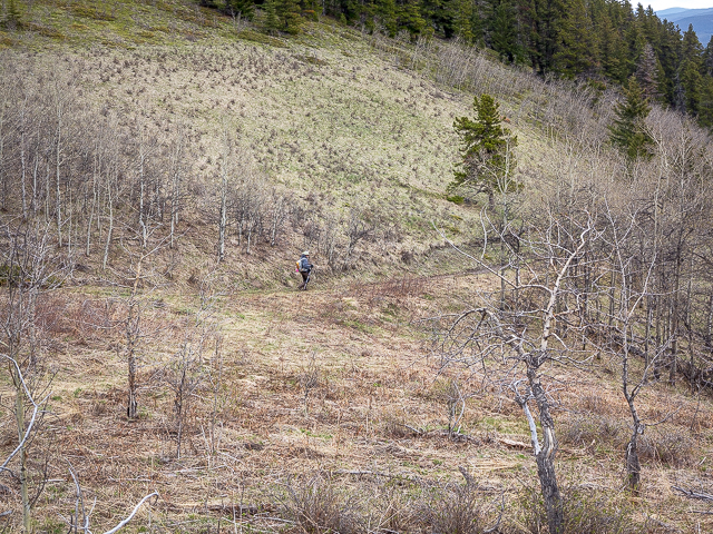
The trail narrows and is sort of indistinct.
And now it heads up.
The objective in back.
On the “official” Eagle Hill Trail.
Having a good time.
It’s not far away now.
At the equestrian hitching rail just below the summit.
On top! In back (l/r) Moose Mountain, Cox Hill & Hunchback Hills.
New additions since we were last here.
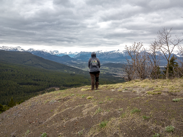
Point west for the best views.
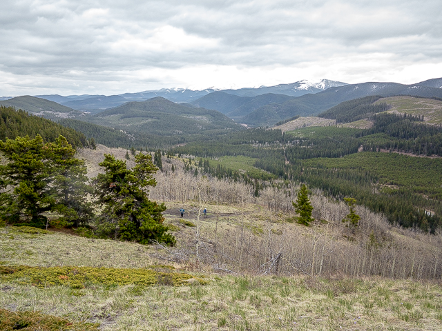
Other hikers down there – looking southeast-ish.
On the way down now.
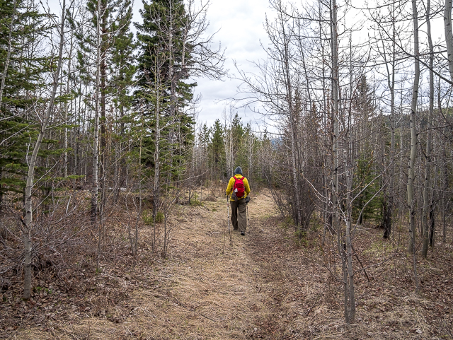
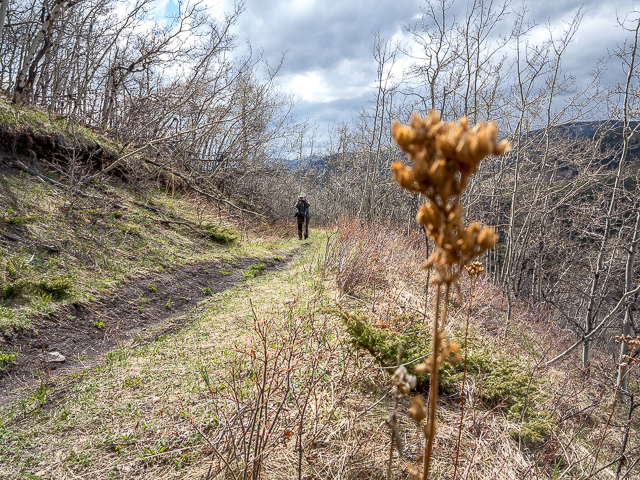
A splash of red & yellow.
One last look.
Easy going on the old road.
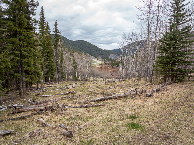
Highway Sixty Eight in back, at Crane Meadows.
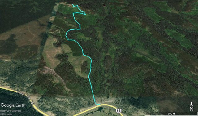
Eagle Hill via Seventy Buck Route – 9km there & back.


")


Well done. One step at a time.
And soon there’s thousands of steps behind her. Go Connie. You are loved!
What a view, way to go Connie! Yay!!!
She’s getting cheered on, and is loving it. Thanks!
You’ve got this Connie! So proud of you!
She’s a hero! Thanks!
Well done!
Thanks, she appreciates all the love.
well done – one step at a time – follow your toes & you will be moving forward….
Thank you for the words of encouragement.
I crawled up a “high hill” like that one. Feat of a lifetime. Hoorah for Connie.
It’s not how you make it up, but that you make it up. And for that cheers to anyone who’s it. She appreciates the support.
Go Connie.
You got a beautiful view as a reward for your efforts.
The view always makes it worth it. She appreciates you cheering her on.
Go Connie! You’re awesome!
Thanks, she is awesome!
Well done Connie!!
She’s got a big cheering section. Thanks for being part of it!
YAHOOOO
Yes!
Awesome to see you on the tail again😊
And we’ve since done more hikes, as yet to be published. But soon. She thanks you for supporting her.
Well done. One step at a time.
It’s a tough and perilous journey, but she’s got this. We appreciate the words of encouragement.
Keep moving forward one day this will be behind you. Prayers for you.
She’s not taking it sitting down, and is kickin’ behind. Thanks for your words of encouragement!
Yay Connie!
Cheer her on!