
Raspberry Ridge via Switchback Route
The very first post at BIGDoer.com, the one that started it all, documented a hike up Raspberry Ridge the very same destination seen in this here write up. There’s a link further down should you wish to see how it was then. We’re not sure why it took us so long to pay it a revisit. It is after all an awesome place, then as now, with amazing scenery, and a fine workout for the old bod, but still one that’s not too hard, the goal a fire lookout at the summit where the views unfold even further. Raspberry Ridge for the freakin’ win.
And it’s a triumphant return, one that speaks of a personal battle won, this being the first “big” hike our own Connie has tackled since her run in with Cancer six months prior. That brave girl for the freakin’ win. It’s things awesome on two fronts, a fine day in the woods and the bestest of friends spending time together on another adventure. This is how we roll and enjoy the time we have on this insignificant little blue marble.
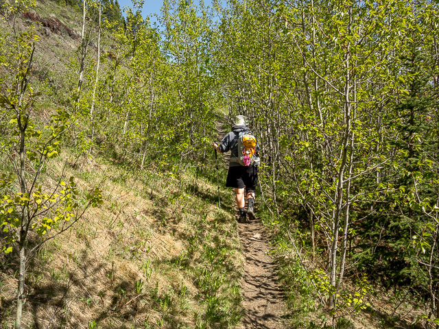
There’s two ways up Raspberry Ridge with us choosing to take in the longer but less steep switchback route that was once an old pack trail used by horses supplying the lookout. Our creaky old legs thanked us. How every you get up, it’s a good clean fun.
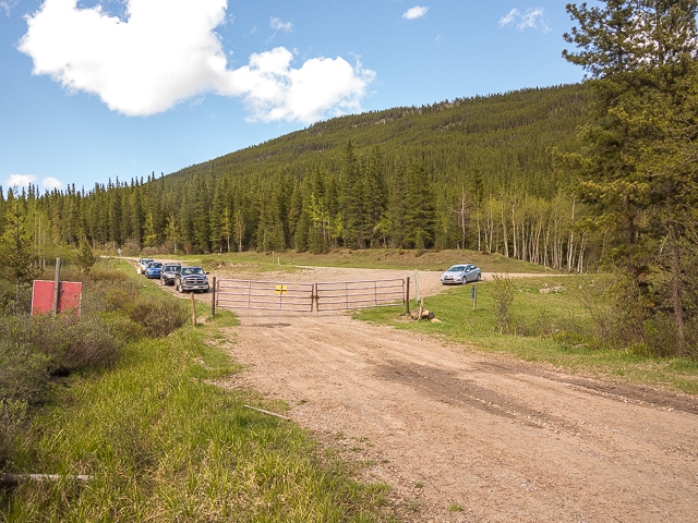
Trailhead parking is along Forestry Service Road #940, a dusty gravel affair some 11 clicks south of Highway #40. There’s plenty of room here for many cars.
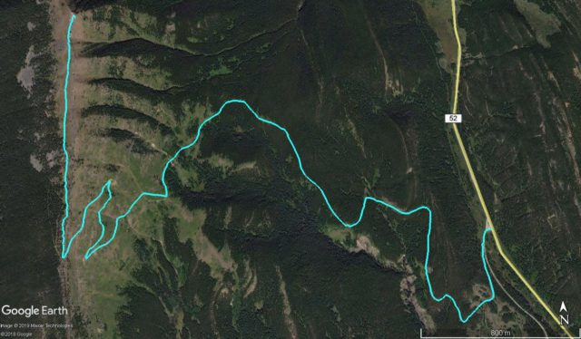
Continue on past the gate on a logging road. Almost immediately take a second road (reclaimed and used for hiking and snowmobiling in winter) heading off to the right at a shallow angle. There’s a second gate here, open on our visit. When this road bends left soon after take the marked single track heading right and follow it till your get to the base of Raspberry Ridge. Along the way, meander this way and that, gaining some elevation as you go. The way is never in question.
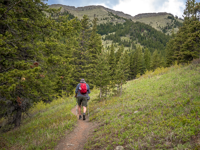
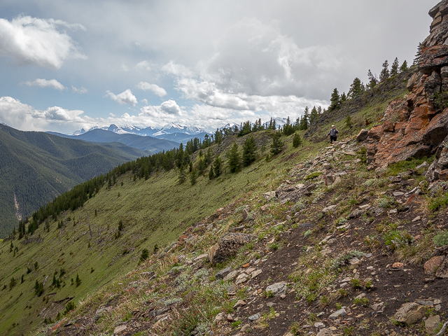
Mostly in the trees, there’s the occasional break allowing one a look at the day’s objective ahead or at rolling hills to the south. If you look close you can see the old pack-trail zig-zag route later used by us this fine day. Interestingly, it’s more defined from a distance than it is up close, as you’ll find out. Still, you can’t loose your way.
The Raspberry Ridge hike is a moderately popular one, so expect to share the trail with others. And give them a friendly greeting should you pass. In woods you’re friends to all.
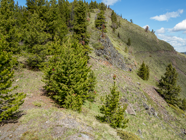
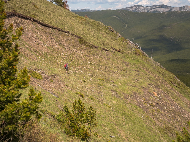
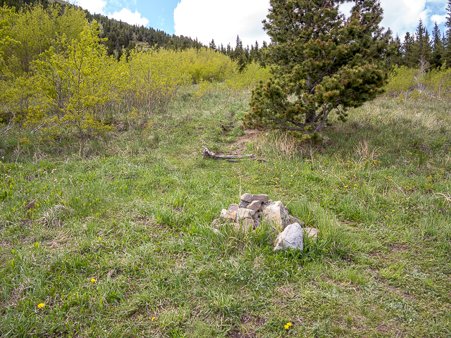
At the base of the ridge there’s a choice. At a stone cairn go right for the direct route, steeper and definitely more popular or continue left and follow the more relaxed routing described here. Come on it’s fun! And being on an steep grassy slope, it offers up really nice views all around. The old trail is being reclaimed by nature but is still easily passable if a bit faint in places. Zig then zag and at a rock face gain the ridge.
Imagine yourself back some sixty years guiding a laden pack-train of horse up this steep hillside, the trail cut in to be just wide enough to accommodate the equines. If one was to stumble it’d be a long deadly tumble down (same holds true today, don’t trip). Now they bring in provisions by copter. The lookout dates from the 1950s, by the way, and the present structure may be the second building here.
Below, it’s forest and meadows and to the right, glimpses of Cataract Creek in a broad valley.
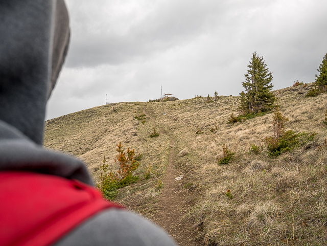
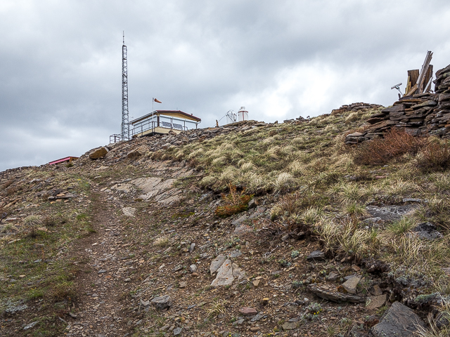
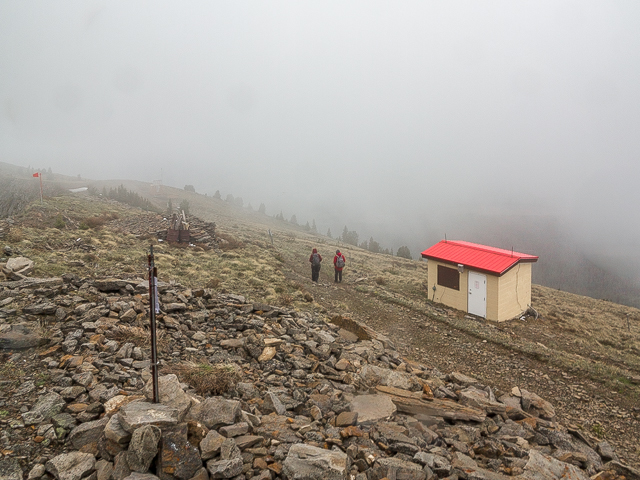
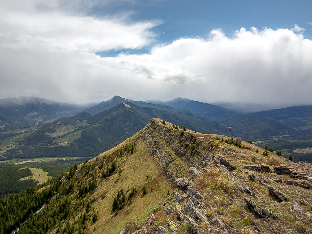
Turn hard right and continue up sometimes in the trees. The trail is indistinct here in places but again it’d be hard to go wrong. Just head up! A cairn marks the junction with the direct trail and soon after a sign announcing your arrival at the fire lookout. Typically someone lives us up here, expect for winter of course, but for some reason the place was unmanned on our visit. We tried to find out why and it appears budget cuts might be partially to blame. Changes in technology may be another. Still, a chat with a lookout operator, should they not be on the job, was always something we looked forward to. We’ve visited many of these places.
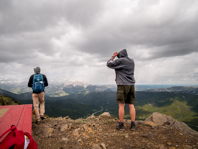
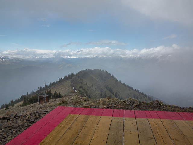
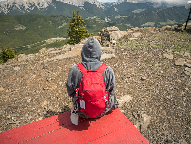
Pass a picnic table, and soon after arrive at the summit topped by the lookout. Stand there in awe and you can see why they picked this spot – great 360 degree views of forests all around. Take in mountains and hills and ridges off in every direction. Raspberry Ridge continues north – thinking we might like to explore it some time.
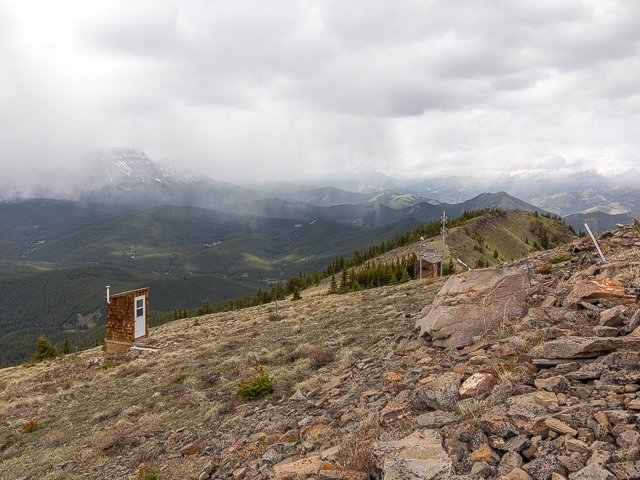
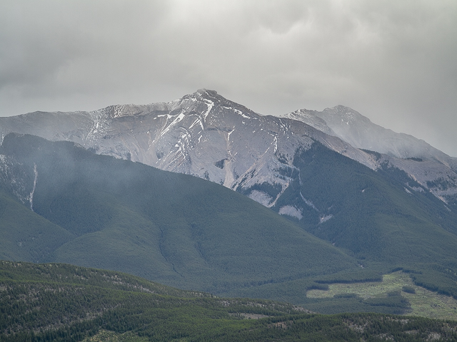
To the north and west, places of note. There’s Holy Cross Mountain, one of the biggest peaks there, and places we’ve been including Bull Creek Hills & Bull Creek Hills East Approach, Gunnery Mountain, Junction Hill, Coyote Hills, Hell’s Ridge and Mount Burke, a planned destination for us one day (when Connie’s stronger) home to an abandoned lookout that the one seen here replaced. Further south, there’s Sentinel Peak and flat topped Plateau Mountain. South, it’s many unnamed hills. To the west, a great towering wall of barren rock marks the border with British Columbia. And there’s so many cut blocks that way, making it not all that scenic photography wise. But we gotta get timber from somewhere.
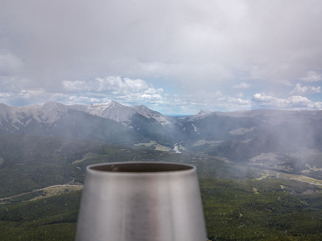
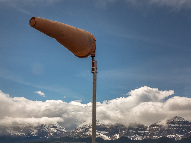
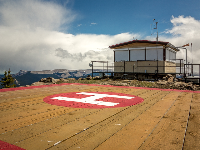
A storm rolls in that has everyone but us making a retreat. The wind was insufferable with the temperature plummeting for a time as the snow swirled about. But it soon passed and things warmed up. Check out the Grasshopper TV by the heli-pad. It’s a “must photograph” element.
Connie strikes a celebratory pose. Take that you b*****d Cancer. It was not all that long ago that she lost a big part of herself and tackling the ridge here was a great feat of strength and courage. Lost a boob and doing well. Still, it’s clear she struggled a tad and that it hurt to no end. But each day she’s stronger and her will is incredible.
When you’ve had your fill of all the awesome, return the way you came. We choose to stick to the east side of the ridge before hitting the switchback again, for the best views.
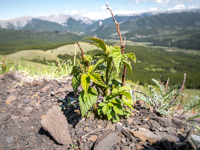
What’s in a name? The ridge seems to be home to very few Raspberries, in spite of what’s suggested. We found only one or two plants and none with fruit. Strawberry Ridge would seem more fitting – lots of those in grassy areas. But there’s already some hills just to the north with that name. See: Strawberry Hills (Forever).
Continuing on, you’ll soon be back at the car – this trail is almost all downhill on your return. It’s over and all that’s left is the drive home, a real downer given the enjoyment had here. Back to that normal existence.
Thanks for joining us on Raspberry Ridge. God, it’s good to get back up “high” again. Still lots of work to go before Connie’s full strength which will keep us mostly on the lesser/lower trails for the time being, with the occasional foray into places lofty. But she’ll only get better and so will the things we do.
If you’ve hiked this trail, please share your experience in the comments below. Or if you have a question, fire away. We’d love to hear from you.
The first time…
Raspberry Ridge.
More like this…
Crowsnest Ridge.
Indian Graves Ridge – Willow Creek Hills.
Wind Ridge.
If you wish more information about this route, by all means contact us!
Date of adventure: June, 2019.
Location: Southern Kananaskis Highwood Area.
Distance: 16km there and back.
Height gain maximum: 650m.
Height gain cumulative: 650m.
NOTE: all distances and heights are approximate.
Technical stuff and notes: Wind, cold insufferable wind.
Reference: Kananaskis Trail Guides by Gillean Daffern.
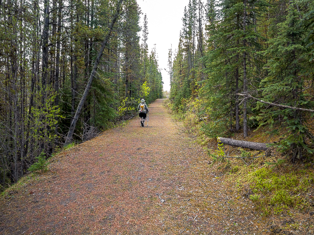
Early in the trail here is a reclaimed road.
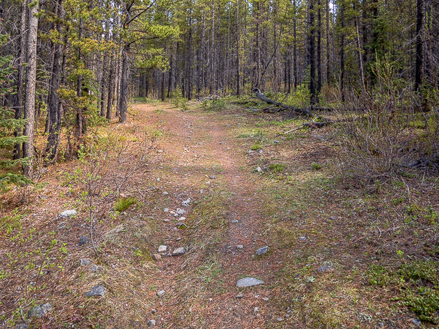
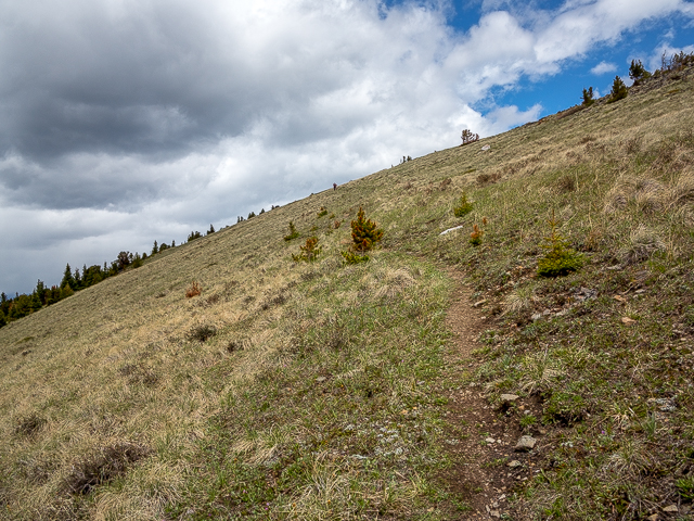
A bit later, this is a typical view.
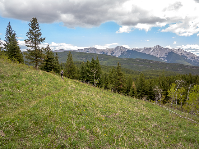
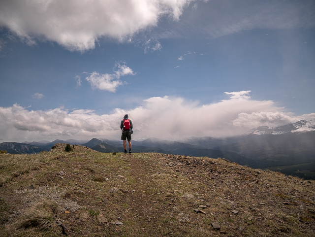
Raspberry Ridge has been spotted.
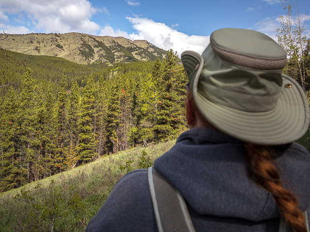
Rolling hills and cutblocks to the south.
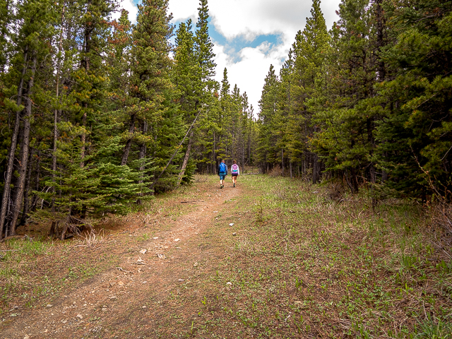
Fellow adventurers.
Soon there’s a decision to be made.
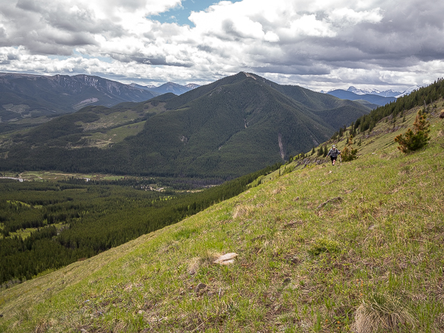
Starting up the switchbacks.
Nature is reclaiming the old pack trail.
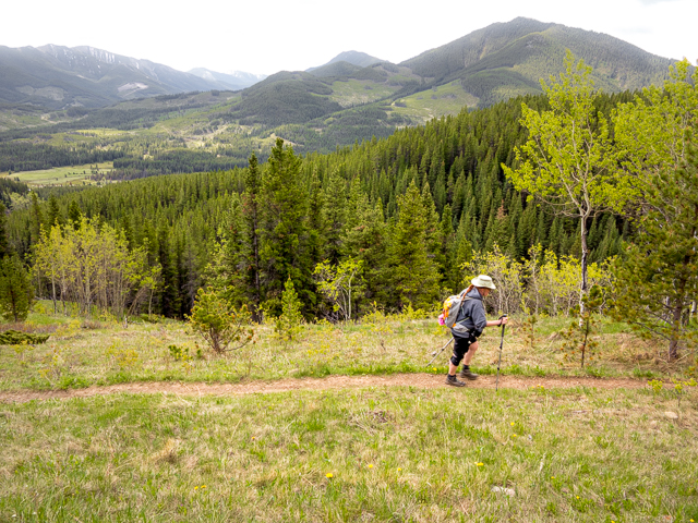
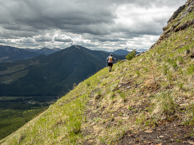
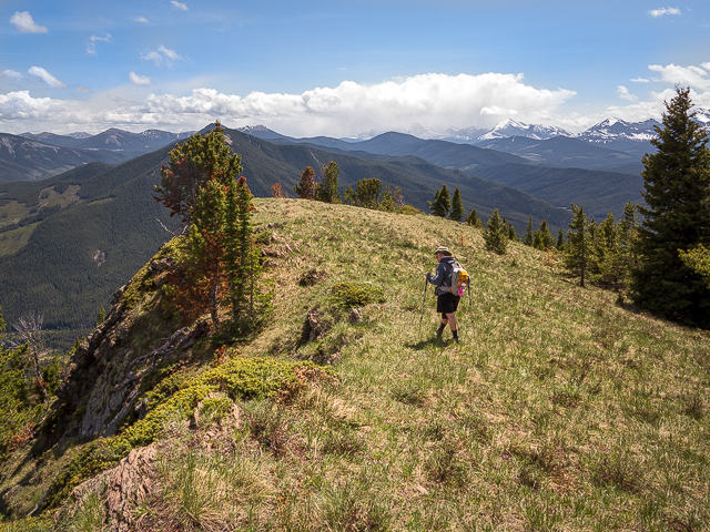
Connie follows.
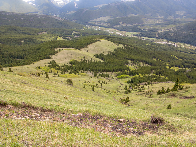
Meadows below.
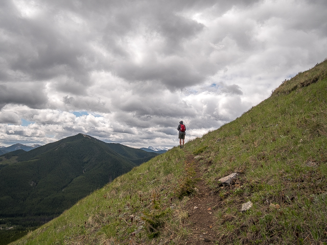
Higher and higher.
Gaining the ridge.
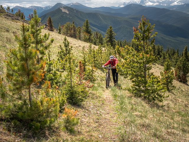
Looking back, a cyclist.
There’s still more up to go.
A cairn marks the junction with the other route.
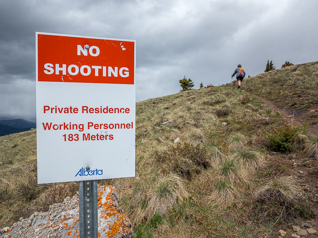
No shooting? But I brought my pump action!
Target acquired.

It’s all downhill from here.
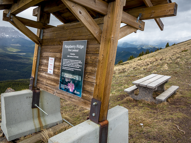
A picnic spot below the lookout.
A few more steps to go.
The lofty “facilities”.
In back, places we’ve been (see post).
A storm rolls in to which we toast.
And with their departure, we’re all alone.
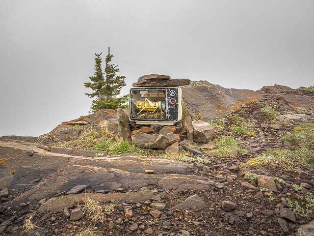
The much photographed Grasshopper TV.
Looking north.
The wind was insufferable.
Mount Burke to the east.
The south end of Raspberry Ridge.
The lookout was (oddly) unmanned on our visit.
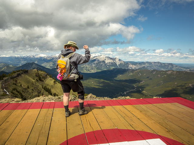
A celebratory pose. Who kicked Cancer’s butt?
The obligatory “watching TV” shot”.
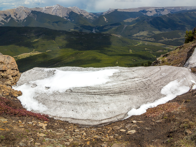
The last vestiges of winter.
About to (reluctantly) head down.
A ridge walk doesn’t get much better than this.
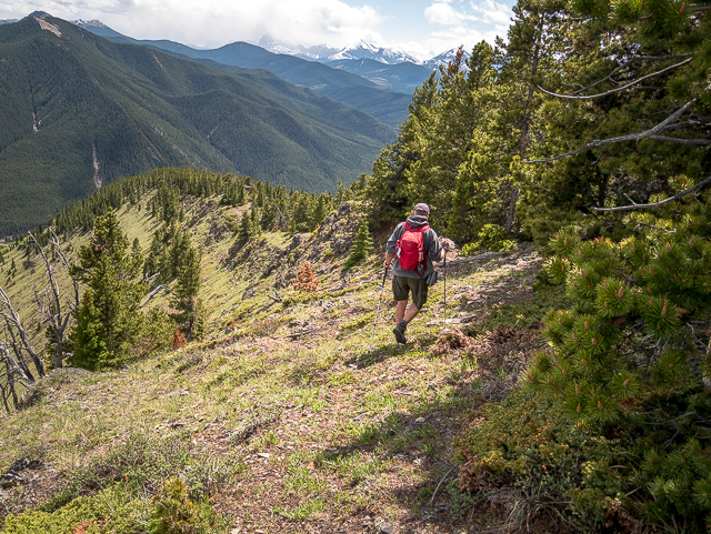
The going’s easy and the scenery wonderful.
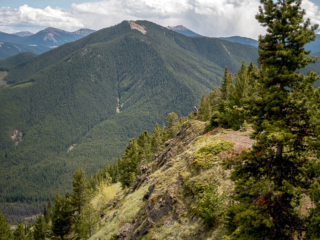
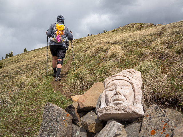
Your author at a viewpoint over there.
Pass below this rockface and hit the zig-zag trail.
Doubling back and dropping further.
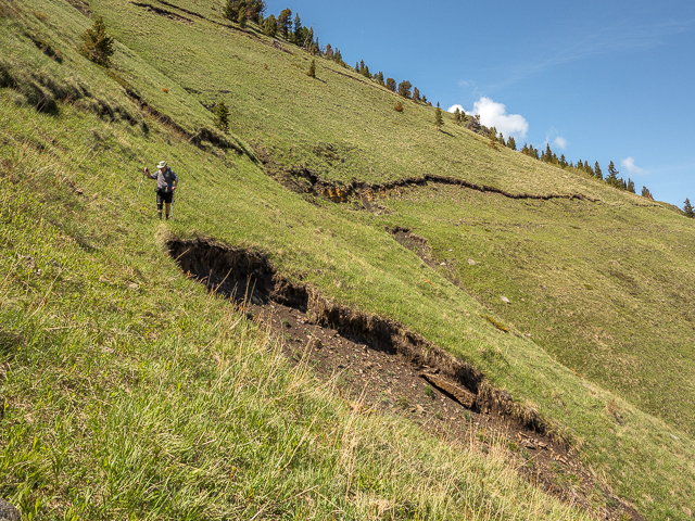
Parts of the hill slumped away.
The namesake plant – no berries though.
These mark the junction with the (untaken) direct route.
No, no, the hike’s almost done.
And all that’s left is the drive home.
Using the switchback route.


Beautiful!
Short and sweet – thanks!
Great time!
Love the time we spend together.
I love hiking ridge tops.
Yes, give us a good ridge any day!
lol wtf, any idea of how this (TV) got there?
Suspect the lookout staff had a part in it. It’s great for photo-ops at the summit and a real curiosity.
Way to go Connie !!! Yay.
Fabulous photos Chris
Thanks and thanks. We’re so crazy happy that the ugly stuff is behind her.
Great pictures…great hike….and Connie you go girl….😊…one step at a time …always up….always forward….
Connie appreciates the support. She’s a tough cookie. Glad you liked the pics too. Keep those comments coming.
Looks like you had a wonderful day in more ways than one. I was up here about 6 years ago. Saw the grasshopper TV!
What a great day to be alive. Love that TV.
Would love to try this hike!
We highly recommend it.
I love the view and the “triumphant pose”. Nice to hear that Connie won the battle.
She’s a fighter!
Congratulations!
Thank you so much.
where is raspberry ridge in the kananaskis?
A bit south of Highway #40 on #940.
Beautiful!!!! And wow to Connie! Thats how to live life!!!
Thanks and Connie sends her love. Trust me, there are few tougher than she.
Holy Cow!! I feel good if I walk around the block twice a day!!
It’s not how far you walk but that you walk. Good on anyone who gets out and does it.
Love it!
Thanks!
Looks like fabulous scenery!
It’s amazing. We have the world’s best playground (as we’re apt to say).
that is just the damndest thing i have ever seen. You go Connie girl.
The TV always elicits that sort of comment. And Connie sends her thanks.
Congratulations to Connie on the celabratory hike.
She sends her thanks! She’s a tough cookie.
Quite a hike up there – but what a view!
Yes to both. That hard work sure was rewarded. It’s why we do it.