The Greater Bragg Creek Trails Association (the GBCTA) manages a huge network of biking, hiking, equestrian, snowshoe and cross-country ski trails in the Foothills of Kananaskis west of Calgary. They go every which way and they keep building new ones! There’s a great mix here and whether you’re into something exhilarating, steep and downhill for your two-wheeled steed or in search of a pastoral stroll through the woods, they’ve got it covered. Some trails are multi-use, others hiking or biking specific (or in winter for XC ski use), but no matter how you take them in, there’s no shortage of fun and adventure to be had.
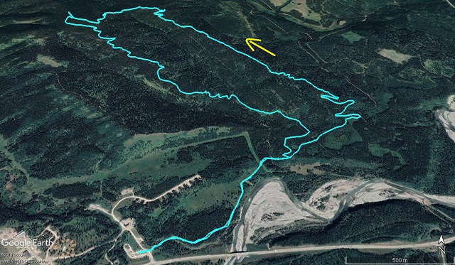
Our route today takes in four separate trails, small sections of Elbow and Strange Brew and all of Sugar Daddy and Sugar Momma. The latter follow two parallel interconnected ridges of very modest height. We did it counter-clockwise, which to us seemed the better routing, but you can do it opposite if you so wish. Mostly in the woods, there’s never any all encompassing vistas, even at the “summit”, only occasional little glimpses of the surrounding countryside at the odd break in the trees. Still, it’s time spend in the wilderness and that’s good for the body and soul.
Sugar Daddy/Sugar Momma: a sweet loop hike in Kananaskis. Another outdoor adventure with Chris & Connie.
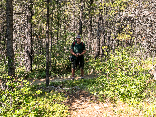
This was just one more trail on Connie’s journey back to health after her run-in with Cancer last year. We’re generally doing easier hikes like this till she fully gets her strength back which is a slow process and may take a year or more. Now on to the hike…
Scroll down for photos and to comment.
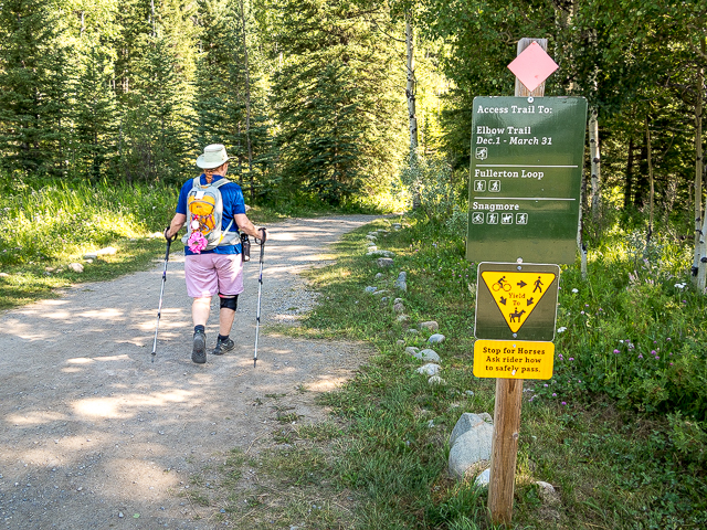
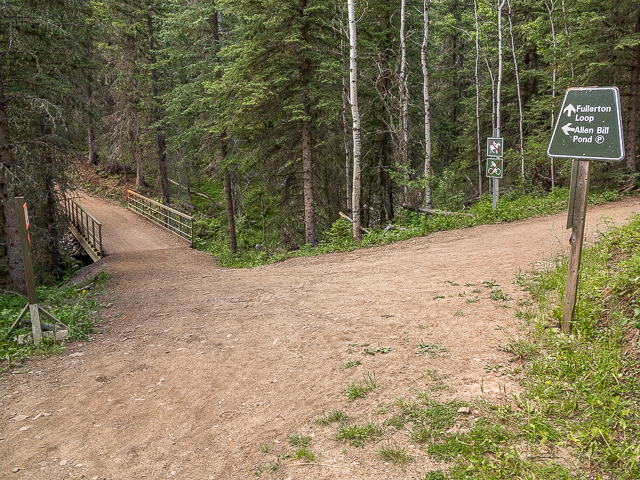
Park at the Fullerton trailhead opposite the Allen Bill Day Use Area. It’s a big lot, speaking of how busy things can get at times. If you like peace and quiet, pick during the week as we did. On a weekends many of the trails, including most of the ones we did, are the domain of the mountain bike. Run-ins with hikers at those times seem a real possibility, especially on downhill sections where the bikes will be moving fast. On a quiet Thursday we saw only a small number of folks, mostly on foot and near the parking lot. Otherwise we had the trails all to ourselves for long periods of time and it was pure bliss.
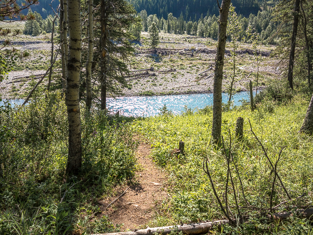
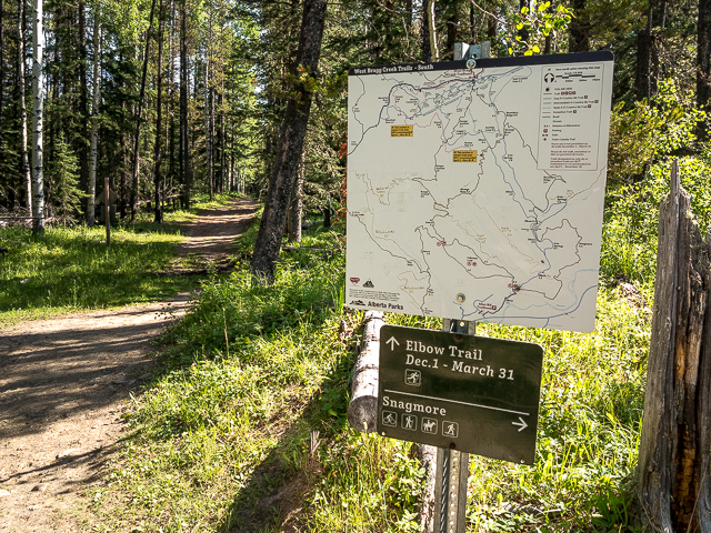
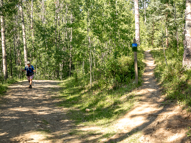
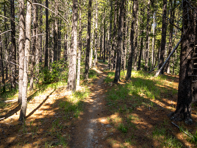
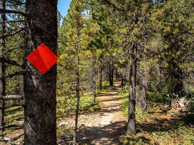
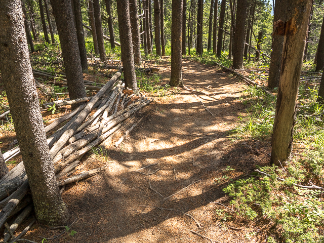
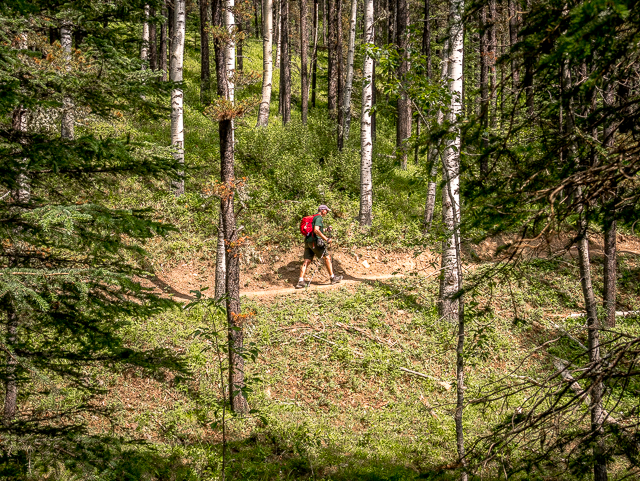
Head out on the Elbow Trail, used mostly as a connector to other routes. Here, it’s a wide path, almost a wilderness super-highway. At the namesake Elbow River, trend north-ish. At a little creek come to the junction of Fullerton Loop. A lot of folks will take in that easy hike (no bikes or horses allowed) leaving the trail much quieter now. Go right and climb up a bit. Soon in pass the junction with Sugar Momma on your left, which will be used on the down leg. There’s a map here, but not all junctions will have these and some don’t seem to have any markings at all. Best to download a copy on to your phone or take a snapshot of one. It’d be easy to get lost in the maze of trails.
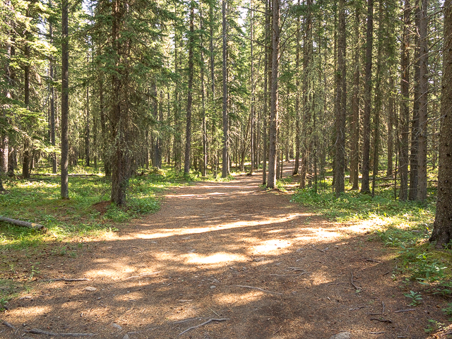
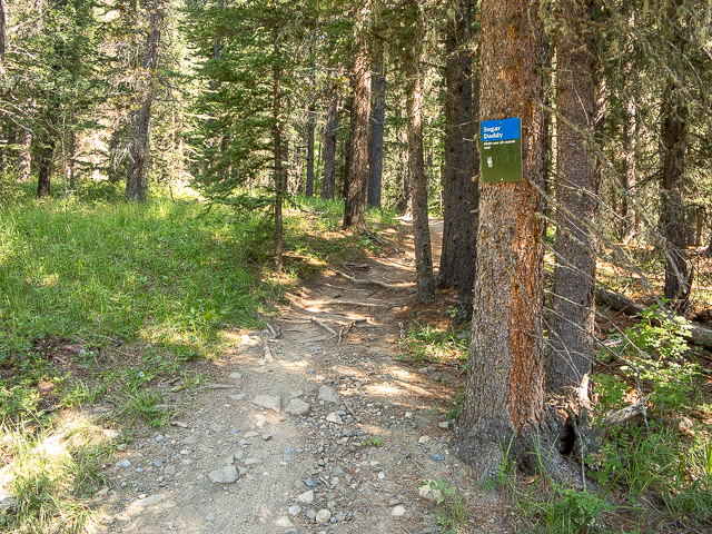
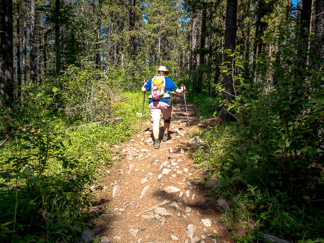
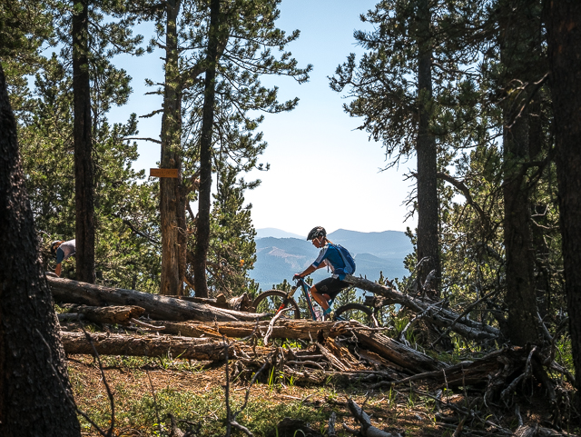
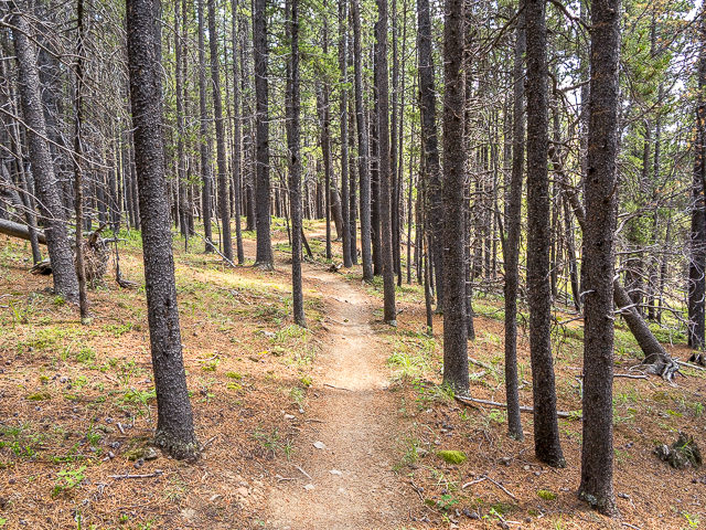
In less that a click come to Sugar Daddy heading off to the left. Now the climb begins, with no real respite till the top, but it’s never all that steep. Keep watch for bikes descending. After a zig-zag or two, the trail follows the ridge up, pretty much always in the trees. It winds this way and that through Aspen, Spruce and Pine always following the best line.
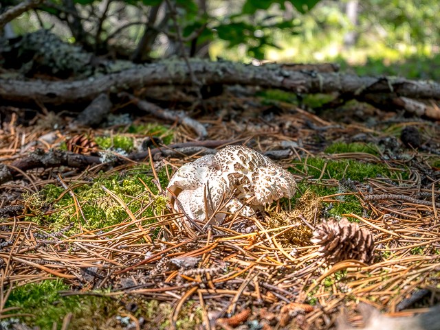
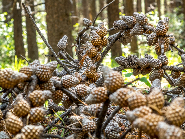
With a wet summer, there were many mushrooms to be seen on our visit. If only we learned something from all those mushroom identification books. Have many and are still none the wiser.
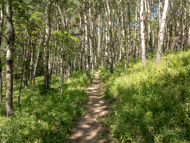
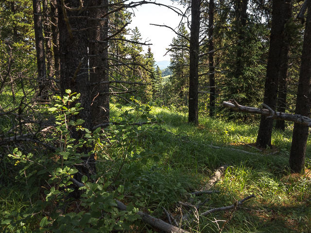
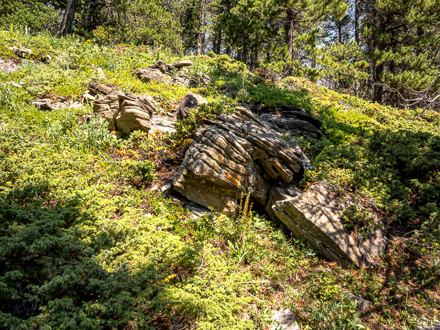
In the forest understory, lots of grasses, mosses and flowers. It’s so pretty. Occasionally there’s a sandstone rock outcropping which often display interesting layering. Come to a seismic cut line, a lane-wide path in the woods, from long ago (1950s-1970s period probably). These speak back to a time when the area was open to oil and gas exploration and are curious in that regardless of topography they are usually dead straight and often extend for off for many unbroken kilometres.
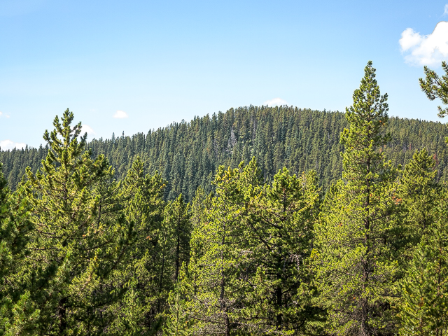
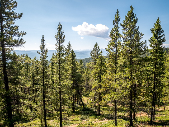
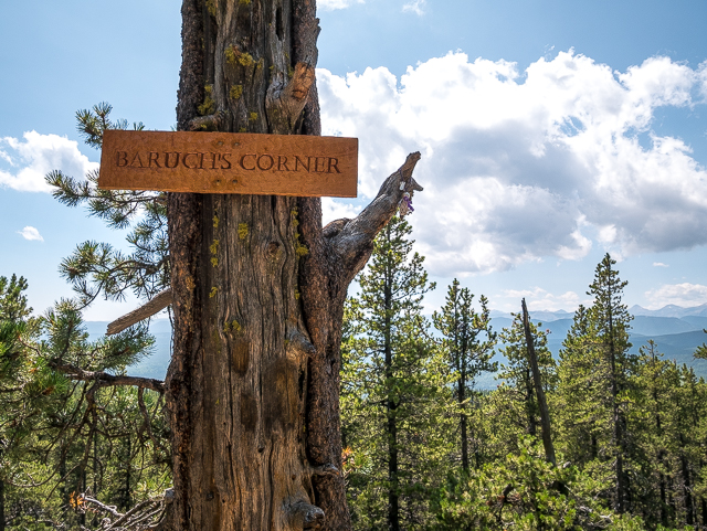
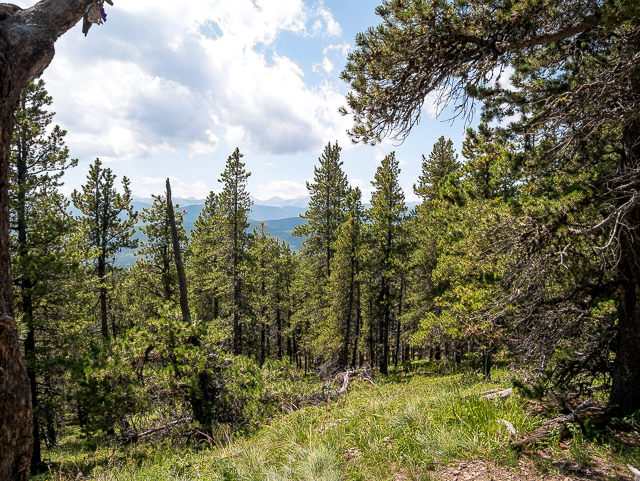
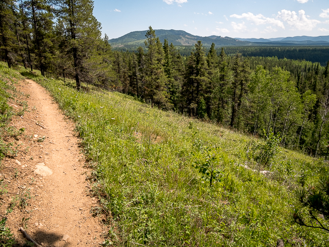
A couple more switchbacks and come a junction with Strange Brew. Turn left. Around here the trees thin enough to afford one a look at the high point of the trail, a bit to the west. You’ll be there soon enough. Drop down for a time, then a final easy push up. Come to Baruch’s Corner the best viewpoint of the day. Even so, most directions are obscured by trees. To the south, so many rolling hills and great swaths of forest and west-ish, and enveloped in a haze from forest fires, more of the same, with some big peaks well behind. This is as good as it gets folks.
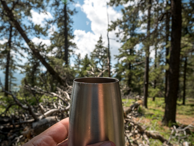
Baruch’s makes a great lunch spot. As always we bring some adult grape juice and raise a toast to the day, Nature, the good company and that we’ve survived one more day on this here earth. Cheers! The reaper ain’t got us yet.
Oddly while sitting here we saw some dozen or so mountain bikers pass in quick succession, the only ones we saw this day. They came and went and again the trail was all ours.
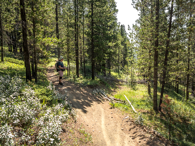
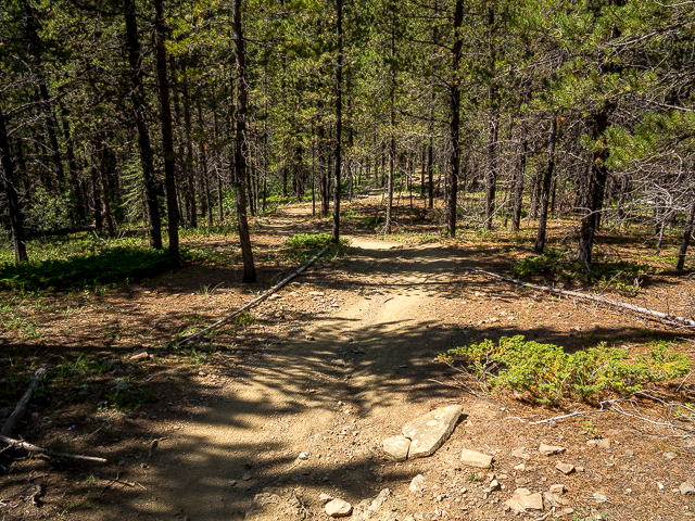
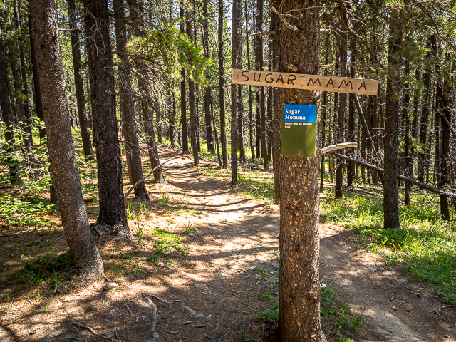
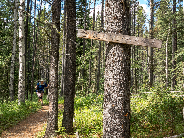
Back in motion the descent begins and soon in come to a three-way junction. Ahead is Ranger Summit, which we mistakenly took for a wee bit, but soon realized our error and backtracked, and left is Sugar Momma. There’s no sign here that we saw. By the way Momma is “Mama” on some maps and markers.
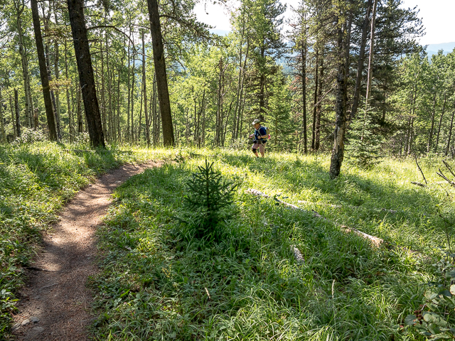
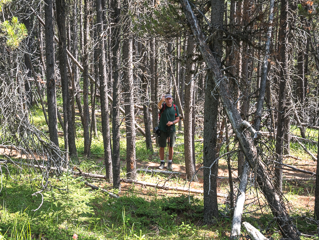
Drop down more and just past a big-bend come to a junction with Bobcat. Take a sharp left here. From this point on there are no more diversions till Elbow Trail is reached. Like the up leg, the trail follows a nice ridge, but down of course, and is mostly forested. There’s a zig and a zag here and there, the grade always easy enough. Listen for bikes from behind which could come upon you at a fair clip and with little warning.
Once in while there’s a meadow but otherwise it’s the company of trees. Always heading down, soon on hit Elbow Trail and follow it back to your ride. Behind you was a good workout, a great time, and the realization that not all hikes have to be wow to be pleasant. Had a blast here and hope you do too. Sugar Daddy and Sugar Momma (Mama) are a sweet pairing. Goodness though, the light was harsh this day – all that extreme contrast and shadows.
If use these trails, please send the GBCTA a donation in thanks so they can continue to care for them. We did! If everyone gave a few bucks they’ll be all ours to enjoy for a long, long time.
If you wish more information about this route, by all means contact us!
Date of adventure: August, 2019. Location: Kananaskis, Elbow River area. Distance: 12km loop. Height gain maximum: 350m. Height gain cumulative: 400m-ish. NOTE: all distances and heights are approximate. Technical stuff and notes: Watch for bikes! Reference: Kananaskis Trail Guides by Gillean Daffern.
Loved reading your blog. Thank you! Pictures great too. Plan on doing this tomorrow (June 19, 2020) hoping the bikes will be at a minimum. Had a very busy time with them last week.
Glad you liked the post. We’ll get back to publishing more hiking articles real soon now that Covid is easing. They asked us to hold off for a time. I understand bike traffic can be pretty heavy at times and a little extra attention is needed. Going on a weekday as you’re doing should have things more quiet, however. Have fun!
We used to do something called the "pointless challenge" 🤪 and miss those days. It was so much silly fun and often frustrating as heck. In these we'd invite people to send in random photos of obscure locations, but not give any information, and then we'd track where it was and shoot something similar.
Most of these came from old family collections, as was the case here. Anyone up to resurrecting the series?
In hindsight, why didn't we pose someone in our shot?
Pointless: “Devoid of meaning (or) senseless” Merriam-Webster.
If you like what we do and want to support this ongoing project (12 years now), go here: https://www.BIGDoer.com/help-the-society/ Thanks to Connie for making this post possible.
Exploring history with Off the Beaten Path with Chris & Connie. Photo: ca1970 and 2014. Posted by Connie.
Captured on a cold, cold day many years ago. We've been passing this old house for decades and it's little changed in that time. At some point we expect to drive by and it'll be gone.
Exploring history with Off the Beaten Path with Chris & Connie. Photo: 2017. Posted by Connie.
When retired old railway cars usually get cut up for scrap. Sometimes, however, they find their way into the hands of the general public or whomever. Flat cars make good bridges, and boxcars can be transformed into storage buildings and the like. Case in point here. We see them used like this often enough and in this case, it's part of a corral.
Incidentally, this boxcar dates from 1950 and this was found by tracing the old road number, which is still visible.
Exploring history with Off the Beaten Path with Chris & Connie. Photo: 2017. Posted by Connie.
This central Alberta racetrack was never a commercial operation but instead just a fun place for car enthusiasts in the area to get together. Early '70s or thereabouts and it only lasted a few years. Even thought it's been abandoned for that long, there is no doubt what was here.
You know we like the the obscure stuff and this one fits the bill perfectly. Found by accident while backroad cruising and the history comes thanks to local car guy Mike.
Exploring history with Off the Beaten Path with Chris & Connie. Photo: 2022. Posted by Connie.
On top of little Myrtle Mountain in the Kimberley (BC) Nature Park.
There's some good wilderness fun to be had here and nice views as you can see, but the real reason we came is mining history. The whole area near the ski hill was extensively worked over a century ago and we were looking for evidence of this. We didn't find much in the area searched, but it's a big chunk of property and we hope to return to cover more ground again soon. Of all the subjects we cover, mining related is a favourite.
Still, it was a good hike and that can't be bad. Look to the comments for more info 👇.
Exploring nature and history with Off the Beaten Path with Chris & Connie. Photo: 2022. Posted by Connie.
It's a strange curiosity in south Kananaskis, there on a hillside and we have no idea who created it. We asked around and no one's completely sure about its history. In the past it showed the Canada 100 logo from 1967 but in 2017 someone changed it to reflect the country's 150th.
That's our friend Emily from DanOCan.com having a look.
Exploring history with Off the Beaten Path with Chris & Connie. Photo: 2017. Posted by Connie.

")


Loved reading your blog. Thank you! Pictures great too. Plan on doing this tomorrow (June 19, 2020) hoping the bikes will be at a minimum. Had a very busy time with them last week.
Glad you liked the post. We’ll get back to publishing more hiking articles real soon now that Covid is easing. They asked us to hold off for a time. I understand bike traffic can be pretty heavy at times and a little extra attention is needed. Going on a weekday as you’re doing should have things more quiet, however. Have fun!
love the bragg creek trails.
They’re a great resource.
Great day with my best friend.
Happy to spend all time having fun with you.
How do you find the time?
We cloned ourselves! We do get around, for sure.
Looks like fun.
It was great time – but then with everything we do we try and make it so.
Stay clear on weekends unless you like to get run over. Too many bikes at that time. We saw a couple crashes due to it being busy.
Yes, we recommended that in this piece. Yes, it can get crazy busy and by that alone run ins, even between bikes, in inevitable.