
Crowsnest radio tower
On our frequent trips in the area I’ve often wondered about that tower that sits high on a ridge above Crowsnest Lake, right at the Alberta/BC border. Surely I am not the only one passing by on Highway 3 who’s seen it and was curious. Could we hike up there, and what would the views be like? The answer to those two questions – yes and wonderful!
There is a documented trail in the area, the Phillipps Pass trail. It’s also referred to as the Rum Runners Pass, aptly named for the liquor smugglers who frequented the area during prohibition. This trail would allow us access to the pass, which hosts the small Phillipps Lake, and from there we can take a side road that switchbacks up the ridge to the radio tower. The route is clearly seen from Google Earth which was used to scope out the trail beforehand.
We start from the BC side, at Crowsnest Provincial Park just west of Summit Lake, but you can also start from east end of the pass too. We elected to do the first part on bikes. However the road up was much rougher than expected and we ditched them early on and hiked the rest of the way.
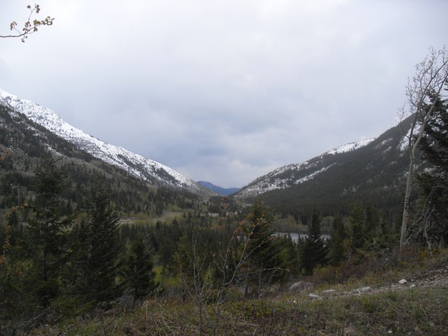
After a steady climb we reach the pass, and right at the lake we take the obvious side road leading to the tower. At this point you can also continue east further down the pass, or you can access the scrambling routes up Mount Tecumseh & Phillipps Peak to the north. It’s the large mountain to the north with the double summit, each with its own name.
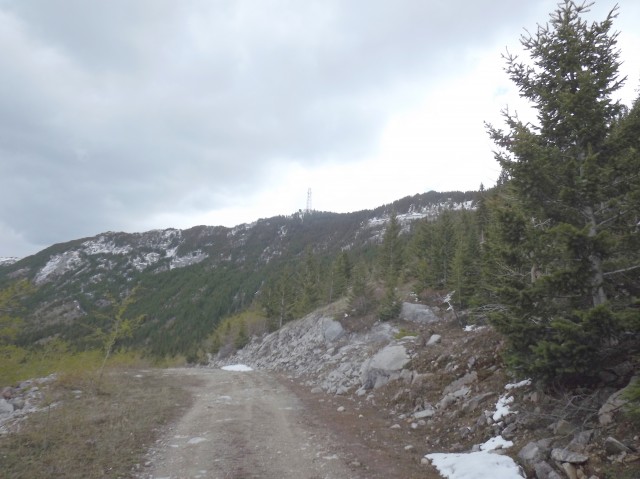
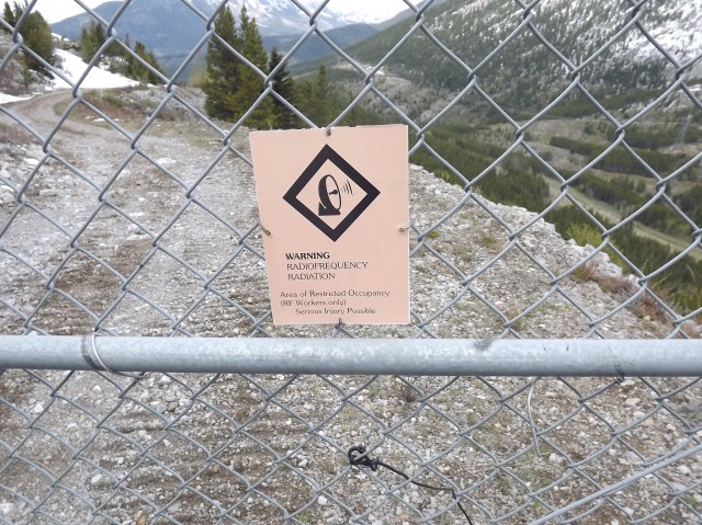
On the switchback road we steadily gain elevation. Because of the way the ridge sits in relation to the border, we pass back and forth from BC to Alberta a number of times. The radio tower itself however is in Alberta, but only by a hair.
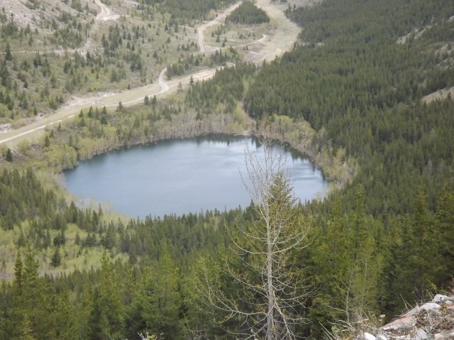
As we gain elevation, we get a good look at Phillipps Lake at the pass. It’s believed this body of water drains underground – there is lots of porous Limestone in the area – and to be the source of the stream that emits from the Crowsnest Lake cave on the south side of the ridge.
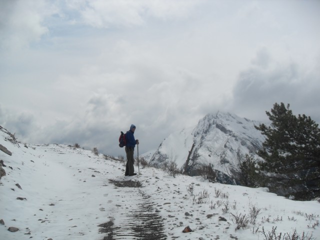
About half way up it starts snowing heavily (gee, snow at the end of May), and this combined with the snow pack that was already there, made for a real trudge from here on in. Lots of unavoidable postholing!
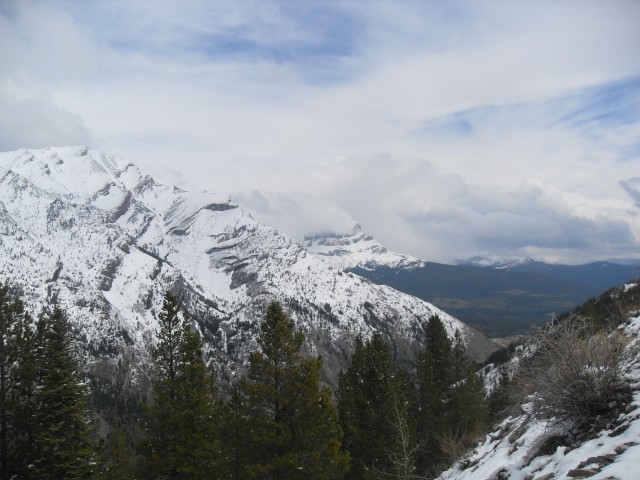
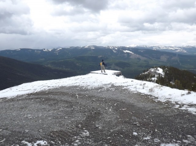
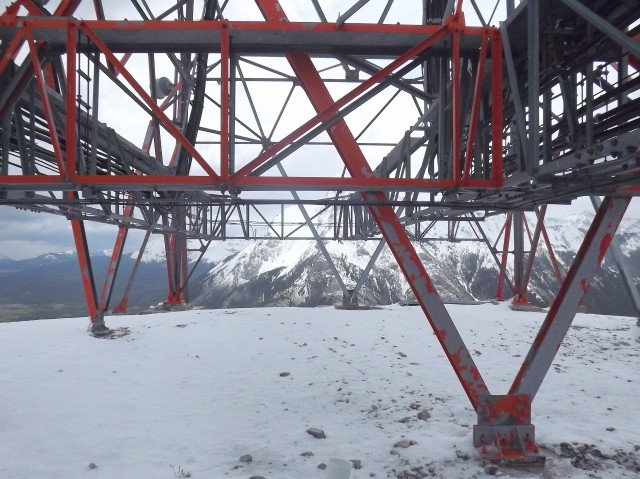
After the last switchback, we get to the tower site and the views I was hoping for do not disappoint. At times when the clouds broke, we could clearly see Sentry Peak and the abandoned Tent Mountain mine to the south of us and Crowsnest, Island and Emerald Lakes below. In spite of the storm where we are, the valley east of us is clear and bathed in sun, but other nearby peaks like Crowsnest Mountain are masked in cloud.
Below to the west we could also see the old Crowsnest power plant, a large brick building situated on the shores of Crowsnest Lake and to the east scars from the Summit Lime Works quarry. In front the busy highway can be seen (and heard).
From a temperature of 15c when we started, at the top it’s a chilly 2c. And the wind – the famous Crowsnest Pass wind. At times it could knock you over and with every gust is sucked all our body heat away. Thank goodness we were all liquored up with wine, which helped keep us warm!
I love engineering works and they tower is quite fascinating. There are lots of massive girders (that whistled in the wind), and huge bolts anchored into a large concrete bases. Given the constant buffeting it would be fascinating to hear what special engineering steps were needed to combat the wind gusts. And how did they assemble it? Erecting the tower must have been done only during calm periods, but those are rare here.
After lunch and wine we proceeded down (stagger down) and as we do the temperature increases rapidly. Luckily we were smart enough to bring both fair weather clothes and winter gear.
If this ridge has an official name, I have not found what it is. I’ve heard others refer to it as Crowsnest Ridge though and that seems fitting and good enough for us. Crowsnest Ridge it is. It’s easily seen from the highway as you pass into BC.
To see some other hikes we’ve done in the pass, go here…
One Mine Ridge.
DC3 plane crash.
Turtle Mountain.
If you wish more information on this trail, by all means contact us!
Date of adventure: May 2012
Location: Crowsnest Pass, AB.
Distance: 16km round trip.
Height gain from start: 550m.
Height gain cumulative: 550m.
Technical bits: None.
Notes: None.
Reference: None.
Higher up the temperature drops dramatically.
At Phillipps Pass.
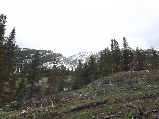
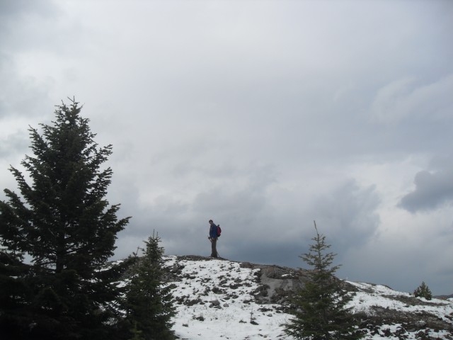
Our goal for the day high up on a ridge.
Phillipps Pass aka the Rum Runner Pass, and Phillipps Lake.
Now I’ll never have kids.
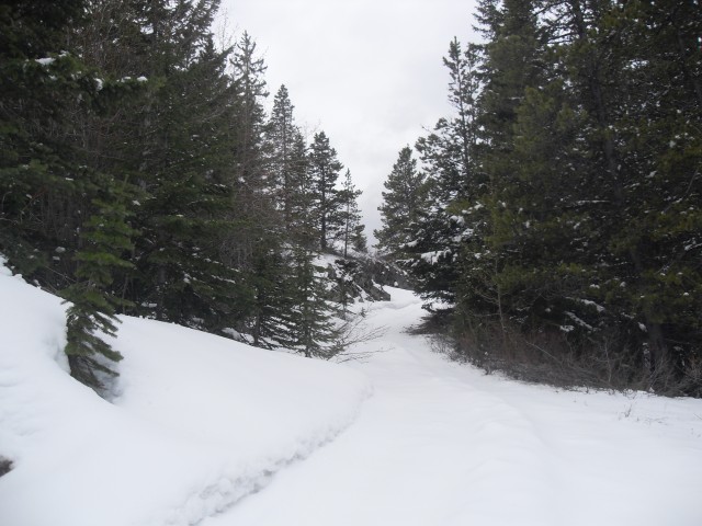
As we go higher, the snow pack increases. It was a real trudge.
Mount Tecumseh and behind hidden in clouds, Crowsnest Mountain.
A view point.
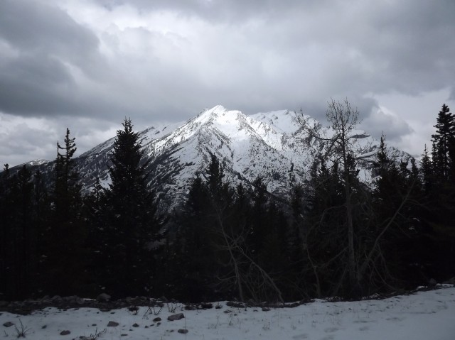
Looking north at Mount Tecumseh/Phillipps Peak.
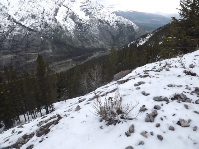
Looking east up Phillipps Pass.
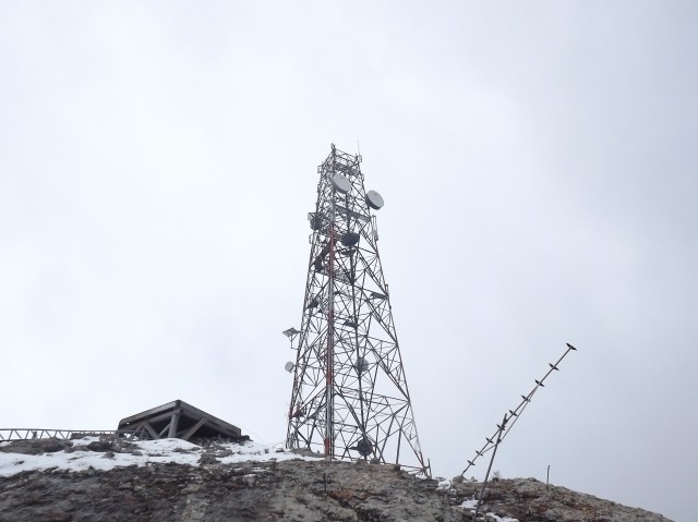
The tower gets near and it’s huge!
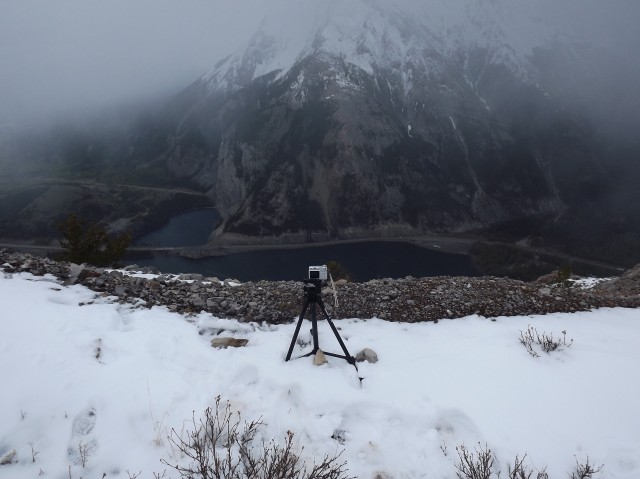
The time lapse rig we call Brucie. See the video below.
Looking west at the helicopter pad.
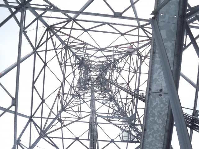
The massive tower.
Looking south towards Sentry Mountain.
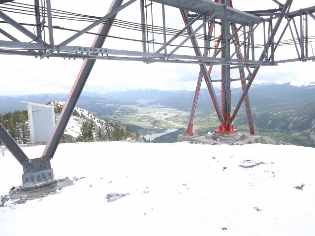
While it was storming on and off at the top, the weather in the valley below was quite nice.
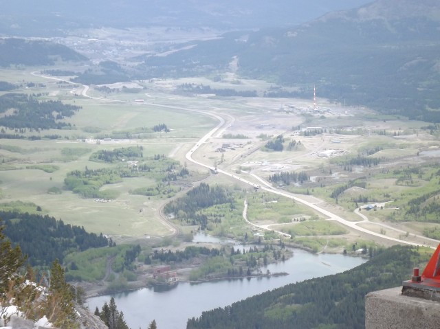
The abandoned power plant can be seen along the shores of Crowsnest Lake.
Things open up between storms.
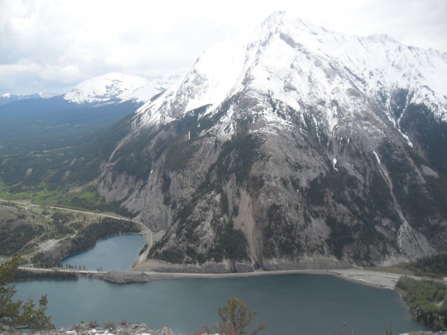
Sentry Mountain, Crowsnest Lake with Emerald Lake in back.
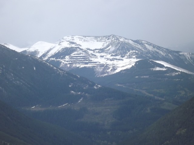
Scars from the abandoned Tent Mountain coal mine south of us.


")


Comments are currently turned off