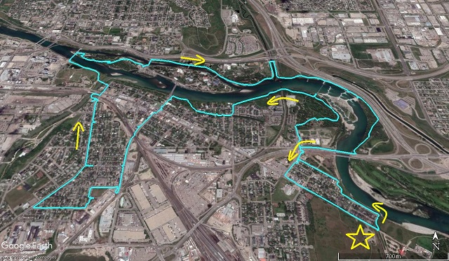
With all the world at full stop here’s a little step back from the uncertainty, another instalment in our inner-city hike series. This route follows the Bow River for a time along a dedicated pathway, with diversions into the historic communities of Inglewood and Ramsay added for good measure. Take in busy city streets, peaceful wooded groves, quiet residential lanes and historic buildings by the score There’s more awesome stuff along this route than our photos could ever show. Do it for yourself and see.
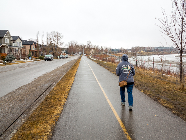
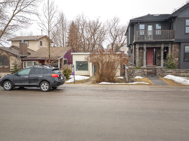
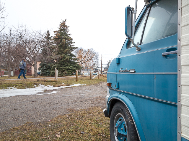
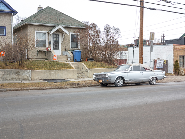
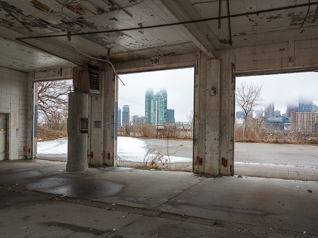
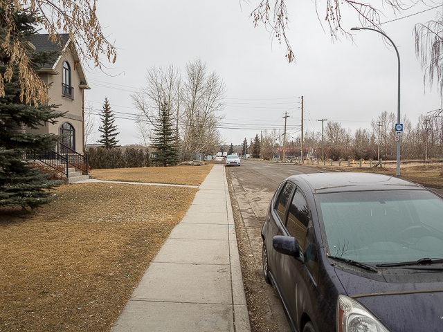
The starting point is the along 9th Avenue SE, by the Inglewood Bird Sanctuary. Take to the pathway and head north that soon trends west on coming to the Bow. To the left two tiny homes (both over a 100 years old)…all the space of a two car garage. Looks like the land they’re on may be due for redevelopment. A newer dwelling next door stands in stark contract – it’s huge! Today many homes in Calgary are built to the maximum square footage allowed with little consideration given to how they fit into the style of a neighbourhood. All that matter is size!
Bow River Loop + Inglewood & Ramsay: a fine city hike. Keeping fit with Chris & Connie.
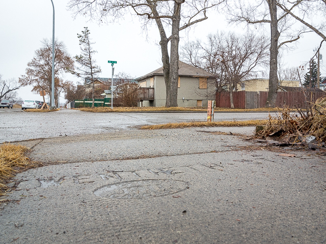
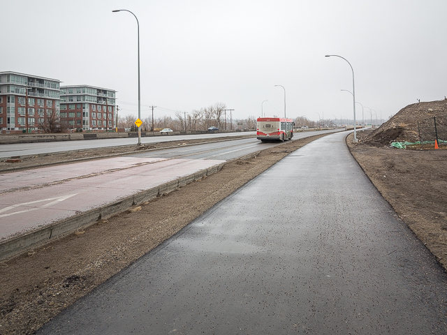
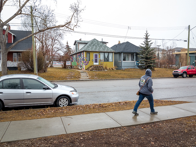
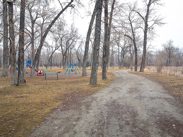
Normally one would continue on the pathway, but construction on our visit (no, not in Calgary!) forces a detour. Take to 7th Ave SE and continue west. Make note of some old sidewalk stampings seen along here…we found one from 1911 that’s been witness to the passing of a lot of feet. Over there, a doomed house, boarded up and with no future. Right on 19th Street SE and soon in cross the new 17th Avenue BRT (Bus Rapid Transit, a dedicated lane) and Blackfoot Trail. Continue along a quiet residential street (look for the “peace out” house) and enter Pearce Estate Park. It’s named after big wheel that one worked for the Canadian Pacific Railway who had a home here. It’s a nicely wooded park, with picnic areas, playgrounds, river frontage and is home to the Bow Fish Hatchery.
Scroll down for photos and to comment.
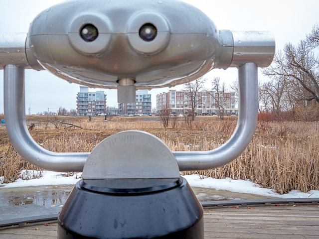
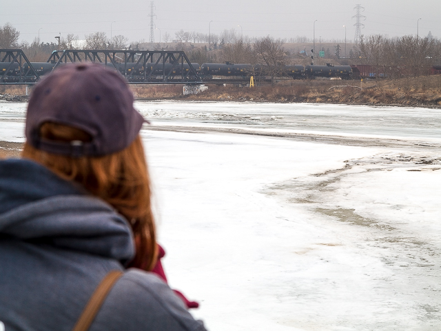
Go right on the first gravel path. Along here, there’s binoculars allowing one to spy on wildlife and birds from a distance. Oh, and people residing in those condos over there. A sign warns that peering into their lives is a no-no. So what does everybody do, us included? Further on, rejoin the paved pathway and go left.
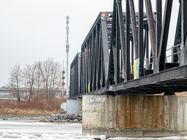
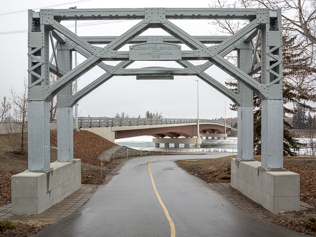
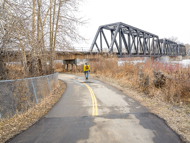
Harvie Passage is series of man made river channels used for kayaking and the like. The old Calgary Weir (a deadly place) used to be located here. Cross under the CPR bridge and soon on, come to 15th Street SE and turn left. Then going right it’s back on the pathway. On coming to 12th Street SE, turn left (south). There’s the new zoo bridge and there’s remain of the one it replaced, from 1908 and much loathed by motorists. Due to tight clearances more than a few side mirrors were lost to it.
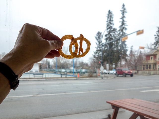
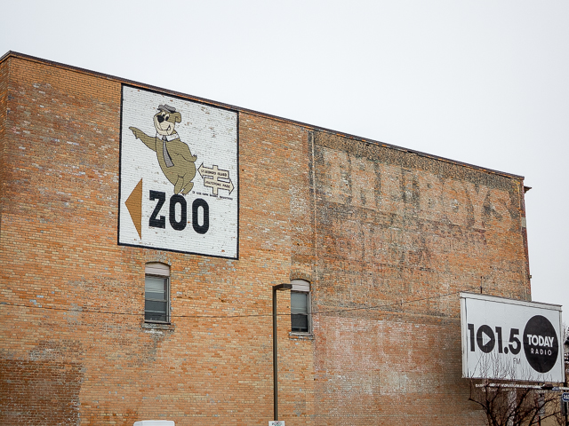
A block later pass the Inglewood Drive In, old school in every way and dating back to 1959. An Inglewood institution, we make this our lunch stop – major calories here – good thing we’re walking it off! A oddly shaped onion ring keeps us amused. Peace symbol? Two rings intertwined, speaking of a solid relationship? What ever…it was yummy! Back on the road, look for the Yogi Bear Zoo sign. It’s been pointing the way for sixty some years and every kid knew they were that close when it came into view.
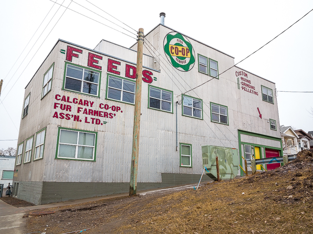
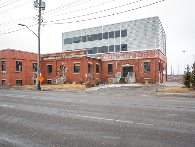
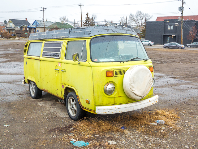
Continue down 12th Street SE (latter morphing to 11th Street). Along here, there’s a number of historic buildings, a former Feed Mill (circa 1940s), home to other business now, and over there, a new addition (circa 2015) put atop the CC Snowdon Building (circa 1911). At the site of the old (and notorious) Shamrock Hotel, an old Volkswagen Microbus commands out attention. A sticker on back reminds us that Jesus loves it when we use turn signals. Left (west) on 21st Avenue SE, passing the Valiant House (after the car – always some parked here), then it’s left on 9th Street SE. Along here is an entire block of century old houses boarded up and due to be demolished. It’s suggested plans are on hold, what with the economy in the pooper, but as soon as oil rebounds it’s curtains for these.
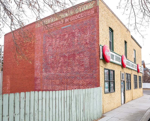
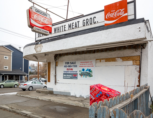
Right on 23rd Avenue SE. Along here, watched over by historic homes, it’s footprint memorialized in a section of sidewalk placed long ago. Right on Spiller Road (formerly MacLeod Trail). It’s more old homes, one of Calgary’s fine sandstone schools and remains of a gas station. At 19th Avenue SE, a couple block diversion takes in the Alberta Corner Store, still in business and looking every bit the same as it has for decades. The city says it’s from 1940, but we think it older. On the west facing wall it’s ghost signage: ”Everything in Groceries”. Most of the lettering was too faded to read. Since we’ve always approached the business from the other side, we’ve never seen these. And here you thought we knew of all.
Yes, we bought lotto scratchies…and yes, we didn’t win. Be sure to patronize this business should you pass so that it continues to operate. It’s one of the last of its kind.
Back on Spiller Road, morphing into 8th Street SE here, and soon it’s another corner store. Here’s Black & White Grocery, circa 1948 but closed up a few years back with the redevelopment monster looming. We used to stop here all the time. The B&W has an attached home for those who owned the place, as was typical for the time (the Alberta Corner Store is similar in this regard).
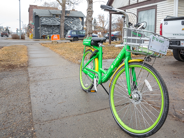
Along here, more old homes, all quite charming, most in good condition. Odd how many Lime Bikes we saw along this section. This firm has since ceased business in the city.
There’s the old Penguin Car Wash. At the core is a building dating back to 1940s that was once a gas station. Of course, the land is due for redevelopment. Cross over the tracks – this day a train came and so we had to duck under it by Elbow River. Back on 8th Street SE, come to a footbridge over the river and head west on the pathway. Wander in behind Fort Calgary, a museum, then it’s left at the George King Bridge. Here we’re at the edge of the revitalized East Village, once a s**thole bad neighbourhood (but one we loved), now being reborn. Think trendy condos and boutique coffee shops but most of all think this –> $$$$.
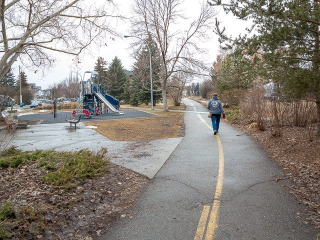
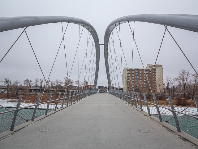
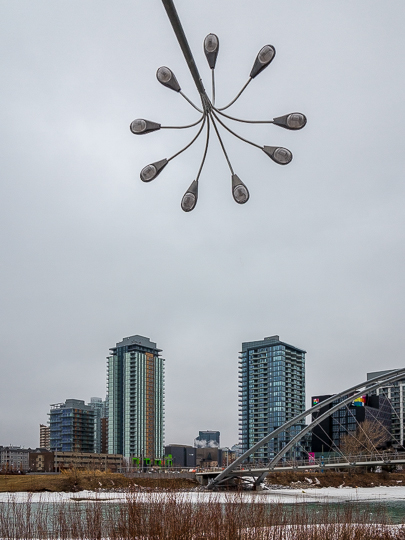
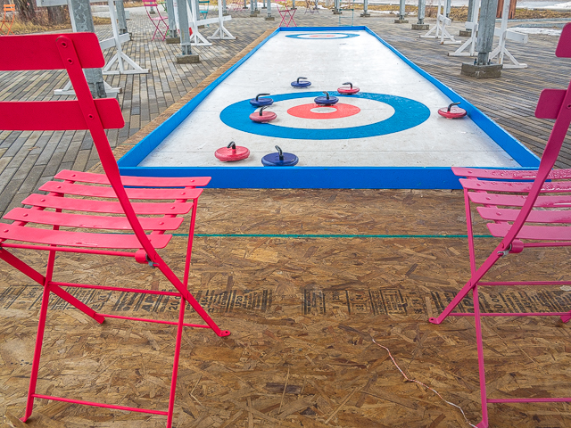
Go right on the ramp leading down to St Patrick’s Island, a pleasant wooded park west of the zoo. To your right is “Bloom” a sculpture made from light standards done up to represent flowers. Along here, a toboggan hill (no snow this day) and a mini-curling rink. Haste firm! Rush solid! Oh…it’s hurry hard. Continue eastbound, duck under the road, cross the Baines Bridge and come to the Bow Pathway again (north side edition). Go right (east).
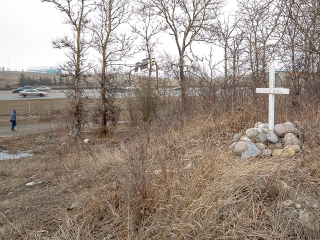
Moving on, to your right across a side channel it’s St Georges (aka Zoo) Island and to your left more zoo lands (it’s a big place). Cross Nose Creek, duck under that train bridge again and come to some old ruins connected to the Western Irrigation District canal which you just crossed. Along here, the pathway is very close to busy Deerfoot Trail. To say it’s noisy would be an understatement. What?! This is the only unpleasant section, but it’s soon over. Hardly the peaceful setting for a memorial, but yet there’s one here. A few years back, one William Kuhl met his end over there in Harvie Passage (behind the camera position). Back in motion, come to a large wooded area. In the 1970s, a motel and trailer park stood here. How do we know? Stayed there as a kid.
Cross over the Bow on 17th Avenue SE, the it’s left on 19th Street SE. Pass the Blackfoot Truck Stop (great breakfasts there). Left on 9th Avenue SE, pass another iconic sandstone school and in mere moments you’re back at your car. Across the road, a large empty space once home to an oil refinery and account ugly stuff in the soil, probably never to be built upon.
There you have it, fourteen and some clicks of awesomeness under the belt. We did a little train spotting, surrendered to voyeuristic intentions (What, naked vacuuming?!) and chowed down on some fine old school drive in fare. Plus we got in a good workout. Win!
If you wish more information about this route, by all means contact us!
Date of adventure: March, 2019 Location: Calgary, AB. Distance: 14.5km loop. Height gain maximum: Negligible. Height gain cumulative: Negligible. NOTE: all distances and heights are approximate.
It’s a sad ending to beautiful homes. I do neighborhood rehab in Edmonton as a heavy equipment operator and have seen so many of these homes get torn down; in some of our oldest neighbourhoods.
It’s a double edged sword. Not all of the homes that have been torn down are condemned or beyond fixing up; but are in the way of progress to build in a much demanded area. More often than not, they make way for modernized skinny homes or duplex’s.
It’s interesting taking a drive through these neighborhoods a year later and seeing the symmetry of the houses change. You end up with what I personally think is a Frankenstein type skyline. Timeless older homes next to progressive mansions and skinny homes seems out of place.
To see these older homes get torn by excavators, then have magnificent trees cut down to make room for the infill is incredibly disappointing.
Just my observations on an ever changing landscape that I am professionally and emotionally attached to.
I love the colour of the house. Sadly, there is little choice but to demolish very old homes. My Grandparent’s home was demolished and replaced by a fabulous home.
It could be for any number of reasons really, but here I suspect money in the motivation. Someone shows up with a dump truck load of cash and a redevelopment permit in hand and no one can resist.
We used to do something called the "pointless challenge" 🤪 and miss those days. It was so much silly fun and often frustrating as heck. In these we'd invite people to send in random photos of obscure locations, but not give any information, and then we'd track where it was and shoot something similar.
Most of these came from old family collections, as was the case here. Anyone up to resurrecting the series?
In hindsight, why didn't we pose someone in our shot?
Pointless: “Devoid of meaning (or) senseless” Merriam-Webster.
If you like what we do and want to support this ongoing project (12 years now), go here: https://www.BIGDoer.com/help-the-society/ Thanks to Connie for making this post possible.
Exploring history with Off the Beaten Path with Chris & Connie. Photo: ca1970 and 2014. Posted by Connie.
Captured on a cold, cold day many years ago. We've been passing this old house for decades and it's little changed in that time. At some point we expect to drive by and it'll be gone.
Exploring history with Off the Beaten Path with Chris & Connie. Photo: 2017. Posted by Connie.
When retired old railway cars usually get cut up for scrap. Sometimes, however, they find their way into the hands of the general public or whomever. Flat cars make good bridges, and boxcars can be transformed into storage buildings and the like. Case in point here. We see them used like this often enough and in this case, it's part of a corral.
Incidentally, this boxcar dates from 1950 and this was found by tracing the old road number, which is still visible.
Exploring history with Off the Beaten Path with Chris & Connie. Photo: 2017. Posted by Connie.
This central Alberta racetrack was never a commercial operation but instead just a fun place for car enthusiasts in the area to get together. Early '70s or thereabouts and it only lasted a few years. Even thought it's been abandoned for that long, there is no doubt what was here.
You know we like the the obscure stuff and this one fits the bill perfectly. Found by accident while backroad cruising and the history comes thanks to local car guy Mike.
Exploring history with Off the Beaten Path with Chris & Connie. Photo: 2022. Posted by Connie.
On top of little Myrtle Mountain in the Kimberley (BC) Nature Park.
There's some good wilderness fun to be had here and nice views as you can see, but the real reason we came is mining history. The whole area near the ski hill was extensively worked over a century ago and we were looking for evidence of this. We didn't find much in the area searched, but it's a big chunk of property and we hope to return to cover more ground again soon. Of all the subjects we cover, mining related is a favourite.
Still, it was a good hike and that can't be bad. Look to the comments for more info 👇.
Exploring nature and history with Off the Beaten Path with Chris & Connie. Photo: 2022. Posted by Connie.
It's a strange curiosity in south Kananaskis, there on a hillside and we have no idea who created it. We asked around and no one's completely sure about its history. In the past it showed the Canada 100 logo from 1967 but in 2017 someone changed it to reflect the country's 150th.
That's our friend Emily from DanOCan.com having a look.
Exploring history with Off the Beaten Path with Chris & Connie. Photo: 2017. Posted by Connie.


")


The remnant of the Zoo bridge doesn’t quite have the same charm as the original structure.
Agree, it lacks character. The old bridge had that in spades.
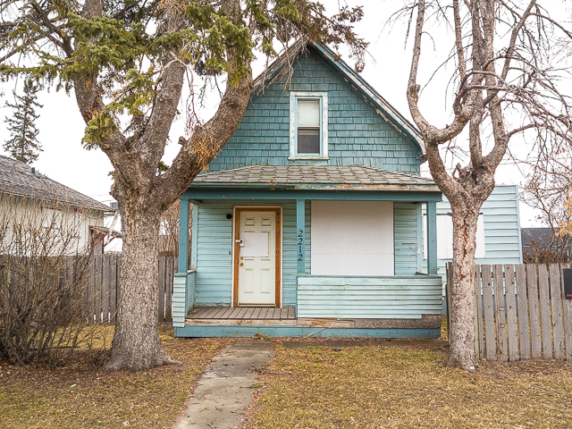
I would like to live in a house painted that colour. And the front porch is nice.
Everyone comments on the colour. It’s nice.
Love this.
That makes us so happy.
It’s a sad ending to beautiful homes. I do neighborhood rehab in Edmonton as a heavy equipment operator and have seen so many of these homes get torn down; in some of our oldest neighbourhoods.
It’s a double edged sword. Not all of the homes that have been torn down are condemned or beyond fixing up; but are in the way of progress to build in a much demanded area. More often than not, they make way for modernized skinny homes or duplex’s.
It’s interesting taking a drive through these neighborhoods a year later and seeing the symmetry of the houses change. You end up with what I personally think is a Frankenstein type skyline. Timeless older homes next to progressive mansions and skinny homes seems out of place.
To see these older homes get torn by excavators, then have magnificent trees cut down to make room for the infill is incredibly disappointing.
Just my observations on an ever changing landscape that I am professionally and emotionally attached to.
Well said. Progress marches on and sometimes we like it, and other times no.
I love the colour of the house. Sadly, there is little choice but to demolish very old homes. My Grandparent’s home was demolished and replaced by a fabulous home.
That colour rocks. It’s sad these old houses go, but change is inevitable. That’s the reality.
Awesome images, the little teal house is so cute.
Isn’t it?! That colour works so well for it.
Why the demolition? Sad what they destroy so many in western Canada for starters..
It could be for any number of reasons really, but here I suspect money in the motivation. Someone shows up with a dump truck load of cash and a redevelopment permit in hand and no one can resist.
I remember the Valiant. Close to the Shamrock. He had several.
This day there was only one that we could see. I’ve seen up at least two any other time we’ve passed there.
Wow, so many familiar places from home. Thanks for the tour!
Our pleasure! You lived in Ramsay or Inglewood?