
Mt Hoffmann outlier
Our original intention was to summit Mt Hoffmann, a modest size bump in the front ranges up the Sheep River valley. An error in navigating however takes us to an outlier, not a bad destination in itself. While at the top, we take cover and bid our time as storm after storm rolls in. And on the way home our car gets written off.
This trail starts at the Indian Oils day use area west of Turner Valley AB. Following parts of the long distance the Sheep Trail initially, we cross the bridge over Tiger Jaw falls. It’s a stunning waterfall, especially at times of high flow, but the bridge and steep canyons kind of make it hard to get a good picture. Just after the bridge turn east and head up. This part of the trail is frequented by horses so watch for road nuggets. It’s a former logging road here, so it’s well drained and wide and not terribly steep.
After perhaps a kilometre or two, just before a dip in the road, there is a smaller almost indistinct road heading back and up off to your right. This is the path to take and it switchbacks once then turns south. It’s a bit overgrown in places but not hard to follow.
Rounding a bend, we come to a meadow and it’s here you can find remains of a lumber camp. There are some old bed frames, a stove base and other bits of flotsam and junk. This camp was in support of a logging operation on the flanks of Mt Hoffmann (before Kananaskis stopped this practice – these logging roads make nice trails though).
Turning west now and still gaining elevation we continue to follow the old road up. Shortly after we come to a junction with the more obvious trail heading to the right. It’s here we go wrong – instead we should have went left even though the trail is more indistinct. Not that the error was a big deal, since we are still rewarded with a fun trail that lead to some nice views. It’s here we leave the Mt Hoffmann trail. It looks like others have done this as well.
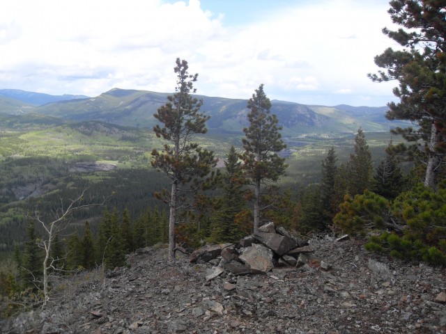
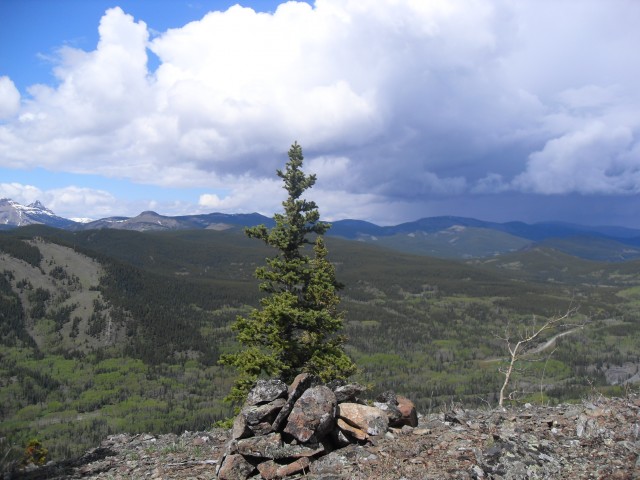
Hitting a saddle we head east up a small bump. The summit here is treed and provides little in the way of views. But further east is another bump of similar height and it’s more open – the outlier of Mt Hoffmann from this report.
We bushwhack our way to it heading though sometimes dense growth and we loose some elevation and then gain it back again. Here at the top we are almost directly above our starting point.
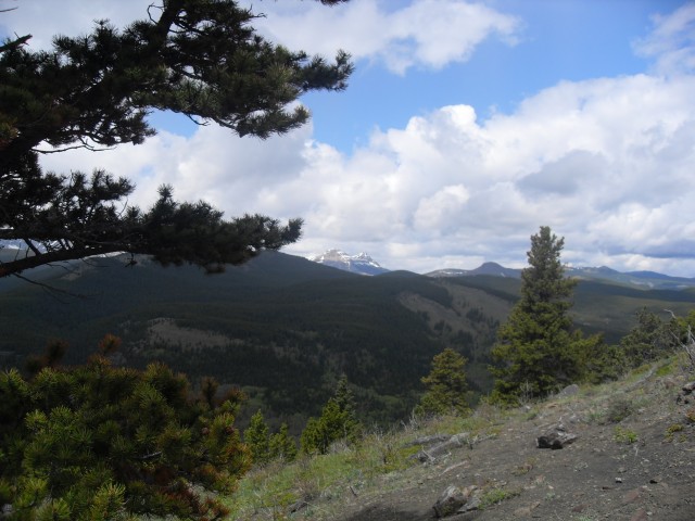
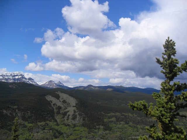
To the east we have clear views of Green Mountain, more aptly described as a big hill. To the north rolling hills stretch off to the horizon. And to the west, we see the big boys – Gibraltar Mountain, Mt Burns, Bluerock Mountain and the more modest sized Mt Ware. Somewhere in the distance too is Missinglink Mountain (I LOVE that name), but it’s small like Green Mountain and hard to pinpoint. We also have a clear view of the highway below.
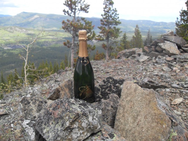
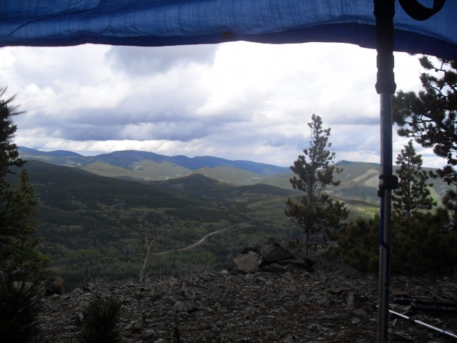
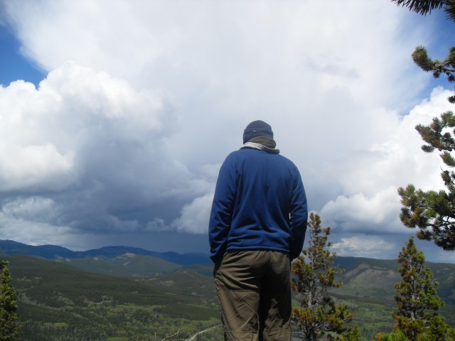
Then there’s the downpour. Whoosh! We set up a tarp in some trees, take cover and enjoy our lunch and some Champagne. Not sure why, but it felt like a Champagne day. And then the rain stops…and starts again…and stops…and starts. We had plans to backtrack to the summit of Mt Hoffmann proper but the endless deluge dampens our spirits. Instead we head back to our car during breaks in the weather.
Back at the falls we have a clear view of our “summit”. We’ll call it Mount CnC.
Heading home we come into some heavy traffic in town. Glenmore Trail is at a standstill and so we sit. So does the car behind us. But not the motor home approaching – it hits the car behind us at full force shoving it into us. We’re propelled into the right lane (it’s a merge lane and was free of cars – thank God) and after coming to a stop some distance away we sit the for a minute get out heads together. We’ve been rear ended and most of our trunk now sits in the back seat. And my seat is broken right off the floor and the car itself has a noticeable bend in it
It’s here, account of some driver’s inattention, that things in our life take a drastic turn. I doubt we’ll ever be the same again. We can still hike and and we can still scramble, but not with the vigour and energy we had before.
The Mt Hoffmann trail is unofficial and does not appear to be well used. However it has been included in the latest Kananaskis Trail guide by Gillean Daffern and this will likely see it become more popular over time. I listed this route as a hike and summit but in all honesty it barely qualifies as the later.
Outlier: A secondary lower high point physically connected to a larger summit, usually via a saddle or ridge, but not a true mountain in itself.
On a later trip we made the summit of Mt Hoffmann and to see this report, click the link below…
Mount Hoffmann.
We hiked a stretch of up the Sheep River Trail mentioned in this report to read about, follow this link…
Sheep River to Burns Mine part 1.
If you wish more information on this trail, by all means contact us!
Date of adventure: June 2011.
Location: Kananaskis AB, Sheep River area
Distance: 7km return.
Height gain from start: 380m.
Height gain cumulative: 450m.
Technical bits: None.
Notes: None.
Reference: Kananaskis Trail Guides by the Dafferns. Some of our route was off-trail.
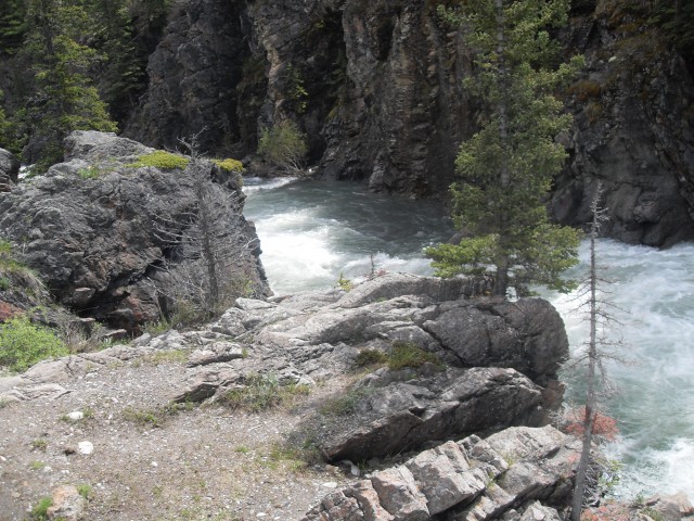
The canyon just below Tiger Jaw Falls.
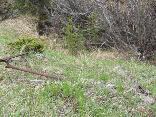
An old bed frame at the lumber camp.
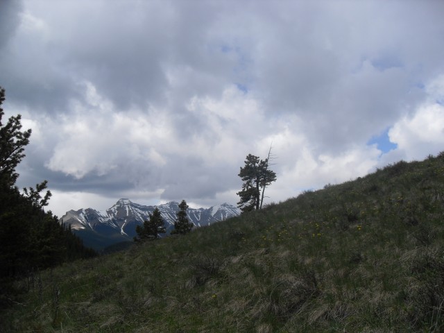
Heading up the outlier.
On the way up, the view to the northwest.
At the top with Green Mountain in back.
It’s a Champagne day! And then the rain starts.
It rains hard so we set up a tarp to enjoy our lunch.
Enjoying the views between thunderstorms.
Looking north, Mt Ware is the bare bump to the left of centre in the back.
Bluerock Mountain is seen on the far left.
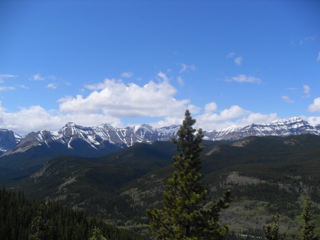
Mt Burns on the left and Bluerock on the right.
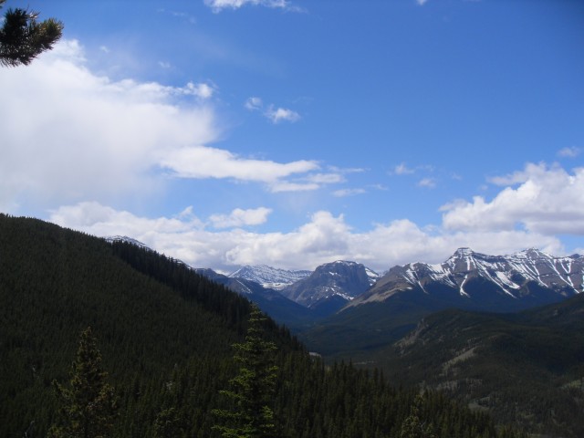
Gibraltar Mountain in the centre distance and parts of Mt Hoffmann in the foreground.
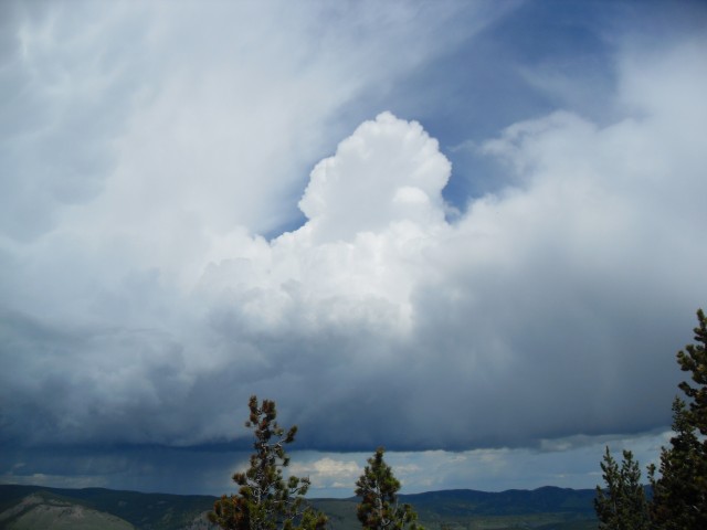
The clouds build up yet again.
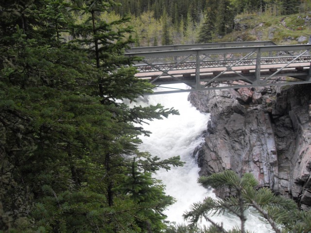
The bridge over Tiger Jaw falls.
Looking back at the bump we were on.

On the way back we have a little run in with a motor home.


Comments are currently turned off