CPR Illecillewaet Bridge Revelstoke BC
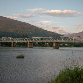
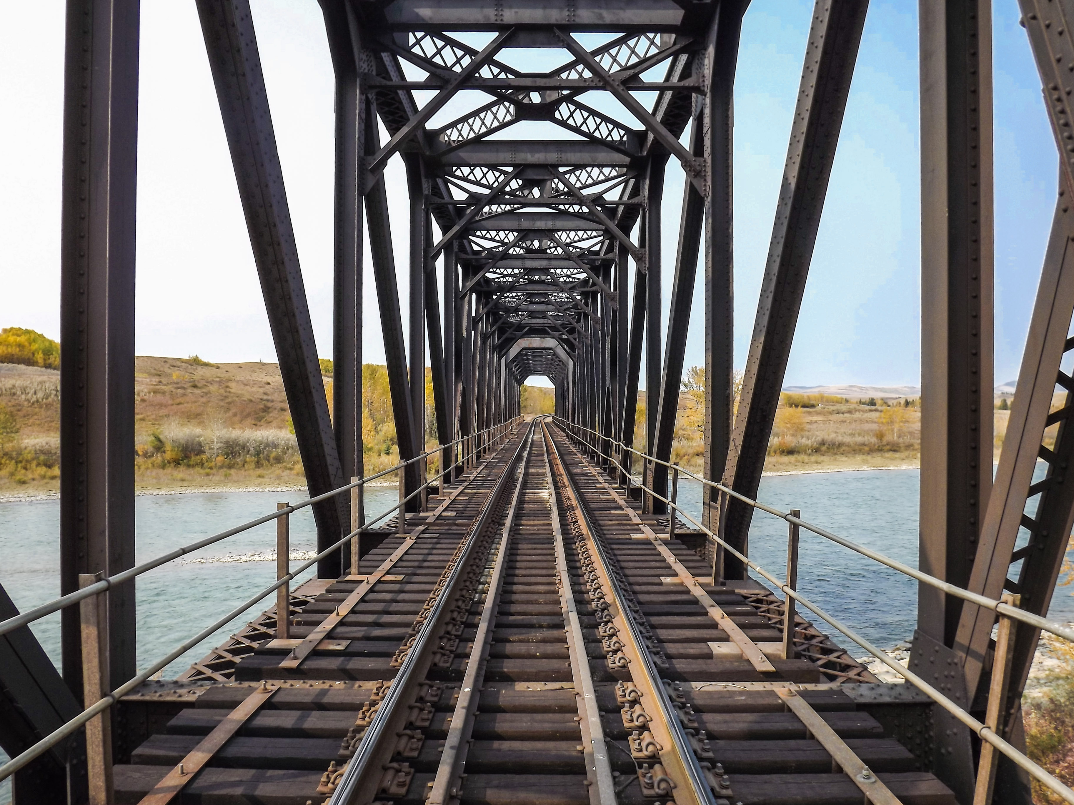
A hundred and twenty years, approximately, separates the two images used in this Then & Now. In the original we’re looking at the Canadian Pacific Railway’s Illecillewaet Bridge in Revelstoke British Columbia and in the second the Mark Kingsbury Memorial Bridge occupies that same spot today. The latter is for foot or bike traffic even if it’s built in the style reminiscent of a railway structure.
The then photo is the scan of a vintage postcard (estimated to be from 1900-1910 period) and sent in by a seller on Ebay. Thanks WinstonJefferson for the fun and enjoyment it brought. The publisher is the Copp-Clark Company Limited of Toronto Ontario and interestingly this firm founded in the 1840s remains in business today.
CPR Illecillewaet Bridge Revelstoke BC: a similar view but well over a century apart. More dollar store history with Chris Doering & Connie Biggart (BIGDoer/Synd).
It seems Copp-Clark produced postcards starting around 1900 and into the early 1910s at least. While this example is undated it would be safe to assume it’s from this period (plus there’s other clues to help date it). Most of their postcards shows street views or town scenes and we saw locations from all over Canada in their offerings.
The contributor also sent in a scan of the back of the card and we noted someone had written “Mile 1.29 Arrow Lakes Subdivision CPR” plus the number “4(?)20” on one corner. The card otherwise looks unused and never mailed.
We welcome reader submitted photos for this series and please contract us if you have an old family picture or vintage postcard you think could be used this way. Broad street or scenic shots work best and they must be your copyright or in the public domain. Most postcards are.
In the Then photo we’re looking down the tracks from the south side of the Illecillewaet River and towards Revelstoke. Town’s not far away. A couple folks can be seen on the structure and if you look close you can see both sitting off to the left, on a beam. What’s the story and who are they? It’s on our minds and probably yours too.
That image isn’t terribly sharp, but it appears to be a man and lady based on the hats visible. Chapeaus were big business back then and for each gender distinctive. Formal hats, casual hats, everyone had a hat and always wore a hat!
The Illecillewaet Bridge in the old photo is made of large timbers and original to this line. We’re along the Arrowhead Branch here (not Arrow Lakes as said on the card), built in the 1890s and running south to its namesake community from Revelstoke. Built mainly to connect with sternwheelers plying Upper Arrow Lake, it paralleled the Columbia River the whole way down.
Due to a dam, the Columbia just downstream of Revelstoke is now part of the Arrow Lakes. For the most part.
A steel truss bridge replaced this wood structure at some point and we suspect early on. Photos from the 1920s (exact dates unconfirmed, but somewhere close) shows a different structure in its place. Wood truss bridges are generally temporary anyway and put in as a low cost stop-gap measure.
The steel Illecillewaet Bridge remained in use until the line here was abandoned and pulled up in the late 1960s. That’s long after the lake boats stopped running and traffic by this point had slowed to a trickle. The rising of Upper Arrow Lake due to a dam downstream is what ultimately doomed the branch, but we can surmise the CPR would have been happy rid itself of it earlier, had government regulations allowed. You needed a good excuse to abandon a line back then and they found it here.
A parallel road bridge once stood right beside from at least the late 1910s and onward. This road also got rerouted thanks to rising waters and directly below the comparison image is a shot taken from the old bridge approach for it. Remains of its paved surface further south can still be found on the flats, dashed lines and all, but nature is taking over. This odd highway through the grass is now part of a walking trail but at one time, the only way down the valley.
The old railway roadbed is just to the east side, but so overgrown as to be impassable and sometimes it’s not even visible.
Regarding the rising waters. Revelstoke is at the upper limits of the Arrow Lakes reservoir and water levels just below town can vary as a result of this. Here on the south side of the Illecillewaet, the old Columbia River flats can sometimes be under water but mostly stay dry. It all depends.
The Columbia River just to the west is now slow, meandering and sometimes more a lake than river. The two waterways join just downstream of the Illecillewaet Bridge.
On our visit, someone had set up a homebrew disc golf course in the area and here’s us without our gear. We do play, but very, very, VERY badly. The “holes” are suspended red metal cylinders hung off trees and they chime when hit.
The current Illecillewaet Bridge for pedestrian use was placed here late in 2011 and dedicated the following summer. The cost: three quarters of a million baby! The Mark Kingsbury Memorial Bridge is named after a former president of Canadian Mountain Holidays, whose foundation made a $100,000 donation to the project in his name. This new crossing reuses the old concrete abutments from the earlier steel railway bridge.
That it’s in the form of a railway bridge but made smaller, is deliberate. It made sense to honour the railway this way but it seems they had other ideas at the start. “It is a departure from the suspension bridge design initially envisioned…” Revelstoke Review Newspaper.
The angle of our now photo is not exactly the same and this due to changes in the railway approach over time. But it’s close enough. The hill in back, a lower flank of Mount Revelstoke, helps tie the two eras together and it’s timeless scene.
The Revelstoke Museum and Archives has a scanned copy of this same postcard online and displays a dated cancellation of April 20th, 1920 from Rossland (British Columbia). This means it got sent and we would have loved to see the backside of that one for the message.
In the early 1970s, your author lived within shouting distance of this location (Illecillewaet Trailer Park & Cabins, a “five star” resort), but only briefly and never explored this far down river. Six or seven year old me had the bug to explore even then, but never went too far afield.
Know more: (new window): Mark Kingsbury Memorial Bridge Revelstoke BC.
They’re saying…
Chris and Connie have a unique way of documenting the places they visit, not copying the style or technique of others, but making it their own.” Alex Craig, Producer.
Also in Revelstoke…
Big Eddy Bridge Revelstoke BC over the Columbia.
BC is awesome…
Highway History (BC): the Garbage Gobbler also in Revelstoke.
JB Fletcher’s Ainsworth BC ~45 Years Apart.
CPR Water Tower Cranbrook BC.
Something to say and no one to say it to? Go here: Contact Us!
Date of adventure: Roughly 1900-1910 (original) and 2023 (Team BIGDoer).
Location: Revelstoke, BC.
Article references and thanks: Revelstoke Museum, BC Archives, Northern BC Archives and the Revelstoke Review Newspaper.
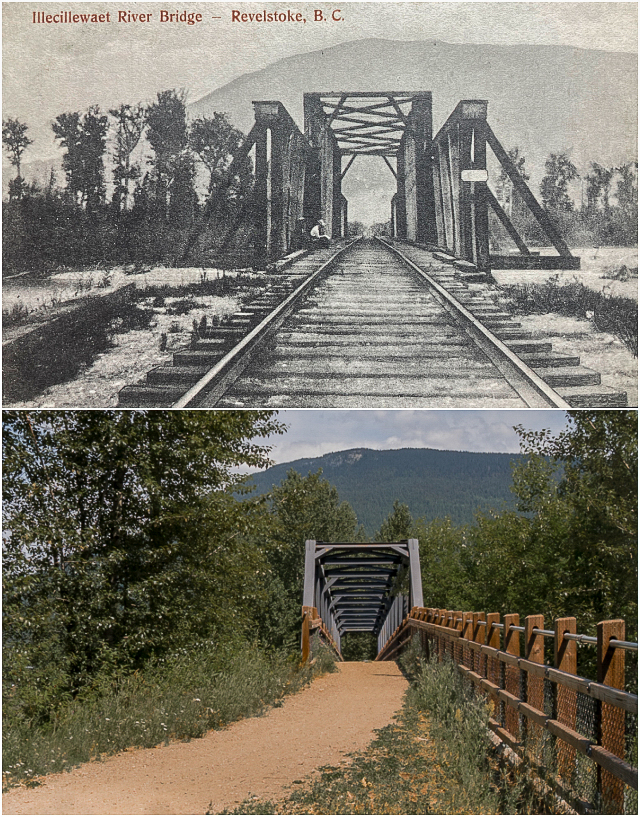
The same location in Revelstoke BC over 100 years apart.
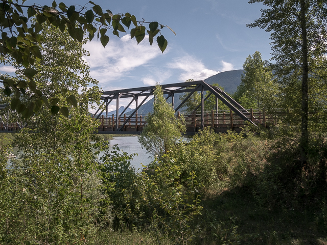
Today’s Illecillewaet Bridge (for pedestrians) viewed from the old highway alignment.
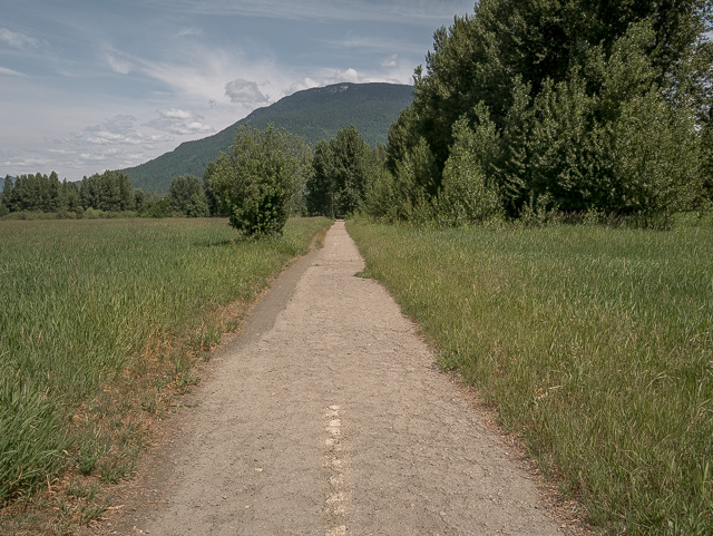
Nature’s reclaiming the roadway.
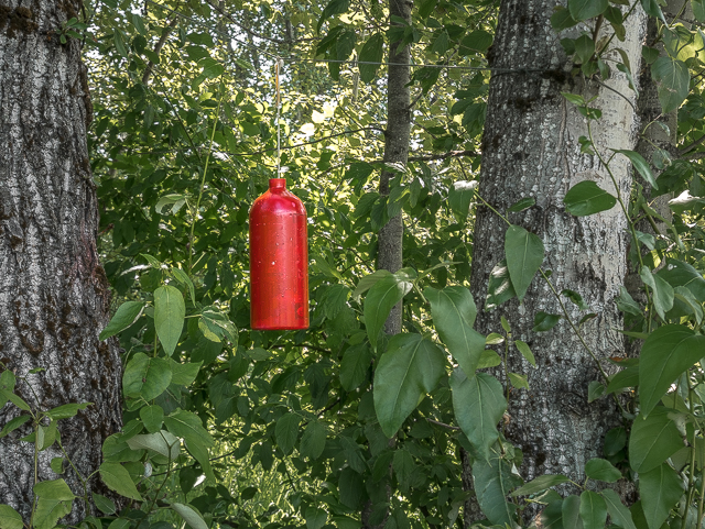
Someone set up a makeshift disc golf course in the area.
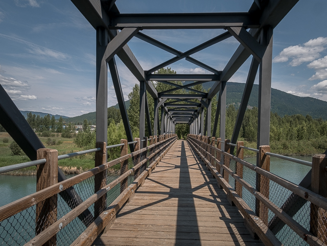
The new structure is built in the style of a railway bridge.
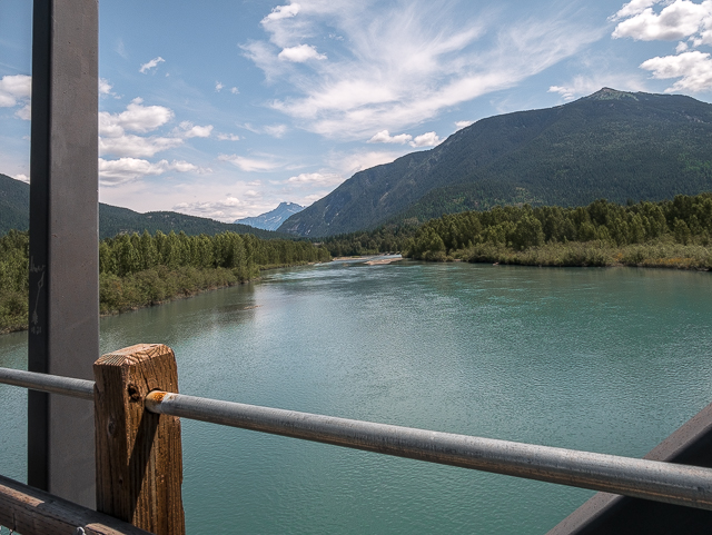
The Illecillewaet River looking upstream (east-ish).
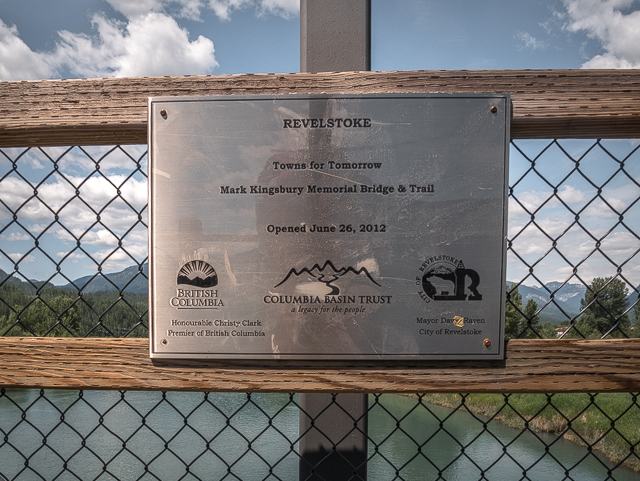
Mark Kingsbury Memorial Bridge officially opened in 2012.



Comments are currently turned off