
Cougar Creek
Cougar Creek makes for a nice outing if you happen to be in the area and are short on time or ambition. The hiking trail starts right in Canmore on the north side of town, and heads up a steep walled valley separating the huge Grotto Mountain from Mt Lady McDonald.
From the trail head parking lot simply head upstream following the numerous crisscrossing trails as they make their way up the creek bed – any of them is fine and they all eventually meet up. As long as you stay in the creek bed – if you follow a well worn trail that heads up on the west side of the canyon, you will instead head to a scramble route up the flanks of Mt Lady McDonald. I understand to the old tea house it’s an easy climb but beyond there can be a lot of exposure.
The stream and trail follows an interesting canyon so deep and dark at times that you’re often in shade. The wind blows down the confines of the valley and in the winter it must be a blustery place Mostly it’s solid and rocky although the larger stones can present a slippery challenge. Other sections have a carpet of moss or other low lying plants making for a nice soft understory. Trees in the area include spruce and fir with a smattering of deciduous trees thrown in for good measure. They grow small here, given the tough conditions.
You can go for much further then we did should you have more time on your hands. However at the point we turned around, the brush starts to get very dense and the canyon walls very close in making travel more of a challenge. The creek is not very big but none the less prepare to rock hop back and forth across it. This trip is best done in the fall when water levels are lower, otherwise you’ll be sure to get wet feet.
Part way up the canyon someone has gone through a lot of trouble making some interesting and very unique rock chairs and they surround a large fire pit in a flat area below a steep rock wall. Sitting there makes one feel like a knight of the round table.
Be sure to watch for climbers in the lower reaches of Cougar Creek canyon. These guys are crazy – but I guess many say that about us climbing mountains. At the time of our visit there must have been a dozen of them spread out within the canyon and we had a good time watching them.
On the way home, watch out for the very sneaky Canmore photo radar. We got dinged! They use a truck but rather than facing the same way as traffic, they sit on the opposite side facing towards you and shoot the images out the back window. Needless to say, it’s a bit sneaky and in talking with some locals this operation is clearly quite unpopular (there is even a website dedicated to it) and the artificially low speed limits are seen as a plain and simple money grab.
Update: July 2013. While we have not been back, it’s clear the spring floods of 2013 have impacted this trail. This creek made the news, it was flowing so high. Expect the whole valley to have changed. The trail may still be passable but you can expect new hazards along the way. Proceed with caution.
The abandoned Mt Lady MacDonald tea house mentioned in this article is due to be torn down this summer.
Follow these links to see some hikes we’ve enjoyed…
Headwall Lakes.
Spectacular Buller Pass.
Paget Lookout & Sherbrooke Lake.
If you wish more information on this trail, by all means contact us!
Date of adventure: October 2011.
Location: Canmore, AB
Distance: 10km return. More if you wish to go further.
Height gain from start: Negligible
Height gain cumulative: Negligible
Technical bits: None.
Notes: Prepare to get your feet wet. While in Canmore watch out for photo radar. They have some artificially slow-posted roads that make them a good income.
Reference: Kananaskis Trail Guides by the Dafferns.
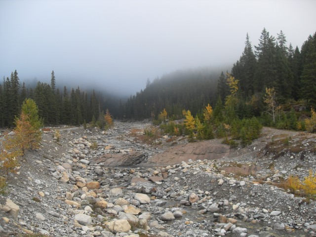
Near the start of the Cougar Creek Trail.
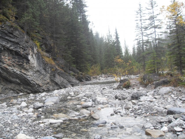
Deeper into the canyon.
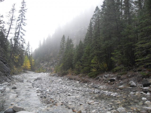
And deeper still.
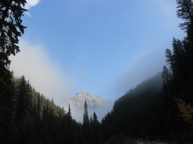
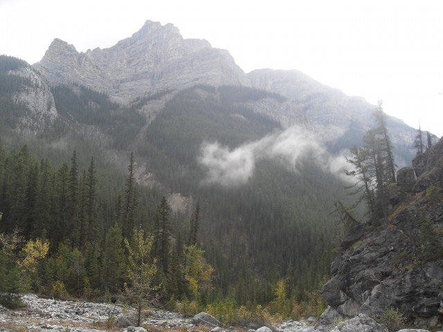
A mountain peeks out of the fog.
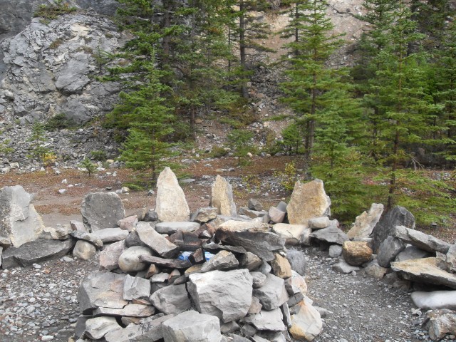
The round table, a great lunch spot.
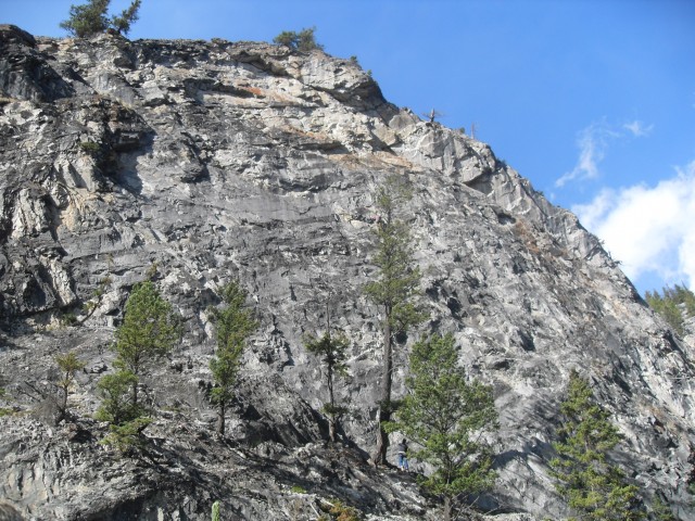
Looking up…
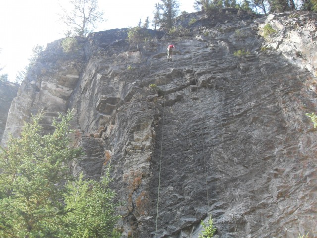
There were lots of climbers along the canyon walls.
Another climber (can you see him?) and his spotter.


")


")


The trail as you describe it is no more. You wouldn’t recognize the place. Those floods really did a number.
I guess this post is not really much help anymore. We’ll keep it up though, for the memories.
Love those chairs!