
Wasootch Ridge
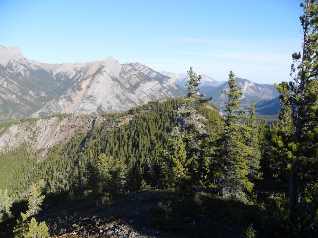
This easy to access ridge walk is very enjoyable and I highly recommend it. You’ll follow an undulating trail along the spine of Wasootch Ridge, gaining and losing and then regaining elevation the whole way. You’ll break out of the trees, head back into them and break out yet again. On either side of you are even higher limestone peaks and ridges, all begging to explored. And the views along it are superlative.
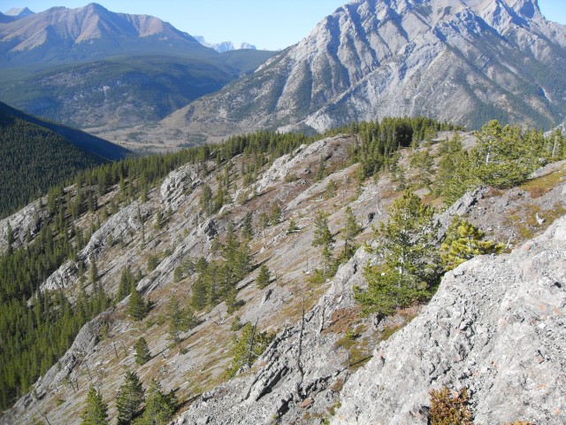
Start right from the Wasootch day use area parking lot – the route is the obvious trail behind one of the picnic spots. It quickly gains elevation and while there is loose scree in places, it’s nothing bad. Near the start you’ll be right above the Wasootch Slabs, an extremely popular rock climbing area. Busy except for the day I was there.
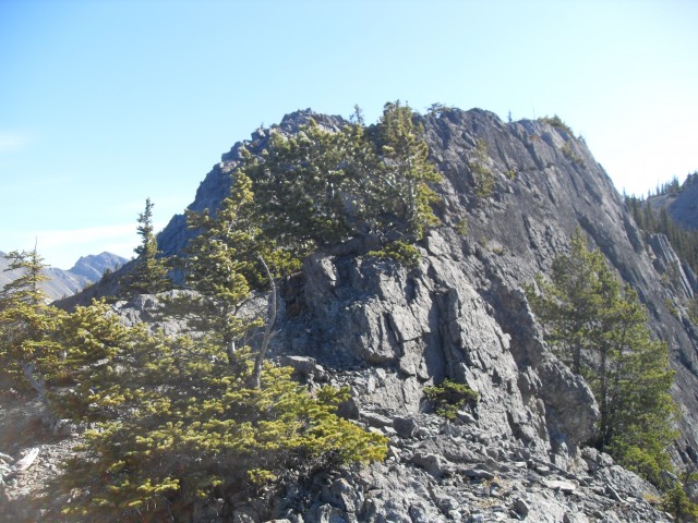
After a while the trail eases somewhat, but there is still much elevation to gain and some lost too due to the roller coaster profile of the ridge – all those ups and downs make it a real leg burner. With each high point the views get better and better.
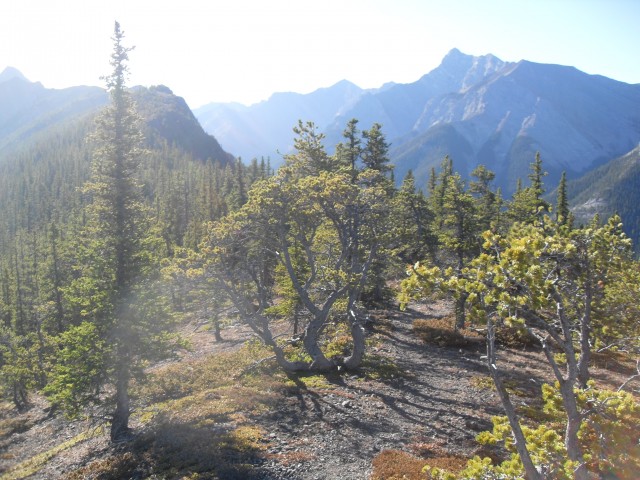
Gnarled pines along the spine hint of the heavy winds that are common in the area. It was fairly still the day of my visit but I hear strong gusts can appear without warning. Given its close proximity to the highway and the ease of assent, I understand this trail can be quite popular (even in winter). My only company though was a squirrel and otherwise I was alone. Good, just the way I like it.
At about the 7km mark is the Wasootch Ridge high point where most people including myself turn around. To proceed further, some hands-on scrambling is required. This means either tackling a crux head on or dropping down and skirting below it, neither which appealed to me.
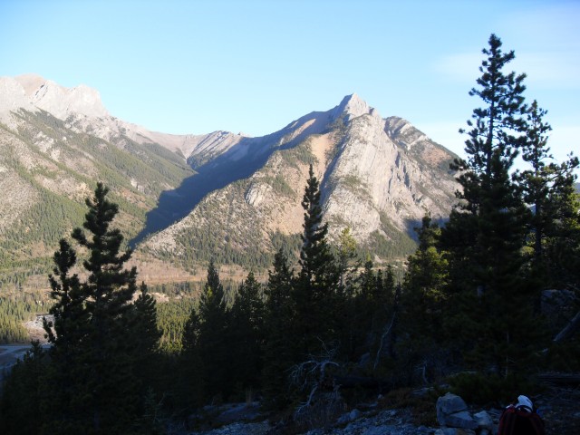
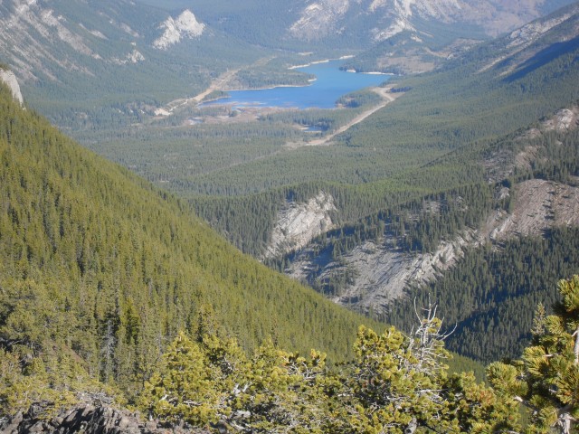
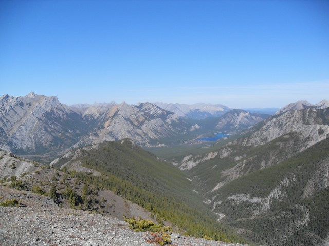
At the turn around point, take the time to soak in the views. Wasootch Peak sits across the valley to your north. I attempted that peak at one time, but was unable to summit. In the distance, you can see Barrier Lake along with the Kananaskis Highway (Highway 40). At the start of the ridge you have a good view of the Nakiska ski hill and Mt Allan. I hope to do that mountain some day.
Your companion for the whole trip but located far below and to the south is Wasootch Creek, visible almost the whole time you are on the ridge. It has a broad expanse of gravel flats and most of the time it flows underground (a common trait of front range streams). However in the spring, it can be a real torrent and logs and branches that be clearly seen from your lofty location hint at the power the creek can possess.
Now comes the hard part, you have to turn around and leave. I always find that part difficult. But I made sure to doddle so I could enjoy the time Wasootch Ridge and I had together.
Connie was a bit under the weather so I did this one solo.
The term Wasootch originates from a Stoney Indian word meaning “unique” and many features in the area share that name (Wasootch Ridge, Wasootch Peak, Wasootch Creek).
Looming over the ridge is Wasootch Peak, and to see a report on it, follow this link…
Wasoothc Peak attempt.
To see some other ridges we’ve explored, go here…
Carry Ridge.
Mesa Butte via Curley Sand Ridge.
Forget-me-not Ridge.
If you wish more information on this trail, by all means contact us!
Date of adventure: October 2010.
Location: Kananaskis.
Distance: 14km return.
Height gain from start: 940m.
Height gain cumulative: Perhaps a hundred plus metres more due to many ups and downs (my gps died).
Technical bits: Some scrambling if you go past the high point (I didn’t).
Notes: None.
Reference: Kananaskis Trail Guides by the Dafferns.
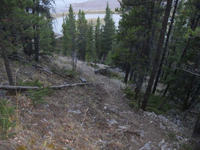
The Wasootch Ridge Trail starts off steep.
In spite of being in the trees for a way, there are some sneak-a-peak views every now and then.
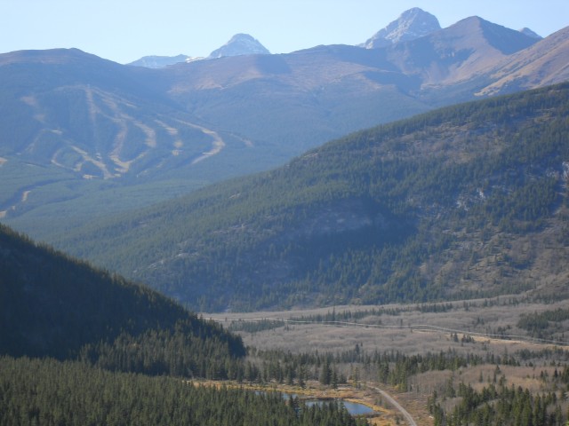
Nakiska Ski Hill on Mt. Allan to the west.
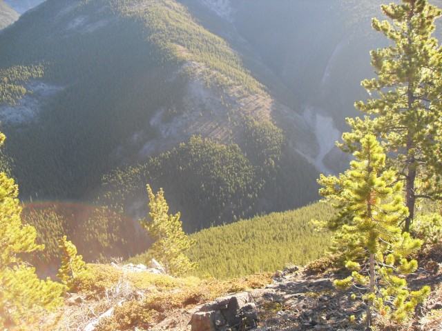
Wasootch Creek below.
Looking roughly south west.
The ridge I came up,
The ridge yet to come.
Barrier Lake to the northwest.
More ridge to go.
Near the high point of Wasootch Ridge.
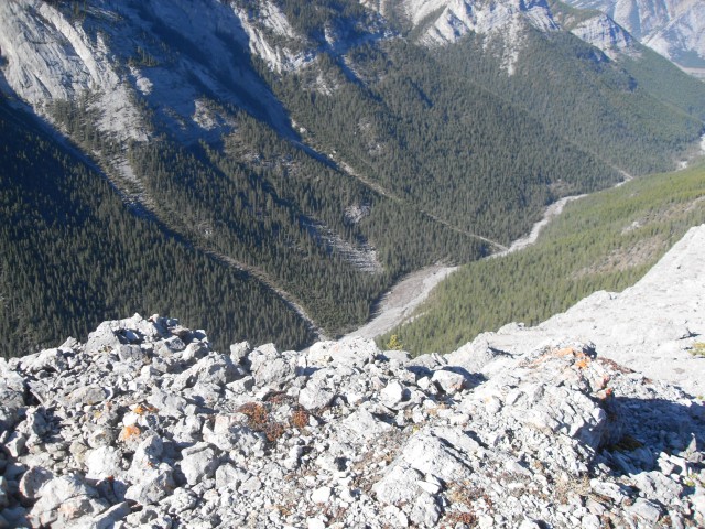
Looking down at Wasootch Creek from the high point.
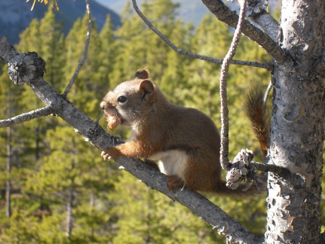
A friend on the trail.
")


Comments are currently turned off