
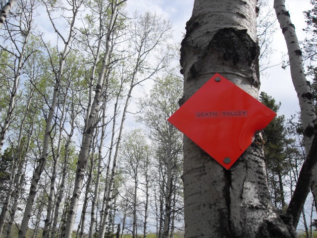
Death Valley – Windy Point – Foran Grade loop
At this time of year access to the mountains is limited, either by snow or due to seasonal road closures. This means we have to settle for hikes in the foothills, not that it’s such a bad thing. Any hike is a good one and while the views along this trail are not superlative, they are still quite pleasant. It’s also a good early season conditioner.
This route encompasses a number of trails to make a decent sized loop and if done counter clockwise, as we did, you’ll get some good views near the end. There are lots of side trails off this route, so it can come across as a bit complicated, but being official trails, they’re signed at all majors junctions and are marked by red diamonds as well. Official status also means dead fall gets removed.
These are equestrian trails so be prepared to meet riders on your trip (we saw none this day) and if wet it’ll be muddy and the trail chewed up by them. There are grassy meadows and low lying boggy areas on some sections too that are a prime mosquito habitat. Our last trip here was in a wet spring and it was a hellish experience and we were harassed by clouds of them, and Muskol did nothing to help. This trip we saw none. Given all this, our advice to you is to come only if its dry and you should be fine. Avoid otherwise.
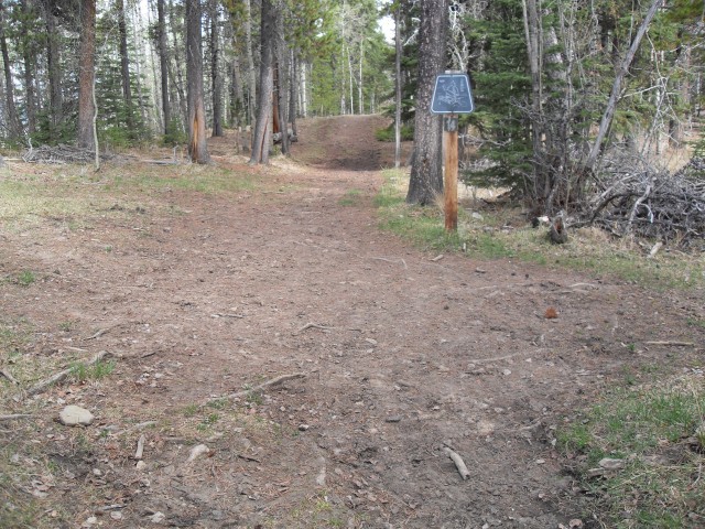
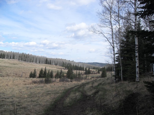
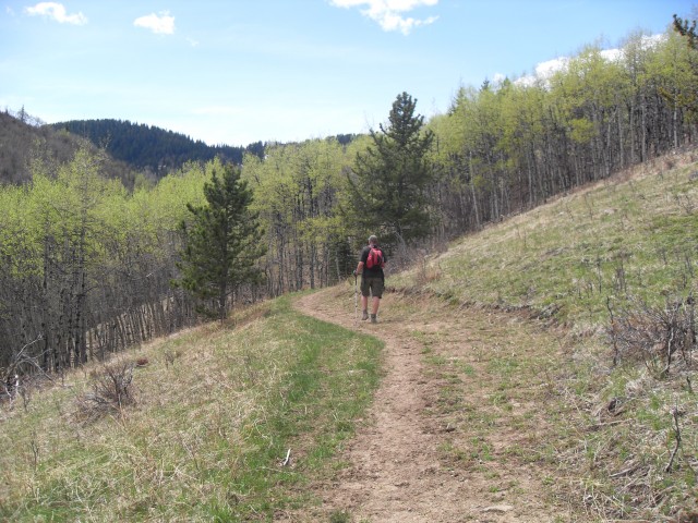
Starting near the Sandy McNabb campground at the winter gate, walk down the highway a hundred metres or so before turning right on the signed Death Valley Trail. For the next kilometre or so you’ll meander through a lodge pole pine forest with few views. You’ll pass through a drift fence (be sure to close any gates you open) on this section.
At the first singed junction head straight ignoring the trail going off to the right. It’s one of many coming in from the Sandy McNabb cross country ski tails, used in the summer by hikers and horseback riders.
Almost immediately you come upon another junction and in this case, go right traversing gently up the hillside. Part way up, another junction is seen – ignore it and stay on the route you are on.
Before long you top out on that small hill and there is an open meadow here with good views of the snow capped mountain to the west. And of course there is a junction. Stay straight ignoring the two cross country ski trails that cut across your route.
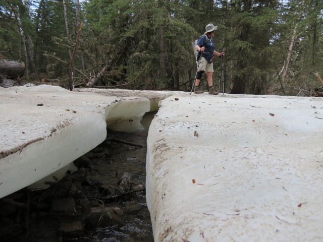
For next little bit the trail flanks a hillside, sometimes heavily wooded, other times in meadow, and all the while undulating as we go. At the first bridge crossing we come to a large ice flow – I measure it an the ice is over a metre thick in places. And surprise, there is a junction here. Turn right here and head up.
For the next bit things are for the most part uneventful. The trail around here has been rerouted many times (for reclamation) and so be sure to avoid the old parts if you can – let them heal – but if you do find yourself on one, rest assured it will meet up with the correct trail soon enough. Before long we break out into the meadows in the valley bottom. To the left, is Death Valley Creek lazily winding its way past. Some of the humps you see near the creek are actually ancient beaver dams.
For the next bit we follow the valley bottom and at a bridge (with a junction of course), we stay straight then almost immediately head left. To the hard right is a new trail I was until now unaware of, and straight ahead is a continuation of the trail you are on. Avoid both.
Coming to Death Valley Creek, we see it’s low and we rock hop across. Yeah! In years past, when it’s been much higher, we had to slog across barefoot (yuck mud). We are now on the Windy Point Trail and after climbing a small escapement we head left (south, or roughly back the way we came).
Staying in the valley for only a short while the trail almost immediately starts to head up, aiming for a saddle between two small hills (Windy Point Ridge and Foran Grade Ridge, our destination). There is not a huge amount of elevation gained here, although it seems like more given we still have our spring legs. Along here we in a mostly deciduous forest can see the scars from the Elk that live in the valley and they strip bark off the trees for food. It’s here, choosing a suitable fallen log as bench, that we have lunch.
After some fine food and wine, we’re back on the trail, in mixed forest now, and almost right away come to another drift fence. It’s here where a new by pass trail has been built, avoiding the marshy draw below. If you take the later, don’t worry, they all connect up at the saddle, which we’ll arrive at shortly. Here’s yet another junction and if you go straight and down, you end up at the highway. To the right is the unofficial Windy Point Ridge trail heading up to the namesake hill to the west. Ignoring both of these, we head left and immediately up.
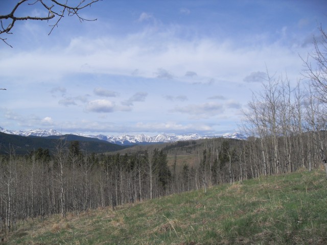
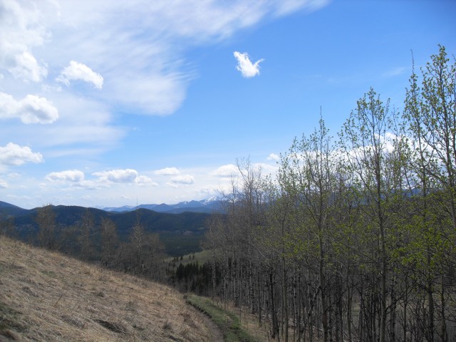
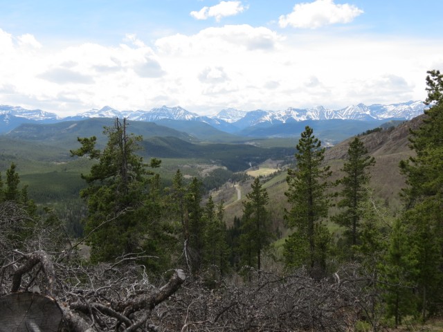
This is the route to Foran Grade and we quickly gain elevation via some switchbacks. Plunging into a spruce and pine forest, we soon top out. Initially the views are limited, but soon things open up and we are rewarded with wonderful vistas to the west. In the foreground is Windy Point Ridge and in the back other small hills can be seen, including Mount Hoffmann which we have been up. Further behind, the rugged limestone peaks of the front ranges can be seen and below, we catch occasional views of he Sheep River. There is still a lot snow on the higher peaks but warm weather will soon fix that. The empty highway (closed from December to mid May) can be seen snaking through the valley.
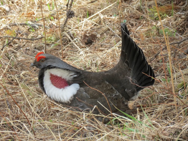
Staying on the ridge, we slowly loose elevation, but all the while the views remain good. It’s along here we capture some Grouse doing their mating routine. These animals, who area clearly some of the densest creatures in the planet, are easily approached, rarely running or flying away until you are right on top of them. Two males who have colourful heads and throat, displays their tail feathers proudly and coo deeply as they dances about. The female, who is rather plain in comparison, seems totally unimpressed with either.
You’ll sometimes hear people refer to these as Prairie Chickens, which is incorrect (there is a Grouse called by that name, but it does not live near here), so called perhaps because of their similar size and that they are as dumb.
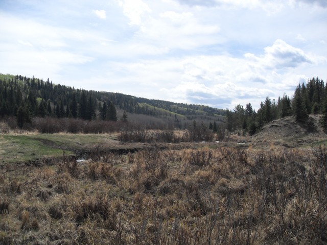
Loosing the ridge now, before long we are at a large open meadow and back on flat land. Passing through one last drift fence, we are at the highway. Here you can make two choices – you can pick the Sheep River Trail which parallels the highway. Or you can walk beside the highway itself, which is what we do. It’s closed and so there are no worries about cars. If it’s open to cars take the trail.
Before long we’re at the winter gate and back where we started, a fun day behind us. Again, this is not a spectacular trip, and you’ll never find us on it except very early in the season. In spite of that, we had a great time and got in some good conditioning.
It’s not clear where the name Death Valley originated from. Don’t let it fool you though and it’s not nearly that bad a place…unless it’s wet and muddy and there are mosquitoes, in which case you’ll wish you were dead!
We’ve done a number of adventures in the Sheep River area, and to see these trips, click these links…
Sheep River to Burns Mine part 1.
Sheep River to Burns Mine part 2.
High Noon Hills
Carry Ridge
If you wish more information on this route, by all means contact us!
Date of adventure: May, 2013.
Location: Kananaskis Sheep River area.
Distance: 16km loop.
Height gain from start: 230m.
Height gain cumulative: 480m.
NOTE: all heights and distances are approximate.
Technical bits: If wet, avoid.
Reference: Kananaskis Trail Guides by the Dafferns.
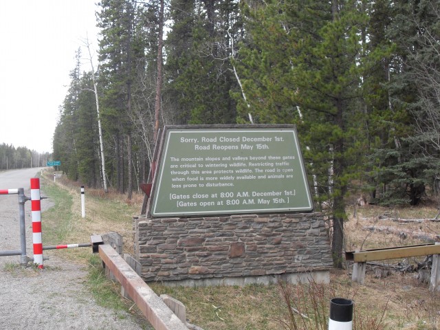
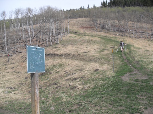
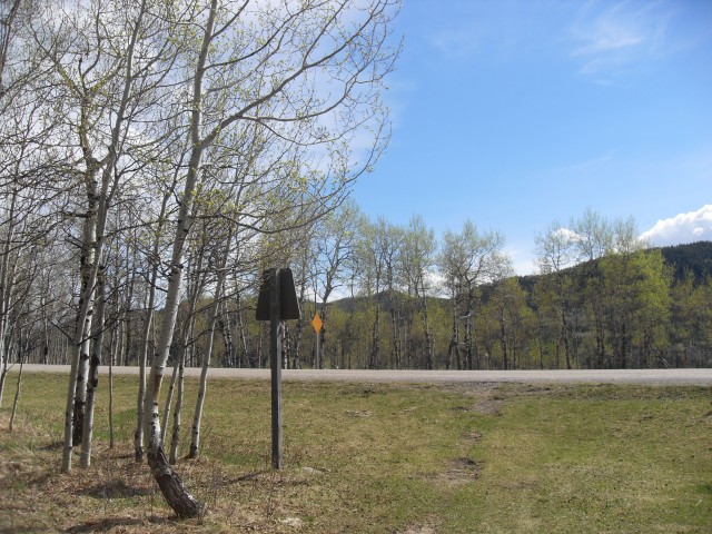
This trip starts at the winter gate near the Sandy McNabb campground and XC Ski trails.
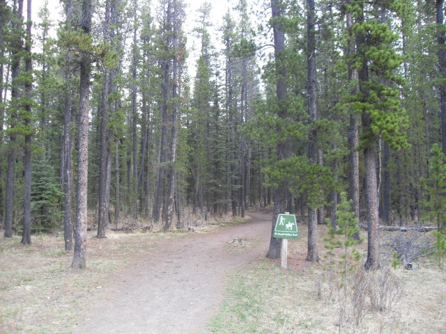
The start, on the Death Valley Trail.
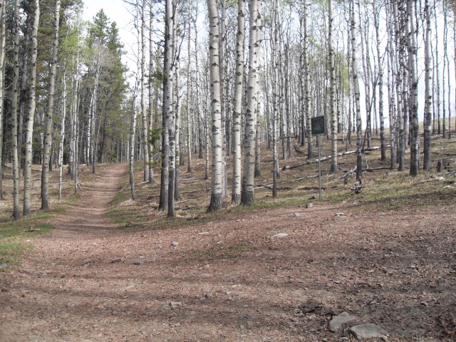
One of many junctions you’ll pass – see post for details on the route.
Another junction – turn right and climb the hill.
Most of the route is marked.
Looking west up the Sheep River Valley.
There are many junctions with the Sandy McNabb XC Ski trails but fortunately they are all signed.
A thick ice flow reminds us that winter just ended.
We break out into the meadows by Death Valley Creek.
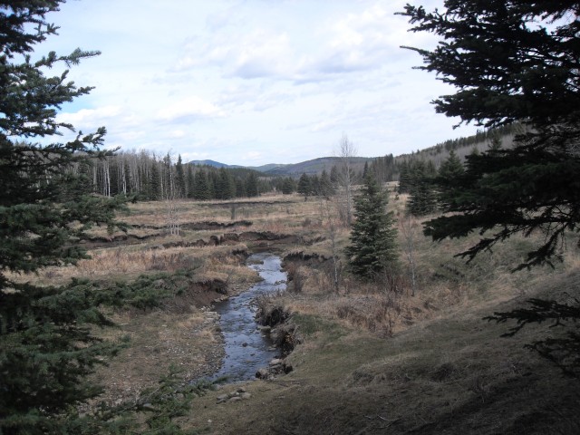
The creek is often a ranging torrent in spring but this year is dry and it’s but a trickle.
After rocking hopping across the creek we join the Windy Point Trail.
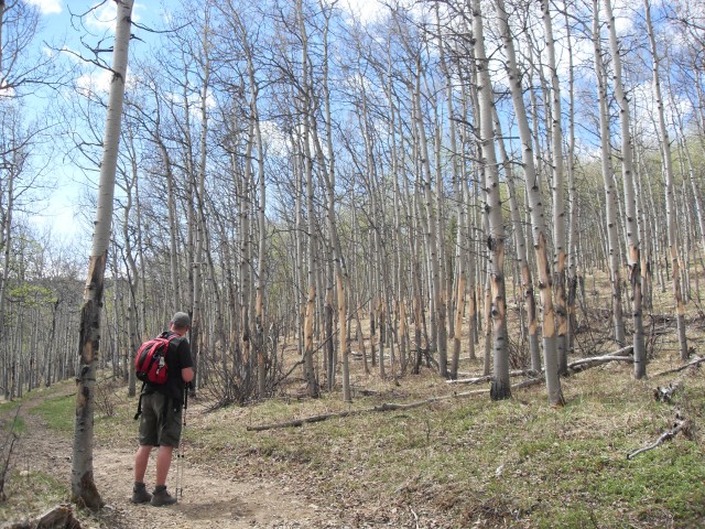
The Elk must have found these trees particularly tasty.
Our objective is the unseen saddle to the left of the green bump.
The Foran Grade junction where we head up.
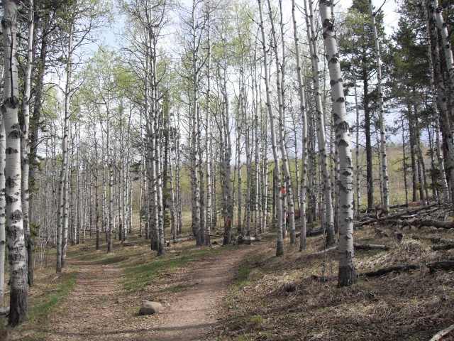
Spring has just arrived, and only a few trees had leaves.
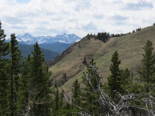
In front is Windy Point Ridge, just a little higher then where we are.
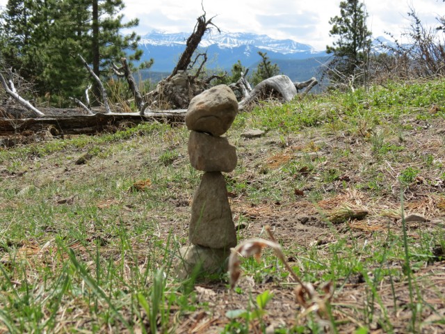
Someone did a good job balancing these rocks on each other.
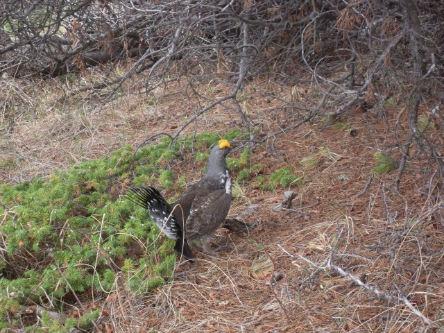
This male Grouse was doing a dance for a female.
Another is seen vying for the gal’s attention.
Treed Green Mountain in front on the left.
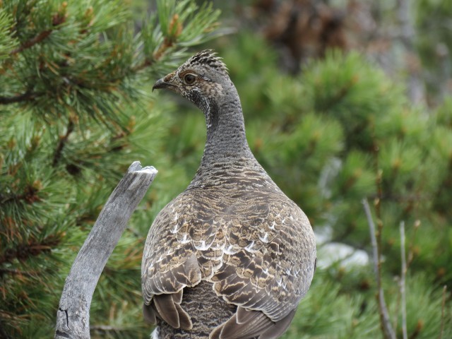
The female Grouse seems unimpressed with either male.
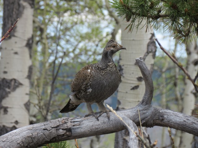
She’s not the least bit concerned with us either.
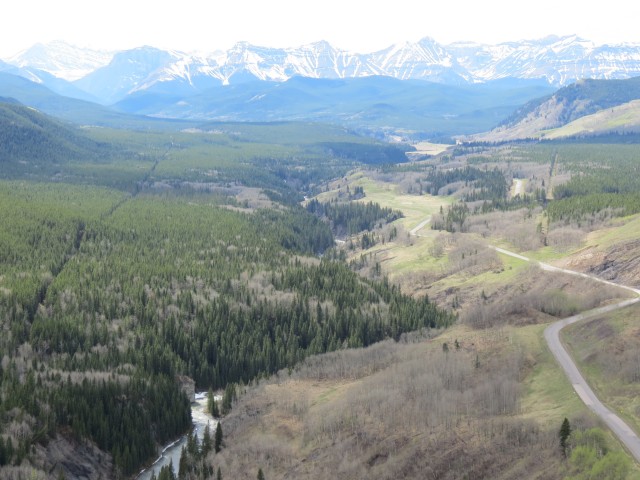
The Sheep River Valley and the seasonally closed highway.
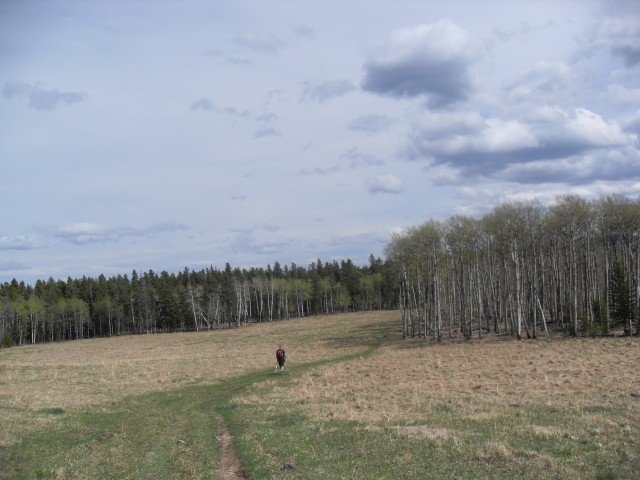
The meadows near the end of the trail.
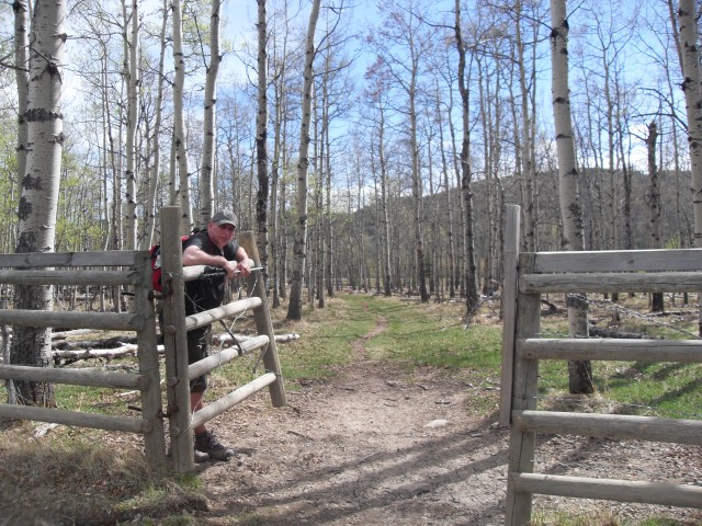
I am…the gate keeper.
Coming out to the closed highway. You can follow it back to the car or you can take the parallel Sheep River Trail.
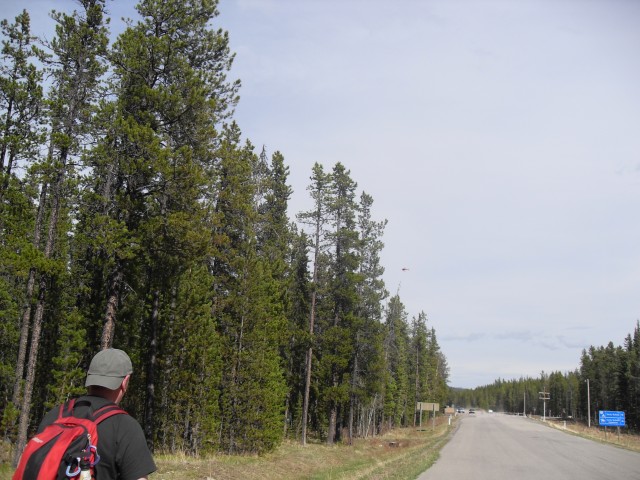
Almost back at the car, a helicopter passes overhead (above the trees, right of centre).


Great post and I want to try this loop but I am worried about all the junctions you mentioned. My sense of direction is awful and I don’t need a search crew looking for me! What do you think?
All official junctions are signed and there are diamonds nailed to trees to guide you, but I guess it still would be possible to get lost if you missed any of those. I’ll tell you what, I send you a map and that should help you visualize the route.
Hi Chris and Connie,
I just wanted to say thank you for sharing all your adventures with us. I think you’ve done a fantastic job! This hike looks to be a fun one. I’ve been up Foran Grade but never knew you combine it with others to make a loop. Looks like fun!
Sincerely,
Kelly Pearson
It’s our pleasure and we enjoy sharing, as you know.
We did Foran Grade the same day as you but didn’t see any grouse. Lucky you!
When we hike in Kananaskis we see Grouse on nearly every trip. I thought everyone else did too!