
Ings Mine
With heavy snow pack still in the mountains we attempted a foothills hike hoping conditions would be better. We choose the Sulphur Springs loop trail, but it was no fun, not even worth a trip report. We spent most of our time either post-holing through heavy snow banks or slogging through mud and slush. No fun at all! Given how miserable it was and so as not to make the day a total loss, we decided to do a short side trip to explore Ings mine (the name of the owner was George Ings).
Actually to call this a mine would be a stretch. It is clearly a prospect to check for a suitable seam. It only goes back 30m and intersects a minor coal band. There is little history to be found on this mine, understandable given its small output (if there was any). But from I can find, this mine, and/or perhaps others in the area were used to supply fuel to some local gas drilling rigs around the time of world war one. Ironic that coal was used to drill for gas. The operation dates from the early 1910s.
There is supposedly another mine up the valley of the same name. Located near the famous Bragg Creek ice caves, I am not sure if it was also owned by Ings, or if the maps have it wrong, or if I am wrong. In looking at report from others though it does appear something existed there, and the debris and flotsam around does hint at a coal mine. So maybe Ings mine comprises both these workings? I will continue to research but doubt much will turn up.
What may be surprising to those that live around here is that in addition to oil and gas, good quality coal exists in the hills of Kananaskis and even into the prairies. Outcroppings can be found on hillsides or in deep river valleys. No serious mining has taken place in the vicinity, however many small domestic mines (dug by farmers, ranchers and others) are known in the area. Along with this small prospect which was an attempt at a commercial mine.
In addition to here, the author has seen workings along the Bow River near the ghost town of Glenbow and west of Cochrane, along the Sheep River valley in many places, near the town of Black Diamond (so named for coal) and others. All within a short distance of Calgary.
To see some other mines we’ve explored, click any of these links…
Lost Creek to Dibble Mine Cranbrook BC.
Sheep River to Burns Mine part 2.
Abandoned Murray Mine.
If you wish more information on this place, by all means contact us!
Date of adventure: May 2009
Location: Kananaskis.
Warning: Mines are dangerous. Coal mines in particular, even little ones like this.
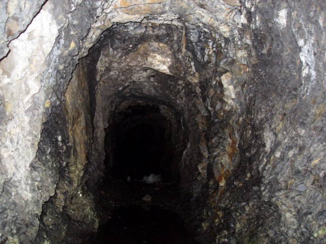
The Ings Mine adit goes back about 30m.
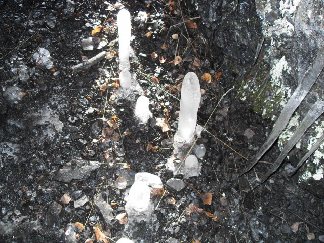
Icicles on the mine floor.
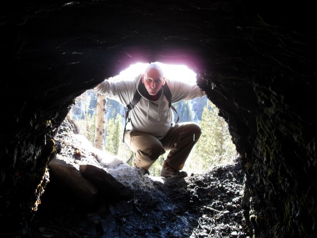
Me looking in, and you looking out.
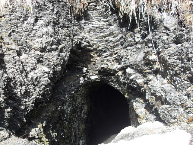
The mine opening.
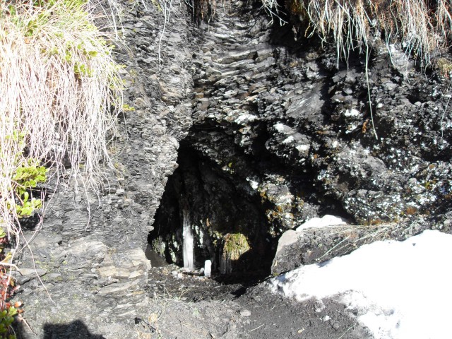
Clearly this was a small scale prospect.


")


I would be interested to know the location for the mine west of the Ice Cave? The caving club does quite a bit out there, and would probably be interested looking around and following up on it. A few hundred yards west of the Ice Cave entrance is another cave called Canyon Rill, which is very tight at the back and hasn’t been pushed very far, but it has a small stream flowing out if it. Looks like there is a lot more to the story than I thought! I have to admit – The only place I have read that refer’s to Ings mine is on the GemTrek topo maps. Lots of cavers in the Club had referred to the caves as Ing’s Mine, too. But it is definitely a natural cave.
Anyways, you’ve caught my interest!
Do you find that coal mine website very accurate when cross referenced with historical documentation?
I have not visited this supposed second mine site but a hiking buddy told me he found some foundations and junk that suggest someone was looking for coal in the area around the ice caves (it is only a click or two west of them I am told). These remains are also mentioned in the Kananaskis Trail Guide by Gillian Daffern. I hope to check it out myself, later this year. Until I see it in person though, I don’t want to speculate too much.
The coal records for the most part seem pretty accurate based upon my own research, but I’ve found many errors and omissions and things that make you go hmmm. It seems the smaller and older operations are the ones where data can be spotty or questionable. I did some field research on the Bow River Coal/Mitford Colliery Mine which they then used to clear up some anomalies in their own report. Here’s my article…
https://www.bigdoer.com/8338/exploring-history/in-search-of-mitford-alberta-part-3-bow-river-coal/
Hi guys,
I found a site on historical coal mines in Alberta:
According to them, I think the mine you were in was owned by WS Herron, was a pillar and room mine, and was owned under the name of Canyon Creek Mine. I can only assume the colloquial name of “Ing’s Mine” was used in later years. The only ‘official’ written reference to “Ing’s Mine” I have found (other than internet) was on the GemTrek topo hiking maps. The site above does not show any other coal mines in the area, so I assume they are one and the same. It could also be that Ing’s is not listed on the site, but it seems pretty exhaustive. I believe Gemtrek perhaps found the name used colloquially, or in error, unless you have found other historical usage of the name (have you?).
Anyways, if you haven’t already used that site, I hope it helps your research!
Regards,
Eli
Hi Eli,
Thanks, I am aware of that website and use it a lot in my research.
I am not entirely convinced it is the Herron Mine. Let me explain…
The Herron had a recorded output where as Ing’s Canyon Creek Mine (he had others) shows none. This mine, if it could even be called such, appears to be a prospect or test adit. The amount of waste material and the size of the workings suggest they were looking for a workable seam but found little of interest. The Herron would likely have a much larger slack or waste pile.
Ing’s Mine, according to the government, has no recorded location. However some old documents found by me mention his workings were located just up from the Elbow River on Canyon Creek. So roughly where this one is.
This of course leaves a lot of unanswered questions. Like, if not here then were was the Herron operation? And what about the mine (which I have yet to visit) which reportedly is located just west of the ice caves? I’ve head it called Ing’s Mine as well. In fact I have heard some people call the caves Ing’s Mine.
In order to clear this up I am thinking the next step would be more field work and an update to this page. It’s overdue.
Thanks for posting. We are always happy to hear what others think.