
One Mine Ridge
For this trip we’ll tackle a nice ridge directly north of the town of Bellevue Alberta in the Crowsnest Pass. It has no official name that we can find, but some parts of it are along the documented Two Mine Trail loop and since we’ll pass one of the mines mentioned, very near the top in fact, we thought the name One Mine Ridge was fitting.
We’ll use the old mine road for most of the trip and we’ll visit not only the mine workings but the ridge proper, a westerly high point and a south heading rib pockmarked with…guess what…mining scars. In spite of easy access from town it does not appear many people visit the place. That’s what I like about the Crowsnest Pass, you usually have the trail to yourself.
The trail head is at the west end of 28th Ave in Bellevue and starting by taking the obvious dirt road that heads up. A few metres along and you’ll come to a gated road heading off to the right, that’s your route.
Not long after the trail enters a meadow and appears to peter out but head to the right following a faint path in the grass. You’ll know you are on the right trail as not not after you come to a slash pile (logs and burned tree bits) and right behind a collapsed cabin. Take time to admire the well made dovetail joints used in constructing it.
Winding left here the trail become more distinct again. You’ll pass an old car (a 1950s Mercury Meteor) and the remains of of a small sawmill, along with a wagon made from an old car or truck chassis, with its wooden spoke wheels.
Skirting a large meadow we get a quick glimpse of some of the surrounding mountains. Into the trees, the trail briefly heads down to the small stream crossing before levelling out on the other side. Here’s your first junction and take a right and a few metres up, another right. Heading back now only higher up, another junction comes into view. Head left.
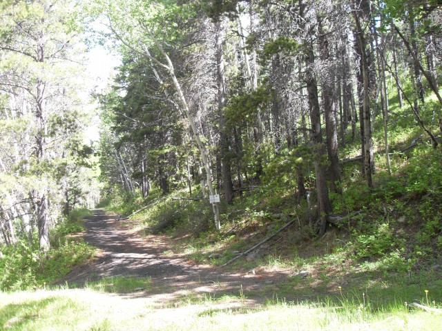
The trail here is level with lots of coal slack spilled around it. These are after all, old mine access roads.
One more junction comes into view, a four way one this time, and you’ll need to take the branch heading up and to the right. There is a nature conservancy sign here helping mark the spot. The trail coming in from the left MAY be the one we left earlier at the first junction, but I have no way to confirm that. The one heading straight is the wrong way and it dead ends in a deep steep walled heavily vegetated draw, but only after gaining 150m or so of elevation. We mistakenly took this route and lamented the wasted effort when we were forced to backtrack.
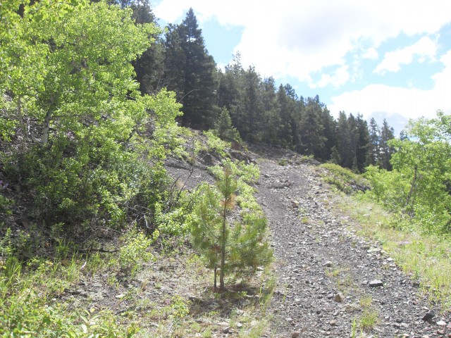
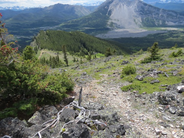
Back on the correct trail..for the last little while the elevation gained has been modest but from here on, it’ll be steep and an almost constant push to the top.
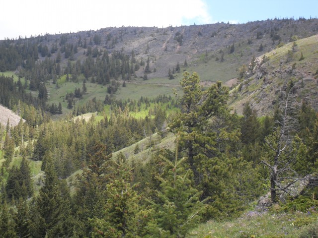
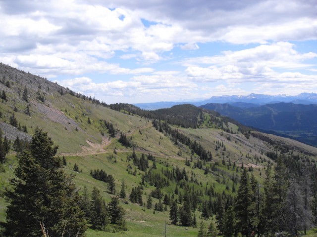
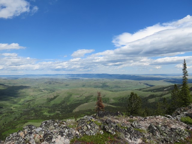
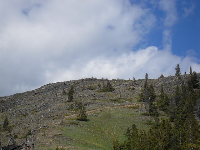
Heading south but only for a bit, the trail quickly changes direction once it gains the spine of the ridge and for the rest of the trip it traverses below it all the way to a saddle. The way is obvious. For the next while you are in the trees but before long you’ll break out and will be rewarded with views of your objective. There is also a junction here and a trail heads down on the east side of the ridge – heading back and down towards a road in the next valley east.
On our visit, the high meadows here were carpeted with flowers.
Passing another junction with a trail heads back to the other side of the ridge we are on, we’re almost at the top now, most of the hard work behind us.
In spite of gated access it appears the occasional ATV somehow gets on this trail. Be prepared should one pass – you don’t want to surprise anyone. Outside of a couple tracks from the former, we saw no evidence of others using the trail. No footprints or anything.
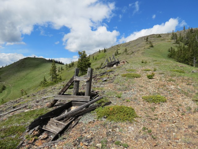
Following the steep road we start to see signs of coal mining activity. We pass some sort of fallen structure and across on another rib of this ridge, we see similar remains. I understand these are part of a tramway system that brought coal down from up high. The road was only for maintenance of that system. On that same rib we can see mine subsistence pits, which we’ll visit later (dangerous!).
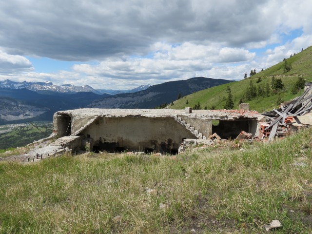
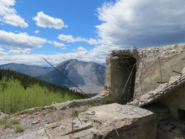
Passing one more junction we continue straight on and before long we are at saddle. It’s here we find a thick cable, more evidence of the tramway system. Not long after a large concrete structure is seen, perhaps the tramway house? There is evidence of some heavy machinery having been inside and there are nice views from this interesting industrial relic. This was a mine with a view!
We take a side road that traverses the west high point but it ends abruptly around a corner. Heading back I head upwards while Connie stays on the road. She’s a little tired, and rather than joins me she seeks out a nice grove of trees where we can have lunch. I’ll join with her in half an hour or so.
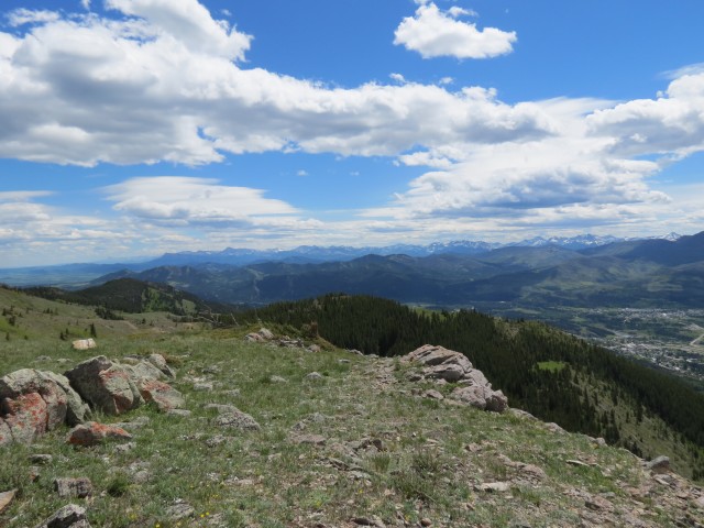
At the top of the westerly high point there are some amazing views. To the north Livingstone Ridge is seen and to the west Bluff Mountain. Our cabin sits right below the latter. To the east and nearby are Robertson and Tallon Peaks, both easily hiked up. Behind them, countless wind turbines spin in the always present wind that blows here (it was actually quite calm this day).
To the southeast rolling hills extend off in the distance and directly south is the most prominent peak we’ll see, well known Turtle Mountain with that huge scar on its north facing side. We’re looking at the famous Frank Slide here which dates back over a hundred years when the mountain collapsed, a disaster that almost wiped out the town of Frank. We’ve climbed Turtle Mountain in the past and looking down at the slide from here or there is a sobering experience.
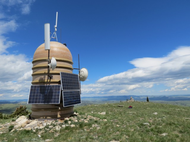
An odd structure sits at the high point and I have no idea its purpose but its shape and look reminds me of a Dalek from the Dr. Who TV series.
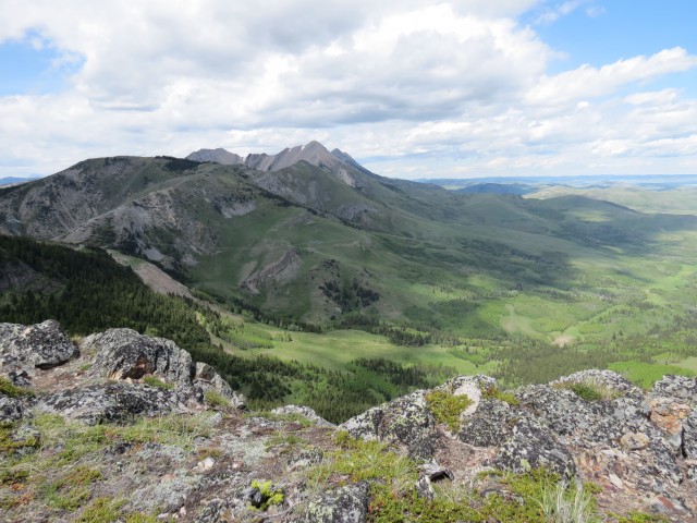
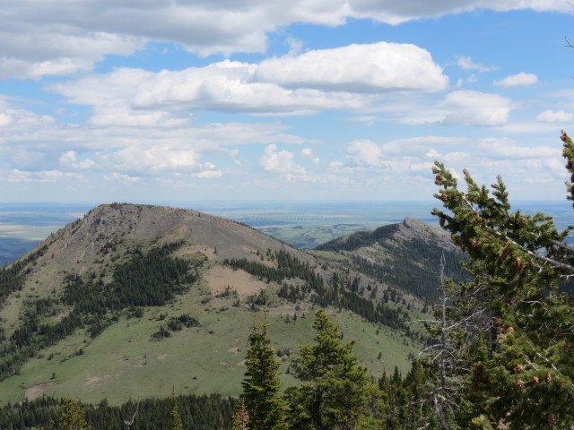
To the east One Mine Ridge proper beckons. There is saddle between here and there and perhaps a hundred metres of elevation to loose. This rocky next section is perhaps 50m higher than the grassy high point I just visited. It’s littered with the skeletons of so many dead trees, reminding one how challenging the conditions are up here. It’s always windy here as it was on our visit. The ridge stays fairly level for a while then quickly drops away.
Retracing my steps I find a convenient ramp that leads me back down to where Connie is. Along the way I pass more mining relics and they to appear to be part of that tramway system.
Connie selected a nice spot on a south heading ridge, that rib I spoke of earlier. It’s here where the mining took place and on sections of the ridge, it’s like a moonscape. It’s pockmarked with subsidence pits – these come about due to collapsed mine tunnels. They are super dangerous and I would suggest you steer clear of this area.
After lunch we return the way we came. Our visit to One Mine Ridge was thoroughly enjoyable!
This same ridge can also be accessed from near the Leitch Collieries site (the second mine in the Two Mine Trail) and this requires following the east spine up.
Not much can be found about the mining operation we visited. We think it was part of the Maple Leaf Mine or West Canadian Collieries Mine (reports are conflicting). Further research is needed or better still a revisit to fill in the blanks. Yeah, the latter is best.
The ghost town of Lille sits northwest of where we visited (although out of view) and to read about this place, click the link below…
A little more Lille and a flat car.
To see some other hikes in the area, go here…
Crowsnest River walk and Hillcrest-Mohawk Collieries plant.
DC3 plane crash.
Tent Mountain Mine.
If you wish more information on this route, by all means contact us!
Date of adventure: June, 2013.
Location: Crowsnest Pass, AB.
Distance: 18km return.
Height gain from start: 680m.
Height gain cumulative: 780m.
NOTE: all heights and distances are approximate.
Technical bits: None.
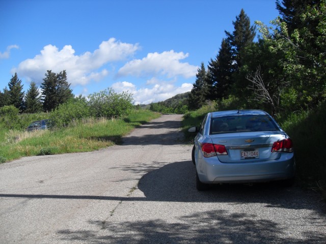
The trailhead is at the west end of 28th Ave in Bellevue.
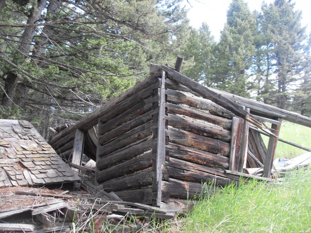
Not long after starting we pass this old cabin.
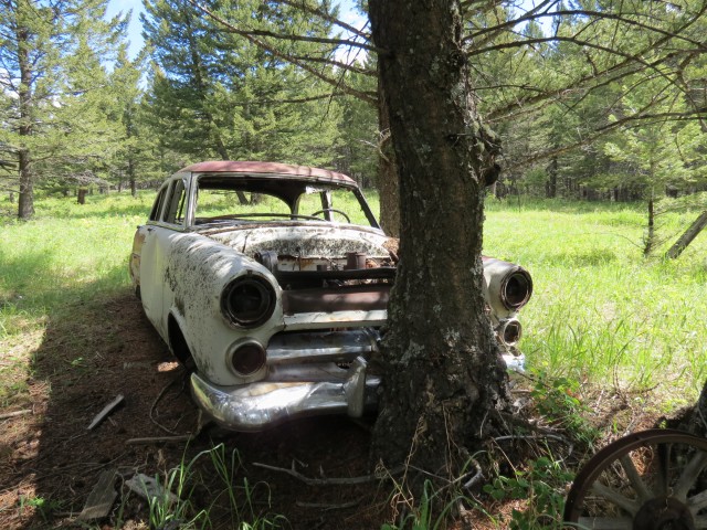
…Then this 1950s Mercury Meteor.
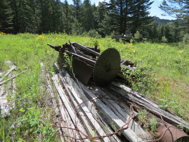
In the same meadow we find remains of an old sawmill.
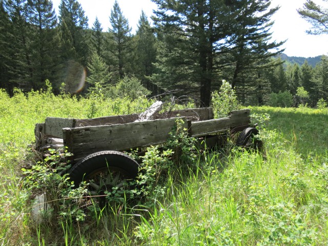
A wagon built atop an old car or truck chassis.
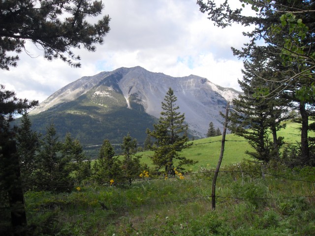
We’ll have even better views of Turtle Mountain once we gain some elevation.
At this sign (centre on a tree), turn right here.
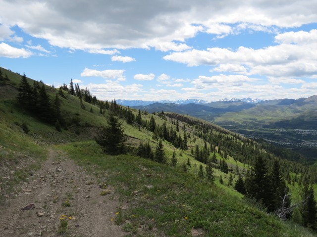
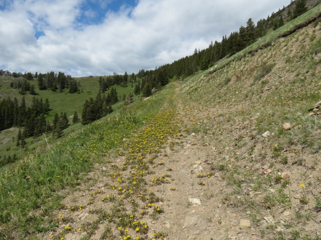
An old mine access road makes travel easy.
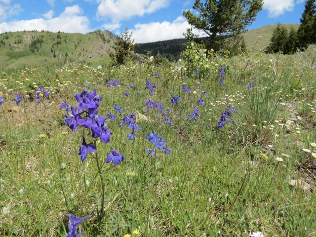
There were flowers everywhere.
We break out of the trees and see our goal above. Notice the old road, which we’ll use.
Looking back at the road we travelled up.
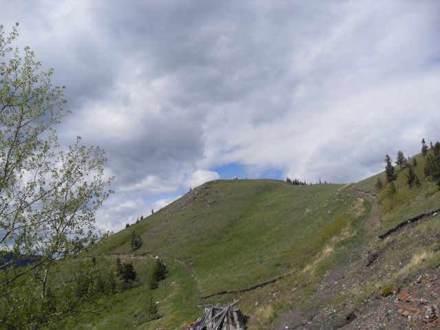
It’s steeper then it looks.
At a saddle we look back.
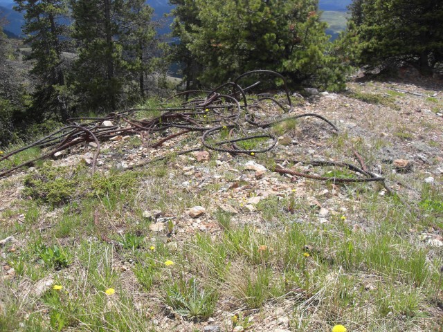
Heavy cables from the old tramway.
Old coal mining remains.
Scarred Turtle Mountain behind.
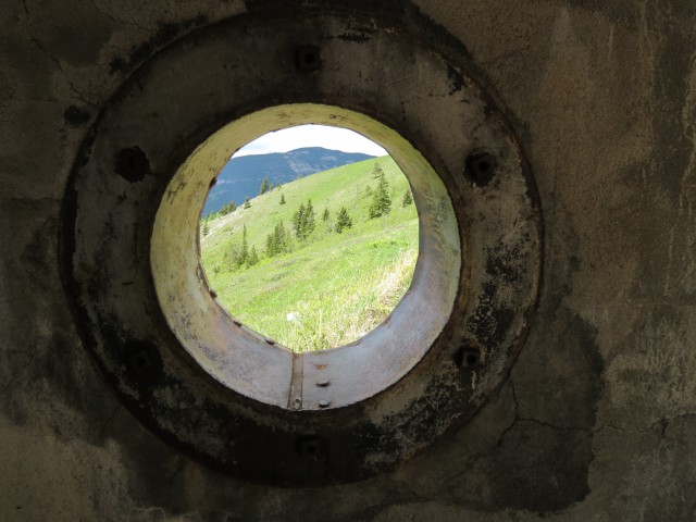
Peering out…
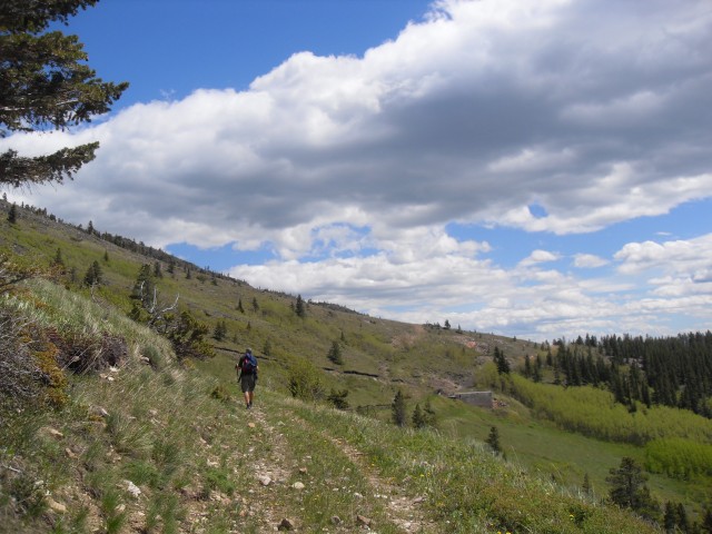
On the old road.
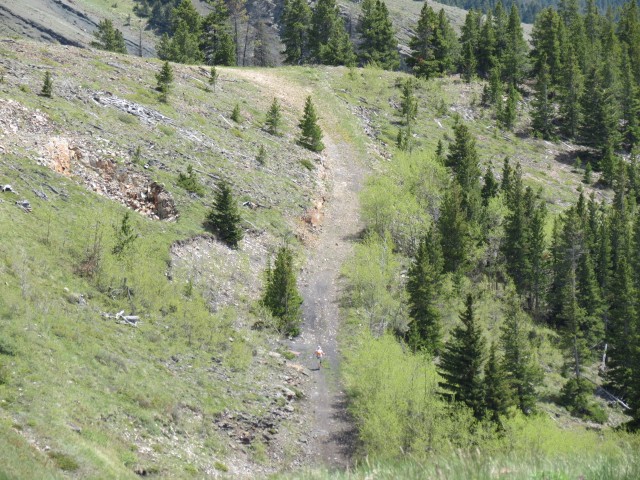
If you look hard you can see me near the top.
Connie far below.
Looking east – I’ll soon tackle the ridge to the right.
This view is to the southeast.
A Dalek from the Dr. Who TV series?
Livingstone Ridge to the north.
Looking northeast to the rolling hills beyond.
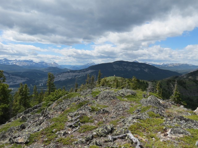
Bluff Mountain in the distance.
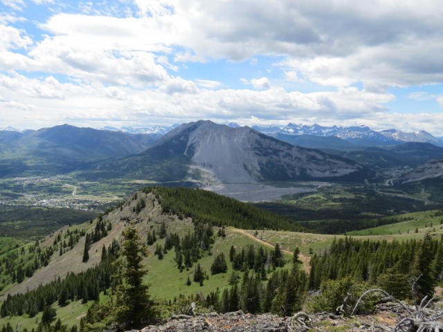
A nice view Turtle Mountain and the huge slide scar.
Robertson Peak in the foreground and Tallon Peak behind.
Can you spot me on the ridge?
Heading back down.
More mining relics.
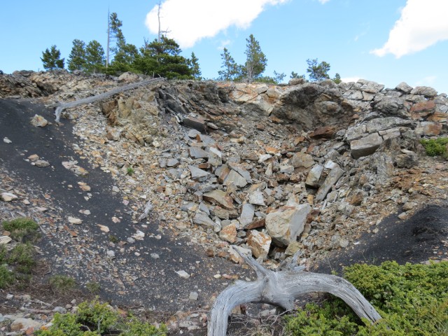
One rib of the ridge was pockmarked with these mine subsidence pits (dangerous!).


(via Facebook)
Oh the back yard! Lol fun play ground the Rockies are!
You know, I was just thinking that myself the other day. We have the best playground ever.
(via Facebook)
I have just this week started reading the blogs that accompany your photos. Gotta tell ya, I really enjoy them.
Fun and inspiring.
Awesome, keep coming back and keep commenting! We love having you here.
(via Facebook)
Grew up in Blairmore…..it was wonderful.
Blairmore is probably the only town I didn’t grow up in. We moved a lot as kids!
I always loved hearing my mom tell the story about Frank Slide!!
It’s interesting to see the slide from One Mine Ridge. This angle in particular really shows just how devastating it was. Thanks for commenting!
I have just this week started reading the blogs that accompany your photos. Gotta tell ya, I really enjoy them.
Fun and inspiring.
Wonderful to hear from you. Glad you like the site. We have so much fun doing this and we’re so happy others enjoy reading about it to. Please, drop by often!
What a great job! I’ve never seen the slide from this angle before, thank you!
We had a wonderful view of Turtle Mountain and the slide all that day.
I wish I had the energy of you two. What a great hike and the views, amazing!
This looks a little tough for me, but I love the Crowsnest Pass and so can you recommend any good, not terribly tough hikes in the area? Especially ones that pass historical mines and places?
You bet, I have a lot of suggestions and I’ll email you on this.
Awesome hike !