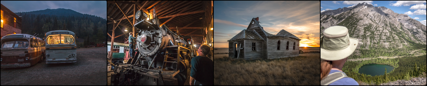
Located deep in a remote valley in southeastern British Columbia, Corbin is home to a few residents, some summer cabins and one giant coal mine – you can’t miss the latter. Very near the Alberta border, the town was once tied to that mine which has operated on and off for over a hundred years. Today, most if not all of its employees now travel in from other communities, but in the past this was a company town with its own railway, businesses, and a population of many hundreds.
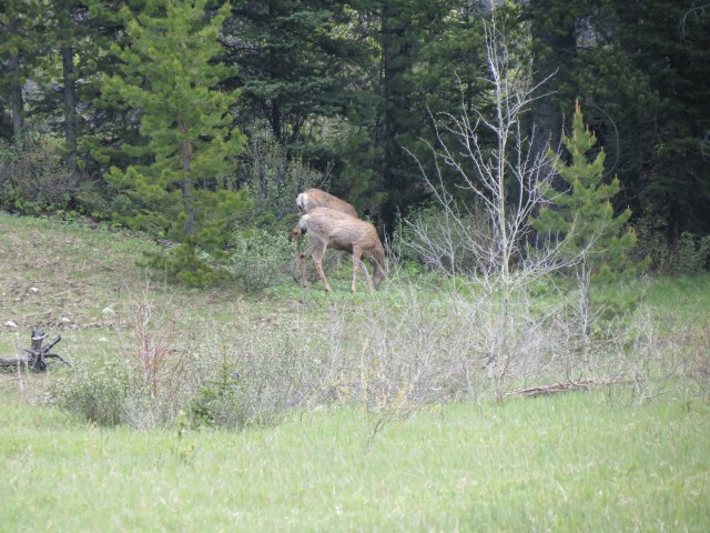
This trip our goal was to uncover the location of the elusive Corbin cemetery. We took on a project for a client who has an ancestor believed buried there, which she wishes us to verify. Unfortunately, a sow and cub reported in the area plus a soon to arrive train cut our visit short (explained below).
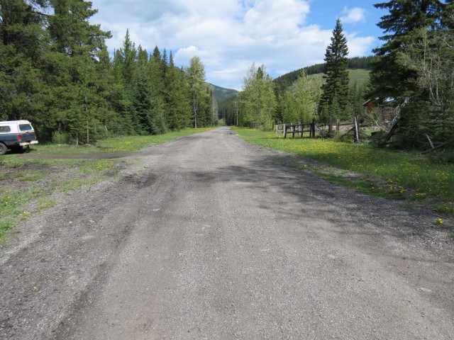
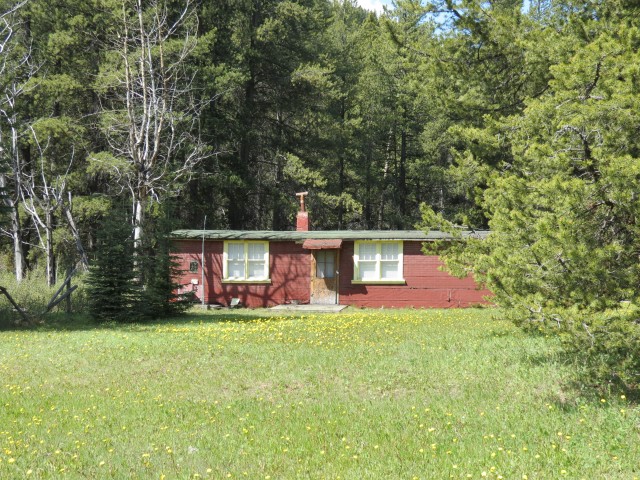
While a few pictures of the cemetery can be found online, no where, at least based on my research, can the location be determined. We talked with people have reportedly visited the site, but none seemed to remember the details on how they got there. With that in mind, we had low expectations, hoping by luck we’d discover where it was at or that perhaps we’d bump into someone in town who knew. We walked up and down “Main Street”, actually the only street, to see who was at home who could help us, but had no luck. So we had some fun photographing the old cabins there (more on this later) and headed back to the main road.
↓ ↓ ↓ ↓ Scroll down for photos or to comment ↓ ↓ ↓ ↓
Its there that we bumped into a helpful mine employee, who came by to warn us of a few things – she asked us to avoid the mine area (no brainer there), that earlier in the day there was a bear and cub in the area and that soon a train would arrived for loading which could cut us off from our car. And as it turned out she had a rough hunch where the cemetery was.
It was, according to this person, on mine property, in the field close to the train loading area and inside the loading loop, but she knew little of its status or accessibility beyond that. It was not along any current road, that she assured us, which is sort of what we assumed anyway. Otherwise if it was that easy to get to there would be more pictures if it.
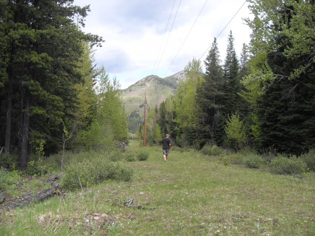
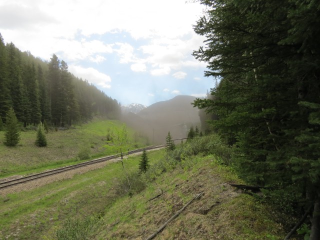
So intro the field we went, mindful of that soon to arrive train and the bears. Normally neither would concern us much, however if the bear happened in the same area as us and if it was cut off by the train too, that would make things dicey. The way the tracks loop here and nearby hills means this would force anyone (us) or any animals (the bears) into the small chuck of land of which there was no real means of escape. Not good.
The trains by the way move while being loaded, but at basically a walking pace. When you consider that a train may be well over a hundred cars long, it can take hours for them to pass.
So knowing that we had less than an hour before the train could arrive (the mine employee was very helpful) we quickly checked the edges of the field inside the loop and the areas around the tracks hoping we’d find what we were looking for. But we didn’t and with perhaps little time to spare before the train cut off our avenue of exit, we abandoned this part of our adventure. We’ll return and have since contacted others who may be able to help is find this elusive quarry. If any readers know, we welcome your input too.
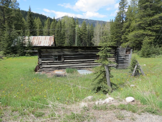
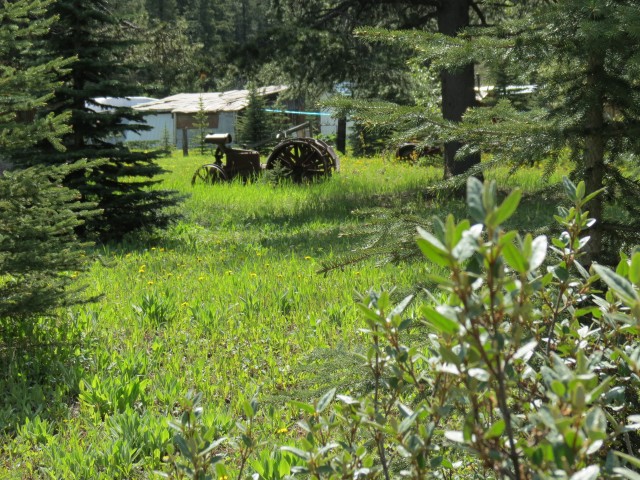
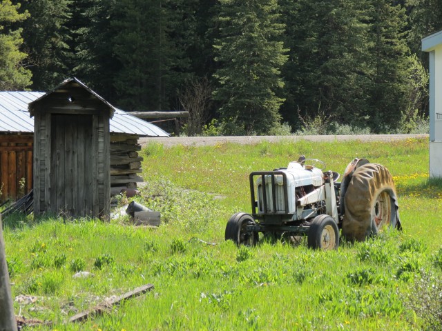
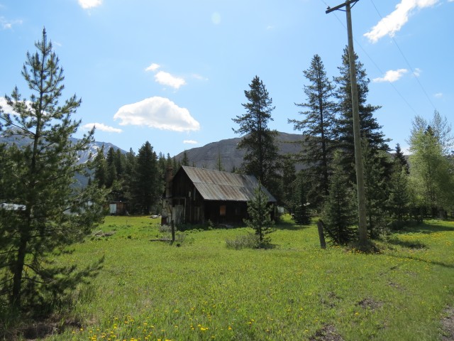
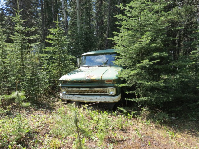
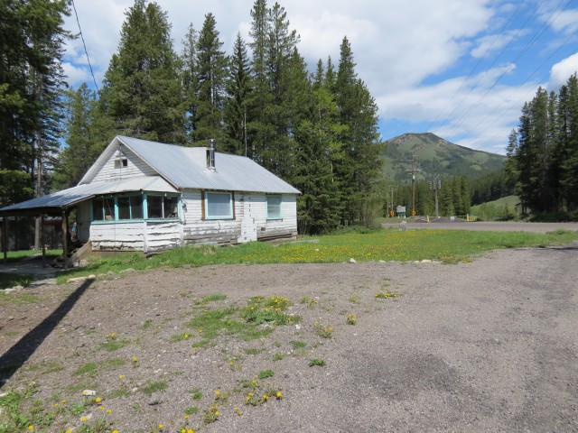
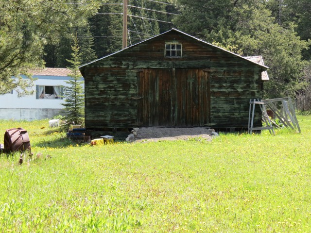
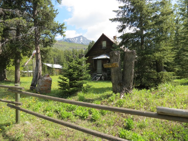
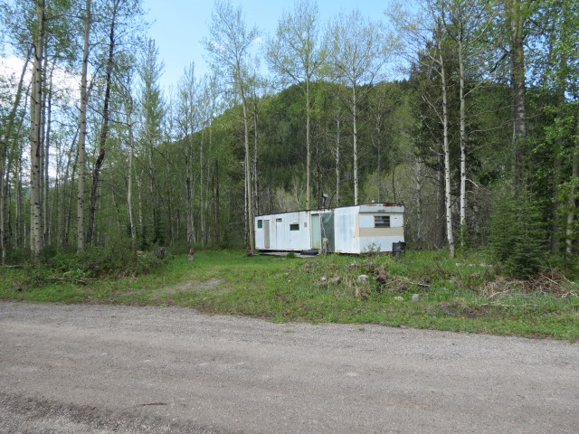
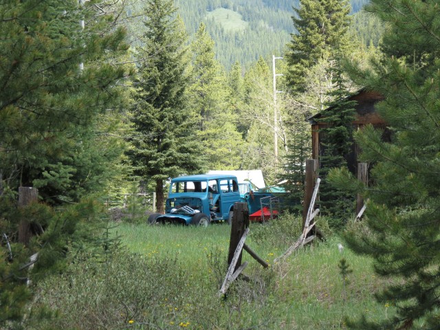
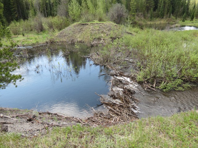
There is not much left of Corbin BC today, just one street with a few houses, cabins and trailers, most of which look to be occupied seasonally. All seem in good shape, save for a couple, and as I understand it one was once a “company house”, built for mine workers and their family. Very interesting and we have fun photographing them and what ever else captures our attention – old trucks, tractors, ancient biffies, beaver dams, old log buildings and locked up sheds, the latter no doubt with treasures inside.
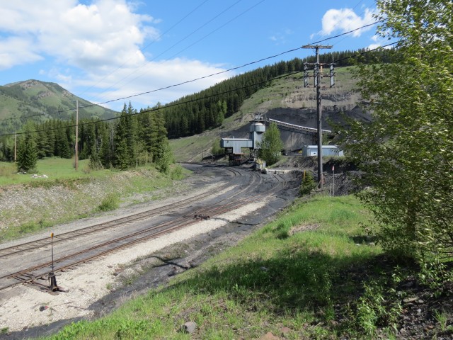
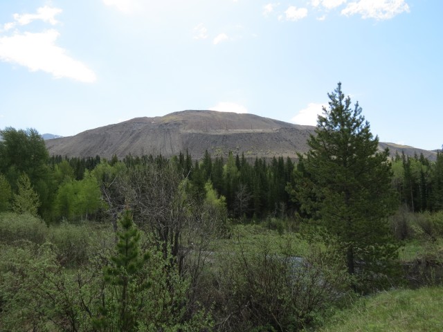
Looming over the “town” is the mine. They have dug coal here, on and off, for the last century and slowing but surely over time, the miners have systematically bulldozed the mountain into submission. Known, not surprisingly, as Coal Mountain, it’s been excavated to such a degree that soon they may have to change the name to Coal Hill. Maybe later, Coal Canyon. I understand that it may soon reach the end of it’s useful life, but they’ve said that before, so who knows. The scar left behind will be something, and it reminds us of the nearby abandoned Tent Mountain mine we visited in the past.
The mine, originally an underground operation, opened in the first decade of the twentieth century. It operated into the mid 1930s when challenging financial conditions and labour unrest conspired to shut it down. For the next few decades it was worked intermittently by a number of companies, mostly on a modest scale. Later in the 1970s, and with lucrative contracts in hand, a new large scale mine was built, much larger than any of the previous incarnations and this is the operation we see today. The coal was always there, they just needed to mine it on a scale to make it economical.
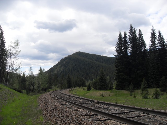
A CPR branch line comes in from the north to serve the mine, the only customer on this line. The track ends at the mine – it passes by the loading area, turns west and loops back on itself in a broad arc. Essentially it’s a giant train turning loop. something called a balloon track, The train moves under the loading tipple (the load out) moving slowly as each car is filled and when done it’s turned around and near where it started, and pointed in the right direction to head out. This is a process that deepening on how many cars are to be filled, can take an hour or hours to complete. There is a small spur right next to the load out, where defective cars can be dropped.
We check out the load out from a public road and studying it one can get a good idea how it works. Coal comes in by long distance conveyor, gets heaped into temporary storage piles, which is then pushed into the load out machinery using larger caterpillar tractors. This way the train is filled without every stopping. The mine employee nicely asked us not shoot the load out when we are on mine property – recall the field and the likely cemetery location are on their land and they graciously allowed us access here. I did however shoot some coal dust whipped up from the mine near the load out, but you can’t see the any of the machinery.
The rail line we see today dates from the 1970s when the mine was reopened and was for the most part was built on the grade of the old railway which operated here until the 1930s. For a time the rail bed was also used as a road.
We vacated the area before the train arrived, but did see a high rail truck travelling the line, which I presume checks out the track ahead of the train, looking for possible problems. It’s not clear how many trains use the line, but in researching it, service seems spotty at times, dependant I guess on markets and such.
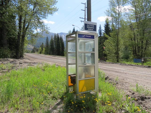
Near the road leading into the mine we see a phone both…a very lonely phone booth. Interesting since you don’t see these very often any more, and so catching this one in the remote wilds, comes as a bit of a surprise to us.
We’ll of course return to Corbin – it’s not terribly far from our Crowsnest Pass stomping grounds anyway – no doubt armed with information needed to find that mysterious cemetery.
It’s sometimes a challenge to define exactly what is a ghost town. For us, it’s a place that is a shadow of it’s former self – not necessarily abandoned, but with few residents. With that in mind, this makes Corbin the most easterly ghost town in all of BC.
Update: June 2013. We knew this wouldn’t take long and someone has come forward with the location of the cemetery (thank you John Kennear). As it turns out, the mine employee was pretty close in her guess and although at the time we didn’t know it, we were within sight of the location when we turned back.
Tent Mountain can been seen northwest of town and it’s home to an abandoned open pit coal mine, which we’ve been up (twice). To see one of those reports, click the link below… Tent Mountain was torn a new one.
My grand-uncle Giacomo Rivero died of spanish flu in Corbin in 1918, otherwise my grand-dad would have joined him in BC from Italy .His grave can be found in the Corbin cemetery (and also in findagrave.com misspelled as “James Riverio”). Great to get details and pictures of Corbin from your blog.
The Spanish Flu took so many. Corbin’s a special place we need to pay a revisit and the old cemetery’s been on our radar for a long time. Thanks for sharing your story.
My mother ‘Margaret’ was born in Corbin in 1919. Her father – Fred Reger – worked for the mine and may have been a geological engineer there. He emigrated from England in 1910 and worked in mines all over the East & West Kootenays.
It went down the branch to Corbin? Now that would have been cool to see! Wonder why given there’s no real population there. Would love to see some pics!
My grandmother was a school teacher in Corbin ( Margret Sykes). My mother was born in Corbin and is still alive today @ 90. I was there in the summer of 1983 and met Mrs Baretteli,we had tea in her kitchen She used to come there in the summer from Calgary.
Very interesting writings. Thanx for the posts. I got onto Corbin as I was looking for an adventure around Fernie. I live in Williams Lake. Happy trails all.
Interesting information regarding Corbin and the cemetery. I have an aunt buried there; she was 8 years old when she died and was buried there. If you go to findagrave.com and search Canada and Corbin cemetery you will see a list of who is interred there. Not sure the source of this information but I have confirmed my aunt with a copy of her BC death certificate.
The find-a-grave guys are usually pretty good at what they do. I’ve helped them with some projects. They use multiple sources – provincial records, newspaper obituaries, company records, family papers and then back it up with field visits.
The phone booth you seemed a bit surprised by ?? Is for a lack of definition (a God send ! ) and glad to see it still there.South of Corbin is big wide open country way down into the Flathead.I have heard many stories of people in dire need having to use that phone ,and yes I have been one of them when we rolled a truck and had to walk out.You name it,winter,summer ect .people have needed that phone at that location,hope it stays there to help people when they are in a bind.There is no cell service in Corbin
Hi I am looking for the owner of a white VW Golf that is on a property in Corbin B.C. I have the licence plate number but rcmp are unable to give me info as to whom the owner is. Could someone send me some info on the property owners of this town.Thanks for your time
My name is Connor MacLean I am the grandson of Josphine Zur whose cabin you photographed. I do know about an old cemetery on the mine land that is fairly easy to get to. I have seen it a few times. You were heading in the right direction just past the train tracks and up the hill is the cemetery. If you are interested email me.
I’ve been snowmobiling from Corbin for years and had no idea about it’s full history until I read this, definately interesting! Can any of the grave sites be seen from the trails? I could swear I’ve seen one or two of them.
Also question for Smitty, do you have any idea who owns the green 1966 Chev truck? I have left notes on the front door of the white cabin a few times, the owner (James Barnes’ son?) phoned me once a few years back, I have since lost his number however. Thanks in advance.
Glad you like the article. The cemetery is not near any trails and is beside the train tracks up from the train load-out. It’s certainly possible other grave sites are in the area however. I will email Smitty and let him know you want info on that old truck. It’s nice and photogenic tucked in the bush like that.
Well, the foundation was a long concrete rectangle with a grease pit, I am not sure if there was a building set on the foundation. When Venuta’s son put the cabin on the foundation, he only used half of it and knocked the rest down. I do have the pivot point for one of the other turntables on my property. Venuta Baretelli told me a lot about what used to be there, like the dairy, grave yard, tennis courts and the soccer pitch. I also learned a lot from the Barnes family, the other old house is theirs. The actual turn tables were used for bridges before the road was upgraded. I remember when my family first moved to Corbin they had just installed new steel bridges, and my father told me that the large long frames next to them were the old turn tables from the mine. I do believe they were sold for scrap after that. That was about thirty years ago or so.
Hi there, nice to see the interest. I am the only full time resident of Corbin B.C. This is not exactly the town site, this is the remnants of the old rail yard. It was called “The Tail Of The Y”. The town site was farther up the Corbin Valley and is now buried under tons of overburden. The “Main Road” as you call it, is actually the former train tracks. You can still see some of the old rail ties farther down near the washout. The tracks used to go much further up the Michel creek valley. The “company house” was home to Paris and Venuta Baretelli and she lived there long after the mine went under. There used to be three of of those houses next to that one and they were for the rail yard personnel.
A note, my cabin is on the foundations of one of four locomotive turntables and the foundations for the water tower just down the road from it.
Awesome, thanks for posting! Yes, I am aware the town proper was once located a bit further away. I saw the washout at the end of the “main” (only) road and though it looked railway like – thanks for confirming what was a suspicion for me. Can you elaborate on the foundation of your cabin? How do did you find this out and is anything recognizable in respects to the turntable? I am interested!
I remember Paris Baratelli sitting on the bridge past the Y going to the Flathead when I was just a kid. I also knew Venuta as she lived much longer and was a family friend. She lived in the house with the rusted sheets of tin on the roof for many, many years. My grandfather was their best man at their wedding. The white colored house was owned by the Barnes family who were a prominent family in Corbin.
My great-grandparents worked in Coleman and Corbin. In Corbin, in 1913, my grandfather was born. Then he returned to Poland. Your blog is very interesting. I like to read. I want to wish you a Happy New Year 🙂
Thanks, others have sent us a map. I spoke with the mine and as long as we let them know what we are doing and that we accept the risks, and that we stay clear of the tipple and loading area (not that far away), they will reluctantly allow us access.
I have a friend who works at the mine and the scuttlebutt there is it has perhaps a year or two left before things wind down. These is more coal in the area though and I believe mining the ridge directly west is one possibility they have explored.
Thanks for posting. I see what you mean, that ridge is covered in what looks to be exploration roads, hinting at what may be to come. If the coal exists and can be mined, the could keep much of the current infrastructure in place – the rail line and loadout for example.
I worked there from 1982 to 1986. There was no one living there at that time. Esso bought the mine but really bought it to get the contract to supply Ontario Hydro and then switched it to a mine in the USA to supply and 2/3’s of the people there were laid off. Workers were bussed in from Fernie and the Crows Nest Pass at that time.
The Legion Hall and Monarch Garage, Loverna Saskatchewan, early 1990s (not 1970s as shown) and the same view in 2017. There's not much going on in Loverna these days, but long ago it was a very active and vibrant community. This was shot between takes while working on the Telus Documentary "Forgotten Prairie" by Rueben Tschetter.
Check the comments for more information. Original image thanks to and copyright Philip Brown.
Exploring history with Off the Beaten Path with Chris & Connie. Posted by Connie.
It's no secret Team BIGDoer is Boler obsessed but we're actually not owners, funny as it sounds. We can only dream and you know if we could, we would. The only thing holding us back from buying one, like the nice example seen here, is the cash to actually make the purchase and a proper vehicle to haul it around. Other than that, we're good to go!
Exploring history with Off the Beaten Path with Chris & Connie. Photo: 2021. Posted by Connie.
When exploring old farm properties, we always check out any nearby low lying areas or coulees. In case they hold any treasures. Jackpot! This is usually where farmers dumped retired old cars and equipment no longer needed. Out of sight, out of mind.
This car's a little more special than usual and is an uncommon post-WW2 Nash. A 600 we believe, but we're not the greatest at this. Scroll down to the comments to see a closer look and a comparison shot of a restored example.
Exploring history with Off the Beaten Path with Chris & Connie. Photo: 2014. Posted by Connie.
While on the subject of old Hotels and the Beer Parlour Project, here's Len, proprietor of the Elk River Inn (aka the Hoz) in Hosmer BC back in 2022. It's one of the first places visited by our group and sadly, we just found out the fellow passed away a few months back. This image was shot on film with an old-fashioned view camera.
During the interview Chris mistakenly called it the Elk Valley Inn and got an earful from Len. He was such a character and with an infectious dry wit! With his passing the business closed and we're not sure what the future holds in store. Look for a bonus photo of him in the comments.
Exploring history with Off the Beaten Path with Chris & Connie. Photo: 2022. Posted by Connie.
The Beer Parlour Project will be on the road this coming weekend and up by Edmonton. Team BIGDoer and photographer Rob Pohl, with his big view camera, are visiting the Warspite Hotel, Warspite Alberta the evening of April 12th and the Viking Hotel in Viking Alberta on the 13th.
We'll get to know some history, interview local characters and old timers, down a few chicken wings and with our cameras capture a little slice of Canadiana. These businesses are a throwback to another time and we're chronicling as many as we can while they're still here. It's 12 down with maybe a 100 to go.
If you're in the area, drop by and chat! Watch for the Beer Parlour Project Website coming soon.
Exploring history with Off the Beaten Path with Chris & Connie. Photos: 2023 (Coleman Grand Union Coleman AB & traditional Beer Parlour glasses). Posted by Connie.
Javascript is required for this site to function. Please enable it in your browser settings and refresh this page.
Please log-in to continue... This allows unrestricted access to every post @BIGDoer.com, popups are eliminated, commenting is on and the "contact us" page is enabled.
Your social site may send you a routine notice of login.
Or signup, here: Subscriber Register ___ BIGDoer.com: Serving up POP HISTORY & other McFun!…(Mmmm, yummy bite-sized pieces.) One million plus words & tens of thousands of photos!


")


My grand-uncle Giacomo Rivero died of spanish flu in Corbin in 1918, otherwise my grand-dad would have joined him in BC from Italy .His grave can be found in the Corbin cemetery (and also in findagrave.com misspelled as “James Riverio”). Great to get details and pictures of Corbin from your blog.
The Spanish Flu took so many. Corbin’s a special place we need to pay a revisit and the old cemetery’s been on our radar for a long time. Thanks for sharing your story.
My mother ‘Margaret’ was born in Corbin in 1919. Her father – Fred Reger – worked for the mine and may have been a geological engineer there. He emigrated from England in 1910 and worked in mines all over the East & West Kootenays.
This is so cool! Thanks for sharing these memories.
A nice place to railfan! Took some nice shots of the Holiday Train going westbound there on Monday. Was worth the drive from the Highway!
It went down the branch to Corbin? Now that would have been cool to see! Wonder why given there’s no real population there. Would love to see some pics!
My grandmother was a school teacher in Corbin ( Margret Sykes). My mother was born in Corbin and is still alive today @ 90. I was there in the summer of 1983 and met Mrs Baretteli,we had tea in her kitchen She used to come there in the summer from Calgary.
Oh, now that’s awesome! So nice to see these personal and intimate connections to the place. She’s ninety? Way to hang in there!
Very interesting writings. Thanx for the posts. I got onto Corbin as I was looking for an adventure around Fernie. I live in Williams Lake. Happy trails all.
Team BIGDoer needs to come back. It’s an interesting place for sure! Thanks for commenting and be sure and come back often.
Interesting information regarding Corbin and the cemetery. I have an aunt buried there; she was 8 years old when she died and was buried there. If you go to findagrave.com and search Canada and Corbin cemetery you will see a list of who is interred there. Not sure the source of this information but I have confirmed my aunt with a copy of her BC death certificate.
The find-a-grave guys are usually pretty good at what they do. I’ve helped them with some projects. They use multiple sources – provincial records, newspaper obituaries, company records, family papers and then back it up with field visits.
The phone booth you seemed a bit surprised by ?? Is for a lack of definition (a God send ! ) and glad to see it still there.South of Corbin is big wide open country way down into the Flathead.I have heard many stories of people in dire need having to use that phone ,and yes I have been one of them when we rolled a truck and had to walk out.You name it,winter,summer ect .people have needed that phone at that location,hope it stays there to help people when they are in a bind.There is no cell service in Corbin
Oh, I totally get why it’s important. Still, in today’s world, a phone booth seems so out of place.
Hi I am looking for the owner of a white VW Golf that is on a property in Corbin B.C. I have the licence plate number but rcmp are unable to give me info as to whom the owner is. Could someone send me some info on the property owners of this town.Thanks for your time
Spoke with my local connections and gave them your email.
My name is Connor MacLean I am the grandson of Josphine Zur whose cabin you photographed. I do know about an old cemetery on the mine land that is fairly easy to get to. I have seen it a few times. You were heading in the right direction just past the train tracks and up the hill is the cemetery. If you are interested email me.
Thanks for commenting Connor. We heard from another who guided us into the cemetery, but thanks anyway. It’s always nice to hear from helpful people.
Wondering if there was a church there or any records of the cemetery Thanks,
Else
Else, there was a church in Corbin, perhaps more than one, but as to records, or any other detailed information, we’ve seen none. Sorry.
I’ve been snowmobiling from Corbin for years and had no idea about it’s full history until I read this, definately interesting! Can any of the grave sites be seen from the trails? I could swear I’ve seen one or two of them.
Also question for Smitty, do you have any idea who owns the green 1966 Chev truck? I have left notes on the front door of the white cabin a few times, the owner (James Barnes’ son?) phoned me once a few years back, I have since lost his number however. Thanks in advance.
James
Hi James,
Glad you like the article. The cemetery is not near any trails and is beside the train tracks up from the train load-out. It’s certainly possible other grave sites are in the area however. I will email Smitty and let him know you want info on that old truck. It’s nice and photogenic tucked in the bush like that.
Thanks,
I do know who owns the green truck and can give them your number
We heard from him after we published the article. Thanks though!
Didn’t see that you found the cemetery, sorry, but if you ever want to see inside the cabin let me know.
Yes, we would love to take a tour. We’ll drop you a line! Thanks!
Well, the foundation was a long concrete rectangle with a grease pit, I am not sure if there was a building set on the foundation. When Venuta’s son put the cabin on the foundation, he only used half of it and knocked the rest down. I do have the pivot point for one of the other turntables on my property. Venuta Baretelli told me a lot about what used to be there, like the dairy, grave yard, tennis courts and the soccer pitch. I also learned a lot from the Barnes family, the other old house is theirs. The actual turn tables were used for bridges before the road was upgraded. I remember when my family first moved to Corbin they had just installed new steel bridges, and my father told me that the large long frames next to them were the old turn tables from the mine. I do believe they were sold for scrap after that. That was about thirty years ago or so.
Amazing, if you don’t mind can you privately email me (chrisbigdoer@gmail.com) and let me know which place in Corbin is yours?
Hi there, nice to see the interest. I am the only full time resident of Corbin B.C. This is not exactly the town site, this is the remnants of the old rail yard. It was called “The Tail Of The Y”. The town site was farther up the Corbin Valley and is now buried under tons of overburden.
The “Main Road” as you call it, is actually the former train tracks. You can still see some of the old rail ties farther down near the washout. The tracks used to go much further up the Michel creek valley.
The “company house” was home to Paris and Venuta Baretelli and she lived there long after the mine went under. There used to be three of of those houses next to that one and they were for the rail yard personnel.
A note, my cabin is on the foundations of one of four locomotive turntables and the foundations for the water tower just down the road from it.
Awesome, thanks for posting! Yes, I am aware the town proper was once located a bit further away. I saw the washout at the end of the “main” (only) road and though it looked railway like – thanks for confirming what was a suspicion for me. Can you elaborate on the foundation of your cabin? How do did you find this out and is anything recognizable in respects to the turntable? I am interested!
I remember Paris Baratelli sitting on the bridge past the Y going to the Flathead when I was just a kid. I also knew Venuta as she lived much longer and was a family friend. She lived in the house with the rusted sheets of tin on the roof for many, many years. My grandfather was their best man at their wedding. The white colored house was owned by the Barnes family who were a prominent family in Corbin.
Love hearing about the place. Thanks so much for posting.
My great-grandparents worked in Coleman and Corbin.
In Corbin, in 1913, my grandfather was born. Then he returned to Poland.
Your blog is very interesting. I like to read.
I want to wish you a Happy New Year 🙂
Awesome, thanks for posting. Very interesting! Happy New Year to you too!
I can direct you to the cemetery and will email you directions. I understand the mine isn’t crazy about having people on its property though.
Thanks, others have sent us a map. I spoke with the mine and as long as we let them know what we are doing and that we accept the risks, and that we stay clear of the tipple and loading area (not that far away), they will reluctantly allow us access.
I have a friend who works at the mine and the scuttlebutt there is it has perhaps a year or two left before things wind down. These is more coal in the area though and I believe mining the ridge directly west is one possibility they have explored.
Thanks for posting. I see what you mean, that ridge is covered in what looks to be exploration roads, hinting at what may be to come. If the coal exists and can be mined, the could keep much of the current infrastructure in place – the rail line and loadout for example.
I worked there from 1982 to 1986. There was no one living there at that time. Esso bought the mine but really bought it to get the contract to supply Ontario Hydro and then switched it to a mine in the USA to supply and 2/3’s of the people there were laid off. Workers were bussed in from Fernie and the Crows Nest Pass at that time.
Sounds like a typical big business move…