
Picklejar Ridge
I am not sure if this little grassy topped mountain has an official name, but I’ve heard it casually referred to as Picklejar Ridge many times (no doubt named after the close-by Picklejar Lakes and Picklejar Creek). If others call it such then until we know otherwise so will we. The route is a wonderful mix of single track, bushwhacking, off trail and old exploration road.
We started at the Picklejar Creek picnic site on the east side of Highway 40 south of Highwood Pass, and the trail starts at the east end of the parking lot. It immediately plunges into the woods, steadily gaining elevation as it goes. The whole time you parallel Picklejar Creek and it can often be heard gurgling below.
Before long we break out of the trees, into a place we’ll call Picklejar Meadows, and the views greatly improve. All around are gently rolling hills and bare and precipitous limestone peaks to the east. Continuing on a faint side trail branches off heading south and I assume it’s a new-ish and alternative route to the Picklejar Lakes, located not far from us. This trail is not mentioned in any guidebook I’ve seen (as of 2012).
Turning north now and near a low pass we leave the trail and start our bushwhacking. The path we are on continues to head north away from out goal and while it appears to be reasonably well used, I know not where it goes, nor does it appear in any of my guidebooks (which admittedly are getting old – we need some new updated ones).
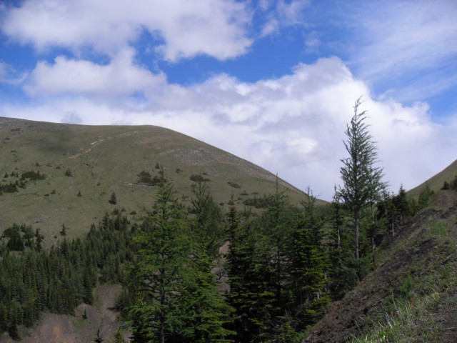
Leaving the trail and heading west we are now on the back side of Picklejar Ridge. For the first few hundred metres you fight through a lot of underbrush, but not long after we break out of the trees. It’s easy going from here on and the ridge is grassy with no underbrush or rocks to worry about.
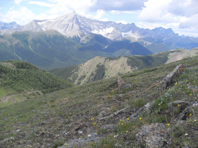
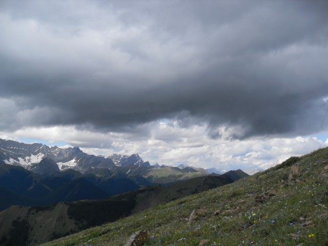
Turning south on gaining the ridge, within a few minutes we are at the summit and we take in the superlative views for bit. The elevation gained here is fairly modest, yet the panoramas that surround us are simply amazing. It’s a great spot for a hill! There are other ridges to be seen from here – Mist Ridge, Eagle Ridge, Odlum Ridge, themselves all great hiking objectives.
To the west the towering Mist Mountain dominated the view and to the east there is an unbroken wall of sharp edges peaks and high ridges. Most of these are best left to hardcore scramblers or mountaineers – people Connie and I are not.
Below you can see the exploration road we’ll take down. It cuts across a steep side-path then zig zags up once before ending just below that other hill’s summit. If you look you can also following another exploration roads as it makes it way to Mist Ridge to the north. These old road make for great trails. They are wide and never terribly steep. On the way down we’ll use part of the Mist Ridge road.
After enjoying a yummy lunch it’s time to head down.
It’s real easy just work your way down the west side of the Picklejar Ridge, intercepting that exploration road at the col between our ridge and that smaller hill to the south. The way is always obvious. Then it’s a simple matter of following this route down until it connect to the Mist Ridge exploration road. Entering the trees followed shorty after by a switchback, we arrive at that junction. Turn left and head down.
The rest of the trail is mostly unremarkable following that Mist Ridge exploration road as it works its way down. As you near the Mist Creek trail the alders start to chock out the path. Watch you don’t get a branch in the eye! At the final junction with the signed Mist Creek trail, head left (south) and follow it to the the Mist Creek day use area. From here it’s a short walk along the highway which leads us back to the car. For the final few kilometres along the Mist Creek trail we followed in the path of a bear who took the same route we did. There was tracks and fresh poo!
I found the exploration road really interesting. The builders of it must have been a bit looney, it just clings to the side of the steep hill, cutting a crazy path across it. What a ride it must have been for the Caterpillar operator!
These date from the late 1940s and early 1950s and research suggests they were looking for coal, which does occur in the area. I have however yet to see an exposed seams along any of these “exploration roads”. I guess what they did was send a Cat cutting across a slope in hopes it would uncover a workable seam.
Other similar roads also occur on the area, always doing the same thing – making a bee line for a ridge top. Mist Ridge has one and so does nearby Mt Lipsett. Still a bit cloudy of their exact purpose, they do make nice and easy trails up!
Also, if you know the real name of the ridge we were on (if it even has one), by all mean let us know.
To see some other ridges, we’ve explored, go here…
Missinglink Mountain.
One Mine Ridge.
Raspberry Ridge.
If you wish more information on this trail, by all means contact us!
Date of adventure: July 2010.
Location: Kananaskis.
Distance: 14km loop (The gps was acting weird all day, so I am not sure if distance and height are accurate).
Height gain from start: 805m
Height gain cumulative: 805m
Technical bits: None.
Notes: It’s bear country and we saw lots of prints and diggings,
Reference: Kananaskis Trail Guides by the Dafferns. Uses parts of the Picklejar Creek and Mist Ridge trails along with some bushwhacking.
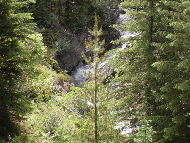
We follow Picklejar Creek for a while.
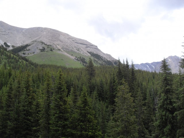
We break out of the forest.
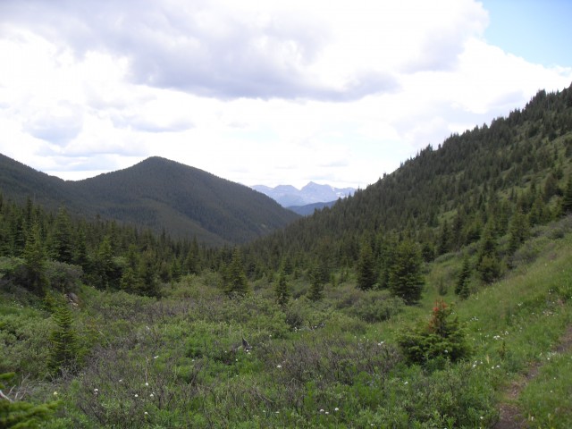
At “Picklejar Meadows”, we came up the valley you see here.
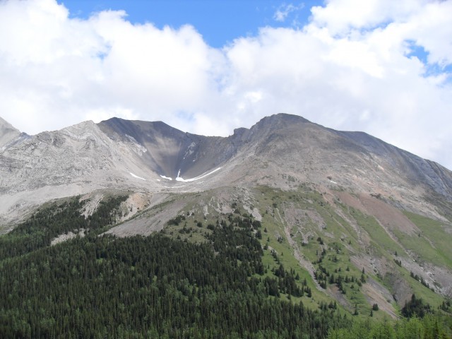
To the east, a ridge connected to Highwood Peak.
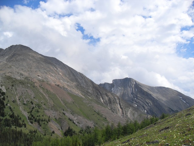
Looking roughly southeast, more of the ridge off Highwood Peak.
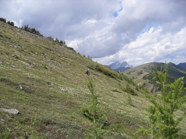
After some bushwhacking, we head up the backside of Picklejar Ridge.
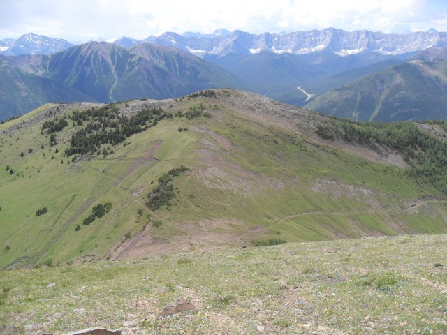
On the ridge top. Note the exploration road below which we’ll make use of on the way down.
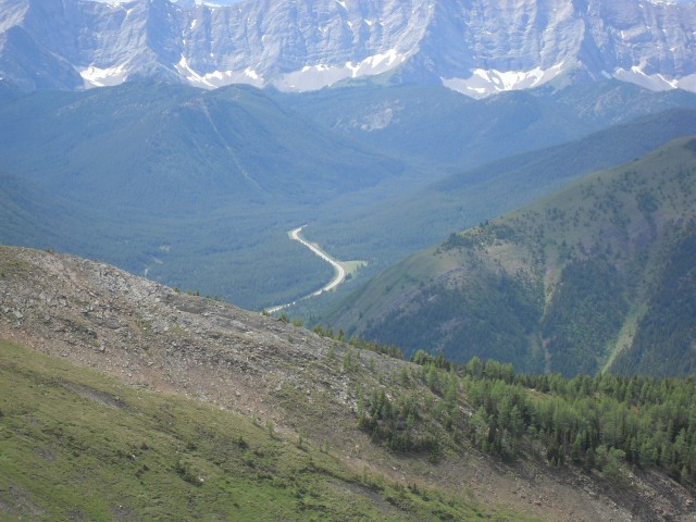
Highway 40 far below.
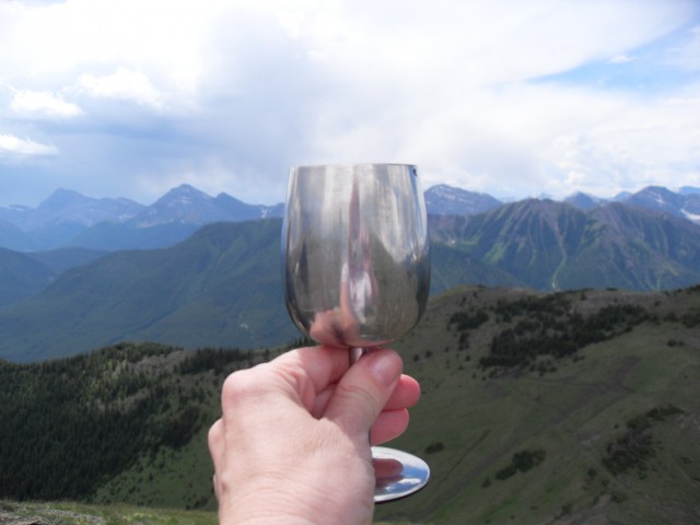
Wine!
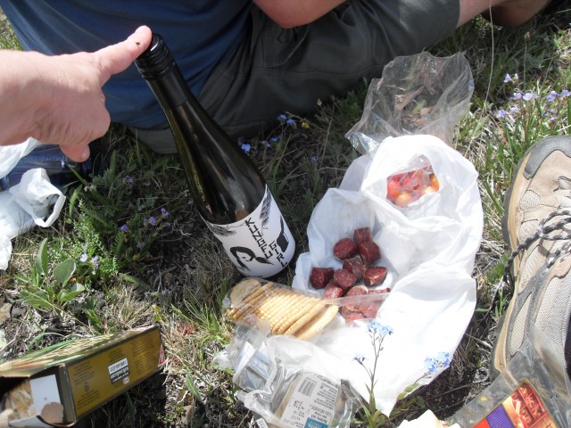
Yummy lunch. We always bring wine (Kung Fu Girl!), it’s the perfect reward.
Mist Mountain dominates the view in the west.

Wandering around and taking it all in.
Great views!
Looking back at the summit of Picklejar Ridge.
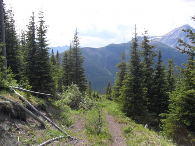
The exploration road down. Soon it meets up with the Mist Ridge trail.
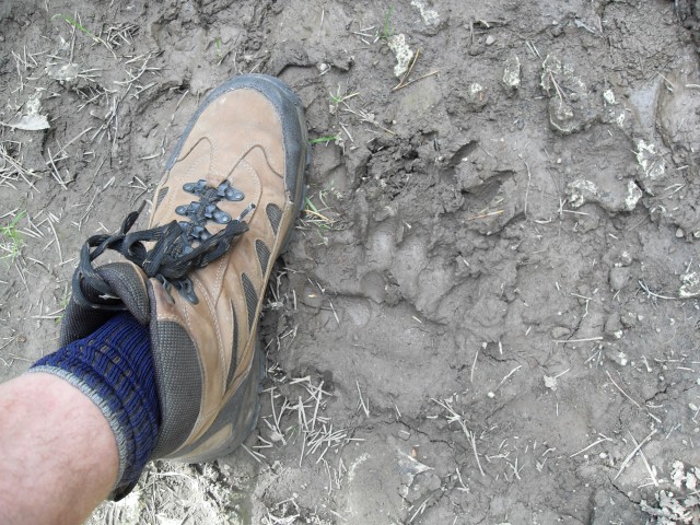
Connie the bear tracker spots a sign.


")


This a new one for us. Never heard of it but it looks stunning. I’m putting it on my to-do list, assuming they ever open up the roads in the area again.
As of today (July 24 2013), the road to this hike is closed with no information to when it may open. I really enjoyed this hike.