Ridge north of Green Mountain
With many parts of Kananaskis off limits or inaccessible due to the aftermath of record flooding, it was clear our hiking options were rather limited. The only open area was near the Sheep River west of Turner Valley, but there are certainly enough trails in an around there to keep us busy.
We were craving a ridge walk however and with that in mind, I’ve been eyeing a modest hill along the highway for some time now. Directly north of Green Mountain, its open grassy slopes seemed inviting. The ridge looked like it could be followed for at least a couple kilometres and I am certain the views to the west and south would be superb (and they were) – so why not give it a try.
The route is probably one of the simplest ones we’ll ever describe. Park near the cattle guard at Nash Meadows – a large and obvious large open field between the highway and the Sheep River at the bottom of a hill just west of the Bighorn day use area and east of the old ranger station.
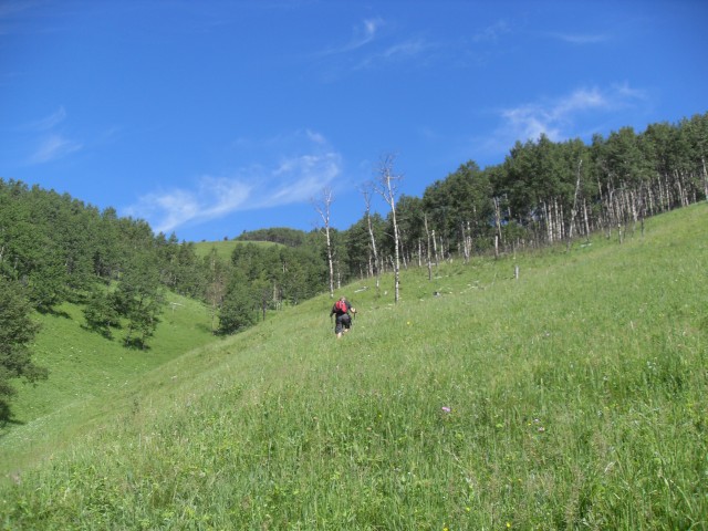
Your “trail” is the grassy slopes to north. Simply head up, taking what ever line pleases you, and before long you’ll be at the top. That’s all there is too it.
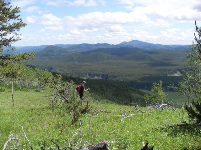
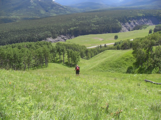
The route up is open with few trees, and the way is always obvious. You can tackle the slopes head on, do long zig-zagging traverse, or if you’re like us, do a little of both. Some sections are steep and there are few flat spots, but regardless the going is never hard. The lush grass, thick and wet from recent rains, did however hide a few obstacles – gopher holes, animal poop and lots of dead fall in the tree groves, plus it was slippery and so care was needed in places. Almost all the elevation is gained along this stretch and the ridge top is always in view.
We elected to summit at the ridge’s most easterly high point and then follow it west as far as we could. The views from the top were indeed stunning, especially so given the modest elevation gain.
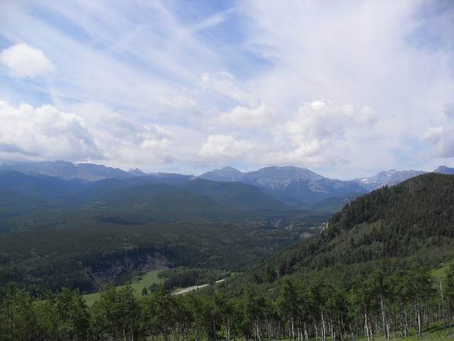
Directly south of us is Green Mountain, a forest covered hill about the same height as the ridge we are on. This mountain is just south of the Sheep River, whose gorge can be seen below, and while you can hike up it, the bridge used to access the Green Mountain trail may be damaged by floods making things difficult.
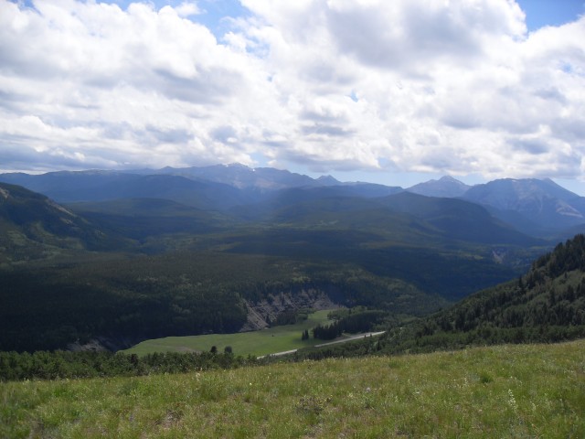
Further east, rolling hills can be seen stretching off in the distance. To the south west, we can see smaller hills in the foreground, like Mount Hoffmann, a nice destination to hike up. In behind are large barren limestone peaks with names like Shunga-la-she, Junction Mountain and Bluerock Mountain.
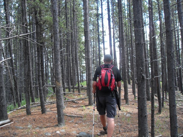
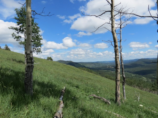
Interestingly, on topping out at the east end of the ridge, we discovered a trail, faint at first but becoming more defined as we travelled west. Here I thought this would be our ridge with few signs that anyone else visited it. As it turns out this is a new trail, at the time unbeknownst to us. It travels along the ridge top, sometimes out in the open and other times in wooded areas. The trail at times vanishes and just as quickly reappears. The ridge is fairly narrow in most places, so even if you loose the trail, you can’t get lost.
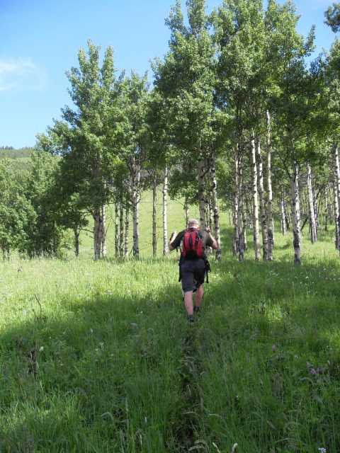
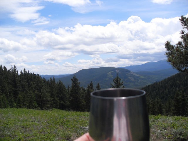
As we travelled west the ridge undulates a bit and the route becomes more forested, with a few open meadows in between. At its westerly edge, the densely treed ridge quickly drops away and this was our turn around point and we headed back to the last meadow to enjoy our lunch.
This trail by the way, as we found out after, is a newly documented access route which leads up the backside of Missinglink Mountain, which sits directly west. I checked with our Kananaskis Trails Guide book and indeed there is a route shown here. We did not however travel beyond our ridge – first of all we were unaware it was even possible to connect to Missinglink Mountain until we checkout out the guidebook later.
One observation: there is dense forest between our ridge and Missinglink and what appears to be a valley too, both of which would be formidable obstacles. It looked impassable in fact. Knowing that it is possible, we may return to try our luck, GPS in hand.
There were lots of strawberry plants seen along the route but in spite of the potential, Connie (the strawberry hunter) was only able to find a couple. If this ridge has a name, I am not aware of it. It may actually be a part of Missinglink Mountain.
Heading back, we retraced our steps. On the way down, we spotted some recent bear activity – turned over rocks, lots of fresh poop and the like. We had a good view of Nash Meadows directly below us. The University of Calgary does field work here, studying various plants and animals as I understand it. Research was going on that day and many students could be seen do what ever they do in the field.
Back at the car, I refereed to our Kananaskis Trail Guide by Gillean Daffern, volume 4. It turns out were were on trail 21A: Missinglink Mountain from Nash Meadows. Given it’s in a guide now, it am certain the trail will be come more popular and more defined in the wooded areas. We hope to return. The book by the way, suggests either taking the route we up choose, or an alternative path a bit east, which follows another rib.
We’ve hiked up Foran Grade Ridge before and to see our report on this, click the link below…
Foran Grade, an easy trail with rewarding views.
To see some other modest ridges we’ve hiked, go here…
Mesa Butte via Curley Sand Ridge.
Deer Ridge.
If you wish more information on this route, by all means contact us!
Date of adventure: July, 2013.
Location: Sheep River Valley, Kananaskis.
Distance: 6km out and back.
Height gain from start: 300m.
Height gain cumulative: 350m.
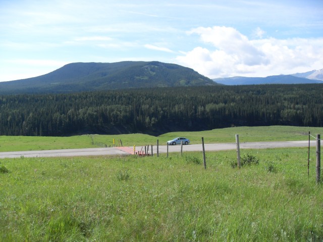
The start of our adventure begins at this cattle guard. Green Mountain in back.
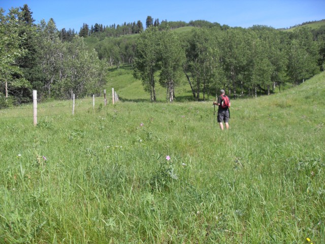
Heading up the grassy ridge.
Sometimes there are animal trails to follow.
The way up is obvious.
We’ve been up to Mt Hoffmann, the tallest green bump in the centre.
Lunch at a pleasant meadow.
Parts of the ridge are in the trees.
Looking southeast. The ridge here is more open.
Looking south. The Sheep River runs through the gorge just up from the meadow below.
East up the Sheep River valley.
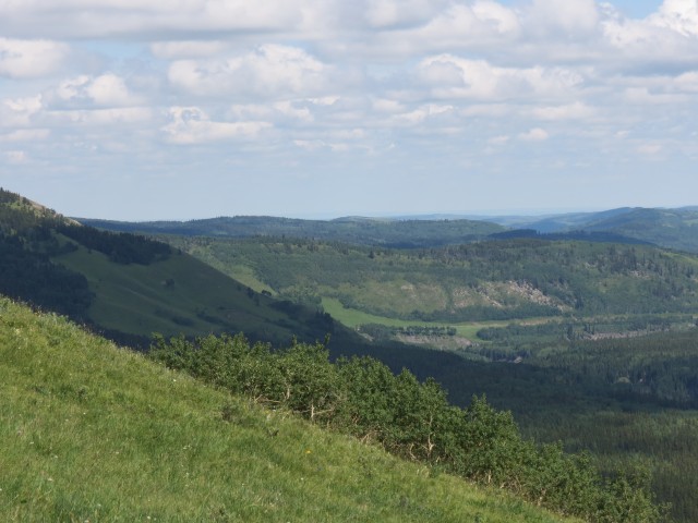
Foran Grade is the first ridge in back.
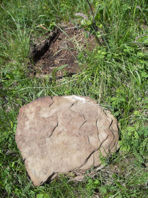
Signs of recent bear activity.
Heading back down.
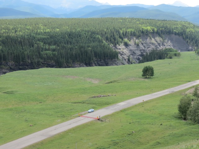
Nash Meadows.
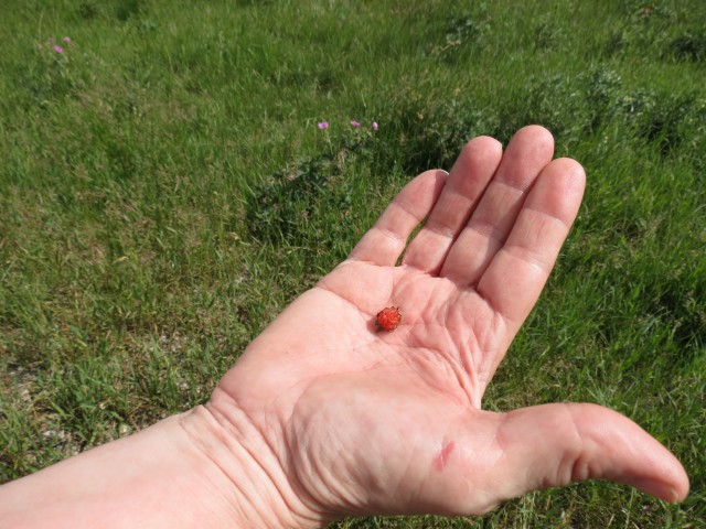
Connie finds one tiny strawberry.


I’ve been contemplating hiking to Missinglink Mountain as described in the Gillian Dafferns book, so using parts of the route you traveled. From the description, the bushwhacking section sounds fairly easy but you seem to think otherwise.
I can’t help but think we missed something, a turn off perhaps. From the west edge of the ridge we were on, it looked like you not only had to negotiate thick woods, but had to drop down steeply to a very densely forested valley to boot, to gain the backside of Missinglink. I see one person has posted a trip report using parts of the trail we did and I have contacted them to see what they have to say about the route.