Sunken (Lost) Creek to Dibble Mine – Cranbrook BC
This trip was a bit of a disappointment for us. This was our third attempt over the years to get to the historic Dibble Mine site, via the gruelling and unforgiving Sunken (Lost) Creek hiking trail. And while we did get to our goal this time, it was a hollow victory. By the time we arrived at the mine, we had almost run out of time, meaning we only had perhaps half an hour to explore the former operation.
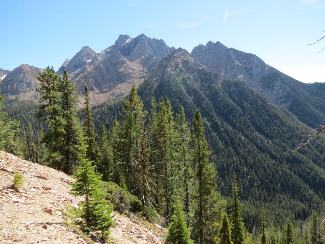
The trail described here is not only hard, difficult, rugged, and challenging, it’s so often in the trees, that views are limited most of the way. Only at the mine did things open up. Based upon this I would not recommend it for a casual hike. It’s just not worth it, unless you like to punish yourself. Go only if you are heading further into the high country above the trees, or are visiting the mine site, as we did.
To get to the mine, located on a high slope, requires one to gain some 1100-1200m of elevation. This is in fact the most height we’ve ever done in one stretch and is marginally higher than any summit we’ve yet to conquer. Everything here is on a grand scale!
Amazingly, this route is used by horseback riders and we even saw some on the way up. The trail is so narrow and steep and heavily over grown in places, and the footing loose, I wonder how they do it? Nothing here is easy.
The trailhead is just east of Horseshoe Lake, south of Fort Steele BC. The last kilometre of road requires a high clearance vehicle (thanks Tarena for lending us yours).
Start out on the wide ATV trail heading into the trees. At any junctions, keep right. Along here you’ll gains some modest elevation. After a kilometre or so, the hillside steepens and the trail narrows to a foot path. Soon you’ll hear Sunken Creek (also known as Lost Creek – not sure why there are two names), which is going to be your companion for the rest of the trip.
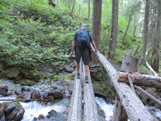
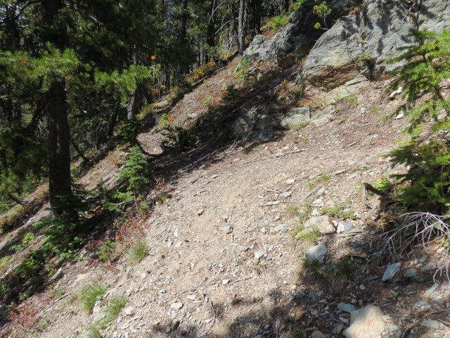
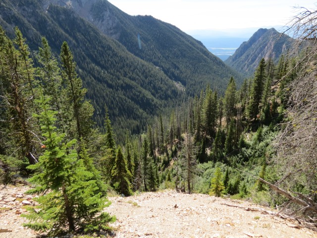
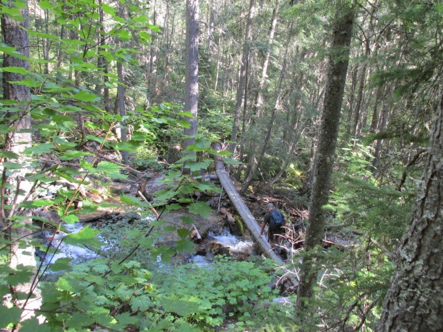
Traversing a steep bank, we soon come to the creek. For those on foot (hereafter known as those crazy hikers), there is log bridge here. From here you’ll head up and up and up, with few breaks, all the way to the mine. It’s relentless. Your only views most of the time are of trees and nothing else. Pretty mundane really.
The trail switchbacks a couple times, connecting with the former mine trail coming in from the right. From this point on, you’ll be using it for most of the trip up. Turn left here and start another climb (a common theme this day). Topping out, momentarily, we find some old cabin remains, but for some reason I did not photograph them. I can only assume that the structure was in some way related to the mining operation, since this spot, a small flat area in an incredibly steep and precipitous valley, is the most unlikely place for a cabin ever. The mine’s base camp, maybe?
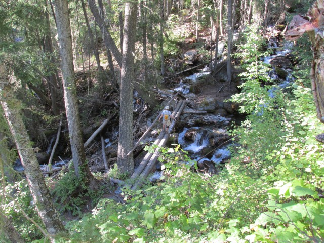
Coming to a second crossing of the stream we come to more switchbacks. While the whole trail is loose in places, these ones are even more so.
Gaining more elevation, in places Sunken Creek is sometimes far below, other times right beside the trail. We spot a garter snake here, sunning itself and dozens of frogs, all of which seem to be camera shy. We couldn’t get one to stay still long enough to photograph it, although the snake cooperated a bit.
Along here is a marked junction, with the Mause Trail or Mause Creek Trail. This route takes you up and over a ridge to an adjacent valley.
Continuing on and always up, we start passing avalanche chutes, They are heavily overgrown and the trail through them is hard follow. Along here we meet some horse riders, who as it turns out are out clearing some dead fall from the trail (thanks). Also not far way, is a bear researcher (who passed us earlier – we’re slow). She’s here to take hair samples from bear rubbing trees.
Coming to some larger avalanche chutes, I know I am close to our objective now. If my research is correct (and it was), the mine will be just above us, accessible via some faint and overgrown trails.
It’s here we realize it has taken us more time than panned to get to the site and instead of exploring the entire Dibble operation as planned, I have to limit my self to a small part of it. Spread over a half kilometre there are four accessible adits, one slumped (collapsed) adit, a couple shafts (we’ll give them a wide berth), along with numerous open cuts and trenches. Lots to explore and all well hidden in the underbrush.
Given the time constraints, I decide to visit the shortest adit only, leaving the others for possible future trips. I guess we started too late (noted).
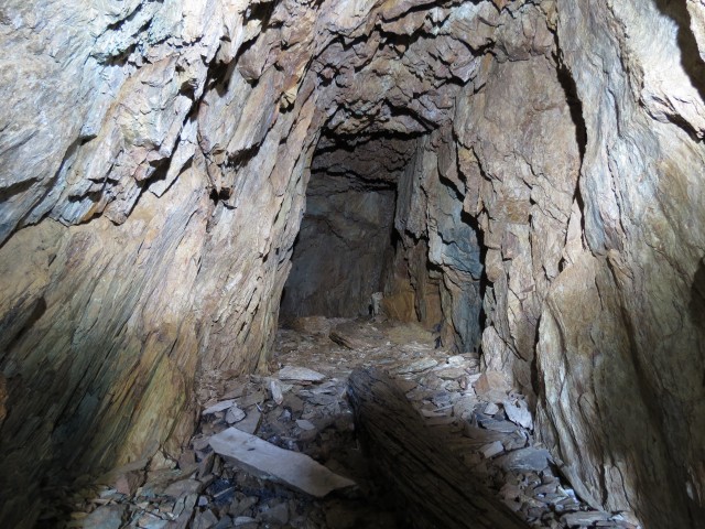
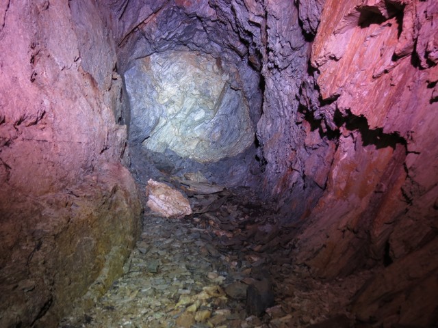
The entry I picked, the #3 adit on old documents, starts out as a deep trench before transitioning underground. I know this one is short, I have the maps, heading in for a few dozen metres before ending at a T. From here two crosscuts continue on at right angles to the main tunnel, before ending shortly after. The small size of this adit means the vein must have petered out quickly.
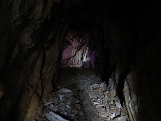
Scrambling down to the entrance, I see the tunnel is free of any rock fall or loose looking patches. In spite of being blasted out eons ago, this adit is in fine shape its entire length and the rock here is obviously very solid. I find some old beams one of the the side tunnels. With the mine quickly explored, I have some fun with the camera, using some coloured gels to add a red glow to the photos. The entrance of the mine has a nice view.
Inside I find some ice crystals (it was 25 degrees outside). And spiders, actually of Daddy-Long-Legs, some of them frozen solid from the cold. Neither of these photographed well – I tried.
Directly below the tunnel I entered, is another a few dozen metres below, down a steep slope. Also a third is nearby, down a second slope – this one is the longest tunnel and I wanted to save it for when I had more time. A fourth adit is further east, along with those cuts and shafts and trenches scattered about the property. I had a map so I knew when each one was.
Regarding safety – we always come prepared and in addition to having a good understanding of underground mining and knowing the dangers, we research, in depth, the history of each operation we visit. We also bring in the correct equipment including proper helmets, headlights, extra flashlights and more batteries than we can count. Mines are dangerous at the best of times, but preparing ourselves as we do assures us the safest possible experience.
The Dibble Mine property, sometimes called the Leo Mine, was a small operation that was worked intermittently from the 1890s-1930s. They mined Silver, Gold and Copper – I even found a Copper stained chip in some waste material. It’s doubtful much money was made from this operation, although even recently junior mining companies continue to explore the immediate area’s potential.
Our time run out, we reluctantly head back down. It’s been too short a visit! Along the way, I gather up some Salmon Berries (yum) to snack as we head down. These grow in thick impenetrable patches on the avalanche chutes.
It’s taken three tries to get this far, but I am willing to take another stab at it, making sure to start earlier so I have the time to properly document the full operation. Hopefully, you’ll see another report on this mine.
The trip back down was totally uneventful.
To see some other mines we’ve explored in the area, follow the links below…
Moyie BC and the St Eugene Mine.
Mining under Moyie Falls.
The Payroll Mine.
If you wish more information on this trail or the mine, by all means contact us!
Date of adventure: September, 2013.
Location: Near Cranbrook, BC.
Distance: 16km round trip.
Height gain maximum: 1100-1200m (A lot!)
Height gain cumulative: 1150-1250m
Technical bits: The trail is steep and loose in many places.
NOTE: all heights and distances are approximate (I forgot the GPS this day).
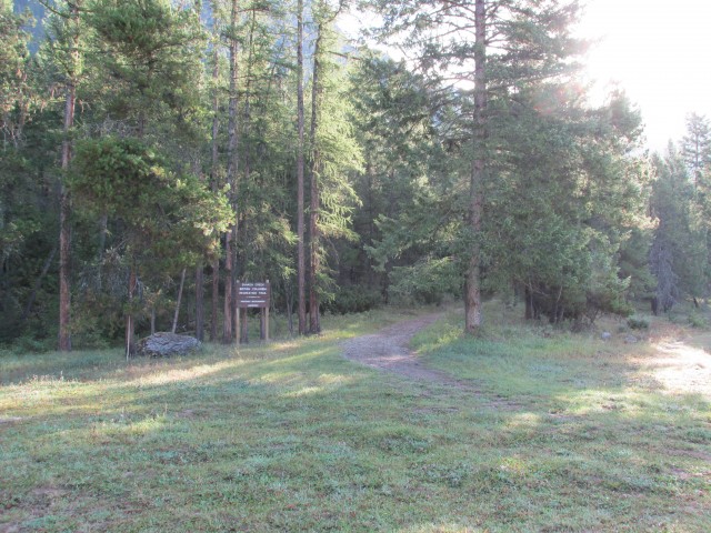
The start of the Sunken (Lost) Creek trail.
It’s higher than it looks.
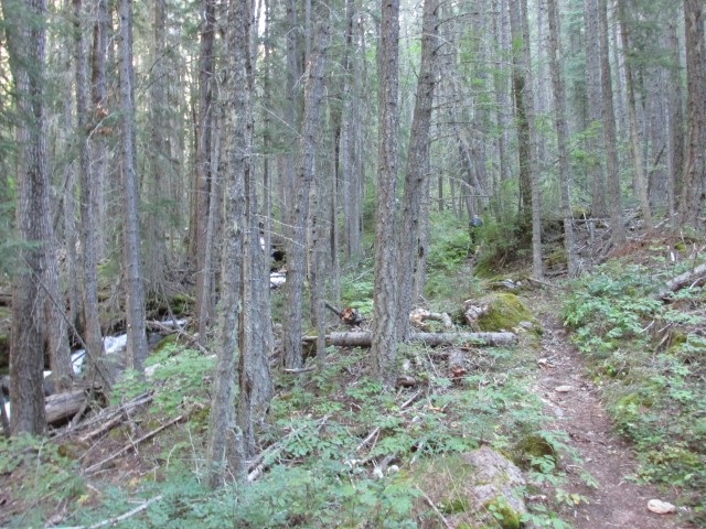
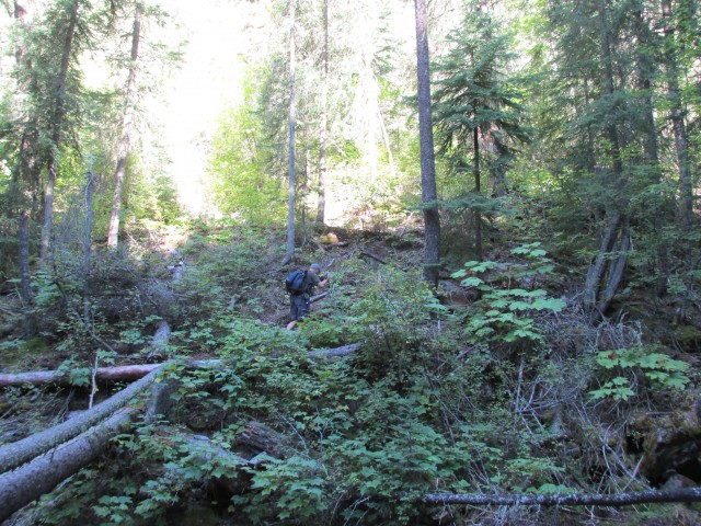
A typical view…trees, trees and more trees.
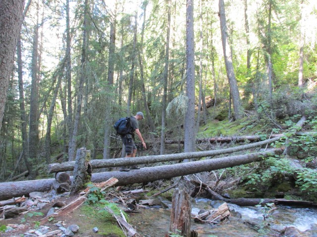
A second crossing.
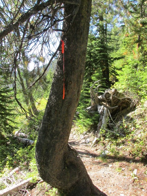
It’s hard to tell in the pictures, but the trail is steep! And it’s rugged.
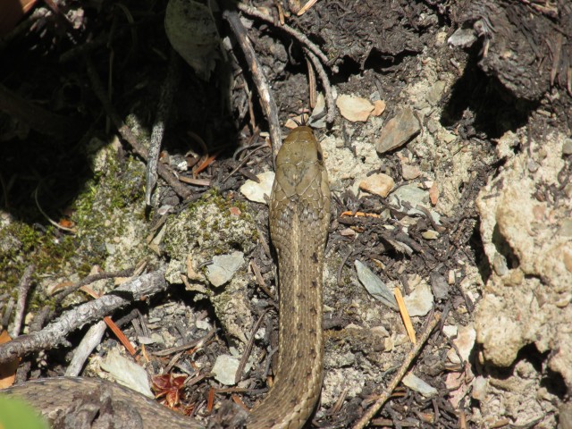
This fellow was sunning himself on the trail.
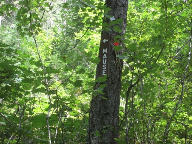
If you wish, you can take this trail that goes up and over the ridge to an adjacent valley.
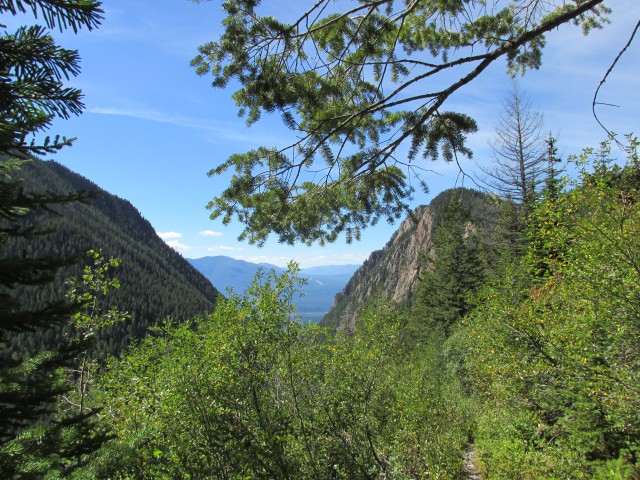
With the dense bush, the views are few and far between.
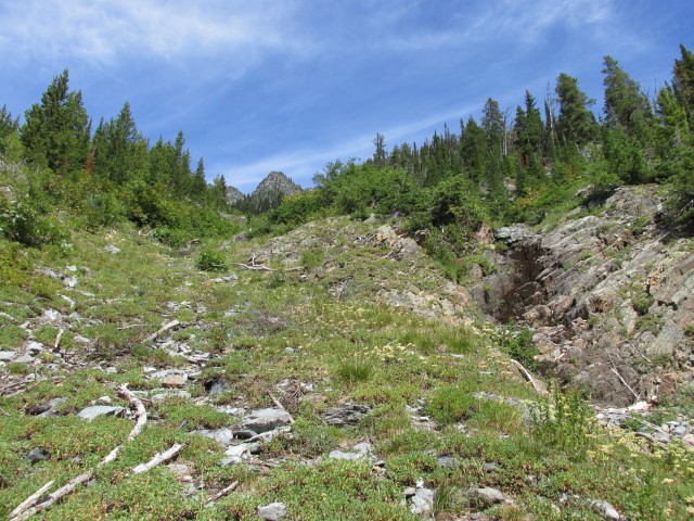
Once we start passing avalanche chutes, we know we are close to our goal.
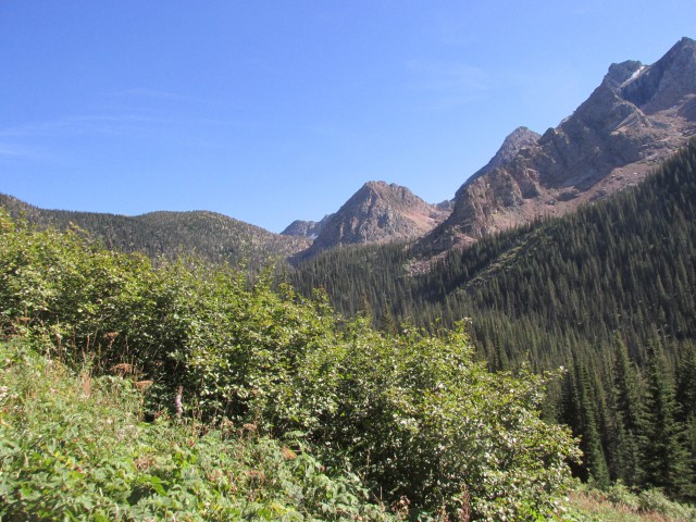
Looking south.
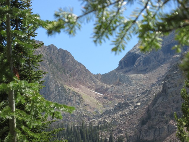
In spite of gaining huge elevation, we have still has not escaped the valley.
The faint trail to Dibble Mine adit #3.
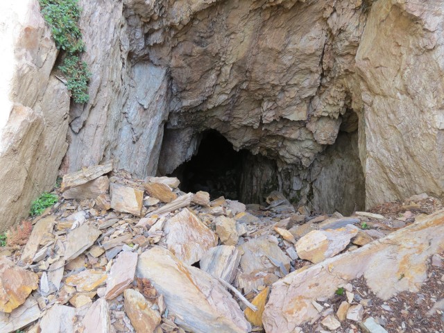
The mine opening. I’ll have to scramble down to get in.
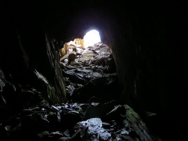
Looking back as I head in deeper.
The mine was worked at various times from the 1890s-1930s.
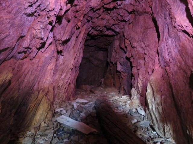
Having fun with coloured gels.
At the end of the short drift was an equally short crosscut.
They mined Silver, Gold and Copper here.
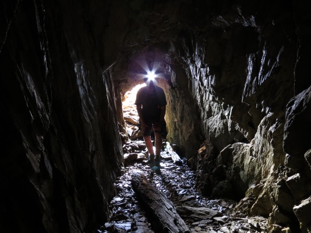
Your’s truly…
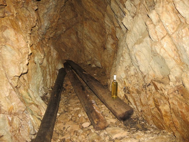
Some old beams…is that wine?
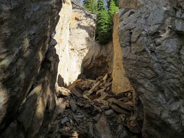
The open cut before the adit.
A second adit is located just down the slope and to the right.
Nice view! A third adit is can be found by traversing down the slope in front.
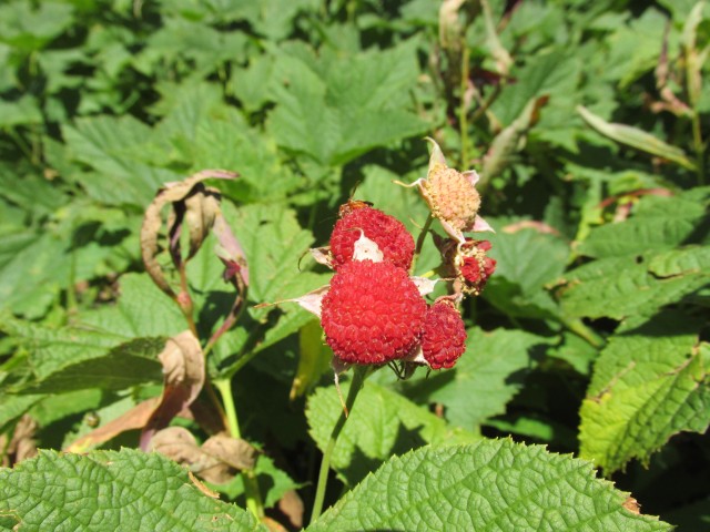
Yummy Salmon Berries.
This, according to the researcher we passed, is a bear rubbing tree.
Heading back down, I cross the second bridge…
…And Connie crosses the first.
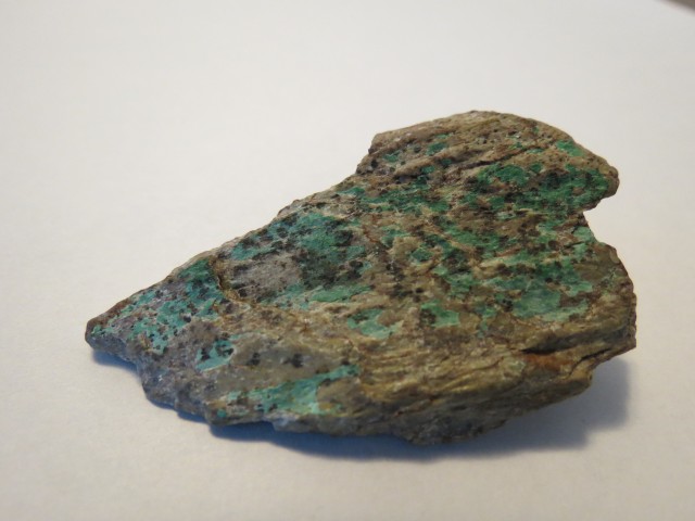
Copper stained rock found in the mine’s waste dump.


Lot of work to get there! No wonder it’s never been visited. Excellent pictures by the way. Always nice to see fellow mine explorers.
It was a lot of work! I want to go back though.
You are right! Unless you go all the way, the trail is simply not worth it. We did it on horseback and went a bit farther than you and the views were spectacular! I did not realize there was a mine here. Very nice pictures from inside!
Agreed! I was cursing the trail the whole time, but I once I got to the mine, the views (and history) made it worth it.
Gorgeous! It’s amazing the hard work done by our pioneers. Working that mine must have been really difficult!
People back then were hardcore! Mining here must have been backbreaking work.