The Pat Burns Coal Mine is situated deep in the mountains far up the Sheep River valley, and is certainly is the most stunning location of any coal mine this author has seen. While the operation was ultimately a failure, it’s certainly a winner for explorers like us. What a great place to soak up the past!
Coal was discovered at this location just past the turn of the twentieth century, but it took many more years for any development to happen. Real work started around 1913 and the intentions were to develop the mine concurrent with building of a railway to the site. Trains, then as in now, are the only way to transport bulk commodities like this economically.
In the meantime, the mine was developed, some coal stockpiled, and some test shipments sent east by wagon.
↓ ↓ ↓ ↓ Scroll down for photos and to comment ↓ ↓ ↓ ↓
But the railway never came, although some grading was done near Turner Valley. After a few years more, all work at the mine slowed and then finally stopped altogether and by the early 1920s it was done for. Without the railway, there is no way this operation could compete with others in the province. Coal from mines in Canmore, The Crowsnest Pass, Bankhead and the Drumheller areas could be sourced for less. So even, while this coal here was of high quality, there would never be demand unless they could get it to market cheaply. That’s what killed the plan.
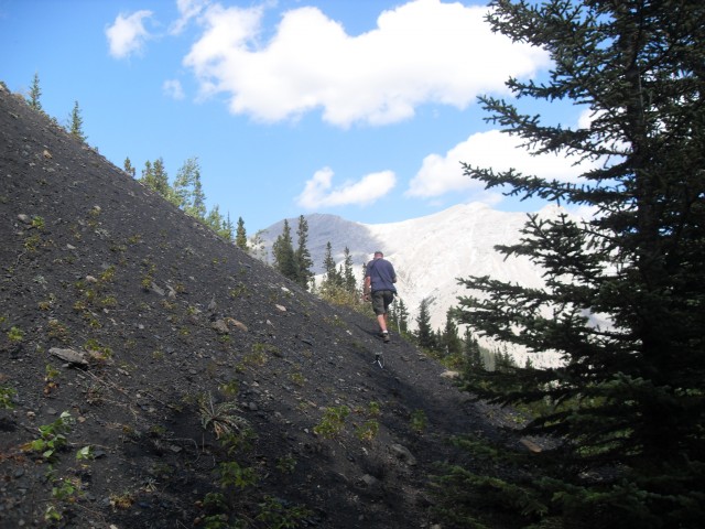
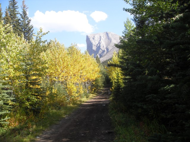
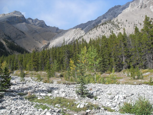
Fast forward and almost a hundred years after the mine first opened, we visit the site. Access is by the decommissioned mine road. It’s couple hour hike, or you can bike in or a ride a horse.
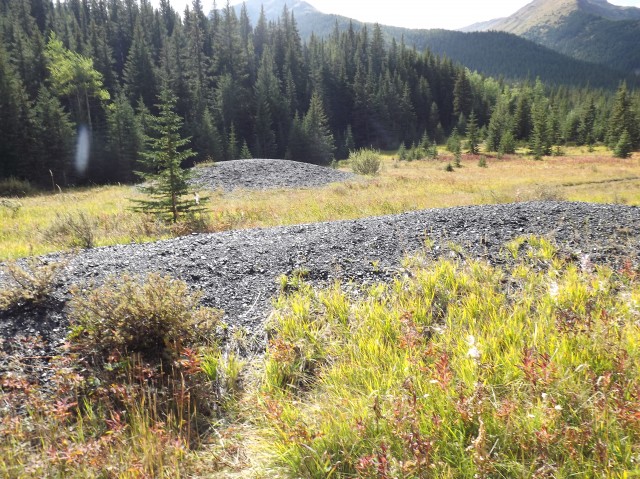
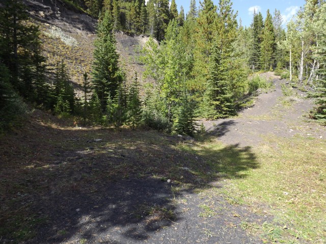
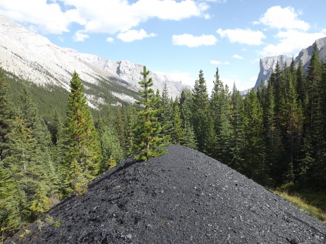
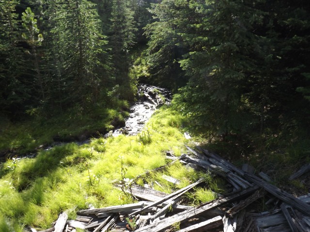
The first evidence of the mine are a couple small coal piles in a meadow. Here in this flat area was the housing for the miners, offices and so on. Nothing much otherwise remains today.
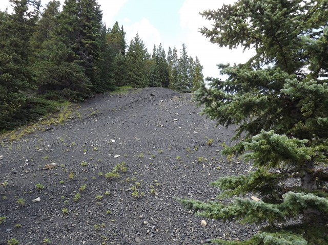
Most people who visit here think this is all there is to the Burns mine site, but it’s not, and higher up on some slopes to the south are two separate workings perhaps under a kilometre apart. It’s a bit of a steep hike to get to them and the trails are somewhat overgrown in places. Because of this, these two areas receive few visitors.
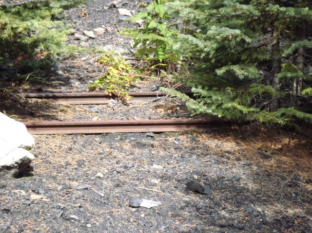
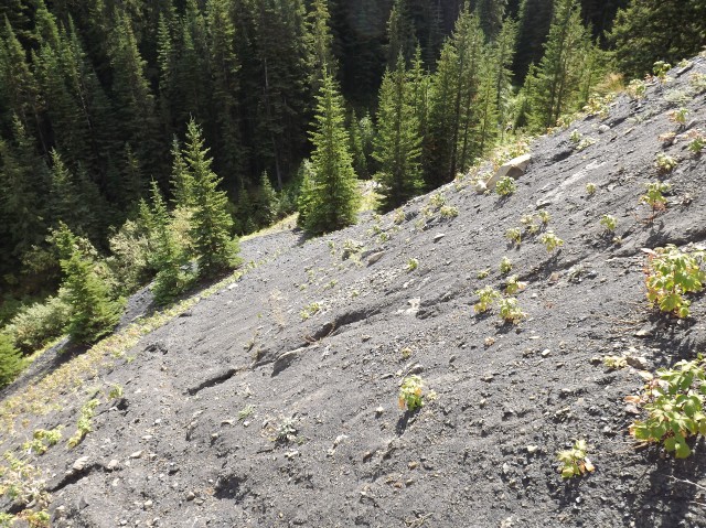
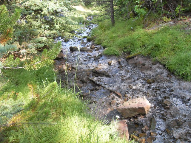
First we explore the east workings, situated on a steep hillside a couple hundred metres above the trail we came in on. There appears to be two levels at this location, one right above the other, with a large slack pile separating them. The lower workings still have rails coming out of the collapsed entrance. How the coal was transported from here down to the loading point at the town site is uncertain. Typically a tramway system is used, but no evidence could be found to confirm that.
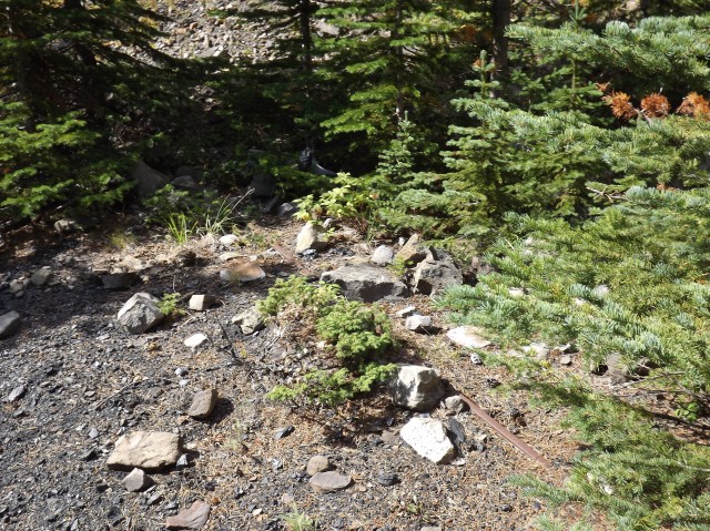
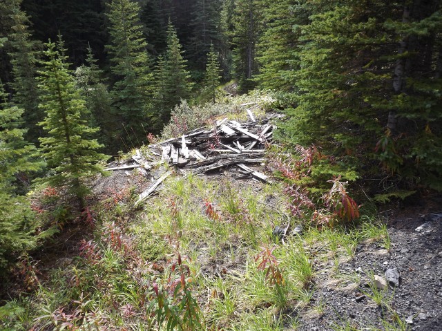
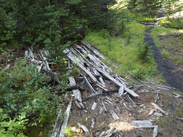
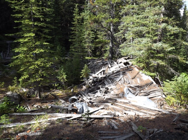
Scattered about here are the remains of a few buildings, old metal bits and not much else. Wild Raspberries grow on the coal slack. While enjoying lunch, I take a moment to make a time lapse of the clouds as they flow and billow past the mine site.
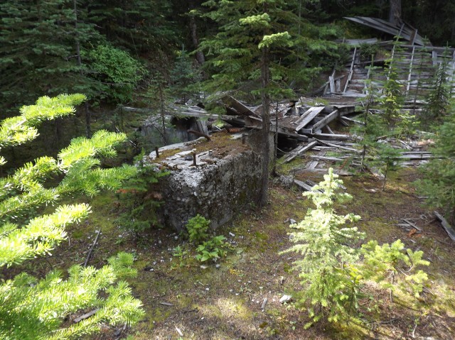
The second set of workings are situated a little lower on the mountain and to the west and judging by the amount of slack, debris and collapsed buildings it seems this was the main area of the Burns Mine operation.
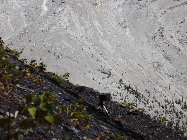
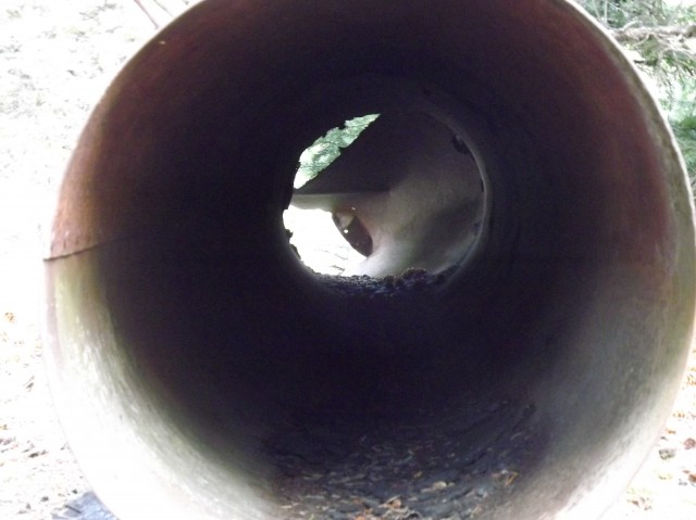
The whole west site is littered with pipes, most of them flattened. It can be assumed these may have been used for ventilation (critical in a coal mine). An awfully stinky sulphur spring flows from the collapsed mine entrance here.
Be sure to comment on this post (below pictures).
It’s possible the east and west workings were connected underground, but it’s only a guess at this point. It’s not unusual for mines to have many access points.
The Pat Burns associated with this mine is the same person behind the company Burns Meats. He had his fingers in many enterprises and has quite a legacy in the area.
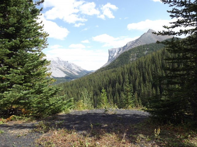
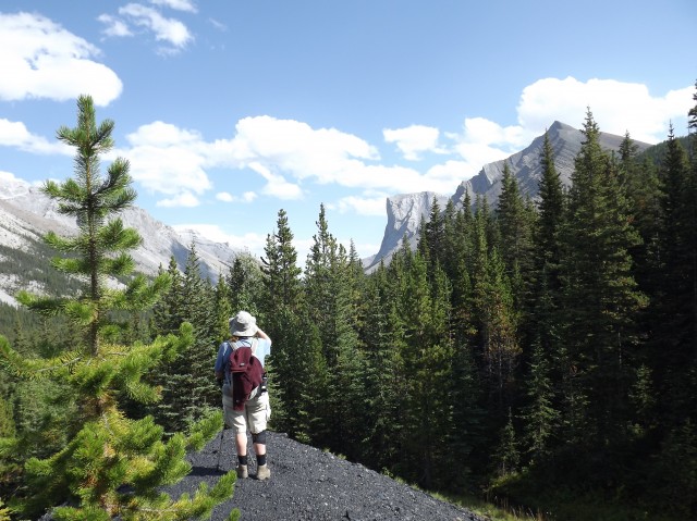
On the way out, we get a final look at Gibraltar Mountain. It’s easy to to spot, with it’s very broad near vertical face. Somewhere up there is the remains of a mine employee. On a day off, this person along with some other coworkers attempted to summit the mountain (using the easier back side), and along the way managed to fall over the edge. He’s still there, a sobering thought.
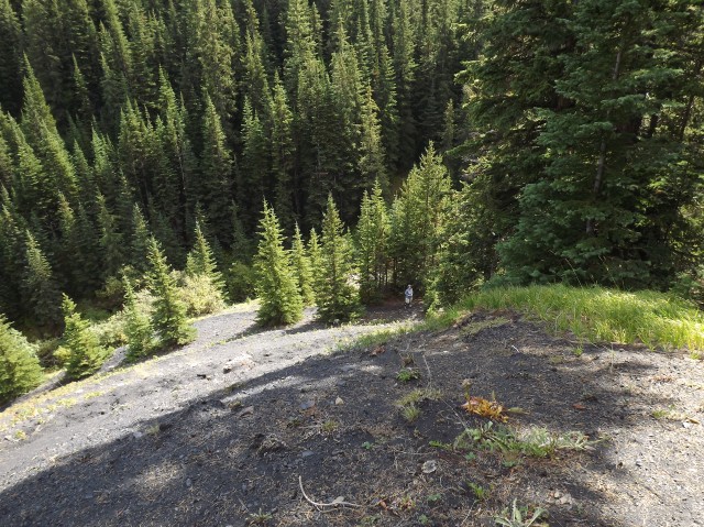
Heading back, reluctantly, we make our way to the car some ten clicks way, thoroughly happy with the adventure that has just unfolded. While the trail back is mostly unexciting, the views are good and they make it all worthwhile.
We used to do something called the "pointless challenge" 🤪 and miss those days. It was so much silly fun and often frustrating as heck. In these we'd invite people to send in random photos of obscure locations, but not give any information, and then we'd track where it was and shoot something similar.
Most of these came from old family collections, as was the case here. Anyone up to resurrecting the series?
In hindsight, why didn't we pose someone in our shot?
Pointless: “Devoid of meaning (or) senseless” Merriam-Webster.
If you like what we do and want to support this ongoing project (12 years now), go here: https://www.BIGDoer.com/help-the-society/ Thanks to Connie for making this post possible.
Exploring history with Off the Beaten Path with Chris & Connie. Photo: ca1970 and 2014. Posted by Connie.
Captured on a cold, cold day many years ago. We've been passing this old house for decades and it's little changed in that time. At some point we expect to drive by and it'll be gone.
Exploring history with Off the Beaten Path with Chris & Connie. Photo: 2017. Posted by Connie.
When retired old railway cars usually get cut up for scrap. Sometimes, however, they find their way into the hands of the general public or whomever. Flat cars make good bridges, and boxcars can be transformed into storage buildings and the like. Case in point here. We see them used like this often enough and in this case, it's part of a corral.
Incidentally, this boxcar dates from 1950 and this was found by tracing the old road number, which is still visible.
Exploring history with Off the Beaten Path with Chris & Connie. Photo: 2017. Posted by Connie.
This central Alberta racetrack was never a commercial operation but instead just a fun place for car enthusiasts in the area to get together. Early '70s or thereabouts and it only lasted a few years. Even thought it's been abandoned for that long, there is no doubt what was here.
You know we like the the obscure stuff and this one fits the bill perfectly. Found by accident while backroad cruising and the history comes thanks to local car guy Mike.
Exploring history with Off the Beaten Path with Chris & Connie. Photo: 2022. Posted by Connie.
On top of little Myrtle Mountain in the Kimberley (BC) Nature Park.
There's some good wilderness fun to be had here and nice views as you can see, but the real reason we came is mining history. The whole area near the ski hill was extensively worked over a century ago and we were looking for evidence of this. We didn't find much in the area searched, but it's a big chunk of property and we hope to return to cover more ground again soon. Of all the subjects we cover, mining related is a favourite.
Still, it was a good hike and that can't be bad. Look to the comments for more info 👇.
Exploring nature and history with Off the Beaten Path with Chris & Connie. Photo: 2022. Posted by Connie.
It's a strange curiosity in south Kananaskis, there on a hillside and we have no idea who created it. We asked around and no one's completely sure about its history. In the past it showed the Canada 100 logo from 1967 but in 2017 someone changed it to reflect the country's 150th.
That's our friend Emily from DanOCan.com having a look.
Exploring history with Off the Beaten Path with Chris & Connie. Photo: 2017. Posted by Connie.
Javascript is required for this site to function. Please enable it in your browser settings and refresh this page.
Please log-in to continue... This allows unrestricted access to every post @BIGDoer.com, popups are eliminated, commenting is on and the "contact us" page is enabled.
Your social site may send you a routine notice of login.
Or signup, here: Subscriber Register ___ BIGDoer.com: Serving up POP HISTORY & other McFun!…(Mmmm, yummy bite-sized pieces.) One million plus words & tens of thousands of photos!


")
")


Pat Burns had nothing to do with Burnco, completely different Burns.
Thank you for pointing that out – it took 10k visitors for someone to notice! Not sure how it slipped past the fact checkers but it’s been corrected.
You bring memories alive with your photos and stories. Coal was a lucrative business once. It is too bad the Company was too far from markets.
Coal’s a dirty word present day, but back when this mine was planned, it was the future.
Have you been to Saunders yet?
We’ve scouted the place and plan to return.
What an amazing piece of industrial archaeology. A most interesting find and love that time lapse!
One word.. Great! Two words.. Very awesome! Three words.. I love it!