
Spectacular Buller Pass
We’ve been meaning to do the Buller Pass hike for a long time. I’ve often been told just how spectacular the destination is and let me tell you, those people were right. The trail, from start to finish, does not disappoint. The route, known officially as Buller Creek trail, takes you through lush fairy forests, burnt areas, larch filled alpine valleys, up to a rocky pass surrounded by stunning peaks.
The trail is maintained by the Kananaskis organization, and so is well engineered, has bridged creek crossings, and is clear of dead fall. Perfect! It was a bit busy on the day we were there – understandable given how amazing the scenery is. Busy is relative though, on many trails we see no one, on others a few people but on this one, perhaps two dozen we passed over 6 hours. Still not that many really.
The start of the trail is at the Buller Mountain picnic site near the south end of the Spray Lakes. You head east and right away cross the gravel Smith Dorrien/Spray Road. Clearly seen to your left is Mt Nestor. Heading into the trees, there is a bridged boggy section here and at this point is a map, showing your official trail, along with those that connect with it.
Initially the trail is flat or fairly so. In this area we find a wildlife camera strapped to a tree, which is used to monitor animal moments.
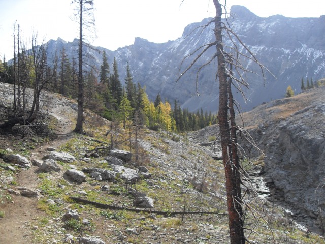
After the second bridge the climbing starts. The trail gains elevation in spurts, with nice flat sections in between where you can rest. It’s seldom steep, save for the very end and the only loose bits are at that final push to the pass.
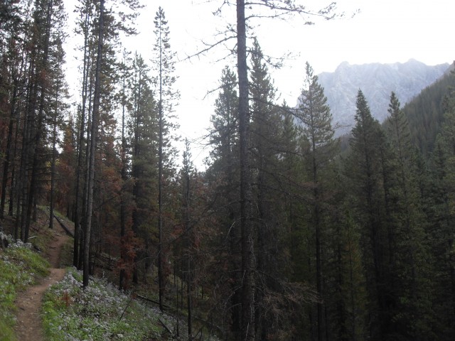
After a spell you pass through some burnt areas. These are from a prescribed fire in 2011 and this was an attempt to combat a mountain pine beetle outbreak in the area. This section of the trail is starkly beautiful.
After the last bridge (hardly a bridge, just some sawed logs), there is a side trail to North Buller Pass. It’s unofficial and is not clearly defined in places. It will allow you however to make somewhat of a loop with the Buller Pass (Creek) trail we’re on. We’ll save it for another day. To your left and towering above is the trail’s namesake, Mt Buller.
Continuing on, you come to this amazing little waterfall with a deep blue pool. I’ll let the pictures do the talking on this one, it’s stunning!
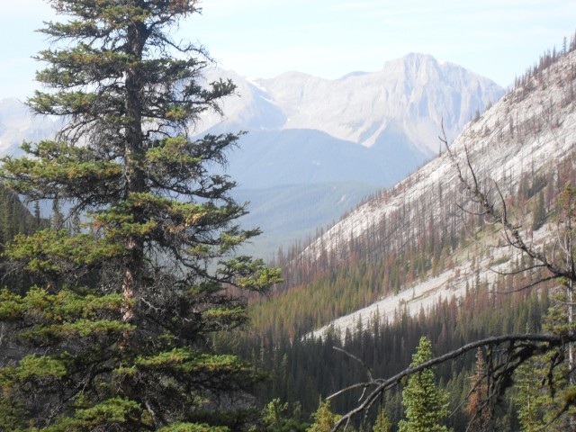
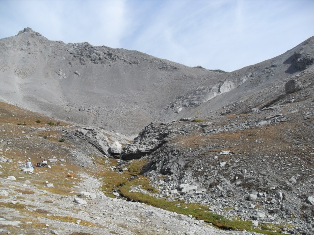
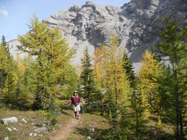
Leaving the last of the burned areas behind, you enter into an alpine valley. The trees thin and larch becomes the dominate species and at this time of year, they are turning a glorious yellow. It was amazing when we went, but given a week or two, it would have been even more spectacular. Larches, (called tamarack where I am from), are the only coniferous species that looses their needles each year, dropping them in the fall much as a deciduous tree drops its leaves.
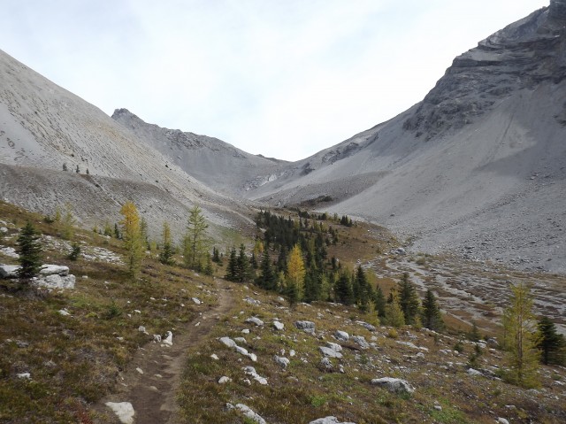
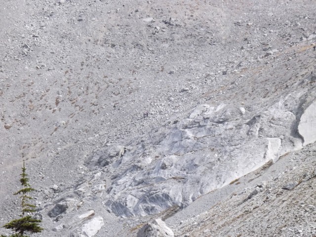
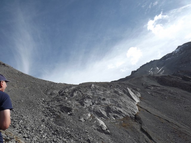
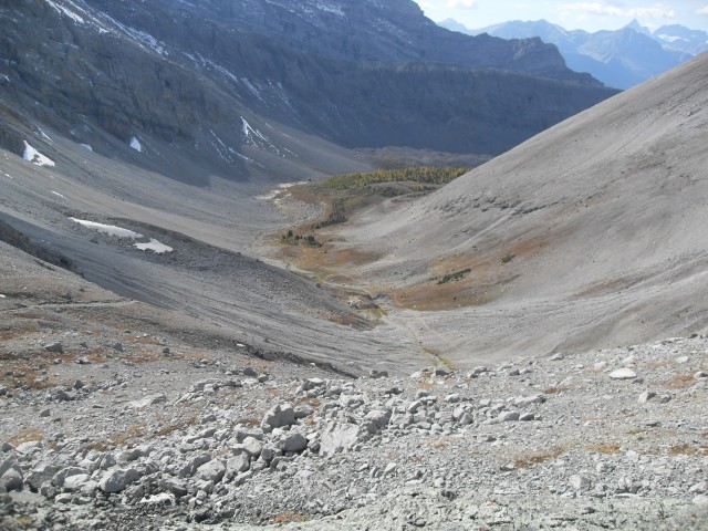
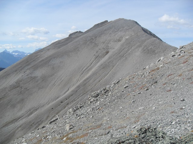
Travelling between tree islands, interspersed with meadows or rugged rocky areas, you enter a wide but deep valley. To the south is Mount Engadine with its sheer cliff faces. Straight ahead you come to steep scree wall and it’s here where you make the final push to the pass, situated just above. The trails looks nasty, but it’s a bit deceptive and in spite of being a bit loose in places, it’s no real challenge. It traverses right up the rugged slope.
In no time, the top of the Buller Pass is reached – prepare yourself for the views!
Blue skies, grey and brown mountains, some white snow, green trees, the deep green lake, and the yellow larches. What a visual treat and the cameras got a workout this day. We had it made at the top!
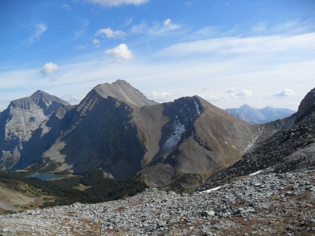
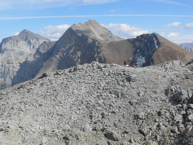
From this lofty perch you can see numerous valleys spreading out below and steep ridges connect the pass to the mountains on each side of you. Some look like they could be scrambled, at least to a point.
Of the mountains seen, some are known to us, Mt Kidd (its backside) for example – there are good views of it. Other nameless ridges extend off in every direction.
To the east you can see Ribbon Lake. There is a back country campground there, which can be accessed from the trail we are on, from the Guinn’s Pass trail that can been seen to the south snaking its way down a steep scree wall, or finally from the Ribbon Creek trail that starts near the Nakiska ski hill. The latter requires climbing up a steep cliff which is dangerous.
If you could pear over the ridge to the south, you could see Lillian Lake, a great hiking destination. It is usually accessed from the east.
While at the top, tourist helicopters could be seen passing overheard. The people inside must consider us crazy, but I like it that way. Personally, when you work hard, as we did, the views are somehow…well…more spectacular. It’s a reward. From a helicopter, it’s just to easy. While having lunch, I set up some our time lapse rig and record some cool videos.
After enjoying an hour at the top (which only seemed like minutes), we head back. It’s always hard to leave a beautiful spot such as this behind. Incredibly hard. Heading back, we enjoy things in reverse – the larches, the burned trees, the lush forest, the gurgling creek – the Buller Pass trail is amazing!
Lots of dogs where seen on this hike, one fellow no bigger than a cat. That’s some hard work for such little legs!
The Smith Dorrien/Spray Road is all gravel and rough in places. It can be done in a car, and prepare to get dusty – super dusty – it gets in every nook and cranny. And the steep part near Canmore can be a bit intimidating to those inexperienced with these types of road (not me, I grew up around logging roads). You can always approach from Peter Lougheed Provincial Park too, which is the less winding/steep way to go.
The time lapse videos we made are a bit jerky. I set the interval a bit long (still experimenting).
Other spectacular hikes in the area include…
Headwall Lakes.
Burstall Pass.
Windtower.
If you wish more information on this trail, by all means contact us!
Date of adventure: September 2012.
Location: Kananaskis, Smith-Dorrien/Spray Lakes area.
Distance: 15km return from our turn around point.
Height gain from start: 675m.
Height gain cumulative: 695m (some minor ups and downs).
Technical bits: Some loose scree on final assent.
Notes: None.
Reference: Kananaskis Trail Guides by the Dafferns.
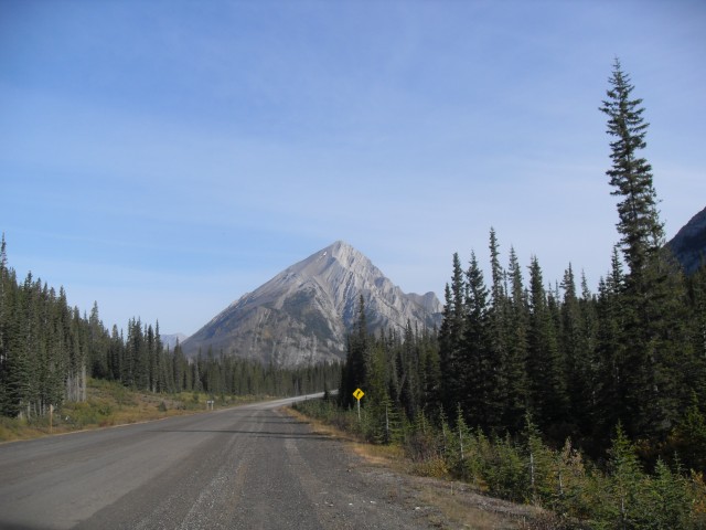
Looking north from the Smith Dorrien/Spray Lakes Road at the start of the trip. Mt Nestor in back.
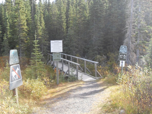
The Buller Pass trailhead, with maps.
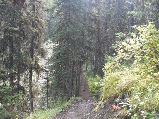
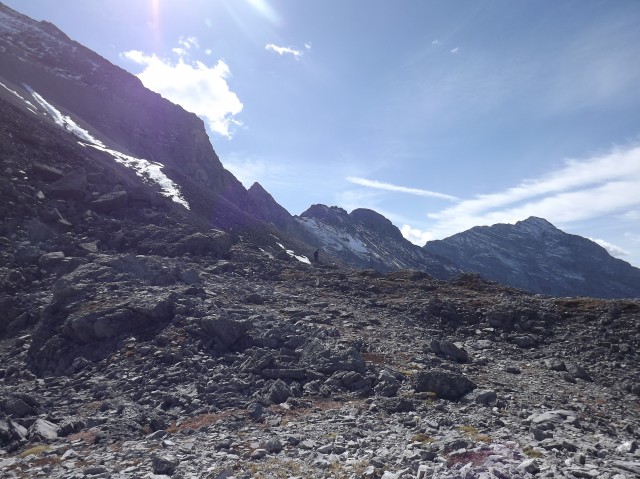
A typical view on the lower trail.
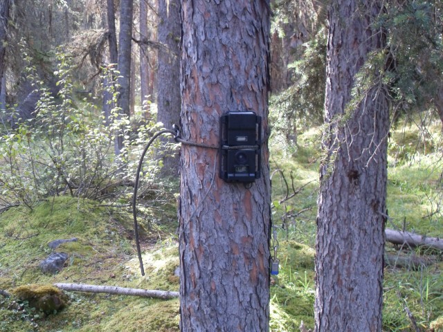
Someone’s watching – Big Brother? Actually this camera monitors animal traffic.
Into one of the burned areas.
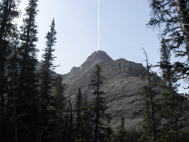
Looking skyward just as a plane flies by.
The valley we came up.
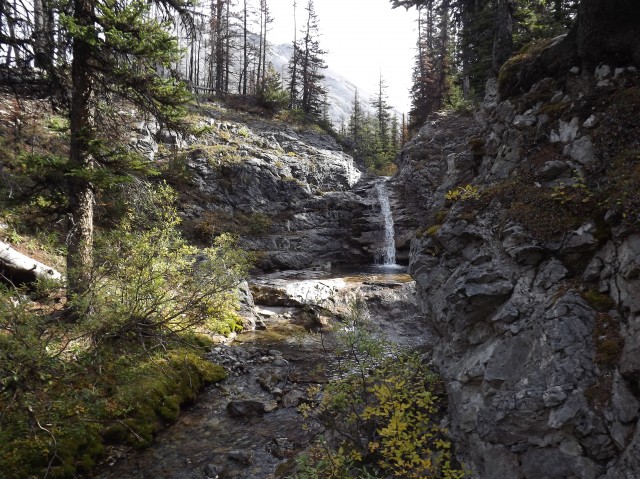
The much photographed Buller Creek waterfall.
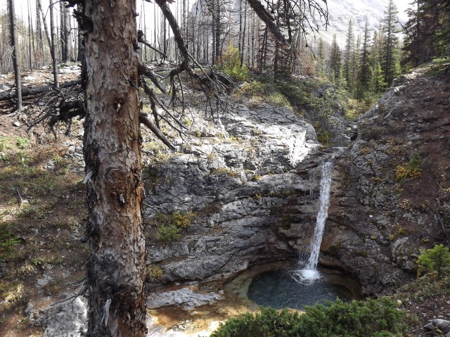
It’s small but incredibly beautiful.
Continuing up, the forest thins.
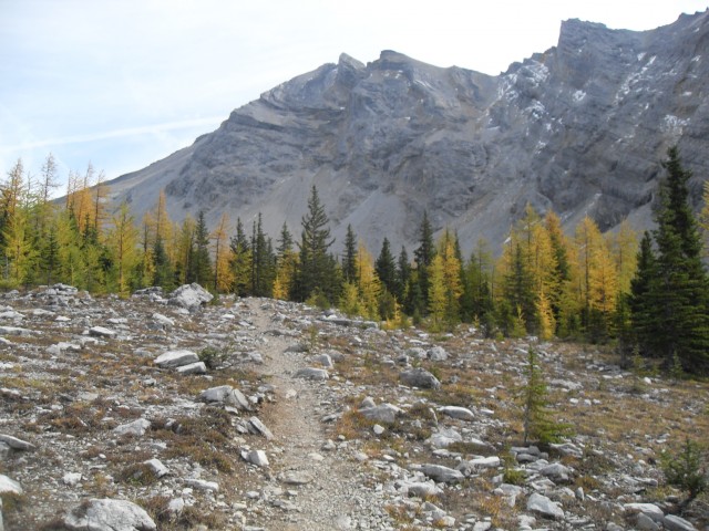
Into the larches.
The last trees…
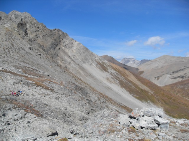
The final section of the trail up to the pass on the right is also the steepest.
You can see people on the trail ahead.
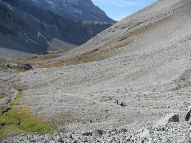
Looking back, the way we came up is clear.
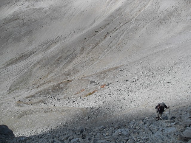
A steep push…
Almost there.
Looking east to Ribbon Lake and Mt Kidd.
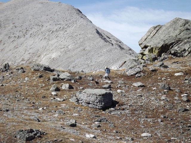
The area around Buller Pass is barren of trees. We’re looking (roughly) north here.
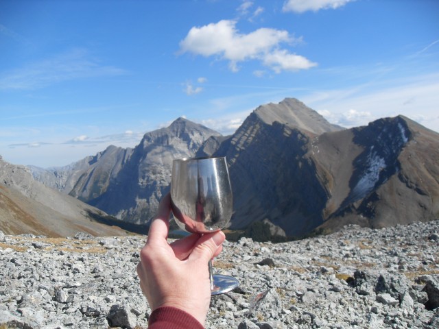
We always carry wine!
At the pass, looking down the valley we hiked up.
The ridge to the northwest.
Connie enjoying her wine.
We shared the pass with a number of other hikers.
Me, way over there.
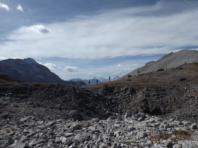
Looking west as other hikers pass by.
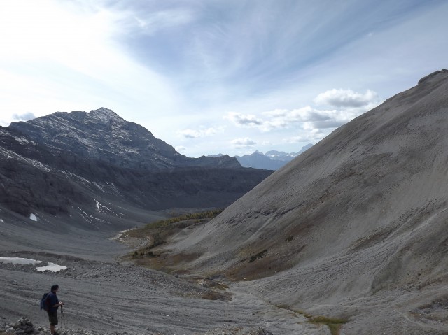
The valley down with Mount Engadine on left.
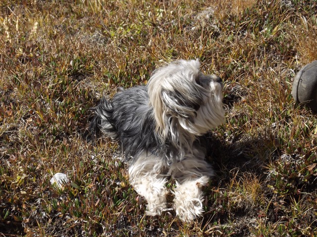
There were many dogs on the trail, including this tiny fellow.
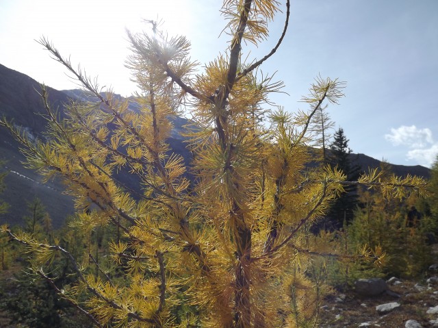
The larches were just starting to turn.
A beautiful shot of Connie.
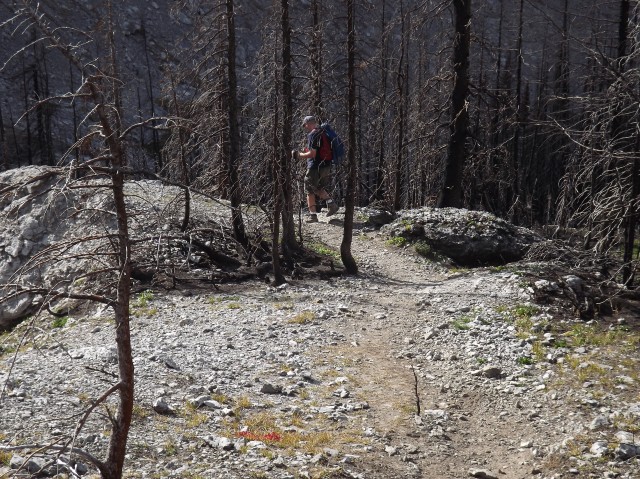
Back into the burn area.
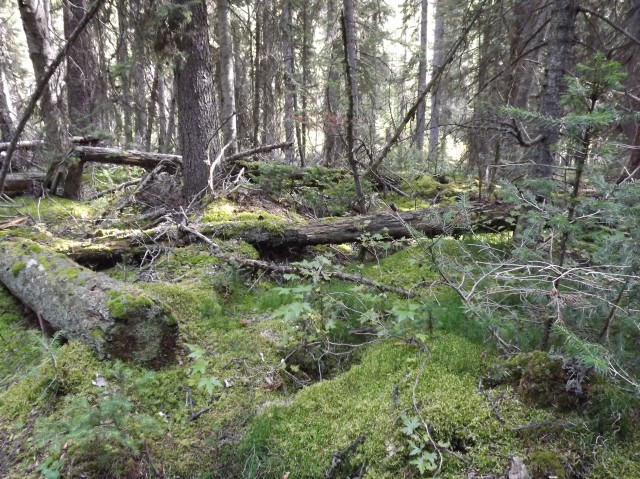
Near the end (or beginning depending on your direction), the forest is very lush.


This is great sir. So love the Alberta Rockies.
Hard to not love them. Just look at Buller Pass here! Gorgeous.
(via Facebook)
Loved Buller Pass to. Would love to go back and try a couple of the ridges extending off it.
I was eyeing them up too…
Have you done this in winter? I tried last year but lost the trail…
No, I’ve never even gave it any thought. Winter hiking or snowshoeing is something we haven’t done much of, but probably should. Thanks for posting!
Nice shots! Also, that’s one of my favorite time of year to be hiking. The way the sunlight hits the turning trees makes it soberingly beautiful.
Buller Pass can’t be beat!
I just spent a few years overseas and seen some pretty cool stuff. However I never got into hiking. Now that I am back in Alberta I have been looking for a hobby. The pics you posted make me want to hike and teach my kids about it as well. Thanks for posting the pics they are awesome!
Hiking is a great hobby, healthy and fun!
Do you know if this trail was impacted by flood damage this year? I want to do this hike, badly!
From what I have heard this trail escaped damage, so I think you’ll be fine. Have fun!
An outstanding hike you must do before you die.
Agreed!
One of the best and most scenic hikes in all of K Country.
Agreed, it’s amazing.
Canada is such an amazingly beautiful place. I say you are lucky to live there!
Greetings from Mexico!
I could’t agree more!
WOW!!!!!
Thanks Chris and Connie. I enjoy your website and the fact that I can see Canada in all its glory through my computer while living at the other end of the world.
Edward Englund
KOE
Published Author
This is one of my favorite hikes in the area. You can’t beat it!
A glorious day! Wonderful pics! Just love those bare rocky mountains.