
Volcano Ridge (almost)
At the time this report was written, March 2013, the last hike of the season was long behind us. To keep this category active and more so to remind us that spring hiking is just around the corner we pull some reports from the archives. Like this one, which takes us to a nice little hill in the front ranges called Volcano Ridge.
Technically we did not “summit” this modest bump, instead taking in a small knob to the east, known in hiking guides as “The Rocky Knoll”. We mistakenly assumed this was the high point, having missed the junction that lead to the real one a kilometre of so away. No worries, we had fun and anyway this gives us a good excuse to try again.
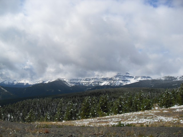
The Volcano Ridge trail is located near the Sheep River west of Turner Valley and this area is home to a number of fairly low rolling hills, including the one we visited. In spite of the modest elevation gained, the views from near the top are superlative and to the west the large peaks of the front ranges offer up a stunning vista. Calling this a summit is a bit of a stretch, but hahaha we’ll do that anyway. Our route was a combination out and back with a loop at the end.
This trail can be found off the Gorge Creek Road, a narrow and winding gravel affair that can be slippery when wet and parking is at the Gorge Creek trail head a few kilometres in. You can’t miss it as it’s at the end of the road at a gate (the road beyond is now closed due to washouts).
Head to the southwest corner of the parking lot, just past the biffies, and follow the obvious path west.
This is also an equestrian trail and there are cows too, so if this part and the next few kilometres are wet it can be quite chewed up and sometimes a real mud bog. Later, once we gain some elevation, the trail is more rocky and well drained and so becomes more pleasant in that respect.
The trail undulates here, all the time paralleling Gorge Creek far below. At one point a side stream drops down to it, via a stepped waterfall. We see if from above, but I bet it’s much more photogenic from below. That would require some bushwhacking down a steep hill though.
Things level out and after crossing a stream (bridged) we come to our first junction of many, all of which are marked. To the left the Gorge Creek trail heads southeast following its namesake creek. But that’s not our route and we’ll instead head roughly northwest which takes us though a series of large meadows. The cows here can really mess things up and of course watch out for landmines (cow patties). At times the tall grasses makes the train indistinct. After a couple more bridged crossings we plunge into the forest and almost immediately come to our second junction. Turn left here and the route to the right will be used on our return trip back.
Winding our way through a small side valley the trail here is relatively flat but soon we’ll start to head up. Within a kilometre or two we come to the base of a hill and from here to the top, with the exception of a few small breaks, it’s all uphill from here. In spite of the hard work this section of the trail is rocky and well drained and more pleasant than down below. No mud!
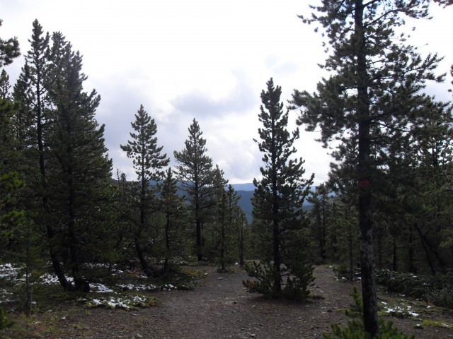
The cows avoid this steep section and it looks like few on horseback attempt it either. Huffing and puffing as we go, before long we are at yet another junction. Ignore the left branch and head right. We’re on what looks to be an old exploration road and it’s wide and easy going, if not a bit hilly (modest ones). Up to here the trail has not been that photogenic – unless you like cow poop and mud – but now things start opening up and we break out the camera.
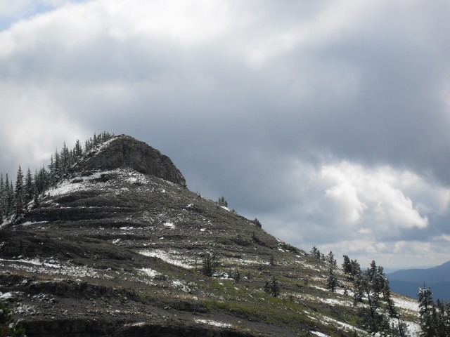
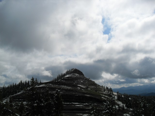
Around here we miss the turn off to Volcano Ridge proper and instead we head for an obvious knoll to the right. It’s an easy climb to the top and the views are wonderful so we’re quite happy in our ignorance. We think we topped out at the proper spot and that’s good enough for us. While the weather has been nice down below, up here it’s been snowing a bit. Volcano Ridge did not look that impressive form the bottom, but up here at the top (or near the top as it was) it’s wonderful place.
Enjoying our lunch, we plan for the trip down. This will take us north for bit before finally looping back to connect with the trail we came in on, at that second junction. As of 2008 this was the route that completed the loop section, but as of today there is a new trail down (I guess you could still use the old one we did). The new part is easier on the legs as I understand it.
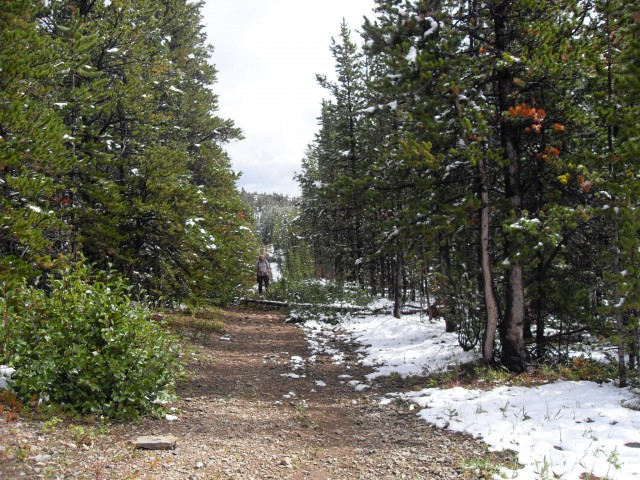
I see why they made the new route and the trail back down to the valley below is steep and loose. Connie always has trouble with type of terrain and so we take it real slow. Before long though it all ends and we level out and plunge into the forest again. After a short while we come to another junction, with the Gorge Link trail and we turn right here.
The next couple kilometres are somewhat mundane mostly passing through dense forests with only a few small meadows to break up the monotony. We parallel a small stream the whole way. Passing through a drift fence we’re back in cattle country and it shows. The mud, the torn up trail and the omnipresent piles of poop. Oh well, it’s not that bad and even on a less than stellar trail like this we always have fun.
Making good time on the flat trail we come to the second junction (from the trip in) and we continue straight. We’re now back on the trail we came in on and we simply follow it uneventfully back to the parking lot.
While this trail will never make anyone’s top ten, it’s still not that bad, especially once you gain some elevation. I have heard of people biking it but between the rough pock-marked trail down low and the steep sections it would be a bit taxing. On our trip we saw no one else, even though there were other cars and horse trailers at the trail head. We did see lots of cows through, dozens and dozens of them. Mooo! I’d like to return to summit the true high point of Volcano Ridge.
This trail and others in the area are official, meaning they are maintained, there are bridges and signs and any dead fall is taken care of.
Other noteworthy hikes in this area include….
Ridge north of Green Mountain.
Mount Hoffmann.
Sheep River to Burns Mine part 1.
If you wish more information on this route, by all means contact us!
Date of adventure: September, 2008.
Location: Kananaskis Sheep River area.
Distance: 14km round trip.
Height gain from start: 350m
Height gain cumulative: 500m
Technical bits: Cow patties, mud and rough spots on the lower sections.
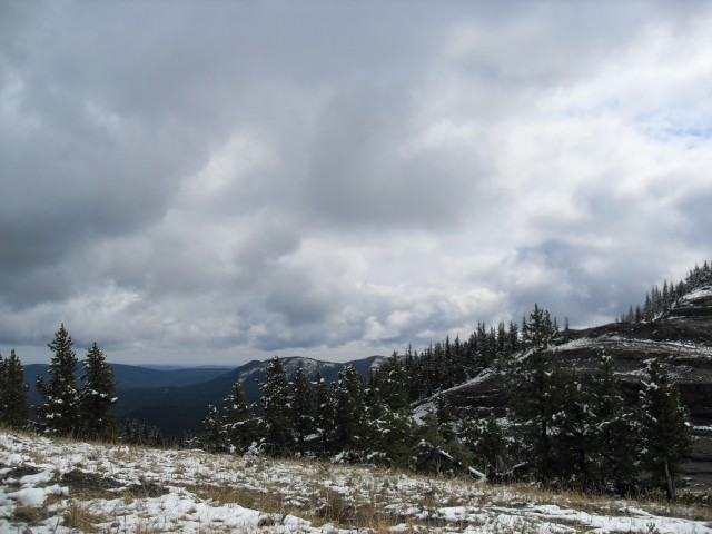
Gaining elevation things finally open up.
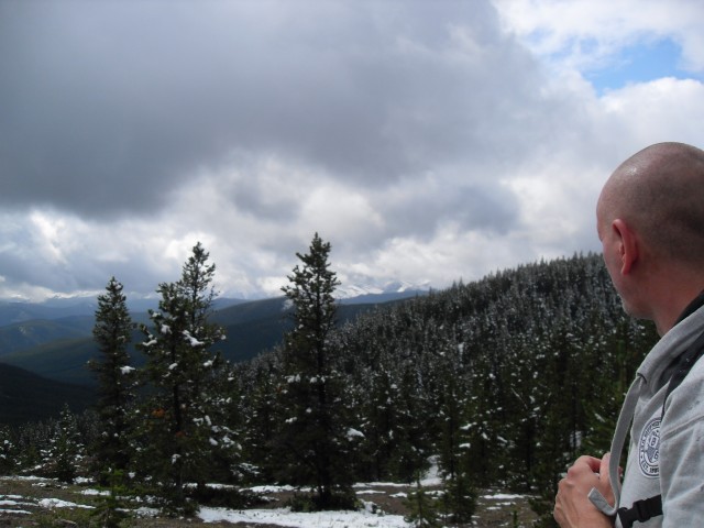
Your’s truly looking roughly south.
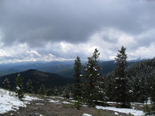
Here we’re looking more south-east-ish.
This section of the trail is wider, looking like an old exploration road.
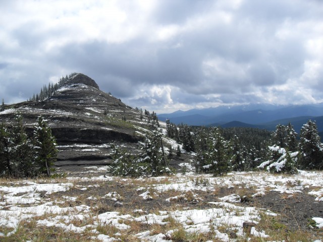
Not the high point of Volcano Ridge as we thought, but rather what’s known as the Rocky Knoll.
Mt Ware is the modest bump in the foreground to the left of centre.
Looking east from the Volcano Ridge trail.
If you look hard you can see me heading up the Rocky Knoll.
On top!


Looks like a nice place. How much “up” is there? We are still pretty green when in comes to hiking and still a little uncertain. You mention a lot of junctions and so is it easy to get lost? Any bears? I am sorry we are still newbies and have a lot of questions.
Thanks, Gillian
Hi Gillian,
There is 500m worth of up – so two Calgary Tower’s worth, plus a bit. Once you start up there is little in way of breaks. All junctions are signed so getting lost is not very likely. We saw no bears this trip but saw two on a different outing. One was munching on something right on the trail just before the up section. We turned tail and did a different route. This hike is fun, but given the remote location perhaps a trail with more people on it might be a good idea for you. Try Bustall Pass. It has about as much up (but with nice flat sections between them), and there are always lots of people around to help make you feel safer. Plus the views are stunning!
I biked this trail…once. With the trail all messed up by cows it was a hellish nightmare. Plus the pushing and the screaming downhills, which were far too intense for me, all conspired to make this an unforgettable trip. In a bad way. The views at the top were nice though.
Yea, I can understand your frustration. It’s just too rutted for bike use.