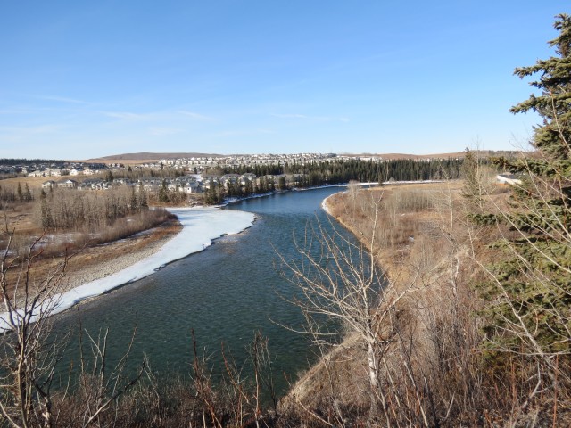
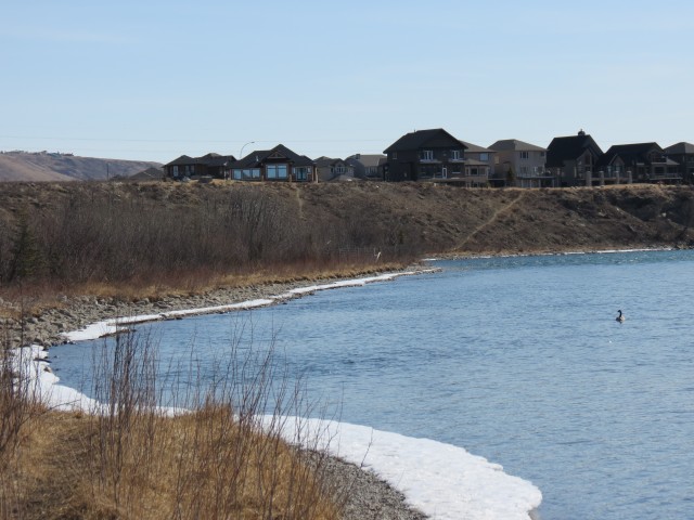
The town of Cochrane is just west of Calgary and like its larger neighbour is located along the Bow River. Once a quaint little village, it seems to be losing that magic as it experiences explosive growth. Where there was once charm and serenity, there is now a sprawling bedroom community with generic strip malls, chain coffee shops, giant F350 Super Duty grocery-getting pickup trucks and cookie cutter McMansions. It feels soulless. It was the small town appeal that brought people in, yet oddly it’s that very thing that’s responsible for destroying it (soapbox off).
Anyway…Cochrane does have an awesome and scenic pathway system that follows the river from one end of town to the other, which will be our route for the day.
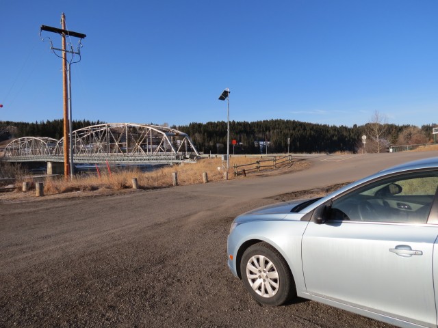
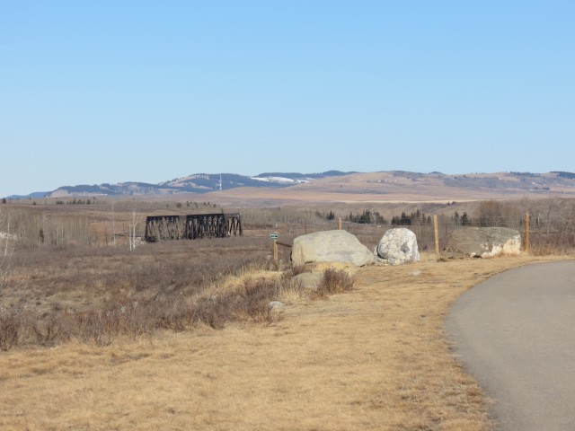
We choose to start at the old single lane bridge at the south east corner of town, but you could actually begin at a more easterly spot if you wish. Our destination was the CPR’s Bow River bridge, which is located just west of the town limits, and from point to point it’s about 7km each way. Some of our trek is off path, but you can always stay on it and get to where we did.
↓ ↓ ↓ ↓ Scroll down for photos or to comment ↓ ↓ ↓ ↓
The official route ends a modest distance from and within sight of the railway bridge and the final stretch can either be reached by following the banks of the Bow River or by walking along on the railway right of way. The latter is wide and the trail set far back from the tracks, so it’s relatively safe.
Heading out, we cross River Avenue and get a good look at the single lane road bridge that spans the river. It looks to be quite an oldie but I have yet to find any history about it.
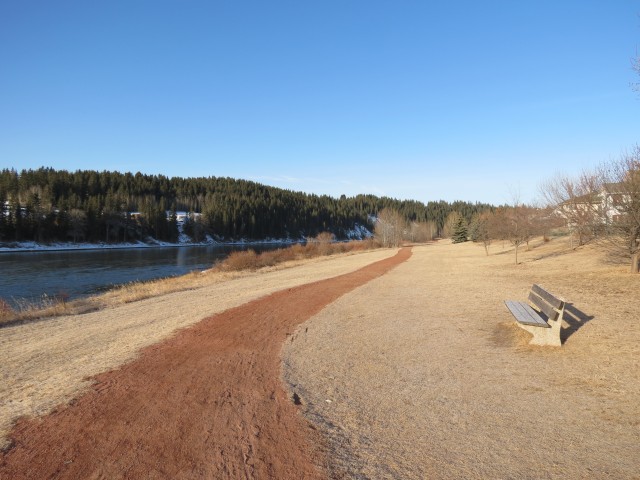
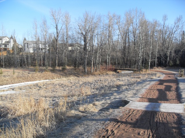
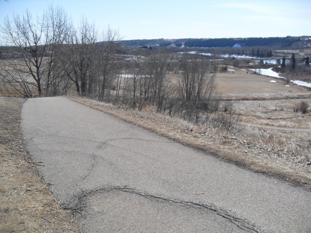
We follow The Bow River along some flats. The town has made sure there is a wide green space here (brown space in the winter), with lawn and trees, and while the backyard of houses will keep us company for most of the trip, they are set back far enough to be unobtrusive. The trail here is paved with red shale but other sections are asphalt.
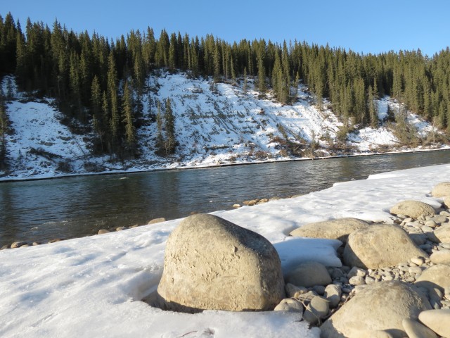
Across the way from here there are some steep wooded bluffs and with the constant eating away of their base by the river, some sections are slumping badly. Even tree roots can’t hold the unstable slopes in check.
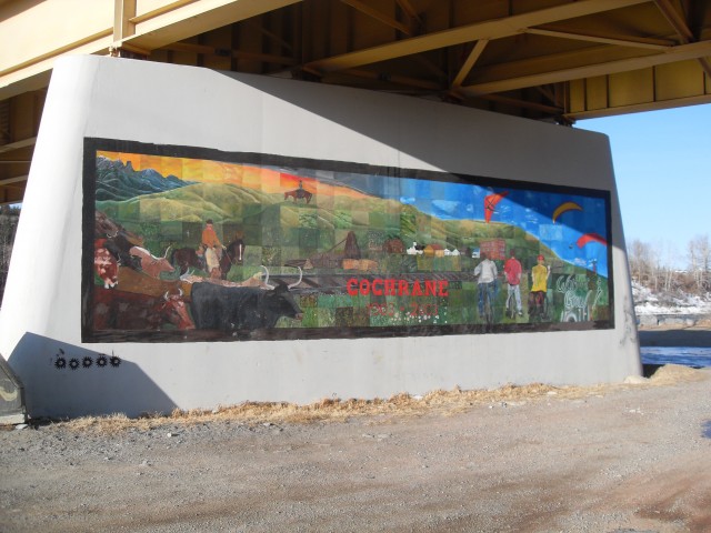
We slowly gain some elevation then drop down to the flats again where a small side creek comes in. There have been lots of junctions and there will be lots yet to come, but stay left near the river and you’ll be fine. Before long we pass under the highway bridge with it’s nice town mural.
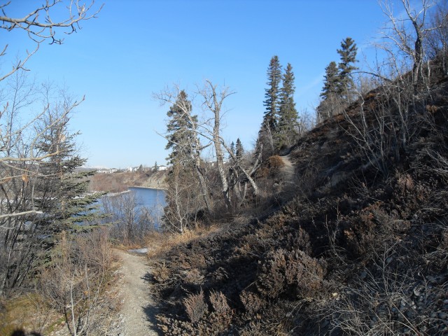
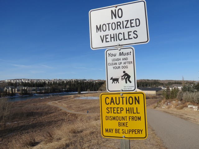
There is two possible routes from here, but both meet up in a kilometre or so, so choose which ever you wish. Or follow one in and take the other on the way back, like we did. Before long we are at the base of a bluff. If you’d like something interesting, there is a west heading dirt path that traverses the bluffs, which is what we took. You can stay on the paved path though and get to where we did.
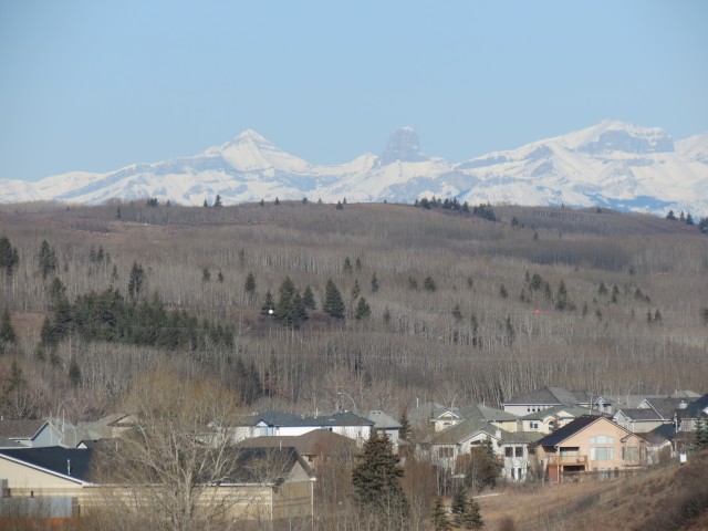
Gaining elevation, the loose track is often narrow and slippery, so be careful. Before long we are at the top of the bluff, meeting up with the paved pathway we left earlier. Along here there are some great views of he river and if the sky is clear, the mountains in the distance. The latter view includes Devil’s Head (I’ve heard it called the Devil’s Nipple), which stands out with it unique tower shape some 70km away. It looks very much like the very famous and similarly named Devil’s Tower in Wyoming USA.
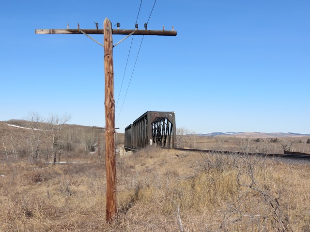
Still along the top of the bluff, in short order we come to a steep hill and head down. Almost at river level now, the route almost immediately starts regaining the elevation just lost, albeit gently now. Before long, in a kilometre or two, we come the end of the official pathway. Here one can double back a bit to meet up with the train tracks, then head west again to the bridge. Or you can drop down to the river via an obvious path and follow its bank to your objective – or do like we did and do one route in and the other back.
If you follow the train tracks remember you will be on private property, so stay on the trail (which is well back from the tracks) and keep ears and eyes open for trains.
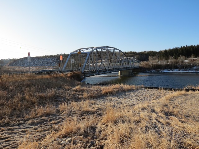
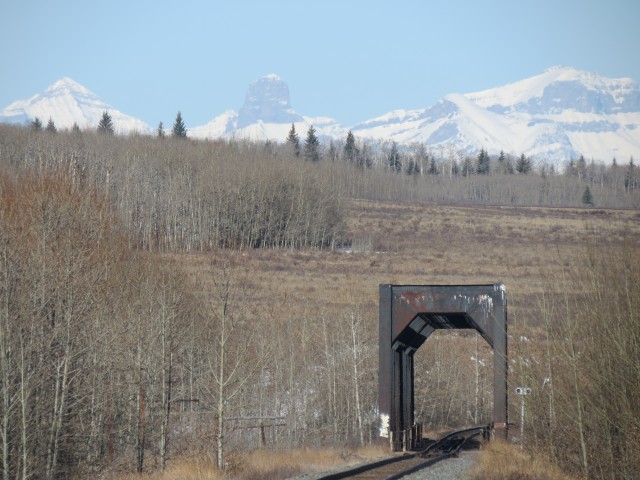
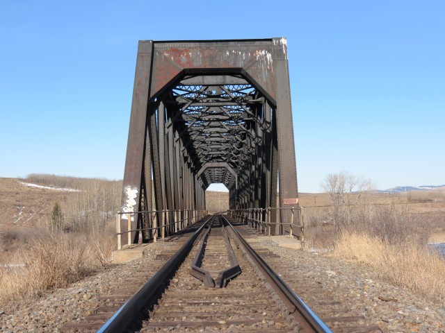
Before long, perhaps a kilometre, you’re at the bridge. It’s an imposing structure and while old, it seems to have no trouble handling the heavy trains of today. This makes sense when you consider that railways always overbuilt and over engineered their infrastructure, to a factor of several hundred perfect or more in many cases.
While I could not find a date on any of the piers, nor could I find anything about it online, looking at the design one could guess it was built in the first few decades of he twentieth century. I believe, and I am no bridge engineer, this one was made in the common Pratt Truss pattern which seemed to be favoured by railways given the ease of construction, strength of design and long spans it allowed. If I am wrong here (me, I’m never wrong :>), please someone chime in.
The track here is along the CPR’s east west mainline, the Laggan Subdivision, and it sees a lot of trains per day.
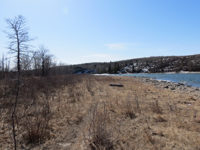
At the bridge you are a very short distance away from something interesting, the old ghost town of Mitford. Nothing really remains, but in the field to the north there used to be a sawmill and brick factory and a small town site. This was an early settlement dating from the mid 1880s but it’s life was short and by the turn of the twentieth century it was already done for.
We’ll be doing a follow up article documenting what we could find of the town (very little, but it was interesting) and a link below will lead you to that. Given Cochrane’s growth, this place is likely to be swallowed up soon by the fast encroaching development.
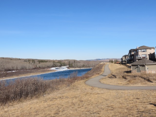
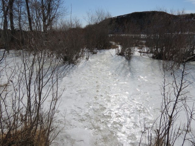
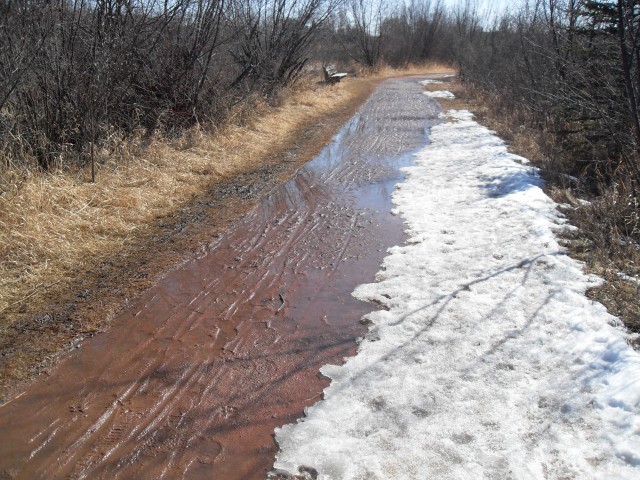
Leaving the bridge behind, we follow the river bank. Along here it’d be easy to imagine you are in the middle of nowhere. The town behind you can not been seen from this angle and there is yet to be development across the river. A nice feeling. Before long though that illusion is shattered and after crossing (the frozen) Horse Creek we climb up the bluff and are back in an urban environment.
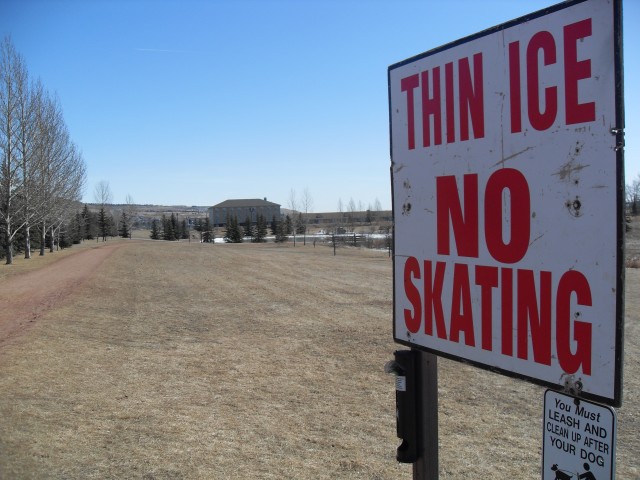
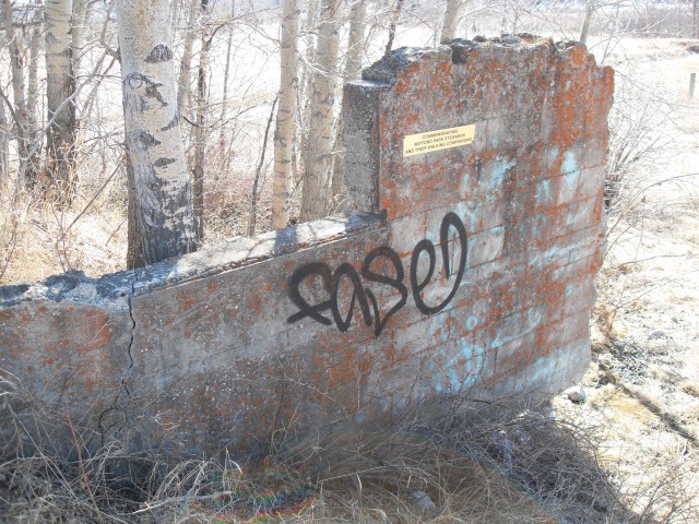
On the way back we take the official pathway (you recall we detoured on a dirt track that traversed the bluff earlier) and pass a skating pond, a bandstand and a concession building. Dropping back down to river level we pass an odd concrete wall. What it’s from is anyone’s guess but it does have a plaque on it. “Commemorating Mitford Park Stewards and their walking companions”.
Just past here the asphalt ends. The ground was frozen on our way in, but with the day’s warm weather, in the interim it has become a muddy quagmire. Before long we are at our parking spot.
There are lots of benches along the trail and many great places to have a picnic. We had ours beside the train bridge.
We really enjoyed our trip. Given it flanks the town, the pathway is surprisingly interesting and serene, there is lots of flora and fauna to see (lots of Canada Geese in particular) and it was overall a very pleasant experience.
If you wish more information on this place, by all means contact us!
Date of adventure: March, 2013. Location: Cochrane, AB Distance: 14km return. Height gain cumulative: 200m Technical bits: One very steep section that may be slippery when it’s wet. Notes: Some mud if wet, last bit to the train bridge is along the CPR tracks or Bow River banks.
I know about it and found zero evidence of it as well – I looked. This subject will be covered in an upcoming article soon, where we look at what’s left of Mitford and area.
The award for the most hillbilly burg in all of Alberta belongs to Provost with Caroline coming in a close second. At the rate things are going, Cochrane is in line to take the throne. I live here and I should know. Arkansas has NOTHING on this place!
You are waaaaaaaay too nice in speaking of Cochrane’s “downfall”. In the last five years our city went from being a nice little place to live to hillbilly central. My once respectable neighborhood in an older part of town has been turned into a trailer park without the wheels. I kid you not. Ask any old timer and they’ll tell you that city council sold their soul to developers and now the place is awash with rednecks and trash. What was once a wonderful place to call home is now hell. I swear if just one more good ol’ boy decides that 11pm is a good time to tune his noisy ATV, I’ll just scream.
This was a report about taking a walk, not about Cochrane bashing, but I guess I planted the seed. I hate urban sprawl when it kills the charm of a place but at the same time, it seems to be a necessary evil and it’s clearly what the people want. That is in spite of what I, you or anyone else feels. As an outsider looking in, the development looks horrible, but for those living in it, it’s heaven. It’s livin’ the life and if they feel that way how can I fault them? We all want to be happy. BTW, I’ve heard from others who have recently moved away from Cochrane, for the very reasons you’ve mentioned, and the words “trailer park” come up quite often. I had to chuckle about that.
Everything aside, I really enjoyed our walk along the river. It’s a nice place.
We used to do something called the "pointless challenge" 🤪 and miss those days. It was so much silly fun and often frustrating as heck. In these we'd invite people to send in random photos of obscure locations, but not give any information, and then we'd track where it was and shoot something similar.
Most of these came from old family collections, as was the case here. Anyone up to resurrecting the series?
In hindsight, why didn't we pose someone in our shot?
Pointless: “Devoid of meaning (or) senseless” Merriam-Webster.
If you like what we do and want to support this ongoing project (12 years now), go here: https://www.BIGDoer.com/help-the-society/ Thanks to Connie for making this post possible.
Exploring history with Off the Beaten Path with Chris & Connie. Photo: ca1970 and 2014. Posted by Connie.
Captured on a cold, cold day many years ago. We've been passing this old house for decades and it's little changed in that time. At some point we expect to drive by and it'll be gone.
Exploring history with Off the Beaten Path with Chris & Connie. Photo: 2017. Posted by Connie.
When retired old railway cars usually get cut up for scrap. Sometimes, however, they find their way into the hands of the general public or whomever. Flat cars make good bridges, and boxcars can be transformed into storage buildings and the like. Case in point here. We see them used like this often enough and in this case, it's part of a corral.
Incidentally, this boxcar dates from 1950 and this was found by tracing the old road number, which is still visible.
Exploring history with Off the Beaten Path with Chris & Connie. Photo: 2017. Posted by Connie.
This central Alberta racetrack was never a commercial operation but instead just a fun place for car enthusiasts in the area to get together. Early '70s or thereabouts and it only lasted a few years. Even thought it's been abandoned for that long, there is no doubt what was here.
You know we like the the obscure stuff and this one fits the bill perfectly. Found by accident while backroad cruising and the history comes thanks to local car guy Mike.
Exploring history with Off the Beaten Path with Chris & Connie. Photo: 2022. Posted by Connie.
On top of little Myrtle Mountain in the Kimberley (BC) Nature Park.
There's some good wilderness fun to be had here and nice views as you can see, but the real reason we came is mining history. The whole area near the ski hill was extensively worked over a century ago and we were looking for evidence of this. We didn't find much in the area searched, but it's a big chunk of property and we hope to return to cover more ground again soon. Of all the subjects we cover, mining related is a favourite.
Still, it was a good hike and that can't be bad. Look to the comments for more info 👇.
Exploring nature and history with Off the Beaten Path with Chris & Connie. Photo: 2022. Posted by Connie.
It's a strange curiosity in south Kananaskis, there on a hillside and we have no idea who created it. We asked around and no one's completely sure about its history. In the past it showed the Canada 100 logo from 1967 but in 2017 someone changed it to reflect the country's 150th.
That's our friend Emily from DanOCan.com having a look.
Exploring history with Off the Beaten Path with Chris & Connie. Photo: 2017. Posted by Connie.

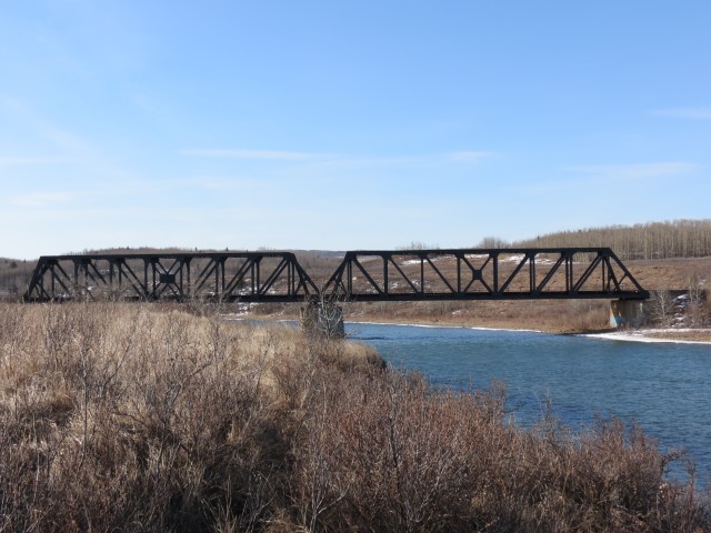


I understand at one time there used to be a toll (road) bridge just to the left of the railway’s. I’ve looked but can find no evidence of it.
I know about it and found zero evidence of it as well – I looked. This subject will be covered in an upcoming article soon, where we look at what’s left of Mitford and area.
You are right though, the river walk is great!
The award for the most hillbilly burg in all of Alberta belongs to Provost with Caroline coming in a close second. At the rate things are going, Cochrane is in line to take the throne. I live here and I should know. Arkansas has NOTHING on this place!
…cue the banjo music. :>
Chris and Connie: Off the beaten path.
Hiking – Adventure – History – Exploration – and now Cochrane Bashing!
Let’s move away from this subject, okay. No more anti-Cochrane stuff!
You are waaaaaaaay too nice in speaking of Cochrane’s “downfall”. In the last five years our city went from being a nice little place to live to hillbilly central. My once respectable neighborhood in an older part of town has been turned into a trailer park without the wheels. I kid you not. Ask any old timer and they’ll tell you that city council sold their soul to developers and now the place is awash with rednecks and trash. What was once a wonderful place to call home is now hell. I swear if just one more good ol’ boy decides that 11pm is a good time to tune his noisy ATV, I’ll just scream.
This was a report about taking a walk, not about Cochrane bashing, but I guess I planted the seed. I hate urban sprawl when it kills the charm of a place but at the same time, it seems to be a necessary evil and it’s clearly what the people want. That is in spite of what I, you or anyone else feels. As an outsider looking in, the development looks horrible, but for those living in it, it’s heaven. It’s livin’ the life and if they feel that way how can I fault them? We all want to be happy. BTW, I’ve heard from others who have recently moved away from Cochrane, for the very reasons you’ve mentioned, and the words “trailer park” come up quite often. I had to chuckle about that.
Everything aside, I really enjoyed our walk along the river. It’s a nice place.